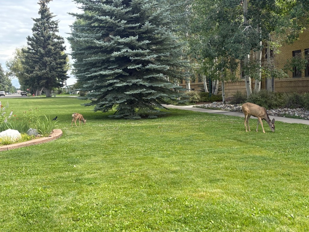
After returning home to let the blisters heal, I began planning a return to the trail. Due to difficult travel logistics for travel to small trail towns, and the need to coordinate with Spokes’ hiking pace, I decided to join him in Salida, CO. That gave me plenty of time for the blisters to heal and to spend a few days in Colorado at some elevation higher than sea level. But it was also a longer time away from the trail than I’d like.
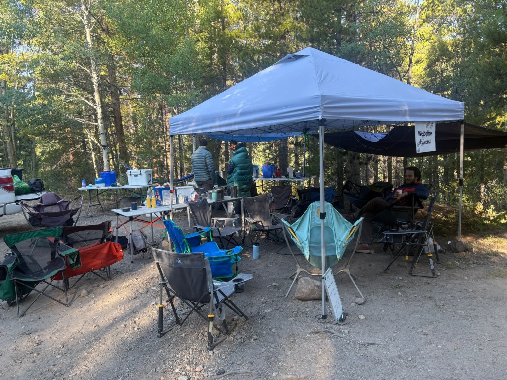
I flew from SeaTac to Gunnison, CO, with a plane change in Denver. I spent a few days there before catching a bus over Monarch Pass to Salida. Spokes showed up here yesterday and I hung out with him while he attended to his town chores: repaired a leak in his inflatable mattress, shopped for resupply, ate town food, etc. We’ve arranged for a ride back to the trail at Monarch Pass, leaving here at 7AM. With all the chores done, we went for a swim in the hotel pool this afternoon and soaked in the hot tub for a while.
I’m looking forward to getting back to the trail, but I’m also a little apprehensive. I didn’t get much exercise while the blisters were healing and I imagine I’ll be a little slow out of the gate. But hopefully I’ll regain my form soon. There is some beautiful country ahead of us.
Day 1
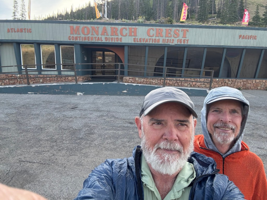
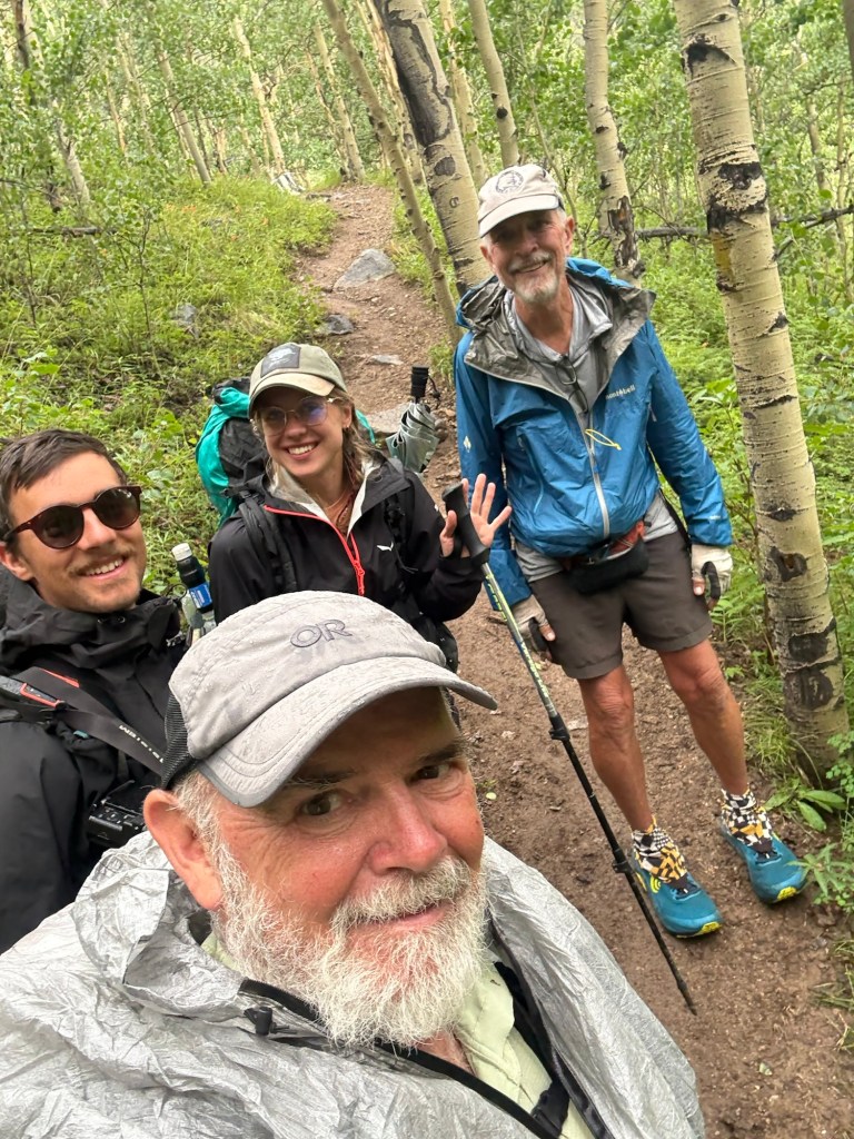
Connie, our trail shuttle was right on time at 7AM and she drove us to the Monarch Pass trailhead in her one month old Ford Maverick. Nifty little vehicle; she likes it.
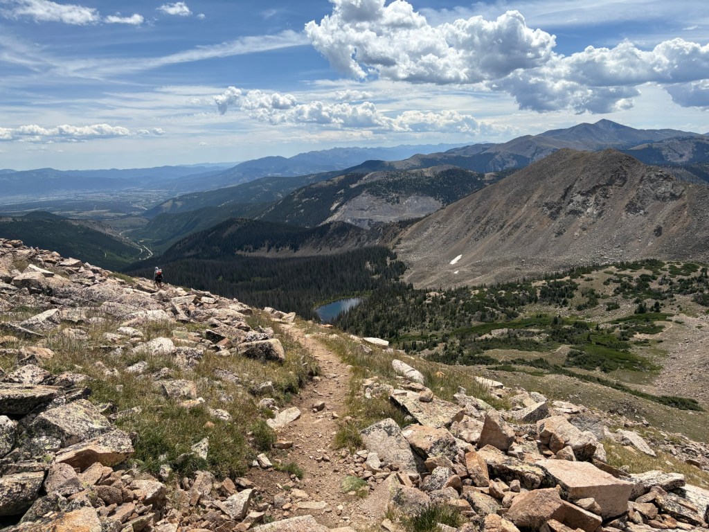
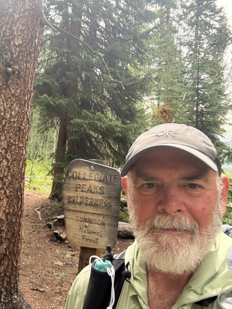
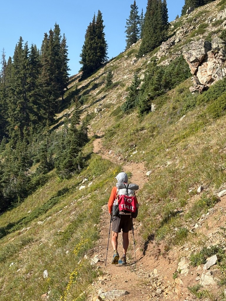
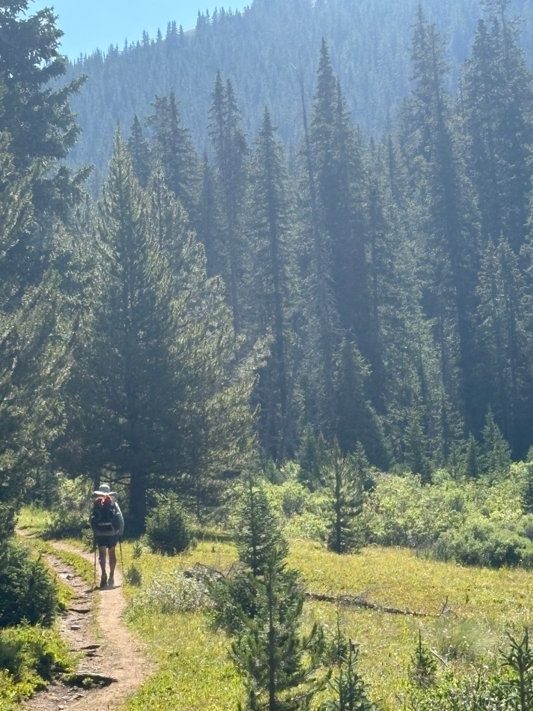
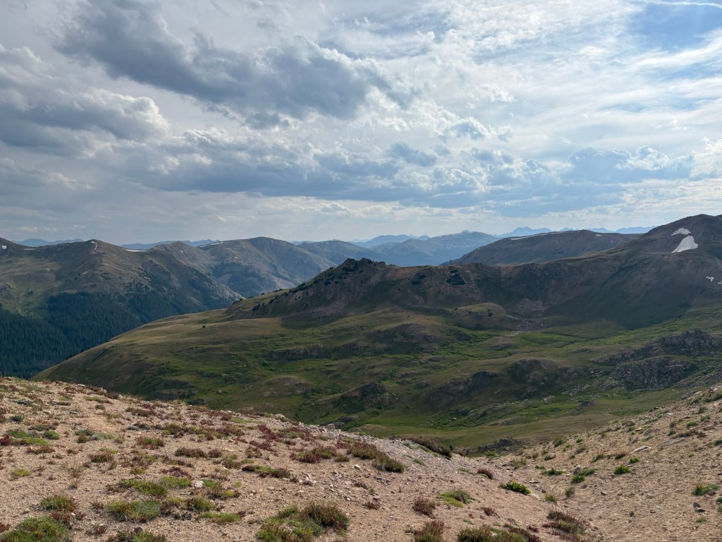
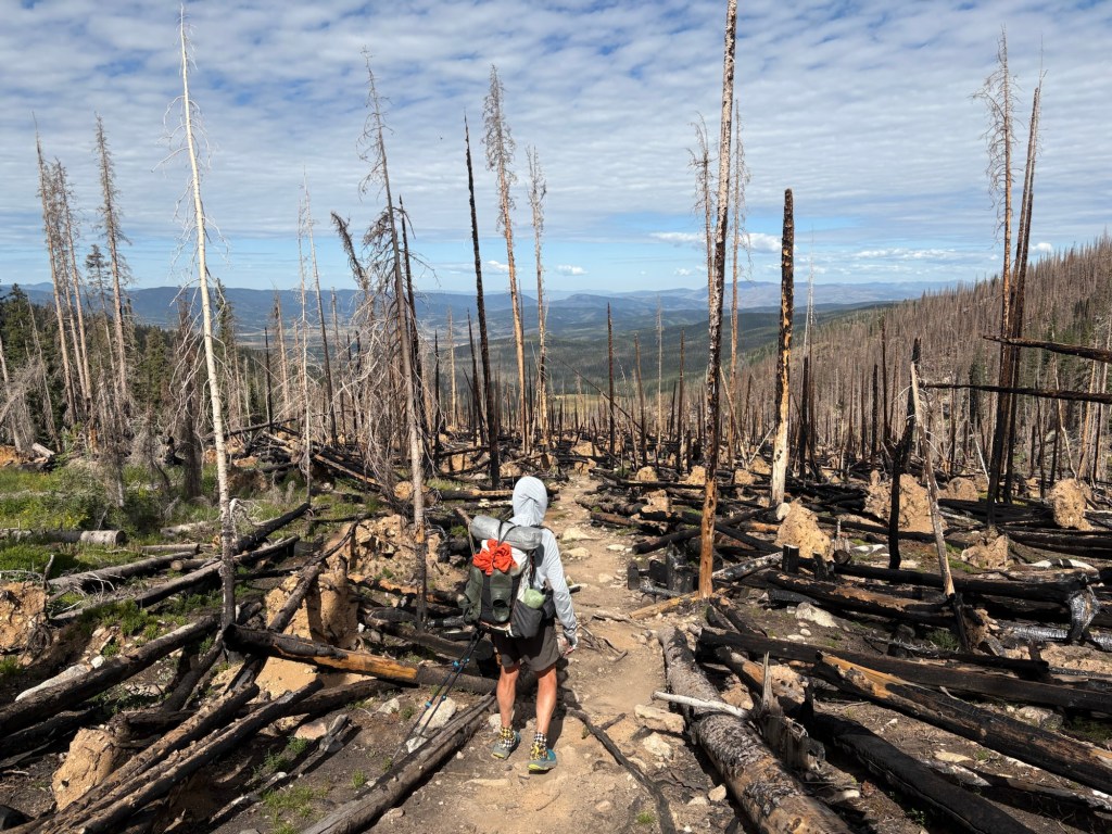
We hung around the gift shop, waiting for it to open so Spokes could see if they had a tent stake to replace one in his kit. No suitable replacement found. We stepped onto the trail at about 8:20 and immediately began an uphill climb. It leveled out soon, and then began its upward trend for the next several miles. We worked our way through a ski area where there was ongoing construction work. Eventually, after about 6 miles, the trail climbed above 12,500 feet before beginning a steep descent to our next water source, a small alpine lake (actually a pond; technically a tarn). Along the way we’d been leapfrogging a hiker named Molasses because of his slow pace. As we were filtering water at the pond, Molasses snuck by us. But we caught him a bit later as the trail descended to cross the Middle Fork of the Arkansas River. The bridge over the river was about 11 miles from our morning start. About a half mile into the climb away from the river, my right foot informed me that the blister on the ball of the foot wished to become active again. So I stopped and checked it out. No real blister showing, but I cleaned it up and placed a patch over it. Then I put some leukotape over all that. It didn’t get any worse after that, and may even have felt a little better.
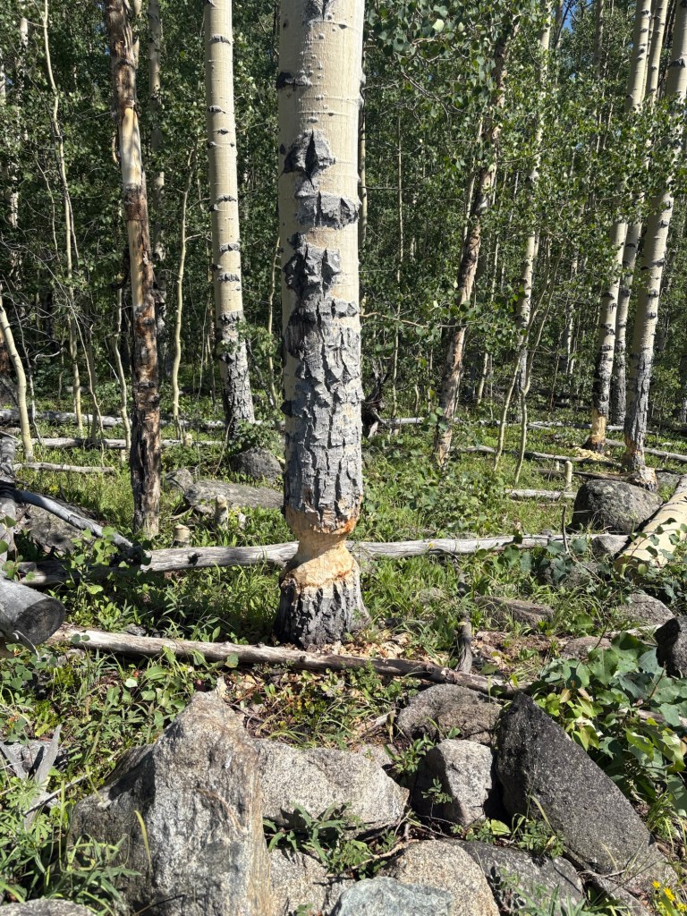
From the river crossing the trail ascended steadily to our present camp site at 12,440 feet. There were lots of dead trees in the area, but Spokes spotted this relatively flat spot across the creek from the trail. No dead trees in this immediate area, so we won’t worry about a dead tree tipping over onto us during the night.
15 miles for the day; almost all of them above 11,000 feet. The river crossing was at 10,444 feet.
Not a bad first day back on the trail.
Day 2
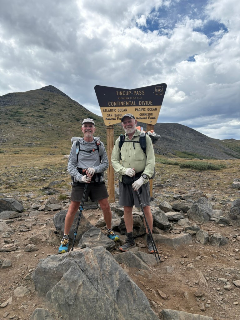
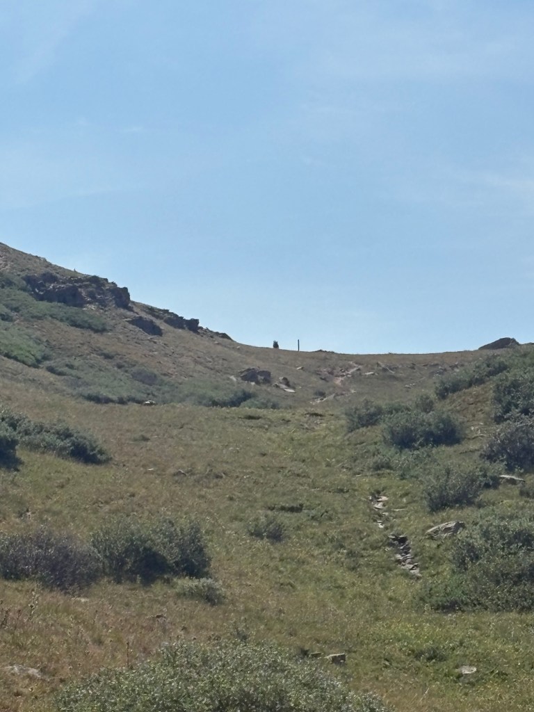
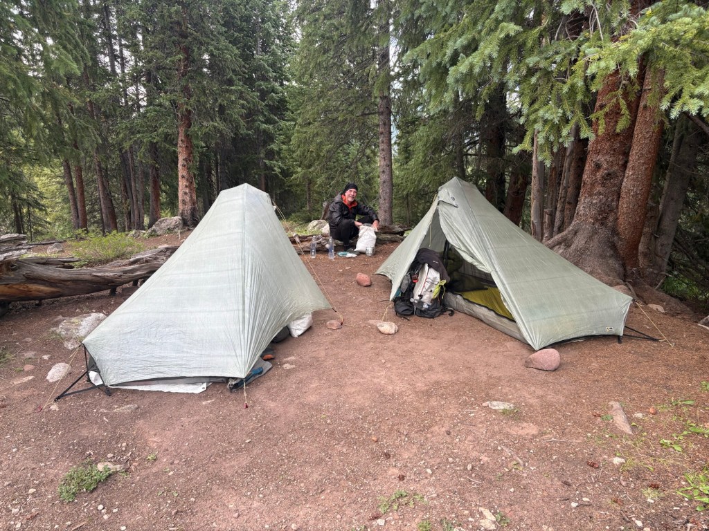
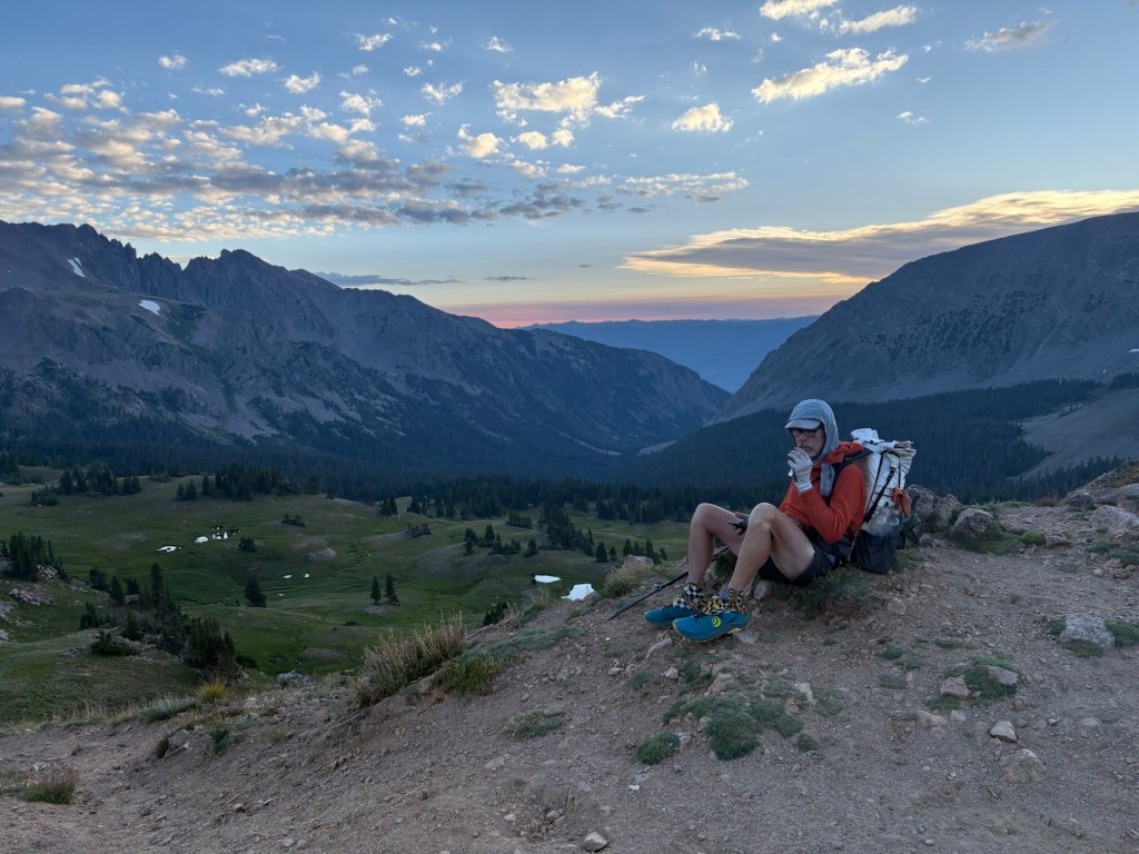
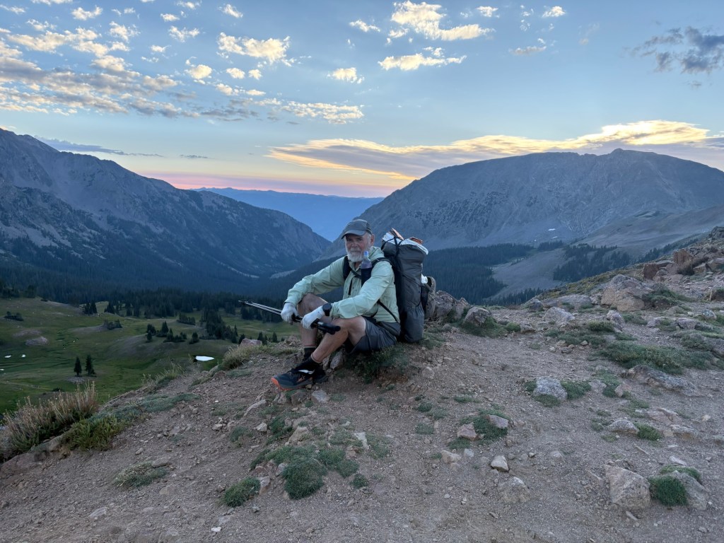
We’d camped one trail mile below the summit of Chalk Creek Pass because that mile included 730 feet of elevation gain. We wanted to save that for the morning. It was a slog, and I just took it really slow. From the top of the pass the trail descended for about five miles before again rising to above 12,000 feet at an unnamed pass. From there it went down to a junction with Tin Cup Pass road. We stopped there for lunch. There was a group of four-wheelers there and we asked them about Mirror Lake Campground, our intended stop for the night. There were also two women there who had just finished their section hike and were waiting for their ride. Since they were leaving the trail, Spokes cadged some of their unused food. He’s starting to feel the “hiker hunger”. While we were there a woman named Garmin rolled up. We had passed her earlier and she caught up with us just as we were packing up. She intends to do the high route and we will be taking a lower route. After we said our farewells, Spokes and I began trudging up the road toward Tin Cup Pass . There were many four-wheelers going up and down the road. It seems to be a popular place for that. Near the top I was passed by a woman with kids and a dog, driving a Toyota 4-Runner. That was a tough road for a regular car, 4 wheel drive notwithstanding. At the top, we took a break for a photo op at the Continental Divide sign and moseyed down the road to Mirror Lake. Once there and walking along the road to the campground, we stopped to say hello to a family who were fishing there. Next thing we knew, we were being offered a glass of wine. A very nice Paso Robles Cabernet, no less. No wine glasses, so the gentleman poured some into each of our water bottles. Very kind and generous. After a few sips and some conversation, we said goodbye and headed for the campground, saving a bit of the wine for supper. At the campground, we found a spot, paid for it at the self-serve kiosk, grabbed some water and went back to set up our tents. Then it began to rain. We hunkered down in the tents for an hour or so until it stopped. Then we crawled out of the tents to cook dinner at the picnic table. Sipping wine with my freeze dried jambalaya. Life is good. Then it was time to retire to the tent to perform surgery on a fresh blister, this one on the side of the heel. I’ll have to dress it in the morning. 18.4 miles for the day, three 12,000 foot passes.
Day 3
The alarm went off at 5:30 AM and I made some coffee and attended to the blister. I popped it last night and it was still flat. So I covered it with an adhesive gel type pad. After we each paid a visit to the campground privy, we stumbled down the road at about 6:30. Stumbled is the word, because we manage to miss our turn and ended up with a bonus mile and a half. Once on the correct trail we began a 2.6 mile climb up to 12,000 feet. Our Mirror Lake camp had been at about 11,000 feet.
The trail then descended to Sanford Creek. From there it was a fairly stiff climb up and over to another valley and down to Cow Creek, where we stopped for lunch. After that the trail descended to Texas Creek. The official trail heads west and goes around Texas Lakes, but we opted to take a shortcut that saved almost three miles. It was a bit of a bushwhack and we crossed three branches of the creek. But we saw some evidence that the CDT had once followed this route.
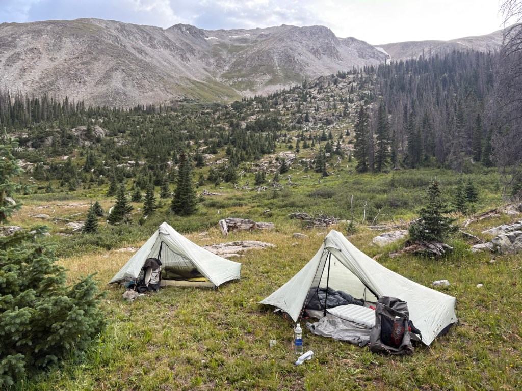
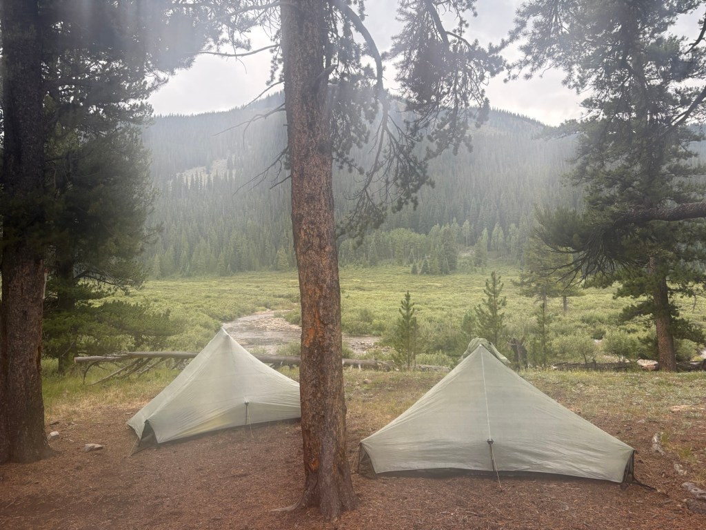
After the crossing and regaining the proper trail we continued east and upstream to rejoin the main CDT (we’d been on the Mirror Lake alternate). There was thunder in the area, and rain looked likely. We were considering how far to push on when we came upon a very nice campsite with great view, on the bank of the creek. Even though we’d only done 16.5 trail miles (18 miles if you include the morning bonus miles) we decided to stop for the day. We got the tents up before the rain came and settled in.
Day 4
We thought we had camped in a prime moose spotting site, but no luck. After it quit raining it became very windy for an hour or two. By the time I got up for the midnight pee break it had calmed down. The stars were all shining brightly.
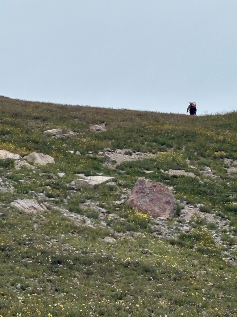
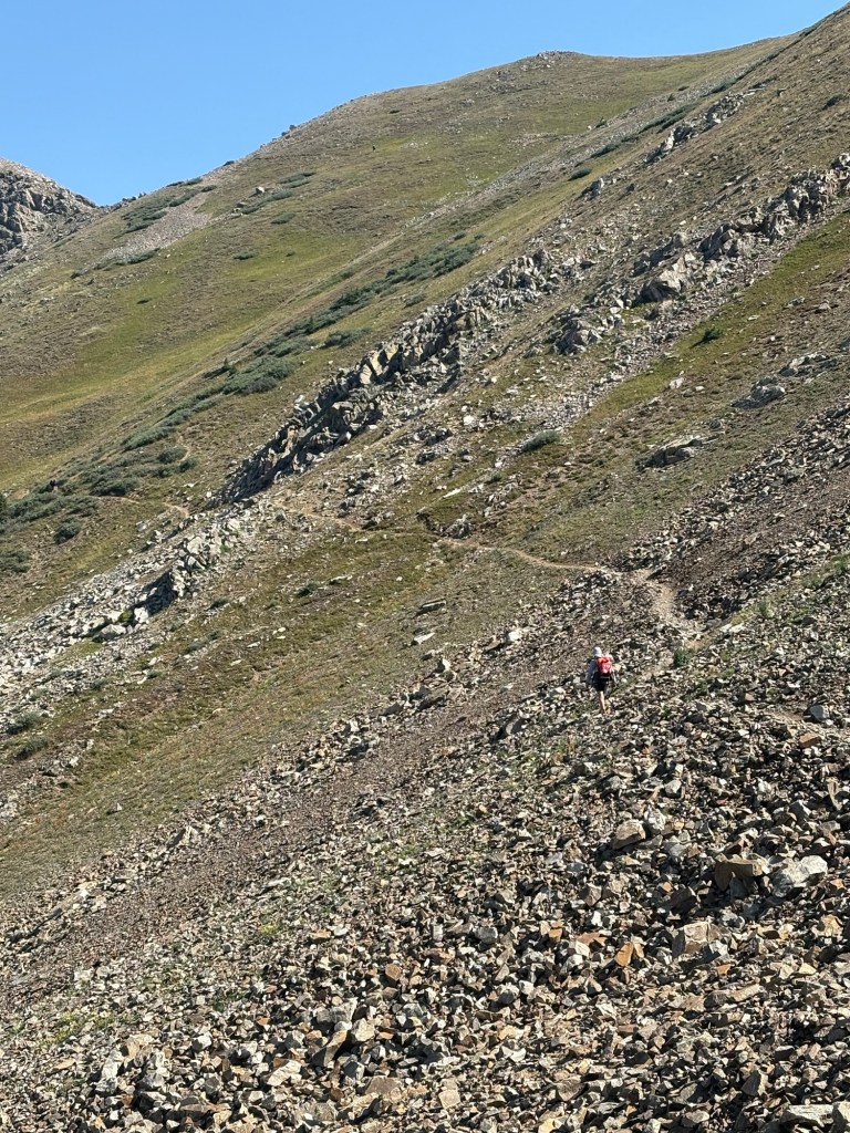
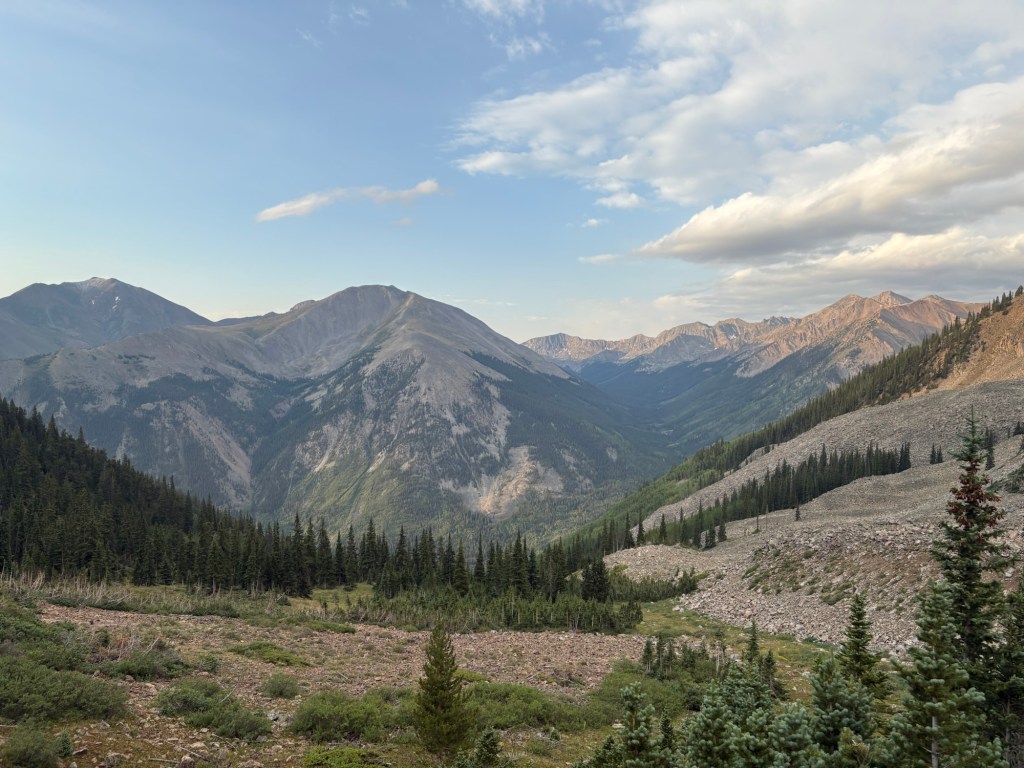
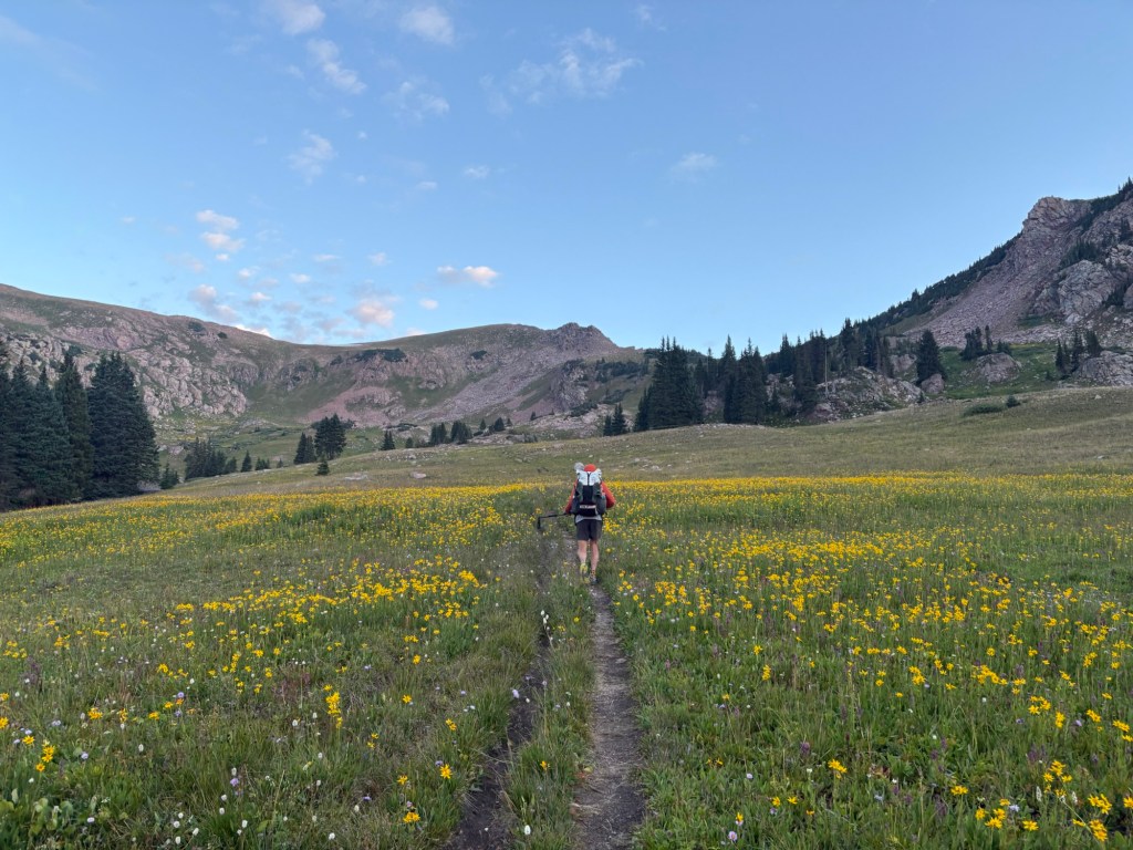
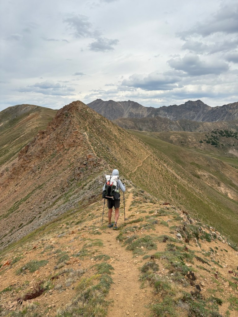
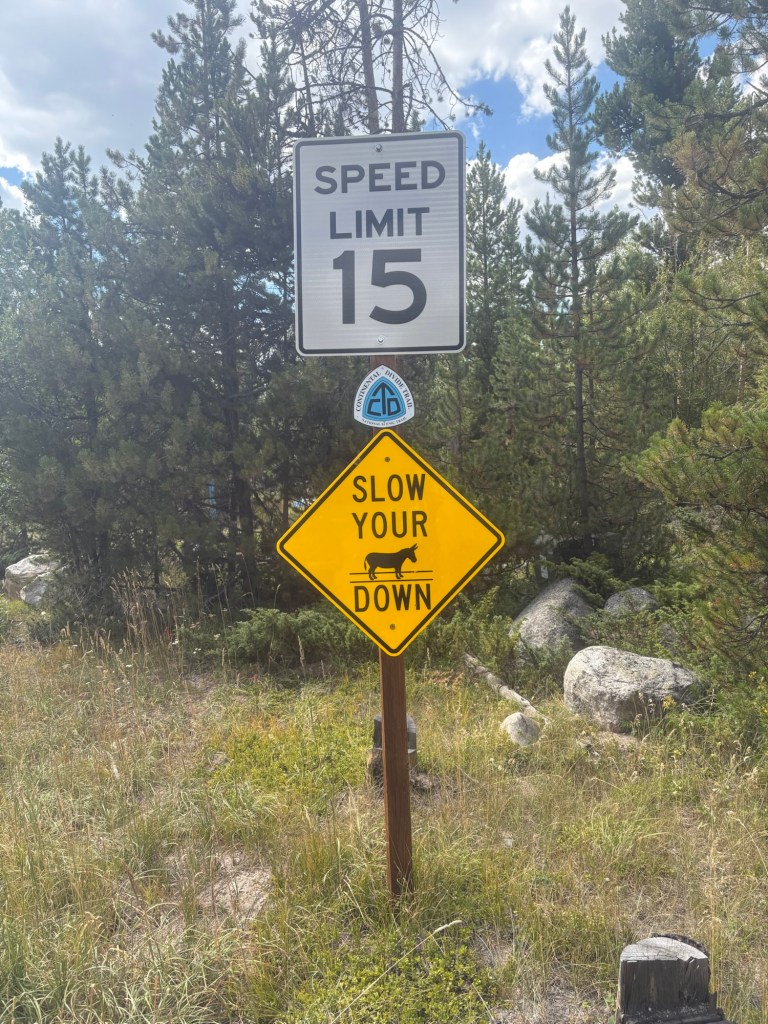
We were hiking by about 6AM. We quickly rejoined the proper CDT and began the 8.5 mile ascent to Lake Ann Pass, 12,595 feet. Beautiful views up there. Then came to obligatory descent, and it was steep and rocky for the first part. We met a couple of backpackers on their way up as we were coming down – Stats and Aquaman. Once we passed the junction with the Lake Ann trail we began to see lots of day hikers. After several miles the CDT diverged from the day hiker trail and traffic thinned out. We did meet several Colorado Trail hikers throughout the day.
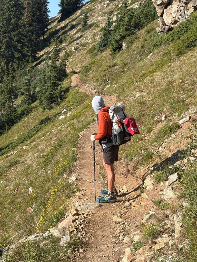
The trail became pretty “cruisy” – fairly easy to make good time. As we neared the turnoff to Hope Pass it began to rain and we donned our rain gear. At the turnoff we to took a short break before tackling the steep ascent toward Hope Pass. After the break we began the ascent. We planned to camp partway up the trail. Spokes took the lead, since he is a faster hiker. The pace was slow – very slow for me. In the 0.9 mile to the camp site, the trail gained over 1200 feet in elevation. Along the way we met and chatted with a couple of Polish hikers – Japanese Tourist and his partner SuzyQ. They’re from Gdansk, one of my favorite European cities.
Spokes was already at the campsite when I arrived and he had picked out two good spots for us. He then went a short distance uphill to fetch us water. Nice guy.
As we sat outside our tents boiling water for supper, it began to rain. We packed up everything and moved into our tents. Soon it began to rain harder and we were forced to eat in our tents. Fortunately, the water had boiled before the rain came.
We were hunkered down and another hiker arrived and pitched his tarp close to us. Kinda miserable weather. It’s 1.5 miles to the top of the pass and from there we’ll descend toward the town of Twin Lakes. We’ll resupply there, and maybe spend the night.
My heel blister is still there, but not too annoying. The blister on the ball of the foot that showed signs of reawakening has gone dormant again.
19.5 miles for the day, and one 12,000 foot pass.
Day 5
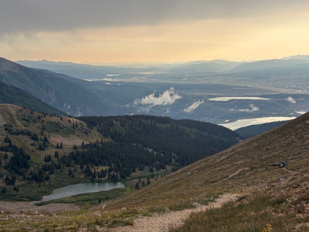
The rain let up shortly before dark, so we were able to stay dry while we brushed our teeth and hung our food so the critters can’t get it. In the morning we were up at the usual time, and hiking at about 6:30. Although the climb was steep, it wasn’t quite as steep as yesterday’s: only 900 feet of elevation gain per mile. Spokes arrived at the top about 10 minutes ahead of me. It was pretty windy, so we went downhill a bit to get out of the wind and finish our breakfast. About five minutes later clouds came drifting over the pass and we were getting snowed on. So we packed up and headed downhill. The precipitation didn’t last long, and as we descended the wind also decreased. We met several southbound hikers and a few day hikers along the way. Once below tree line the trail followed alongside a stream most of the way to the bottom. Where the trail turned east to go completely around the Twin Lakes, we went straight and followed an old jeep road to the river. The river was only shin deep where we crossed and on the other side we again followed the old road. Eventually we came to Highway 82 and followed that for 0.7 mile to the village. The woman behind the counter at the store told us that there might be a room available at the inn next door. So we went over there, and sure enough there was a room available because someone had cancelled when they learned there was no laundry on site. The room wouldn’t be available until 3:00, so we had time for town chores. We stashed our bags at the inn went for lunch from a food truck next door. Then we went back to the store and bought our resupply. Then it was back to the hotel to sort and stow the resupply food, etc.
Once the room was available, it was time for a shower and shower laundry. At about 5:30 we went for pizza from the other truck next door. After that it was a quiet night in town.
About 8 miles for the day.
Day 6
We were up by 6:30 and packed up our stuff. The breakfast buffet started at 7:00 and we wandered downstairs to partake. It was a pretty good spread. Shortly after 8:00 the store opened and I took an envelope containing unneeded items there to mail home. It was 9:00 by the time we walked out of the village and began our climb back to the CDT. Once we rejoined the trail we continued to gain elevation for a few miles. From there, it was up and down until we got to the top of the ridge at about 12,300 feet, 12 miles from town. We continued to meet southbound Colorado Trail hikers (the CT and the CDT coincide for many miles). Also some trail runners training for the Leadville 100 which takes place in a couple of weeks. There were a few mountain bikers, too.
We stopped for lunch at a campsite near a stream and rested a bit before pushing on another 7.5 miles. For much of the day the trail was fairly easy going, but there were a few climbs just to keep the lungs pumping. Near the end of the day we grabbed some water from a stream and came downhill on the trail to camp near a gravel road. So far we’ve seen three four-wheelers full of yahoos drive by, one mountain biker, and one trail runner. Saturday night fun. 18 miles for the day.
Day 7
After the yahoos roared by, it was quiet until about midnight when a windy little rainstorm moved through. Spokes was up for his midnight pee break when it hit. The wind had awakened me, and when the rain came I watched Spokes go headfirst into his tent. I needed my break, too, but I waited for the wind and rain to move on. About 30 minutes later I was able to stay dry while accomplishing my business. My mattress has sprung a leak, and every hour or two I had to blow it back up.
Come morning, Spokes was moving around before 5:00. The alarm was set for 5:30, but since we were already awake anyway we started the morning routine. We were on the trail a little after 6:00.
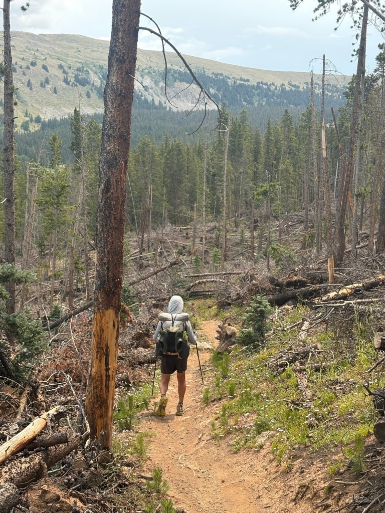
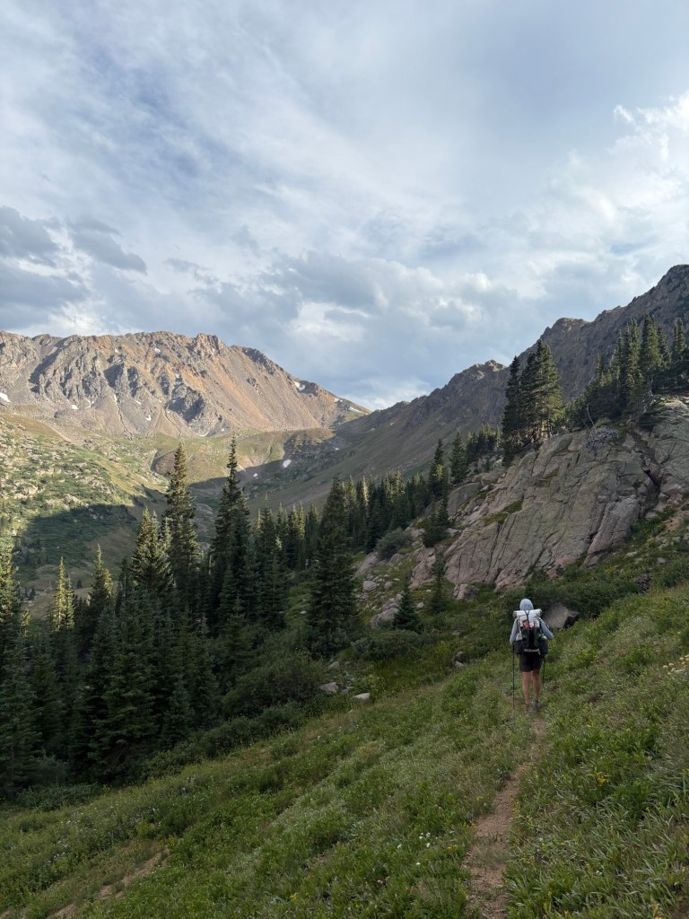
The morning began with a climb and for much of the day was very rocky with lots of tree roots. All of the normal ups and downs were more difficult because of the rocks and roots. We stopped for lunch in a sunny spot, and I inflated my mattress and dunked it in a creek to try to see if bubbles might indicate the location of the leak. No luck.
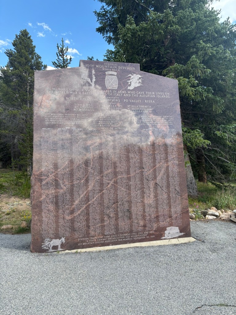
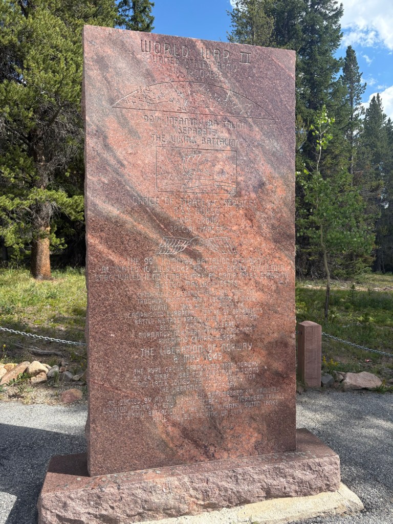
After lunch , the rocks and roots continued as we moved through the area where the 10th Mountain Division trained during World War Two. Around 2:30 we came upon some trail magic. A hiker named Rainman had set up a tent and was making grilled cheese sandwiches for passing hikers. He had beer and sodas and chips and great conversation. He knew a lot about the area. Such kindness.
After that the trail eased and we made pretty good time. For four or five miles the trail was the cruisiest we’ve seen since I came back to the trail. We went downhill to Tennessee Pass and crossed the highway to see the 10th Mountain Division memorial. Back across the highway to the trail, which followed a gravel road for a while. There are lots of marked cross country skiing trails in this area. Eventually the trail diverged from the road and continued its descent. We opted not to take water from a stream and carry it over a mile to camp. But we began to worry that the stream at our chosen campsite might be dry. Fortunately, there was water at the campsite. There are a few Colorado Trail hikers camped around here.
Our first 20 mile day since I returned to the trail. Colorado makes you work for it.
Day 8
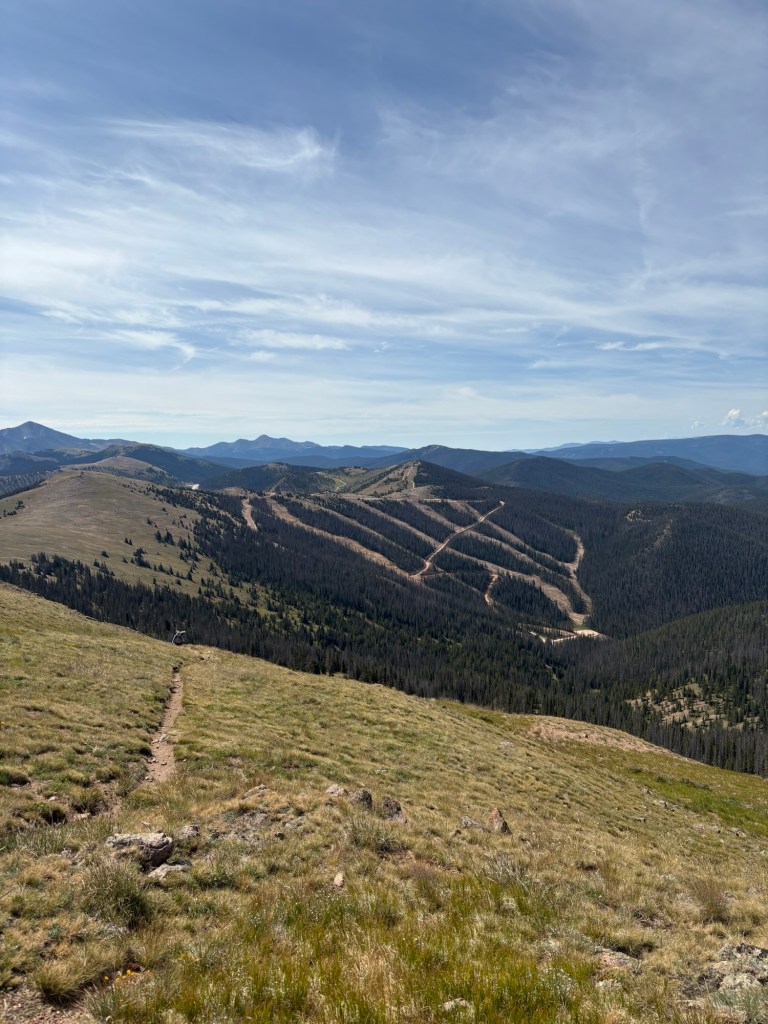
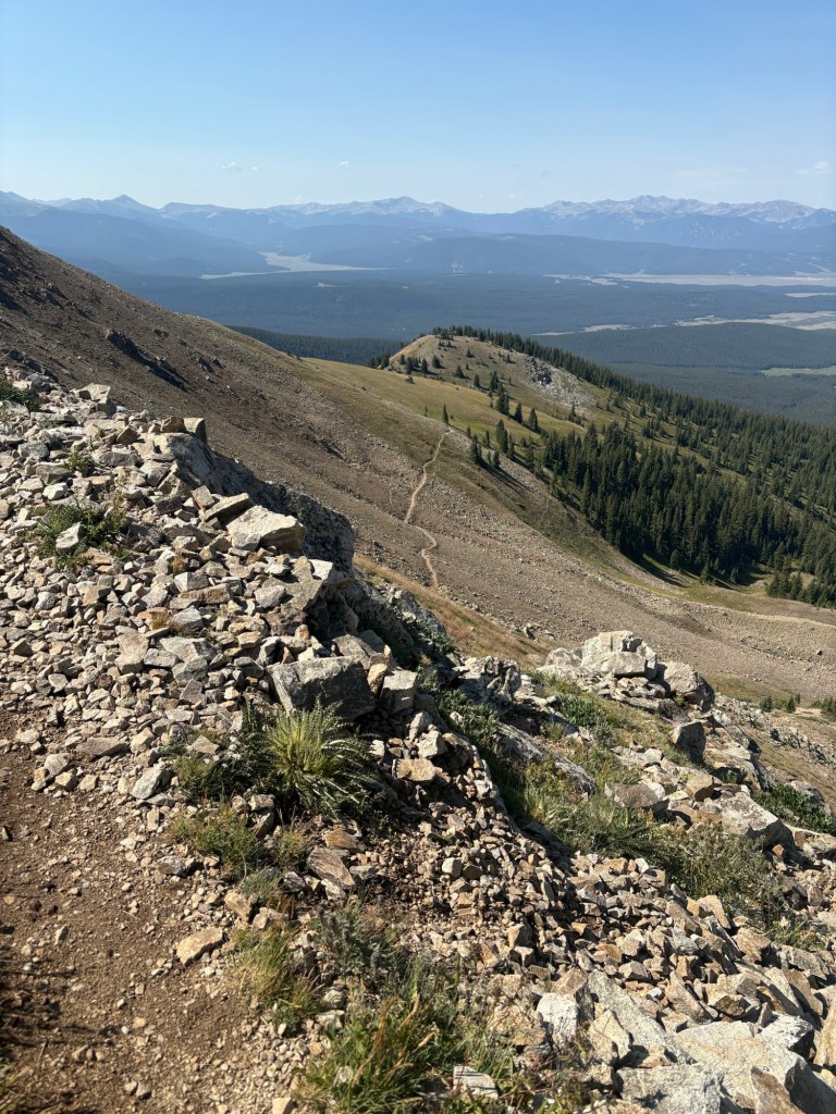
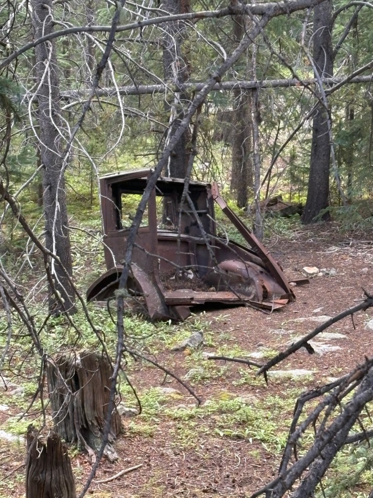
We were up at 5:00 and hiking at about 6:00. The trail began with a slight downhill, and in 2 or 3 miles we came upon another trail magic setup. There was a group of about five friendly young hikers making pancakes and coffee, etc. We sat with them and chatted for a bit while Spokes had a couple of pancakes and I drank a cup of coffee. After leaving there, the trail descended and then leveled off onto a gravel road. We passed some bunkers left over from the 10th Mountain Division days, then joined another road. Soon the trail diverged from the road and began to climb towards Kokymo Pass (12,024 feet). Along the way we encountered several southbound mountain bikers and also several southbound CT hikers. It was about a six mile climb, and at the top we paused for a break and to check for a cell signal. About 100 yards up the hill from the pass there was a lone sheep hanging out. We’d heard from another hiker that a rancher on a horse, traveling with a dog, had been in the area looking for stray sheep but we saw no ranchers. After the pass, the trail climbed to Elk Ridge (12,281 feet) before beginning a descent to Copper Mountain Resort. We felt cheated, having come to Elk Ridge and only seeing a lost sheep. Also, from Elk Ridge we could see a couple of massive tailing ponds from mines.
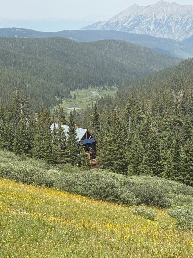
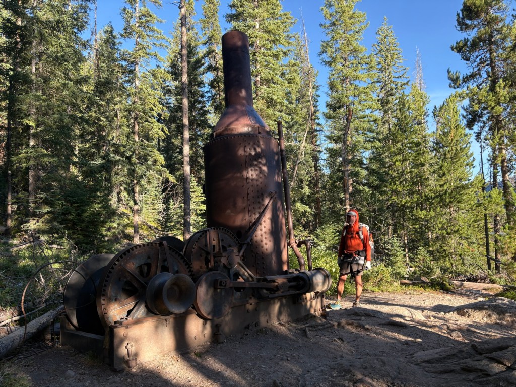
Descending from the ridge the trail was rocky and steep at first. We passed by Janet’s Cabin, originally part of the 10th Mountain’s hut system. It is being well maintained and is apparently rented to cross country skiers during the season.
As we descended we encountered many southbound hikers, and chatted with a few. At about 4:30 we came to Jacques Creek and found a campsite. It was a bit early to stop, but camp sites are scarce around Copper Mountain Resort and we will still need one more night before arriving at Silverthorne (our next stop).
17.5 miles for the day.
Day 9
Last night was quiet, except for the sound of me blowing my mattress back up 3 times during the night. There’s a leak, but I can’t find it.
We were hiking by about 6:00 and it was mostly downhill for about 3 miles to Copper Mountain Resort. As we approached the resort we stopped to chat with a couple of women walking their dogs. We walked through the large complex and stopped at a gas station for some coffee and a rest room opportunity. After about 40 minutes we moved on. We followed a road that passed over the freeway and joined the proper trail. We are diverting from the mainline CDT to take the Silverthorne Alternate.
Of course it was a climb out of the resort, but the spectacular views made it worthwhile. Also, since we’re no longer on the mainline, we’re seeing hardly any other hikers. We passed two women out for a day hike on our way up to Uveta Pass, and just after the pass we encountered a couple who had summited Uveta Peak and were taking a break.
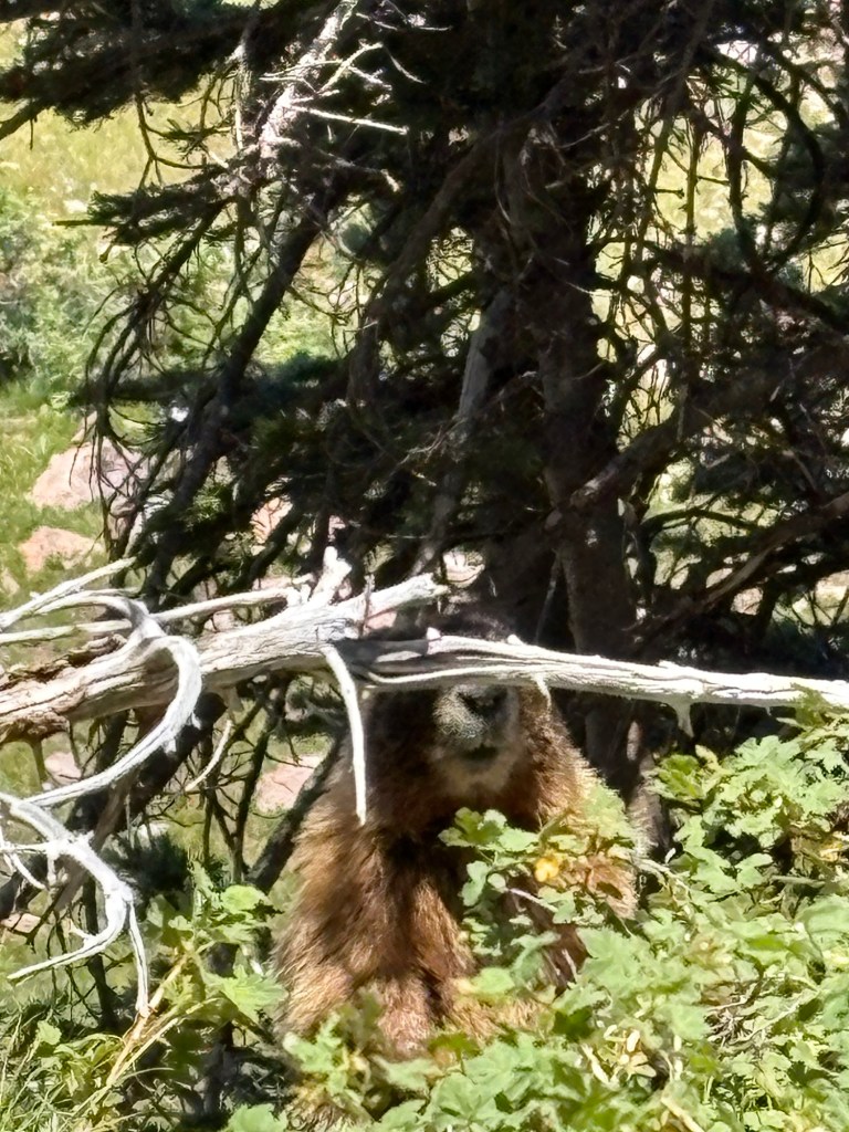
We stopped for lunch at a small lake and were visited by a pika and a marmot who were obviously looking for a handout. They got nothing from us. We took the opportunity to rinse out yesterday’s socks and hang them on our packs to dry, then headed downhill again.
There had been some confusion about the route in this section- apparently the route shown in our navigation program is grossly inaccurate and some of the comments from hikers reflected this. We just followed the obviously maintained trail and didn’t worry about being on the line shown in the program. We had no navigation problems.
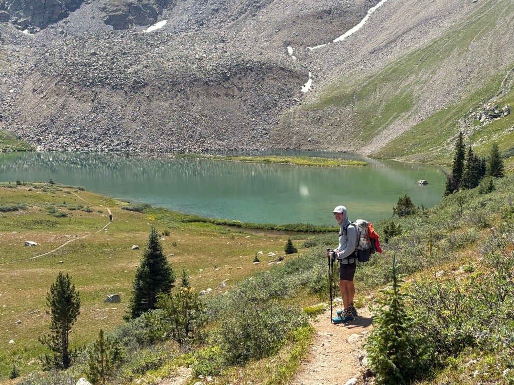
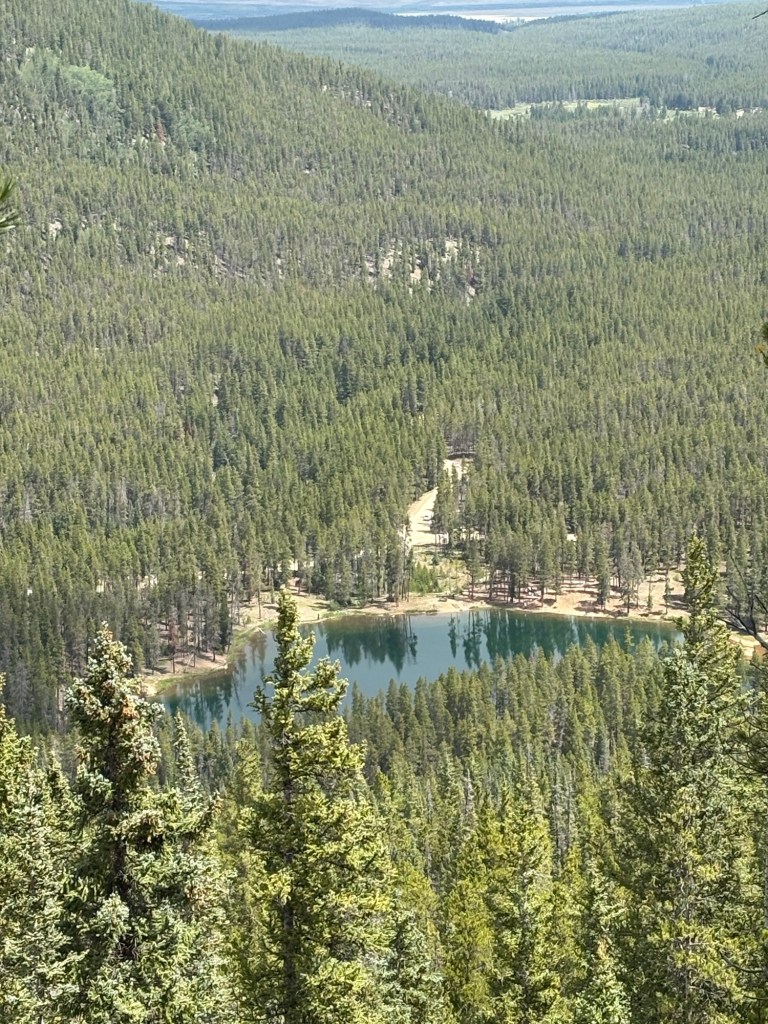
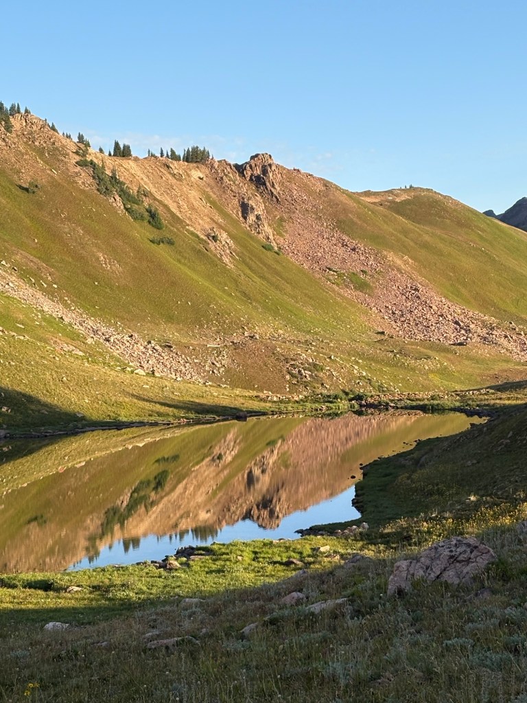
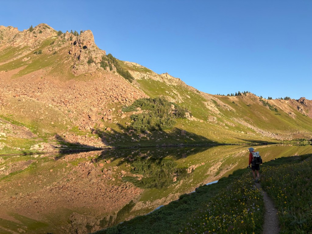
At the creek at the bottom of our descent we stopped for a short break. From there it was 2.8 miles to our intended campsite at a small lake a mile or so before Eccles Pass. Another stiff climb and we arrived at the lake. We scouted around a bit before finding a suitable spot some distance from the lake and settled in.
Day 10
Town day! Up at 5:00, hiking at 6:00. The climb up to Eccles Pass was eased by the spectacular views. This section is incredibly beautiful. It was about 42 degrees when we started and the climb warmed us so it was a comfortable hiking temperature. We stopped several times just to gawk at the scenery. After topping out at Eccles Pass we took a short break and then headed down to town. After about 5 miles or so we began to encounter day hikers; more day hikers than I expected. And the trail began to add a little “up” into the “down”. Eventually we came to the trailhead and began our road walk to the hotel. The Silverthorne/Dillon/Frisco area seems like one big strip mall and is definitely automobile oriented. When we arrived at the hotel a little before noon we were told we wouldn’t be able to check in until 3:00. So we went for lunch, visited REI, and talked to a southbound hiker named Villain. We explained the navigation issues in our navigation app and hopefully saved him from the confusion other southbounders have complained about. Eventually we were able to check into the hotel and grabbed a shower. Later, we took all of our clothes to the laundromat, wearing only our rain gear, and started them in a machine. Then we went next door for a pretty good Mexican dinner while the laundry was going. After dinner we put the clothes in the dryer for a few minutes (all our stuff is quick drying) and when it was finished, we bagged it up and headed for the hotel. Even in town, hiker midnight comes early.
About 11 miles for the day.
Day 11
Zero day in Dillon, resting.
Day 12
We arose early and mostly packed up, then went downstairs to enjoy the meager, but free, hotel breakfast among the itinerant roofers and other workers staying at the hotel. After that, it was back upstairs to finish packing, grab our packs, and hit the road.
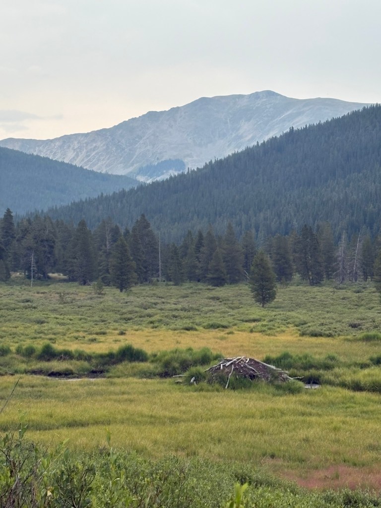
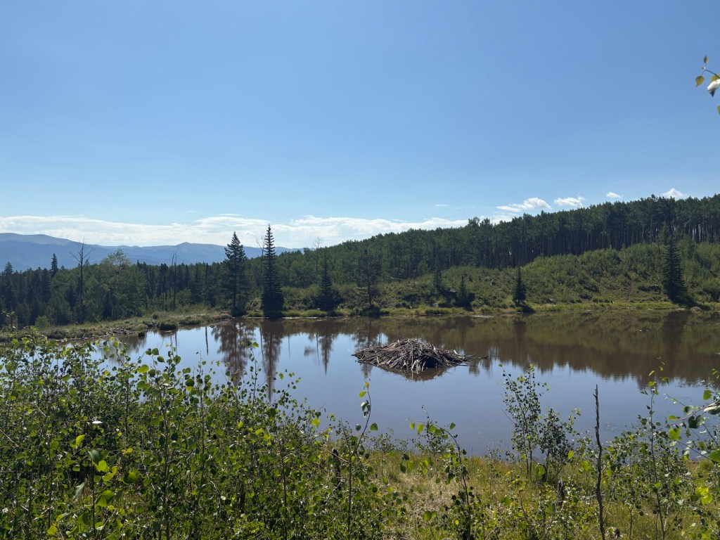
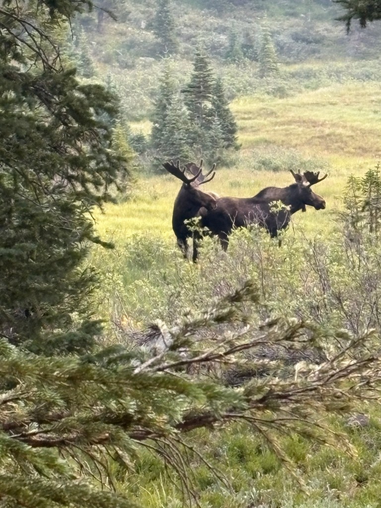
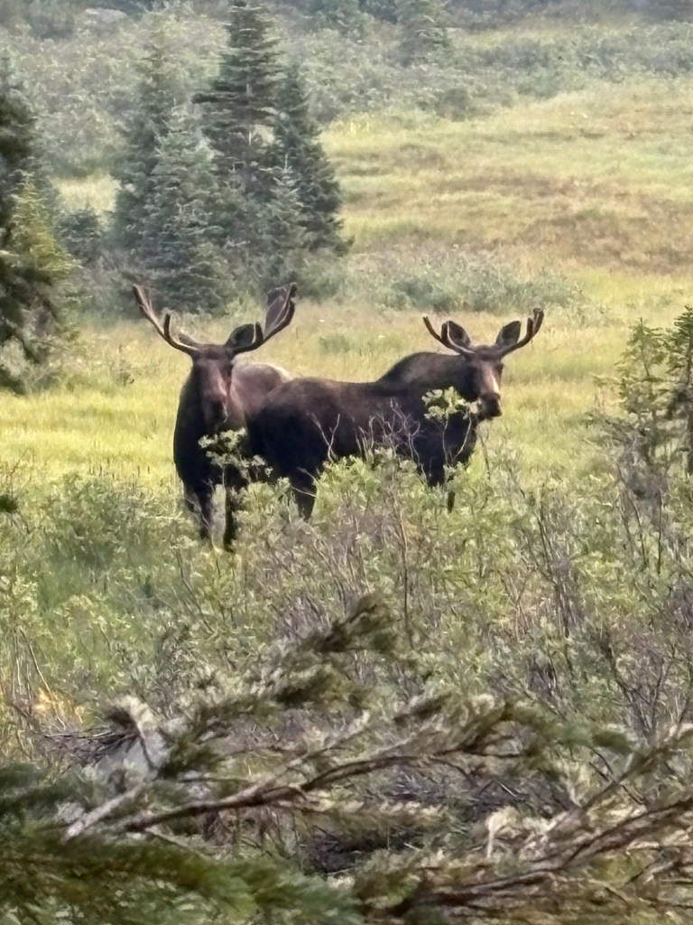
It was about a two mile road walk, passing under the freeway and moving uphill to the trailhead. It was about a 3000 foot climb over 8 miles to Ptarmigan Pass (11,781 feet). The lower trail was in good shape and seemed like it got a fair amount of traffic. As we climbed the views got better, especially above tree line. From the pass we descended to the South Fork of the Williams Fork creek and stopped for lunch. Then it was up and over a ridge and on to Bobtail Creek to camp for the night. We saw no moose, but our campsite seemed to be the favored dumping ground for moose droppings. I had to kick a lot of them aside to make a clear spot for my tent.
About 19 miles for the day.
Day 13
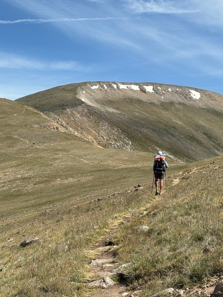
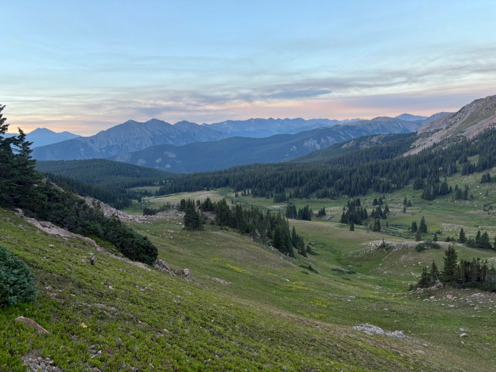
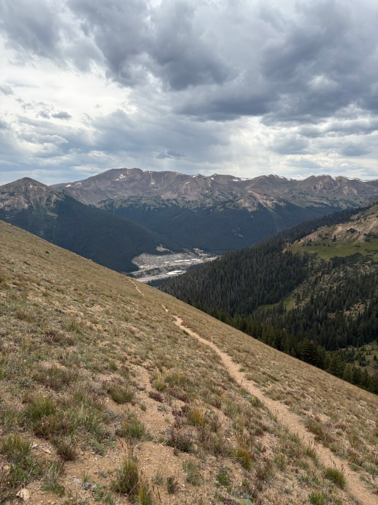
While hiking from our camp towards the mainline CDT this morning we saw four moose at a distance of about 50 yards. As we passed by, they watched us as carefully as we watched them. After a couple of miles the trail joined a road and began a steep climb up to a ridge to rejoin the CDT. We stopped for a break on the ridge and there were numerous 4-wheel ATV’s and dirt bikes buzzing around. Apparently a popular spot for that kind of activity. Shortly after the break we entered the Vasquez Peaks Wilderness and soon reached the summit of the ridge (12,648 feet). We stopped for lunch at a stream and took a short break. Then it was about a mile and a half climb to Stanley Mountain Summit (12,499 feet). After that it was basically a ridge walk in very windy conditions, often above 30mph. Late in the afternoon we descended to tree line and ended up at Berthoud Pass where there was a warming hut with pit toilets and garbage cans, but no water. There was a family group taking senior graduation photos in the forest nearby. We scouted around and found a camp site and then searched for a water source. Eventually we scooped some water from stagnant pools in a drainage channel. Not optimal, but we’d had worse in New Mexico. It filtered clear and tasted okay.
About 17 miles for the day.
Day 14
This morning we broke camp, packed up, and paid another visit to the warming shed. It’s nice to be able to unload whatever trash we have, rather than carry it for another couple of days.
After that, it was about a 3 mile trudge to the summit of Mt. Flora (13,123 feet). As we were coming down from Mt. Flora we met a hiker named Interview, who said, “James Peak was a bitch”. He was correct. We descended to Fall Creek for a lunch break, and then began the long slog to the top of James Peak (13,309 feet). The lower part was forested switchbacks, and for a brief period we followed a road. Eventually we broke out of the trees and for about a mile or so it was fairly level trail. Then the climb began. It was a long and slow climb, with several false summits. It was also a little windy. When we finally reached the summit we had to search for the trail down. People had placed some confusing cairns and there were at least a couple of places where rocks had been piled to create windbreaks, possibly with the idea of overnight bivouacs. The trail down, once we found it, was very rocky with tricky footing. So the descent went slowly for a while. Then the trail followed the side of a ridge line, just a bit lower than the top of the ridge. It was a steep slope overlooking a valley. When the trail met Rogers Pass we followed an old jeep trail that took us to a lower elevation where we expected to find water and a more protected campsite. The ridge line had neither water or protection from the wind. After switchbacking down we eventually came to a stream where we grabbed some water and then began looking for a decent camp site. We found nothing suitable until the jeep road met the the road to Rollins Pass. The road to Rollins Pass is actually a long abandoned railroad bed. We scouted around and the best we could do was a sloped site just off the jeep road, where someone had tried to make a lean-to against a tree by piling up limbs and branches. It had collapsed, and we pulled it apart and tossed the branches downhill. There were also signs that people had used the area as a toilet, and we cleared that out, too. After pitching the tents, we sat on the fire ring rocks and cooked supper. I noticed movement out of the corner of my eye and turned to see a fox on the jeep road, maybe ten feet away. It had a look on its face like “What’s for supper, guys?” It wanted to hang around, but we tossed rocks at it until it moved away. I think it was Spokes’ imitation of a roaring bear that finally sent it down the road. It had been a long day and we hung our food bags and crawled into the tents.
About 19 miles for the day, and two 13,000 foot peaks.
Day 15
Although we expected another visit from our friendly fox during the night, there was no evidence of it. Despite my best efforts, the sloped site kept me and my mattress sliding downslope all night. I’d wake up, move things back uphill, and pass out again, and repeat. In between, I managed to get some sleep.
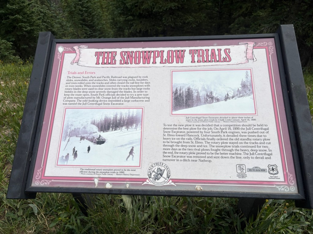
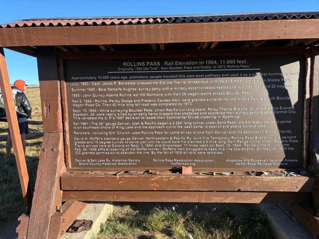
It was just over three miles from our camp to Rollins Pass, and it was a nice morning. Along the way we passed a few car campers. When we reached Rollins Pass we took a few minutes to read the historical info signs before heading up the ridge.
The trail climbed up and over a saddle before descending fairly steeply to Cabin Creek. From there the trail climbed a bit before more or less leveling out in a series of up and downs and kind of cruisey traveling. Toward the end of the day, the trail began a descent and we found a camp site near a stream and a short distance from an old collapsed log cabin. Just after we pitched our tents a young couple showed up and shared our camp site. We had a nice time chatting while we all ate our supper.
About 18 miles for the day.
Day 16
We were up before the young couple, and tried to be quiet as we broke camp. It was to be a town day, and we expected a fairly smooth trip on the way to Grand Lake. But I’ve found that every time you think Colorado is going to cut you a break, it screws you.
I hadn’t been feeling great for a couple of days. I think the 13,000 feet of elevation was affecting me. I had almost no appetite and had occasionally gagged while trying to force myself to eat lunch. Also, my feet were bothering me – the blisters that knocked me off the trail earlier had not returned, but the areas were becoming very sensitive. The pollen was also causing issues in my sinuses. A litany of complaints.
So, while the trail generally tended downhill towards Grand Lake there was an awful lot of “up” in that “down”. PUD’s (pointless ups and downs).
As we lost elevation, my appetite began to return. But the feet still hurt and the sinuses were causing pressure on my back teeth. The views of the lakes from the trail were great, and the weather was clear. The day was pretty hot as we worked our way through the ups and downs. Eventually we came to a trailhead and began the road walk to our hotel. We arrived just before 4PM.
Grand Lake is a cool little town; a gateway town to Rocky Mountain National Park. So it’s a little expensive. After a shower we went next door to the laundromat. Then it was time for supper. We went to a pretty good barbecue place. On the way there we ran into Stitch and her friend Deferred. We hadn’t seen Stitch since Lordsburg- we were in the restaurant after having walked from the border, and she came in. Her shuttle to the border was the next morning, and she joined our table. It was cool to see her again.
After thinking things over for a couple of days, I decided to leave the trail at Grand Lake. I was concerned about heading back to high elevation and not being able to properly fuel my body if I had no appetite. The feet and the sinuses also contributed to the decision. I hated to bail on Spokes, but I also didn’t want to end up in a situation where he would need to babysit me, or where I’d need to bail out at some random trailhead. It’s disappointing, but I’ll figure out a plan and return to the trail.
About 20 miles for the day.

Leave a comment