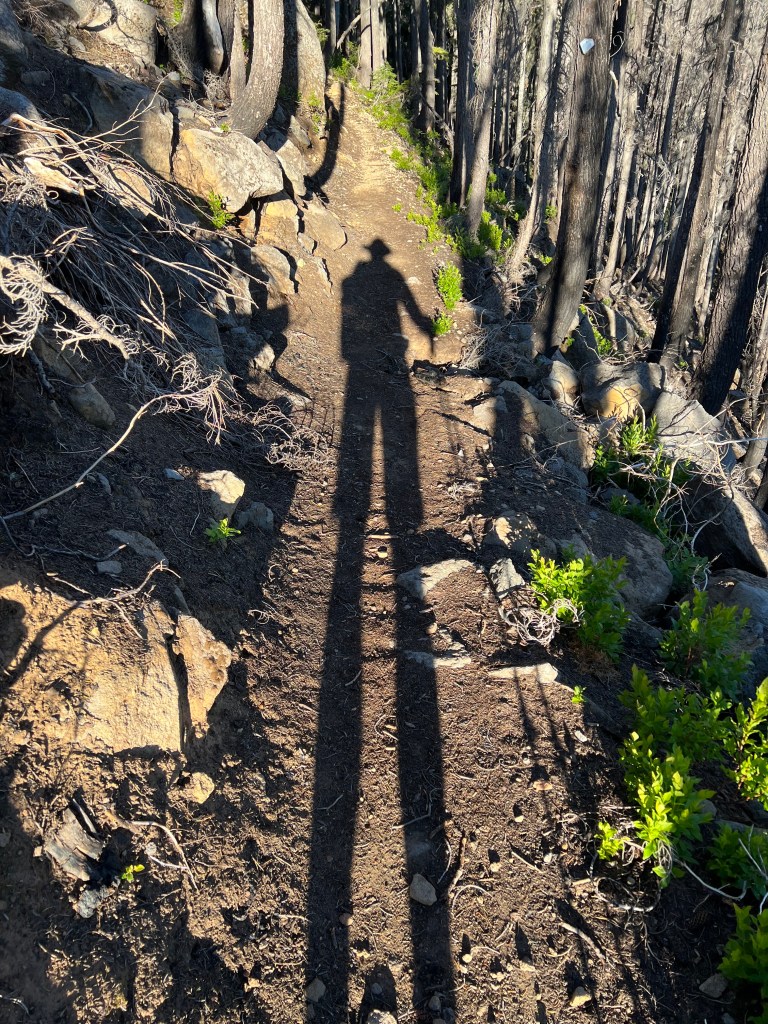
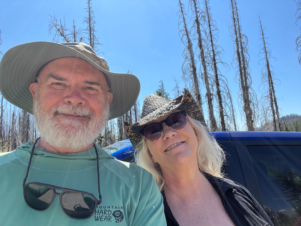
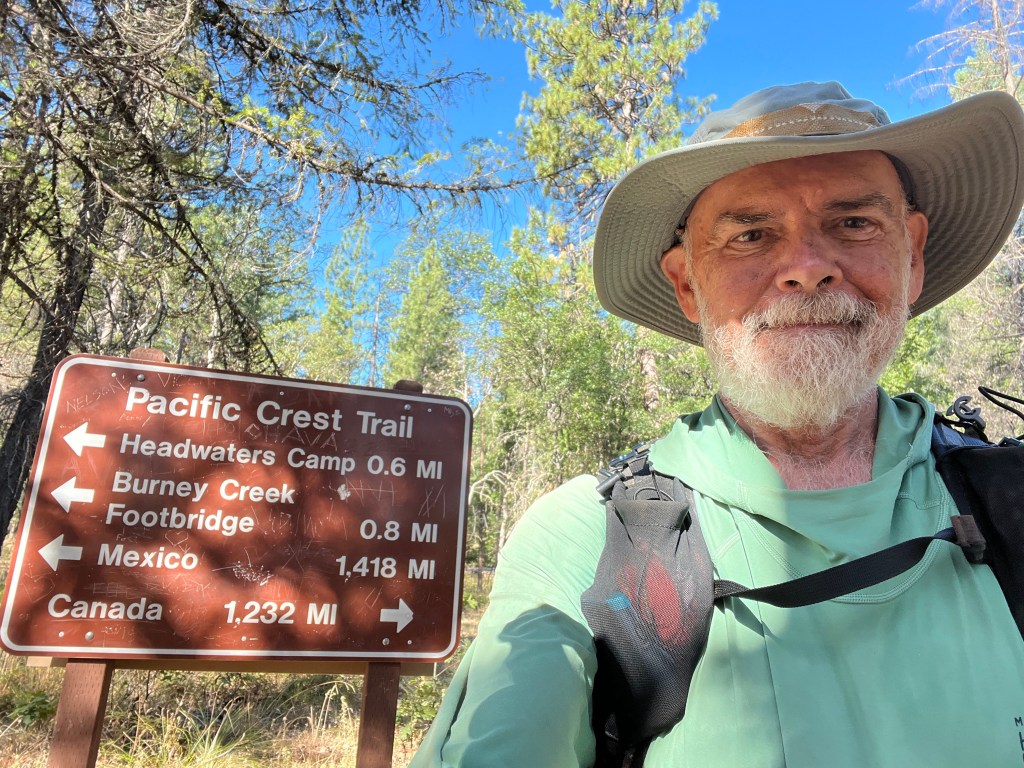
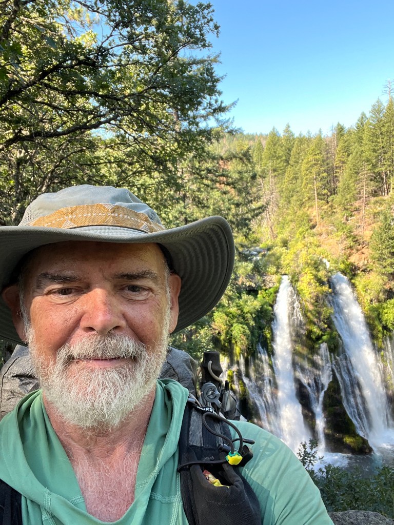
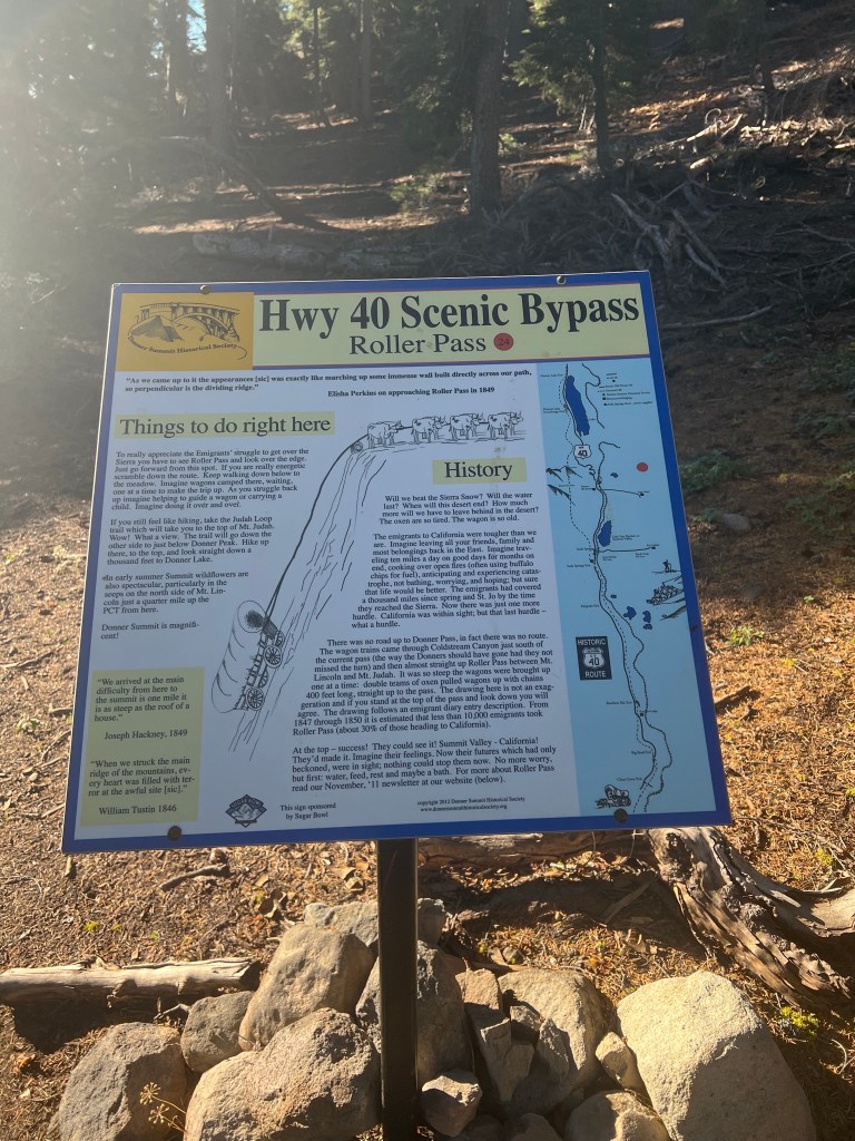
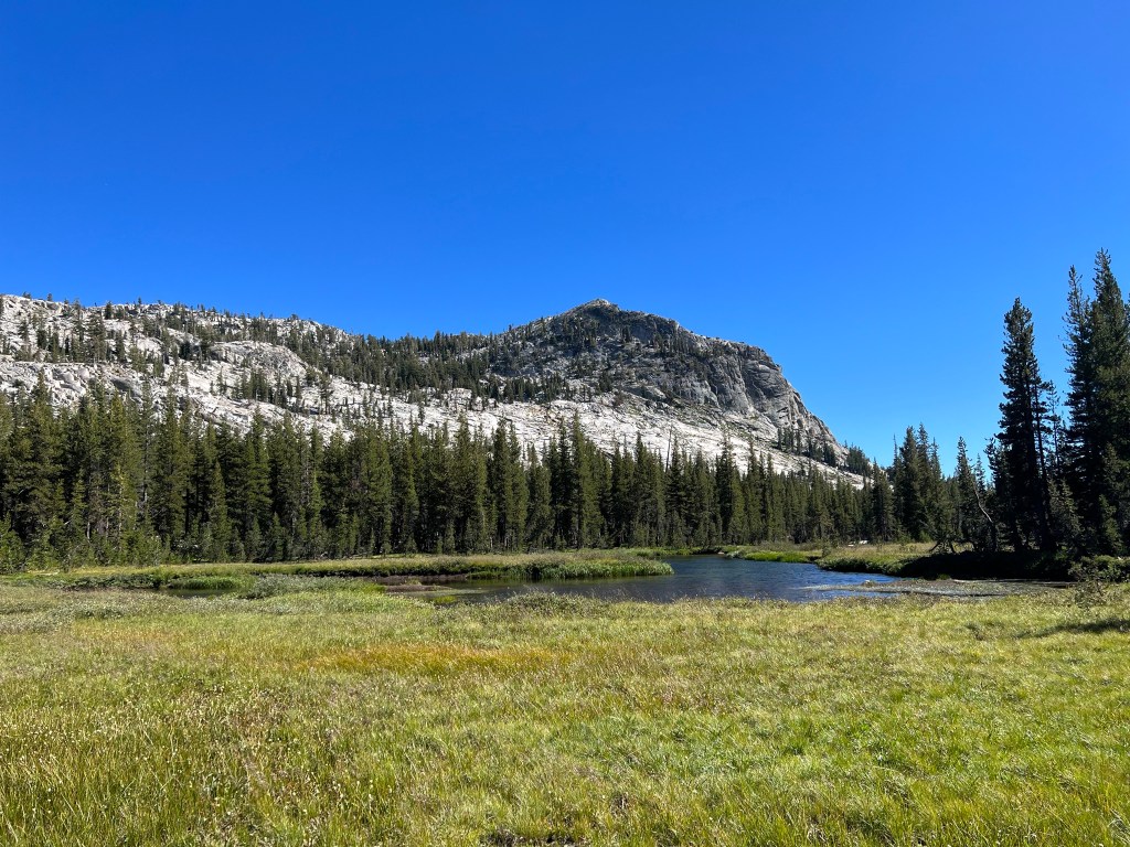
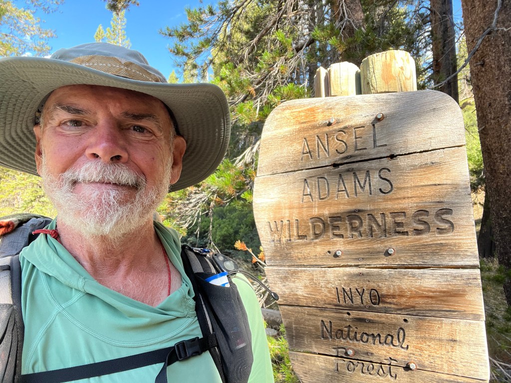
PCT, D-Day minus 01.
After a few last minute home projects and transportation snags, tomorrow I’ll finally be on the way to the trailhead to begin my southbound Pacific Crest Trail hike. I’ve previously section-hiked the PCT through all of Washington and the northernmost 60-some miles of Oregon. This year, I’ll try to finish the trail at the Mexican border. I’ll be taking the train from my hometown to Portland, OR and from there a bus to Government Camp, OR. I’ll pick up the trail about 7 miles east of there, and begin hiking south. I expect to encounter some snow in the higher elevations and probably hordes of mosquitoes. I have microspikes and DEET in the backpack, along with a mosquito headnet. I’m also carrying an ice axe, just in case.
Day 1
Jackie dropped me off at the Edmonds train station this morning.
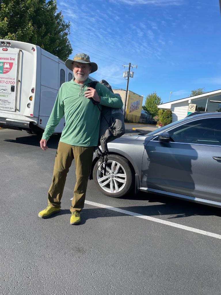
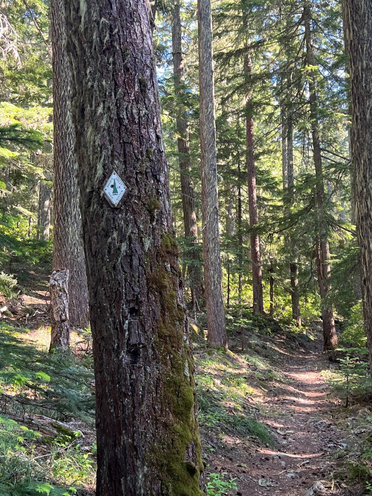
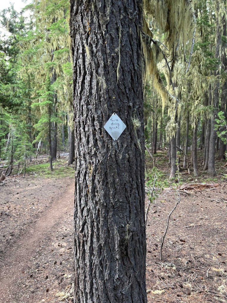
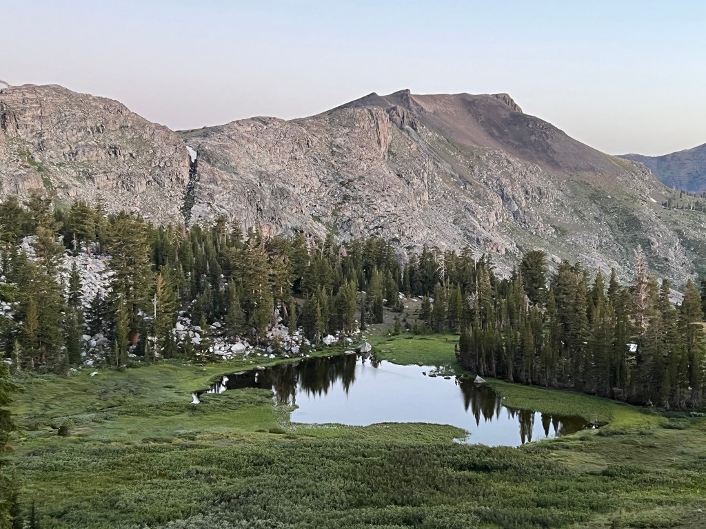
From there, I caught a bus to King Street Station and rode the train to Portland. From Portland I caught another bus to Government Camp. The bus driver was kind enough to drop me off at the trailhead 7 miles down the road. That enabled me to hike 8.8 miles to Timothy Lake where I am camped for the night. The trail was in good shape except for a few blown down trees across the trail. The first PCT blaze I saw was an old school one, just like the one I have hanging in my garage, which was given to me by a dear friend. It came from her father who had done some trail work back in the day and it was never used.
Good to be on the trail. Feet, ankles, knees and hips all feel fine. Frogs at the lake are singing a lullaby. Hoping for an early start in the morning.
Day 2
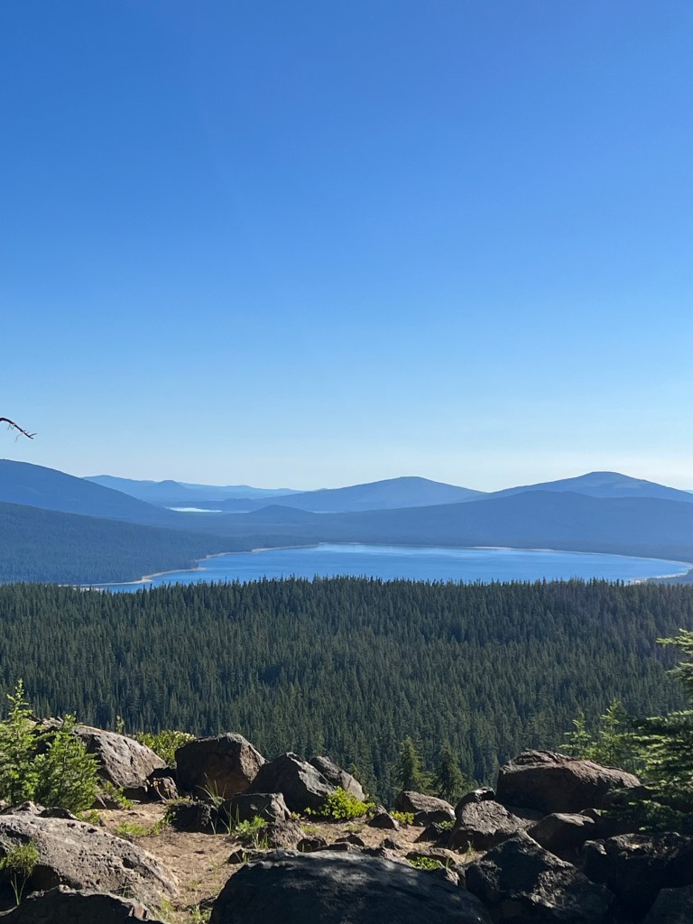
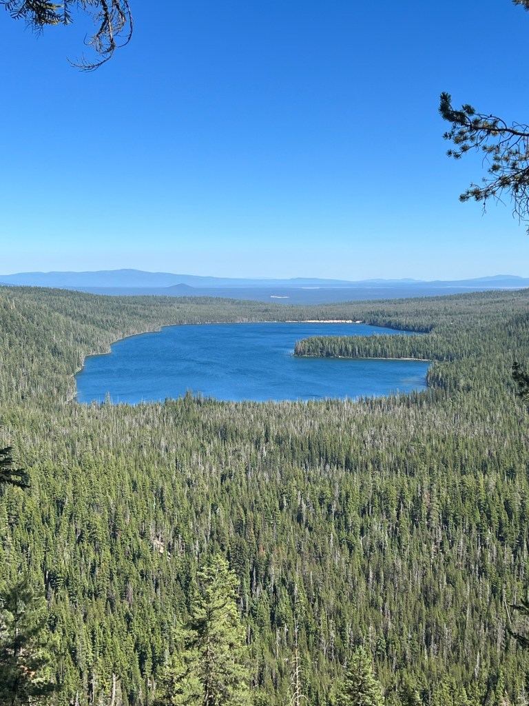
Timothy Lake to Pinhead Saddle 19.7miles
Started hiking at 06:20 this morning. Nice day, but it warmed to about 80 this afternoon. Got 13 miles in by noon when I stopped for lunch at Warm Springs River. I sat on the low bridge and soaked my feet for a few minutes. The river was colder than the name would suggest. I met one hiker on the trail today, trail name IPA. She thruhiked the PCT in 2017, and is just hiking all of Oregan this year. We leapfrogged a couple of times, but I doubt I’ll see her again. She’s pretty speedy. After the river, it was a steady six mile climb in the hot afternoon. I was in low gear for a while.
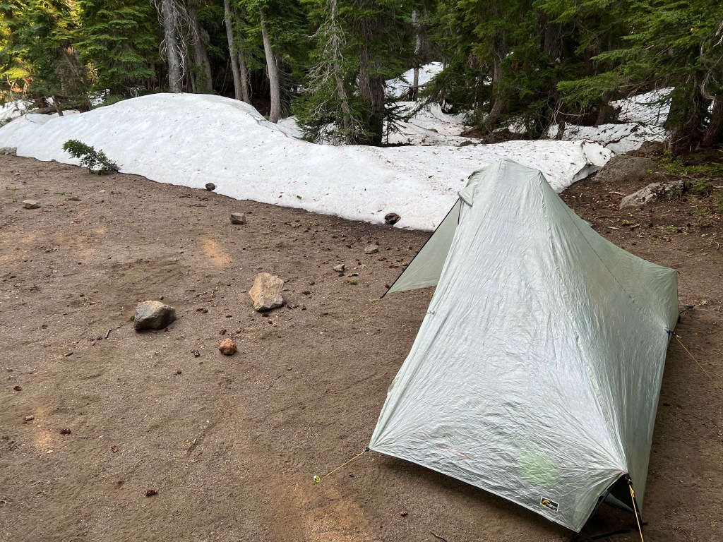
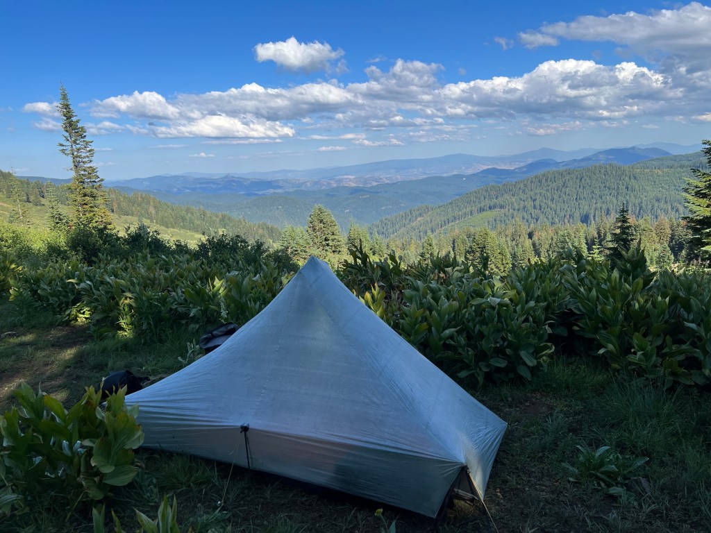
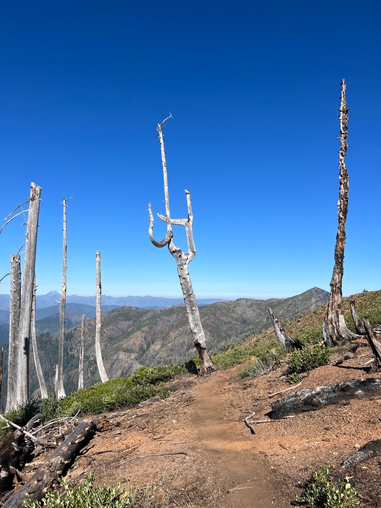
Now camped at Pinhead Saddle. No Zippy in sight. Hard to find a camp site not next to dead trees. Don’t want to pitch the tent under a snag. I squeezed the tent into a small, safer spot. Bit of an evening wind blowing.
I found a tick on my arm when I was getting ready for bed. It was really dug in, and there was some redness spreading from the bite. I knew better, but I butchered the thing trying to get it out, even though I was using one of those tick removal tools. Tick parts remain in my arm. I’ll see what develops.
Day 3
Pinhead Saddle to Olallie Lake Resort, 13 miles.
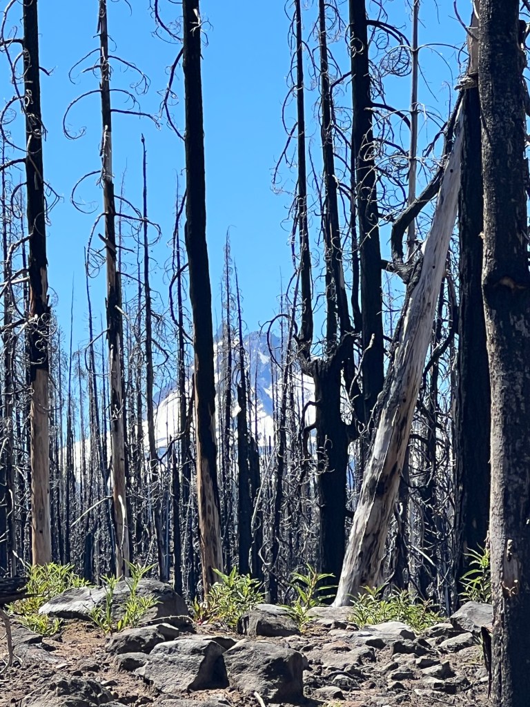
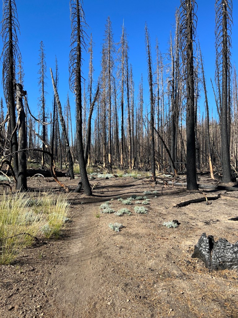
Woke up with a stiff left hip. It was fine last night, never noticed it until I started moving around this morning. I thought it might work itself out by walking – yeah, not quite. So after walking through the part of the Lionshead fire zone, I pulled up at Ollalie Lake to give it a rest. The folks at the resort are really nice, and they let me camp in their day use area (all their cabins are full). Busy place, no Wi-Fi or cell. It was miraculously saved from the fire. It would be worth a visit if you’re looking for some downtime. I took the opportunity to finish my tick surgery and finally got the rest of tick out. It’s still a little red in the area and I’ll keep an eye on it. 10 mile uphill climb through a burn zone in the morning and I assume I’ll encounter snow. It’d be nice to push up and over and then downhill til I’m out of the burn zone before camping for the night.
Day 4
Lake Olallie Resort to Woodpecker Ridge Trailhead -19 miles.

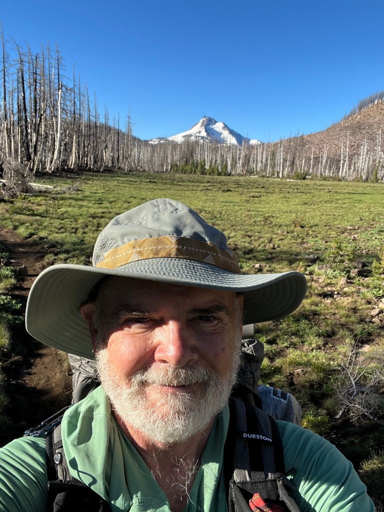
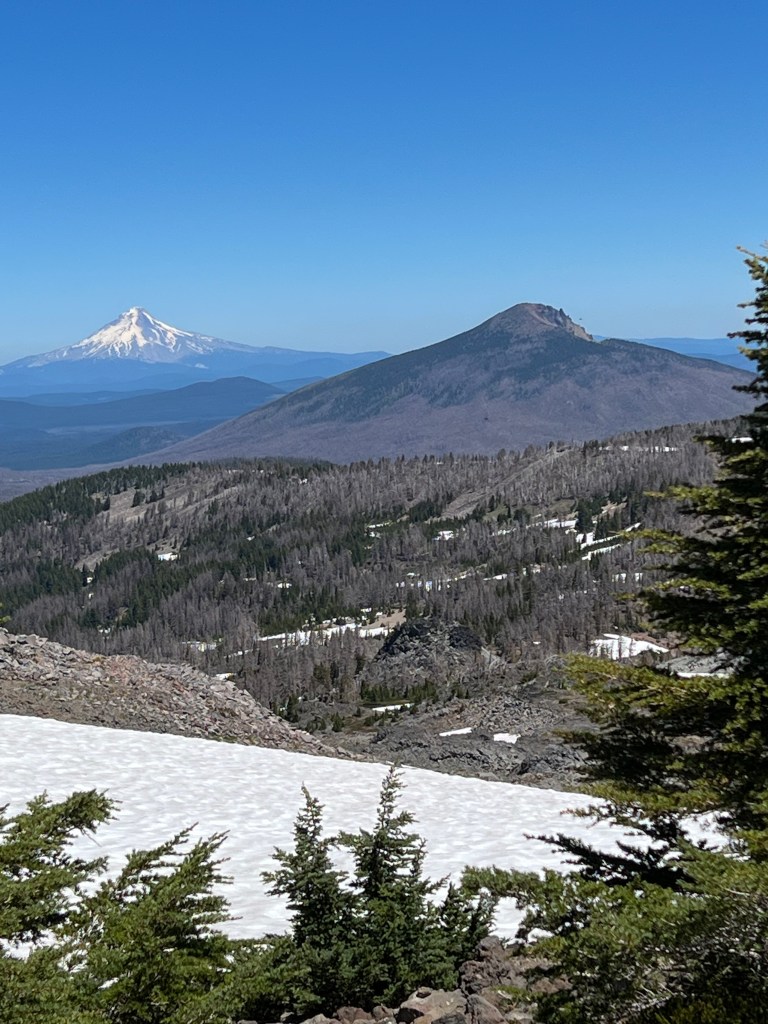
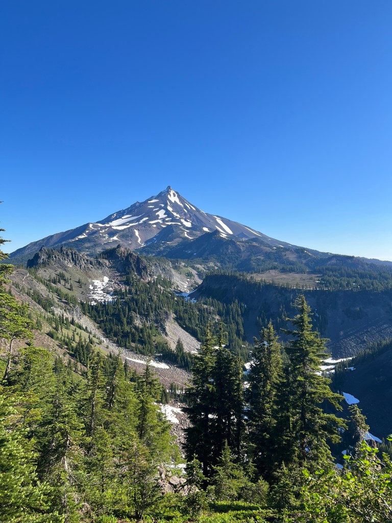
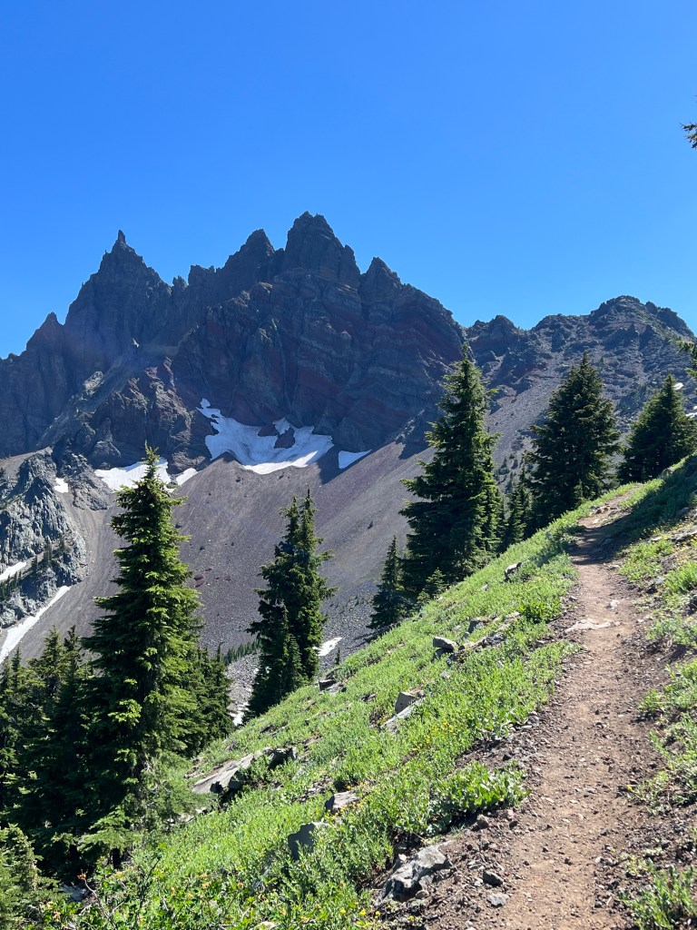
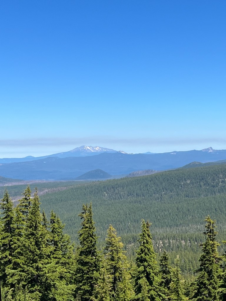
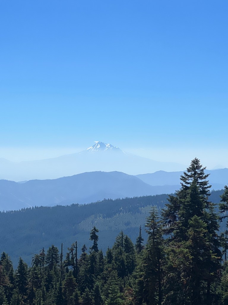
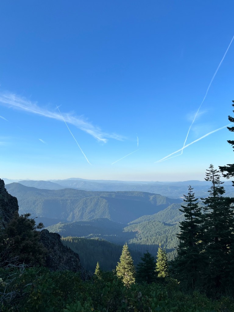
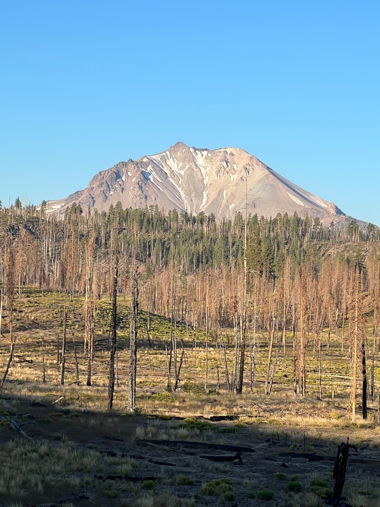
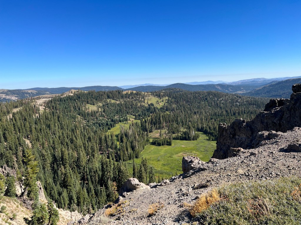
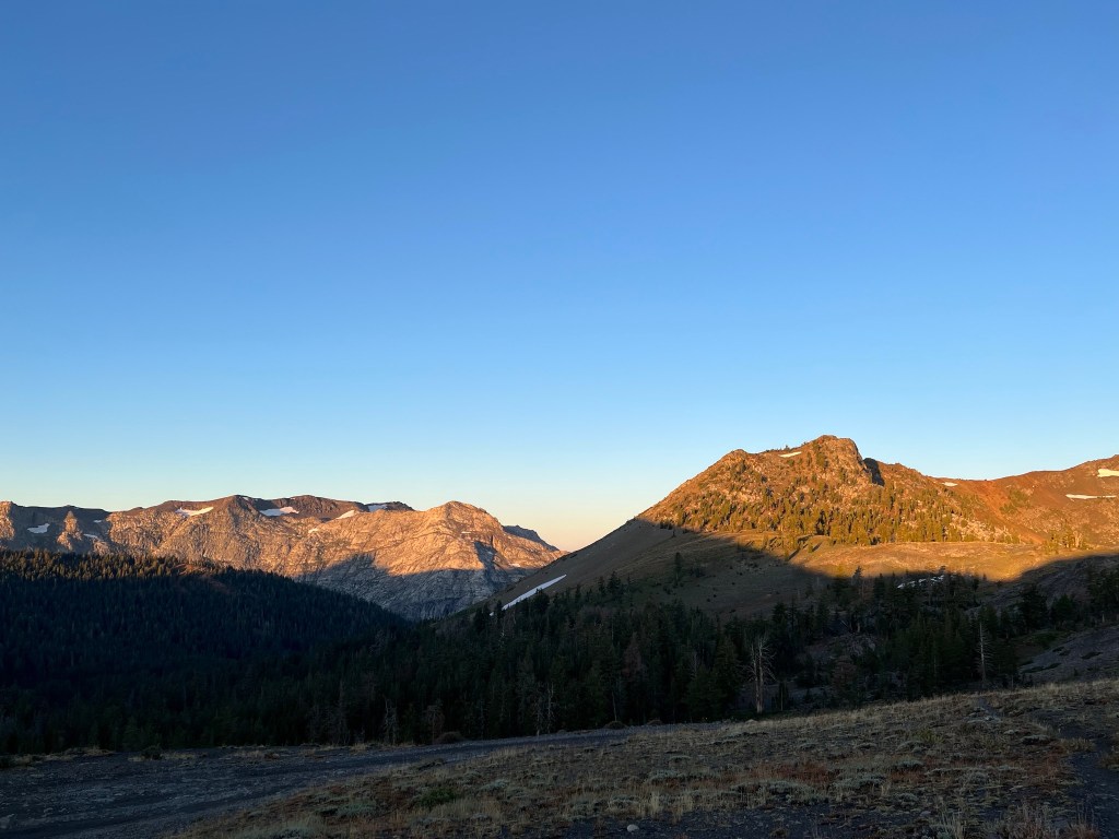
The hip was much improved when I woke up this morning. Packed up, and after getting a scouting report on snow conditions from a northbound camper I headed out. It was a steady climb through the burn area, with great views of Mt. Jefferson and the surrounding area.
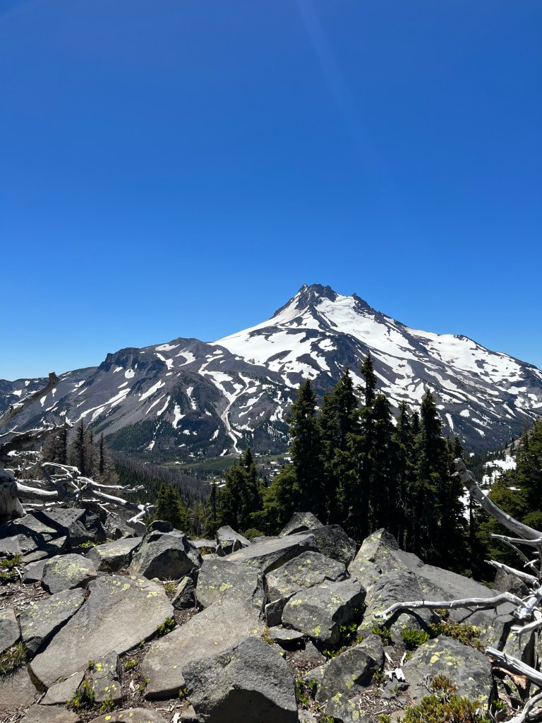
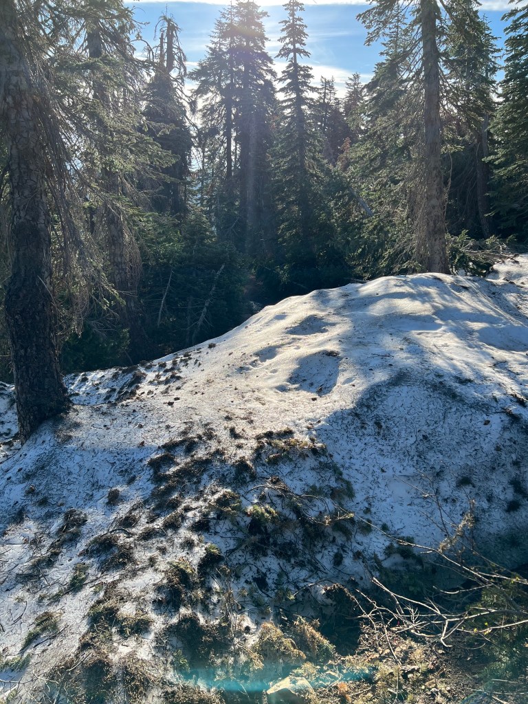
Larger snow patches began at around 6000 feet and I was glad I had my microspikes, but the ice axe was not needed. I took a lunch break at the crest and the border of the Mt. Jefferson Wilderness area.

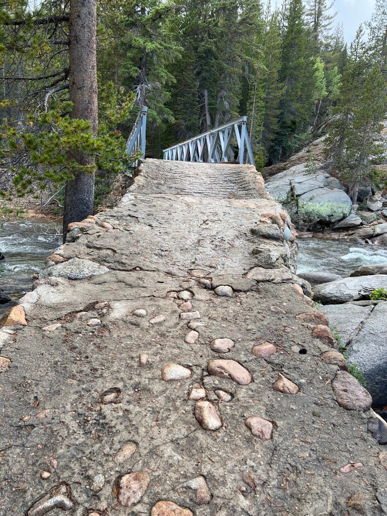
From there, it was downhill for a while. Some minor navigation hitches occurred when I followed the wrong footsteps in the snow once or twice, but I managed to spot the errors in time to avoid bonus miles. Only saw a few northbounders; three thru hikers and a few section hikers. Stepping off the wooden plank bridge over Whitewater creek, I rolled my right ankle. It felt a bit worse than the usual ankle roll, but there was no pain when putting weight on it. I kept going and it was feeling okay. But at Russell Creek, a fast moving stream, I took off my socks and removed the insoles before lacing back up and wading the creek. When I was putting my socks on on the other side, I notice a golf ball growing on my ankle. I chatted with a couple of women and their dogs at the creek, told them how I managed the crossing, and continued on. The ankle had stiffened up a bit during the stop, and I thought I’d soak in in a creek while filtering water for my next camp a mile or two further on. The ankle was getting stiffer and more swollen and the creek wasn’t deep enough for a good soak. I was beginning to doubt that the ankle would magically heal itself over night, and started to think about escape routes and whether I could make it 30 miles to Santiam Pass and hitch a ride to Bend. About that time a couple of day hikers came by and agreed to give me a ride to Salem. Ian and Leah really helped me out, and I am very grateful. After a night in a hotel in Salem, with ibuprofen and ice packs, the ankle was much better. I’m catching the train home to maybe see my doctor (at least consult via video chat). I’m able to walk normally on it, so I don’t think it’s as serious as I feared. But I’ll give it some time before I get back on the trail.
Day 5
Woodpecker Trailhead to near the northern boundary of the Shale Lake Limited Entry zone 7.7 total miles, 6 on the PCT
I decided to pick up the day count where I left off. After several days at home, alternately resting and lightly exercising the ankle I arranged to get back on the trail. I picked up an ankle brace to help avoid re-injury and arranged with trail angel Karla in Redmond, OR to take me back to my exit point. I flew into Redmond from Seattle and she picked me up at the airport. With a stop at Fred Meyer for stove fuel and bottled water, we headed out. Google maps lied, and sent us down the wrong road. And when we got it figured out, the correct road was longer than we anticipated. Karla was very gracious and kind about it, and I am very grateful to her.
After she dropped me off at the trailhead, I repacked my backpack and started hiking. The first 20 minutes or so were a steep climb through a shadeless burn area, with a temperature near 80 degrees. After that it eased up a bit, and eventually I got into some shaded forest. At about 4:20 PM, I rejoined the PCT. It was almost exactly one week since I’d bailed out. A couple of miles down the trail I stopped at Milk Creek to filter some water and chatted with Grizz and wife and son. They’re from Alaska, and are hiking with a husky who had run the Iditarod. The husky was laying in the creek throughout our chat. I don’t blame him. They’re hiking the miles they missed last year due to fires. I only saw two other hikers on the trail. I pushed on 4 more miles to this camp. Ankle feels okay. I hope it’s that way in the morning.
Day 6
Northern boundary Shale Lake area to forest camp- 19 miles
It rained overnight, and the tent had some condensation inside. Broke camp without coffee and hiked the mile or so to Shale Lake where I filtered water and drank coffee. Today was a constant struggle with blowdowns, mostly through a burned out area. Magnificent views, though.
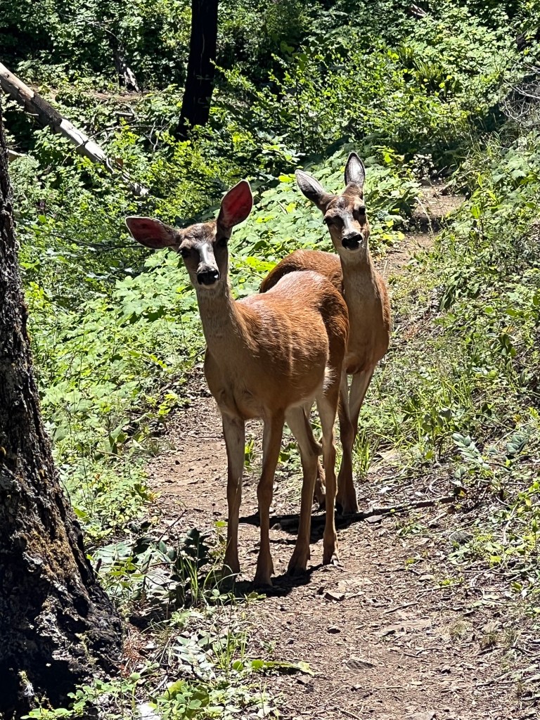
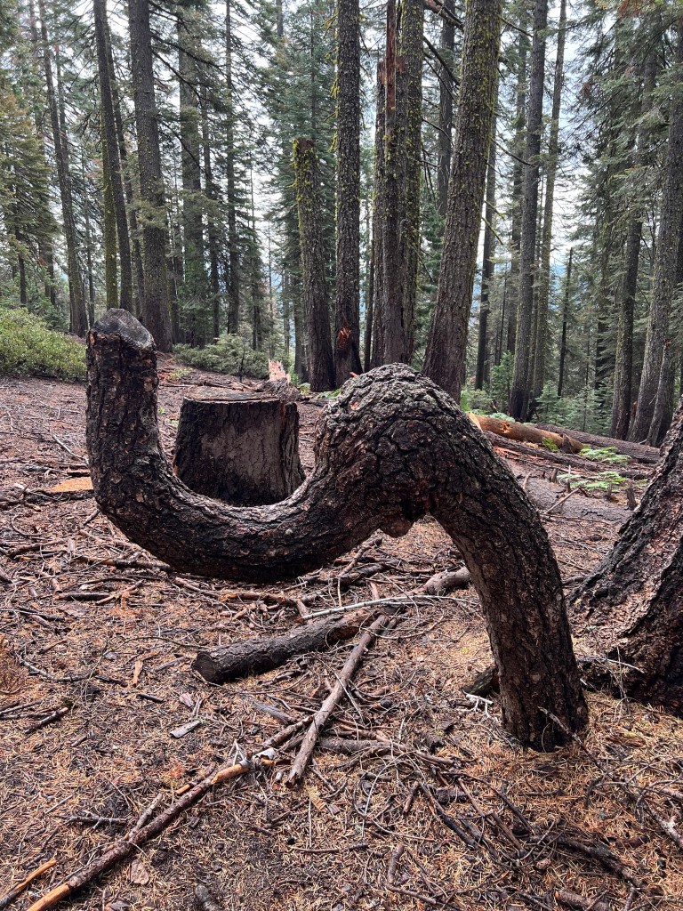
I’m not including any pictures of the blowdowns because I never want to see them again. I took lunch at Rockpile Lake, where I was joined by a deer. I didn’t get a good photo because my hands were full, but the deer was within 10 yards at one point.
I’m starting to see more northbound thru hikers. I chatted with a few and exchanged trail intel. Apparently there are more blowdowns in my future. It’s about 10 miles from this camp to Big Lake Youth Camp. I have a resupply package there, and they offer showers and laundry to hikers, so I’ll probably spend a little time there. Oh yeah, the ankle is doing well.
Day 7
Forest camp to camp at mile 665 from the Canadian Border – 16 miles
I’ve decided to use trail mileage from the terminus at the Canadian border when no other logical description seems available.
I was the first hiker in camp last night, but it filled up. Ended up with 5 tents there. I started hiking at about 6:20 this morning and there was a cool breeze blowing. I kept my long pants and windbreaker on until the sun rose above the hills to the east. The first few miles had numerous blowdowns so I got my morning jungle gym workout. As I neared the Santiam Highway I met two guys my age carrying a 5 foot crosscut saw, heading up to work on clearing some of those blowdowns. We chatted for a bit, and then continued on our separate ways.
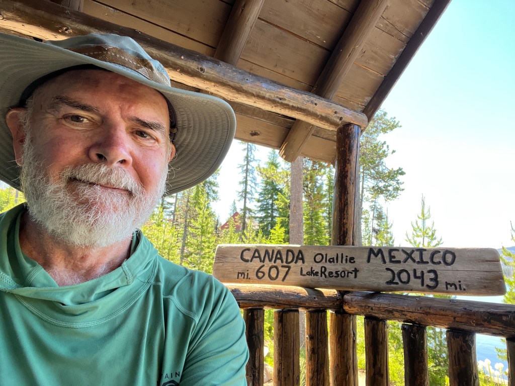
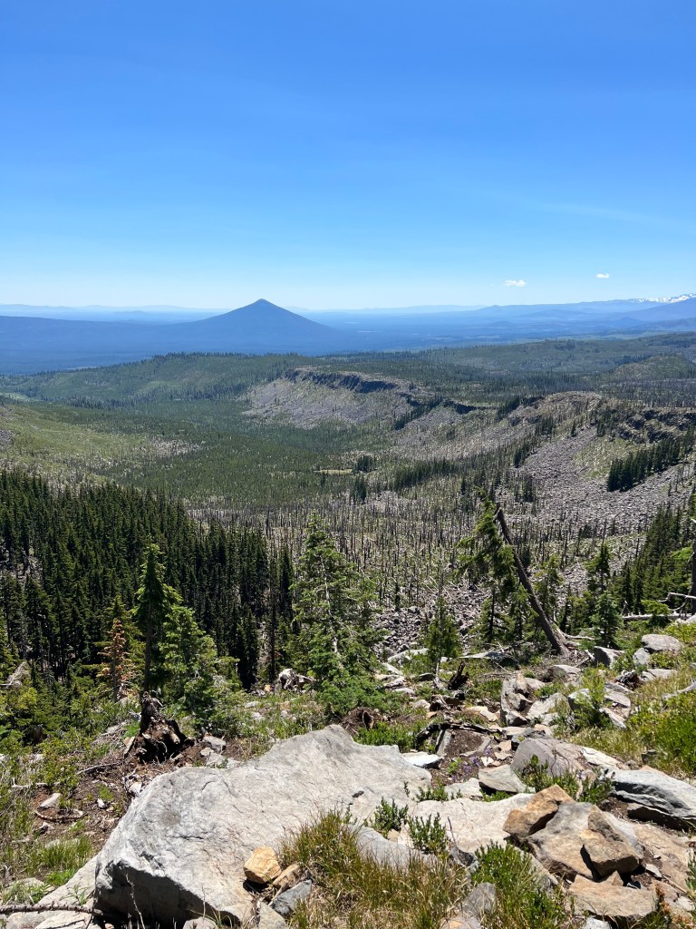
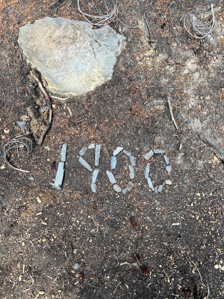
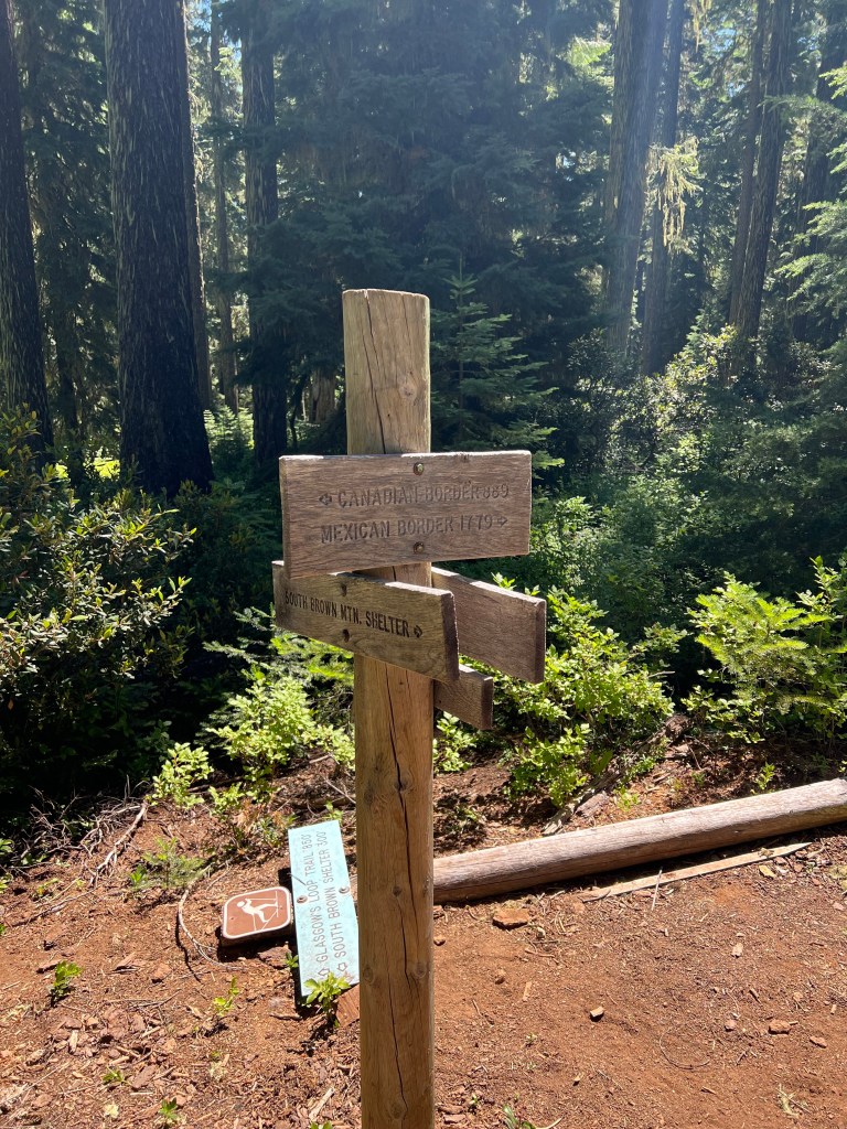
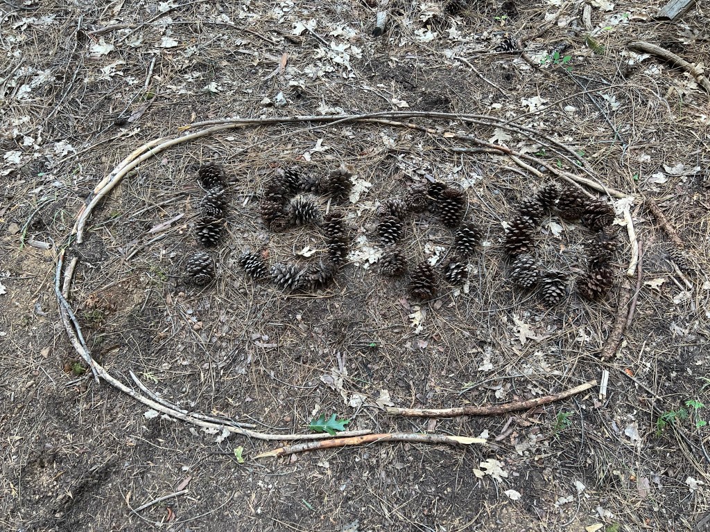
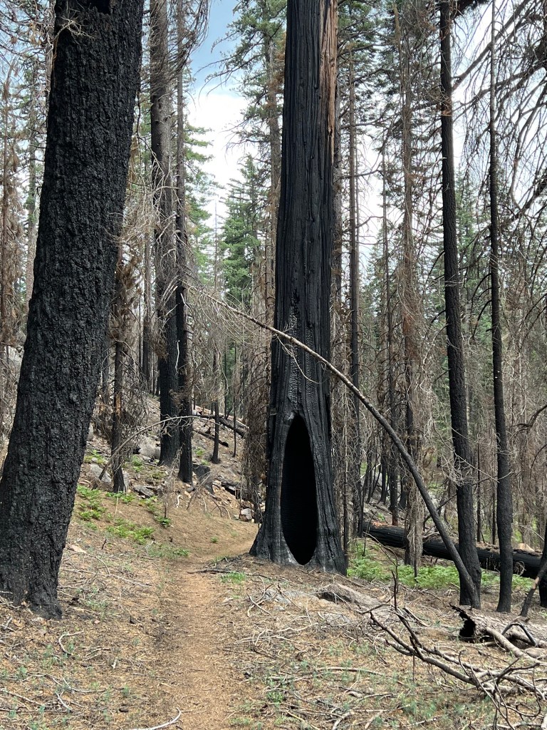
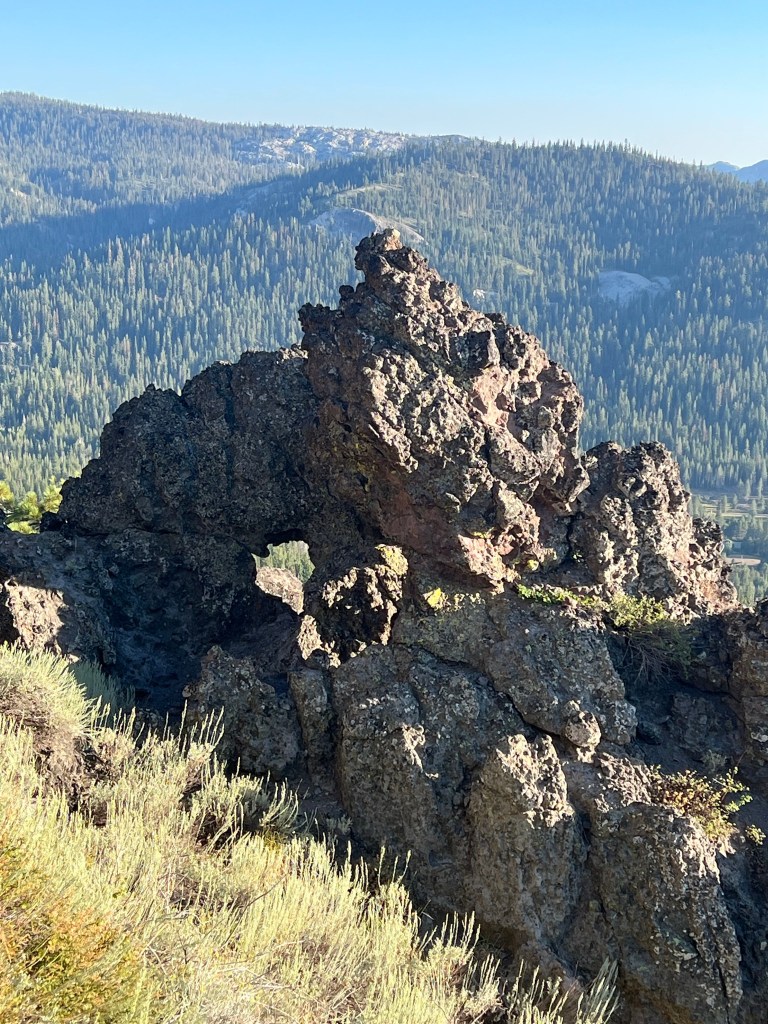
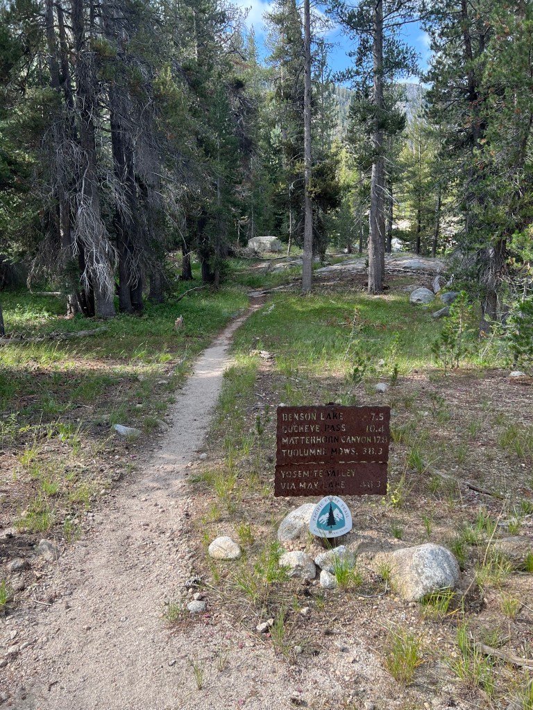
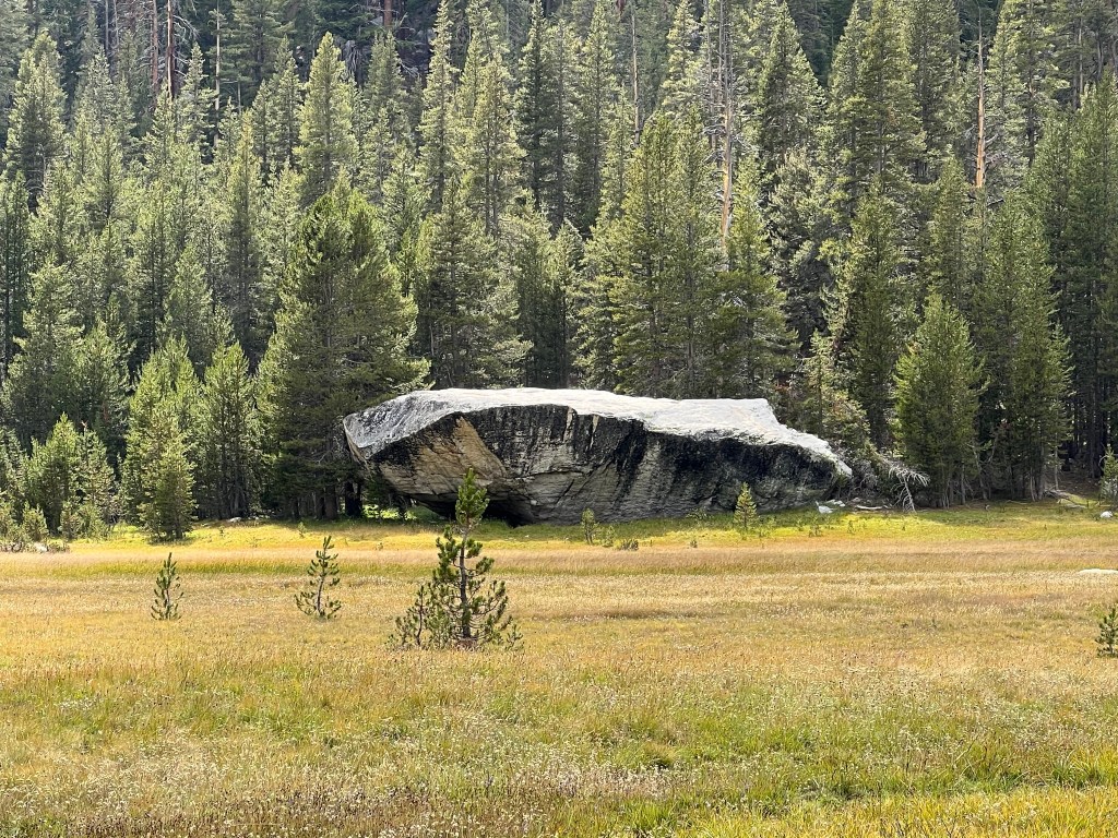
After crossing the highway, the trail was again plagued with blowdowns almost all the way to Big Lake Youth Camp. Along the way I came across this:

and how far I have to go.
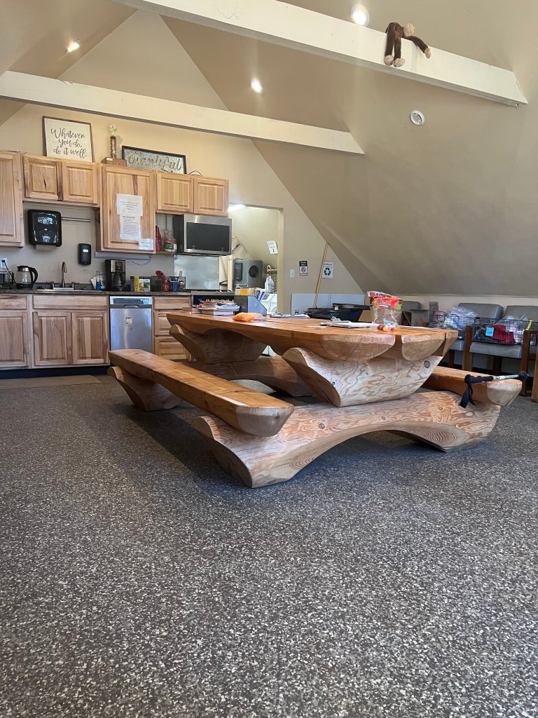
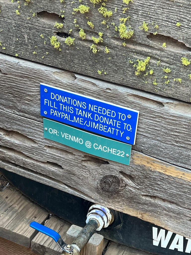
I went to the camp to pick up a resupply box, and since I was there anyway I had lunch, took a shower, and did my laundry. The camp is very friendly and well organized. They even have a PCT coordinator who looks after the hikers. There was no charge for any of the services, but they do accept donations. I donated.

After repacking my pack, I killed another hour and a half, drinking as much water as I could. After leaving camp, the next water source is 12 miles away. I left camp at around 3:00 pm and started a sunny and hot climb. After 6 miles I camped near the edge of a stretch of shoe-eating lava rocks, which I’ll tackle in the morning. From what I hear, the lava rock stretch is about 10 miles long, and I hope to be through it by noon. One other hiker, Runway, is camped here tonight. He wants to hit breakfast at the youth camp tomorrow, so he’s planning an early start. I asked him for a wake-up call. The ankle continues to do well. I’m certain the brace has saved me from rolling that ankle again – several times since I returned to the trail.
Day 8
Mile 665 to near a pond at Mile 688 – 23 miles
After Runway and I had both crawled into our sleeping bags, some female hikers that he knew arrived and kidded with him while they made camp. Runway was up and hiking by 5:30, and I started out at 6:00. The women were still waking up when I left.
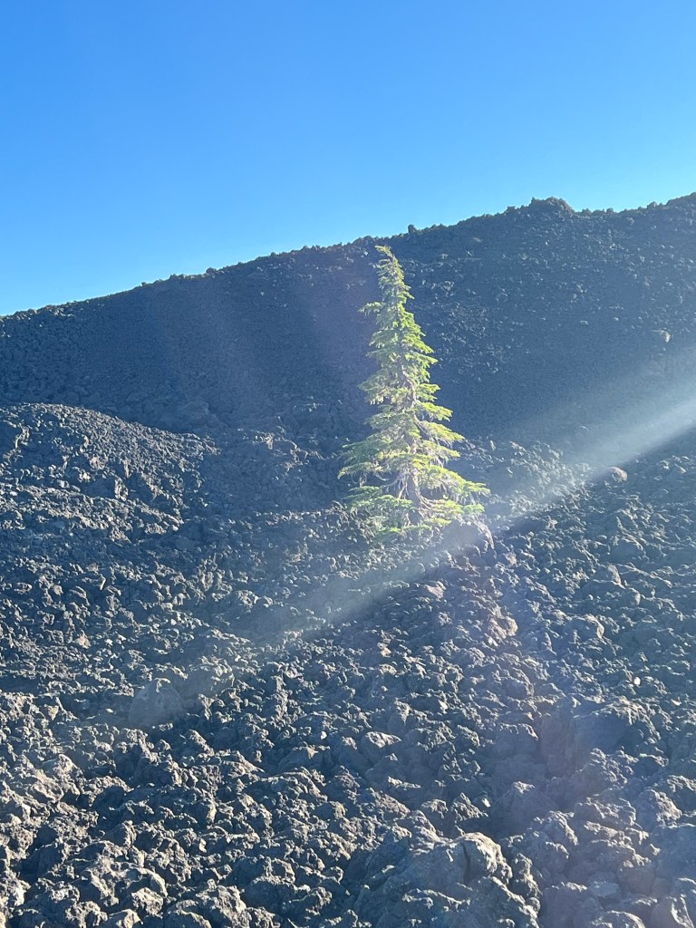
The morning began with a climb, and the trail tread was loose lava rocks. That tread continued to Mackenzie Pass and on to Lava Camp Lake, about 7 miles total. It was hard on the feet and the shoes.
I took a break at the lake, filtered and drank water. There were two young women northbounders, E.T. and Sagebrush. We chatted and traded trail intel. Shortly after I started hiking again, I met a ranger. She checked my permit and gave me a PCT tag to hang on my pack. She was very nice.
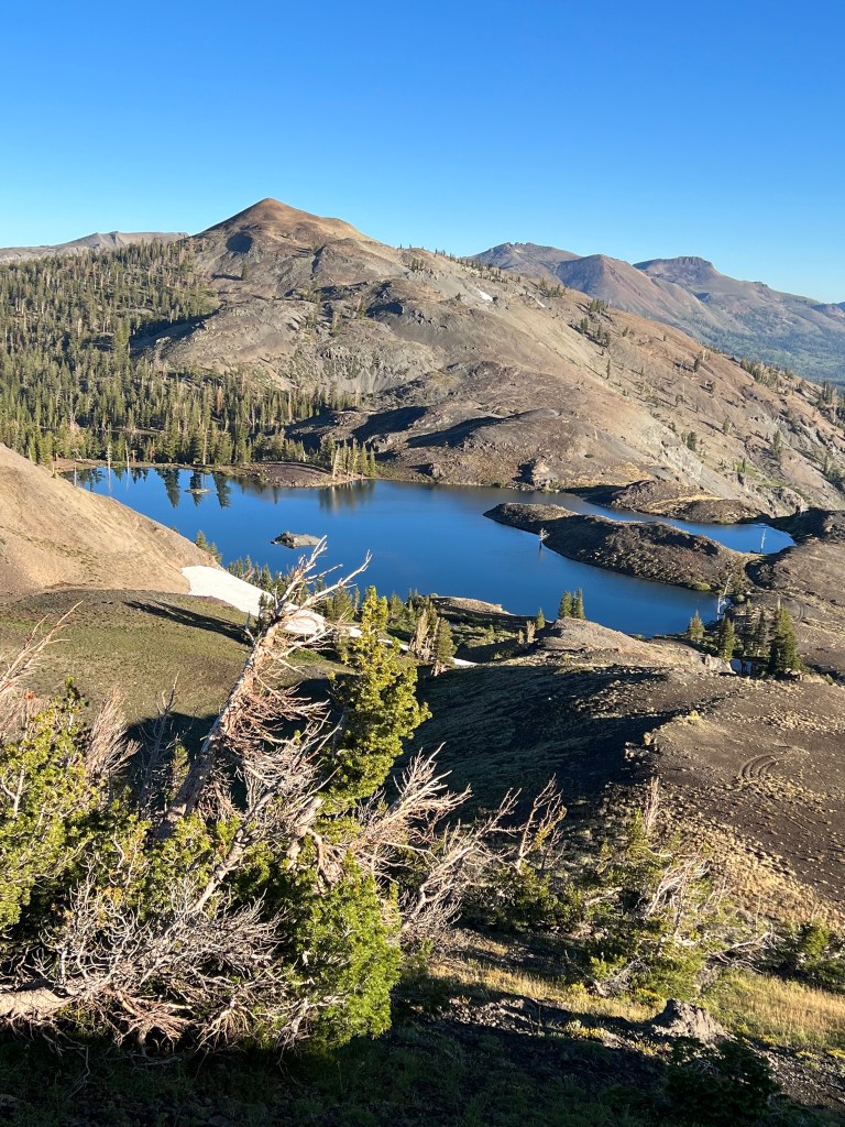
The trail was in the forest for a while but eventually went through another area with lava rock. After a lengthy climb and descent on lava rock the trail eventually became forested again. I passed through the Obsidian limited entry area. The last seven miles of the trail were much easier than some of the earlier miles, and that enabled me to hike more than 20 miles in a day, for the first time on this trek. I’m camped near a pond with a great view of South Sister Mountain. Mosquitoes here are annoying, but I’ve seen worse. From here, it’s 15 miles to Elk Lake Resort, where I might get a birthday beer.

Day 9
Camp at Mile 688 to Elk Lake Resort
15 miles
Condensation in the tent this morning; wiped it down with a little piece of Shamwow I carry for the purpose. Had coffee while breaking camp and was on the trail by 6:10.
The trail was much more benign than yesterday and despite a few blowdowns I made 10 miles by 10AM, and the other 5 miles to Elk Lake by noon. Nice trail, gorgeous views, and not too many mosquitoes.
Since it’s my birthday, I had a root beer and a burger and a beer on the deck. Pretty good living. After lunch I was killing time, waiting for the “town meal” to settle and planning to go another 6 miles or so. But I got to chatting with some northbound hikers, Salty and Frito and eventually decided to pay for a campsite here. Then some other hikers showed up (Prov, Gringo Loco, and Lucky Boy) and I had my supper paid for. Nice folks.

One thing that influenced my decision to stay here is that the mosquitoes south of here are rumored to be bad. Another thing was timing my arrival at Shelter Cove Resort, where I have a resupply package waiting. I’m hoping it will be two 20 mile days followed by a short hike into Shelter Cove.
Day 10
Elk Lake Resort to Charlton Lake- 27.5 trail miles, 28.7 total miles
Todays word: proboscises
Note that word is plural. I amused myself during the day by thinking of synonyms for plague. Affliction.
Blight. Curse. Scourge.
Up at 5:30, hiking shortly after 6:00. Salty and Frito were a few minutes ahead of me.
I saw a fox on the short climb back to the trail. It seemed unconcerned with my presence, and I banged my trekking poles together to move it off the trail.
Shortly after getting back on trail, I was forced to deploy my headnet, and it stayed deployed most of the day. I might not notice the mosquitoes when walking at pace, but the second I slowed for a blowdown or a drink of water, they swarmed. The picaridin spray did seem to work on them, but I donated blood while filtering water, anyway.
The trail passed by a constant series of small lakes and ponds, which explained the swarms. Around noon, where the trail rose and the mosquitoes abated, I came upon a couple of section hikers from Arkansas. We chatted while I ate some lunch. Turns out they are trail stewards for the Ozark Highlands Trail, and they’ve done multiple hikes in the Olympic National Forest. Nice folks.
I spotted a deer near the trail shortly after parting company with the Arkansas folks. Strange to see one in midday. The head net interferes with visibility in certain light conditions, such as a shady forest and certain angles of the sun. That’s why I caught a unseen root and went down, landing on my upper right chest. I think I may have slightly bruised a rib. But it didn’t bother me when hiking.
At Brahman Lake, I stopped to filter water and took the opportunity to take a dip. There was an intermittent wind and therefore intermittent mosquitoes. I mostly got away with it and it was very refreshing.
Toward the end of the day, I considered camping at Irish Lake, because it was just before a burn area. But the camp sites weren’t good and the mosquitoes were thick. I decided to hike another 5-6 miles through the burn area and camp at Charlton Lake. I figured the camp sites had to be better, and hoped the mosquitoes wouldn’t be as bad. Only one of those things was true. I found a good campsite here, but I think there are about 20 tents here tonight. Apparently I’ve found the northbound hiker bubble.
I didn’t really plan on a 27 mile day, but it worked out well. And it set me up for a 19 mile hike to Shelter Cove, where I should have a resupply package waiting for me.

Day 11
Charlton Lake to Shelter Cove Resort- 19 miles
Up at 5:00, hiking by 5:35. Tried to be quiet for the other hikers in camp. Mosquitoes were out even then, trying to bite during the morning rituals. I started with the head net deployed.
The trail was mellow early on, and I was cruising. Not a lot of views today since it was mostly forested. I saw a deer on the trail mid-morning, but he wanted nothing to do with me and took off.
Eventually the trail began a steady climb. It was long and slow. Near the top a northbounder informed me that the skeeters would almost disappear soon. He was correct, and I soon hiked on without the head net. On the descent, I stopped at Upper Rosary Lake for water. Soon I encountered multiple families with dogs, couples with pack rafts, and day hikers.
From there, I hiked on to Shelter Cove Resort. I took my resupply package down to the PCT tent near the water. There was a nice breeze blowing as I sorted my resupply and repacked my backpack. Had some nice chats with other hikers. Everyone else is northbound.
Day 12
Shelter Cove Resort to Summit Lake – 18 miles
I was up at 5:00 and hiking by about 6:00. I seemed to be the first one up, so I tried to be quiet.
It was a short climb back to the trail, but once on the trail it started climbing toward a traverse around Diamond Peak. It was about a 4-5 hour steady climb. As the day warmed the trail seemed steeper. And of course, the mosquitoes were relentless.
Near the top of the climb, I stopped for water at Mountain Creek. There was an intermittent breeze that helped to keep the mosquitoes at bay, so I had some lunch. I also chatted a bit with northbounder Houdini who is hiking the Oregon section of the trail.
After the climb, the trail descended through forest for several miles to Summit Lake. I’d heard about a small peninsula there and went to check it out. There was a nice steady breeze blowing and three young women were chatting. After learning that two of them were leaving, the other one, Nonstop, and I decided to share the camp site. I dropped my pack and started filtering water. I have a gravity filter system, so I went for a short dip in the lake while the water filtered. It felt pretty good. Later we were joined by two other hikers, Yost and Sprout.
As I write this, the breeze has died and I’m in the tent avoiding the skeeters.
Day 13
Summit Lake to Maidu Lake, 23 trail miles, 24.5 total
Since Sprout and I are both southbound, we decided to team up for the next couple of days. The next section of trail is dry, but there is a water cache at Windigo Pass, 11 miles ahead.
We got a slightly late start, but I was hiking before 7:00. Sprout started a little later and caught me at a rest stop a couple of hours later. After the break she just walked away ahead of me on a climb, and I hiked on solo. She’s a speedy hiker.
At Windigo Pass, the water cache was unbelievable- many many gallons of water, some basic first aid stuff, extra toilet paper, and boxes of charged battery banks. Those people are capital-T capital-A Trail Angels. All out of the goodness of their hearts.
We took lunch, drank some water, and briefly charged some of our electronics.
The climb out of Windigo Pass wasn’t bad. We stopped for an afternoon break at Six Horse Spring junction. The spring is a third of mile down a steep trail, but we didn’t need water because we’d loaded up at the pass.
Maidu Lake is down a 1.5 mile side trail from the PCT, and we arrived here just after 5:00 PM. After setting up the tent, I took a dip in the lake, rinsed out some socks and my shirt, and hung them up to dry. In the lake, I noticed dozens of tiny dark tadpole-looking fish swimming around a submerged log. There was a breeze blowing most of the time, and the mosquitoes weren’t quite as brutal as the past couple of nights. I still ate dinner in the tent. The breeze had died down when I crawled into the tent and about a dozen skeeters came into the tent with me. I murdered them all, then sat on the pile of their carcasses while I had my dinner. Lord of the manor.

Day 14
Maidu Lake to Grouse Hill Camp
27 trail miles, 28.5 total
Today we walked around Mt. Thielsen.
It was chilly when we woke this morning, probably in the 30’s. No mosquitoes bothered us as we had coffee and broke camp. We were hiking by about 6:30. The trek back to the PCT took about 20 minutes.
It was 10 miles to Thielsen Creek, a major water opportunity on this dry section and along the way we hit the highest point on the PCT for Oregon and Washington. There were several northbounders at Thielsen Creek, and we chatted a bit while filtering water and eating lunch. After that, the trail climbed for a couple of miles before leveling out.
The next water source was another water cache 7 miles down the trail. We watered up there and took a short break. From there the trail was relatively level with mostly minor ups and downs, but it was a bit uphill for the final two or three miles to the next water cache at Highway 209. We each took 2 liters and headed over to Grouse Hill Camp, a half mile away.
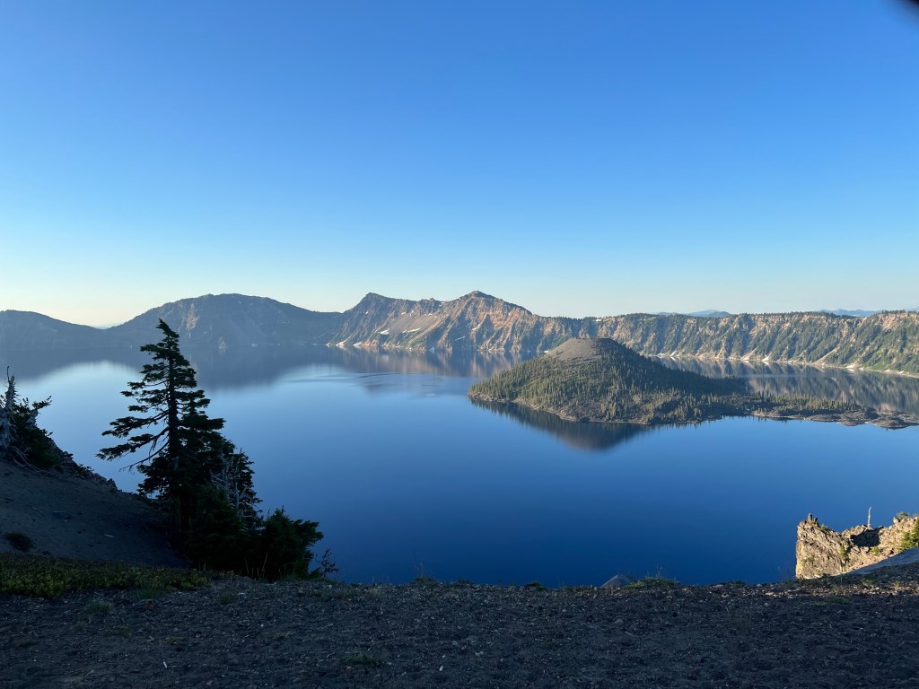
As we set up camp, the mosquitoes swarmed and I again ended up eating in the tent. Tomorrow we’ll walk the Crater Lake Rim alternate trail instead of the true PCT, which is further from the lake. We hope to catch the breakfast buffet at Crater Lake Lodge.


Day 15
Grouse Hill Camp to Mazama Village
14 miles
We were up early and hiking at 5:35, hoping to catch breakfast at the Crater Lake Lodge. Today’s hike began with a strenuous and somewhat lengthy uphill climb. Eventually it settled out to a series of ups and downs, with some great views of the lake. We made it to the lodge in time for breakfast and took advantage of the Wi-Fi to update our map app, etc. Then we ended up walking the rest of the alternate trail to the true PCT, and from there found our way to Mazama Village.
I checked in at the store to pick up my resupply package and the we each took a shower and did laundry while I sorted out my food resupply. After that, we had an early supper in the restaurant and then came to the hiker campground. There are fewer mosquitoes here than at our recent camp sites and there are at least a couple of dozen tents in the area. I think we’re the only southbounders.

Day 16
Mazama Village, Crater Lake to Snow Lakes – 28 miles
We were up at the usual time and hiking shortly after 6:00. We tried to be quiet while breaking camp out of courtesy to the other campers. Dozens of tents scattered throughout the hiker campground; all northbounders but us.
We drank as much water as we could, and left Mazama Village with a couple of liters each. We figured we could get water at Jack Spring in 12 miles, but since it is half a mile off trail we’d prefer to bypass it if we could. As it turned out, we held out until Honeymoon Spring at 19 miles. Most efficient, and thirstiest. It worked out fine. From there it was about six miles to Snow Lakes (ponds).
We’d kind of neglected to look closely at the topo maps and were mildly surprised to find ourselves climbing and rounding the shoulder of Devil’s Peak in the late afternoon. It was a bit of a slog, but the task was accomplished without any Faustian bargains and then we cruised mostly downhill to our camp at Snow Lakes.
We set up camp at the first pond and filtered some water. Sprout walked around the small pond to where the bottom wasn’t too silty and took a bird bath. I waded into the silt and rinsed my dirty legs. Soon we were joined by Slow Burn, a northbound hiker. There was a slight breeze blowing and keeping the skeeters at bay. We chatted over our suppers and then turned in for the night.
Day 17
Snow Lakes to Fish Lake Resort- 25 miles
We were up at around 5:15 and made coffee. I had a protein bar for breakfast to go with the coffee – I’m just not very hungry in the early morning. Slow Burn was out of camp first, heading north. We were gone a few minutes later.
The trail was fairly benign; no huge climbs or descents. We got our first water after leaving camp at Christi’s Spring, about 11 miles down the trail. As we neared Highway 140 , the trail crossed a fast moving creek on a bridge. Sprout stopped to take dip, before her overnight trip back home to attend a wedding. We’ll be splitting company at Fish Lake Resort.
On reaching the highway we tried to hitchhike for about 30 minutes. Another hiker, Hot Rocks, was doing the same. We ended up just walking the two miles to the resort.
After some burgers and a beer, Sprout left with the trail angel who will take her to Klamath Falls, and I found my way to the hiker campground. I very much enjoyed the days on trail with Sprout, a strong and smart woman and a good companion.
Day 18
Fish Lake Lodge to Klum Landing Camp- 25 miles
I woke up at 5:00 and quietly broke camp, trying not to wake Pacifico who had been kind enough to allow me to share her campsite.
No one was awake yet, so I found an outlet on the deck at the store and charged my electronics while I made coffee on my camp stove and had some instant granola. I also used the time to doctor a blister.
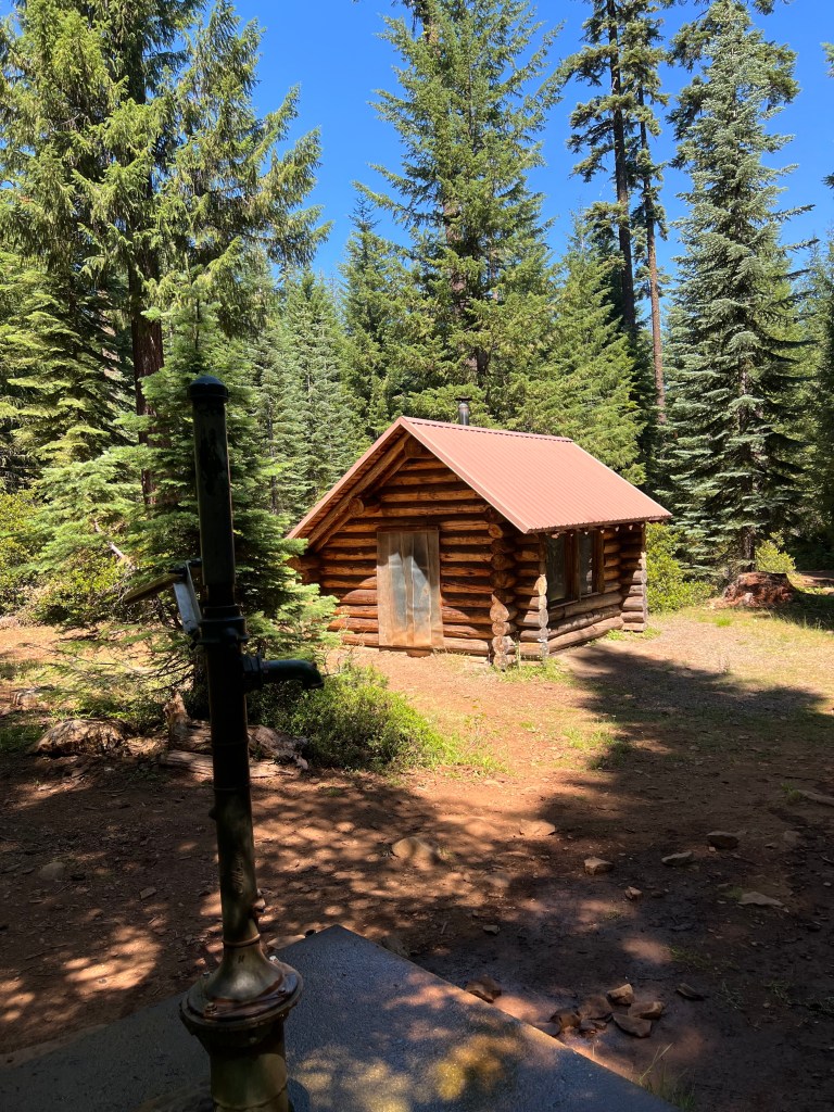
At about 7:00 I started hiking and was back on the PCT by 7:40. Soon the trail alternated between forest and rock slides. In about 10 miles, I stopped at South Brown Mountain Shelter for water. It’s a log structure meant for cross country skiers and snowmobile riders. There’s an old style hand pump to bring water from the well and it works very, um, well, well.
From there it was overall downhill with a 2 mile climb in midafternoon (I need to talk to my scheduler) and then mostly downhill to this camp. There are probably 8 to 10 hiker tents here. Free showers, flush toilets, picnic tables, trash cans. Hiker heaven.
Day 19
Klum Landing Camp to piped spring Mile 924 – 20 trail miles, 23 total
Up at 5:15 again. It was nice to have the restroom for the morning rituals, and nice to make coffee and eat breakfast at a picnic table. I was packed up and hiking by 6:30.
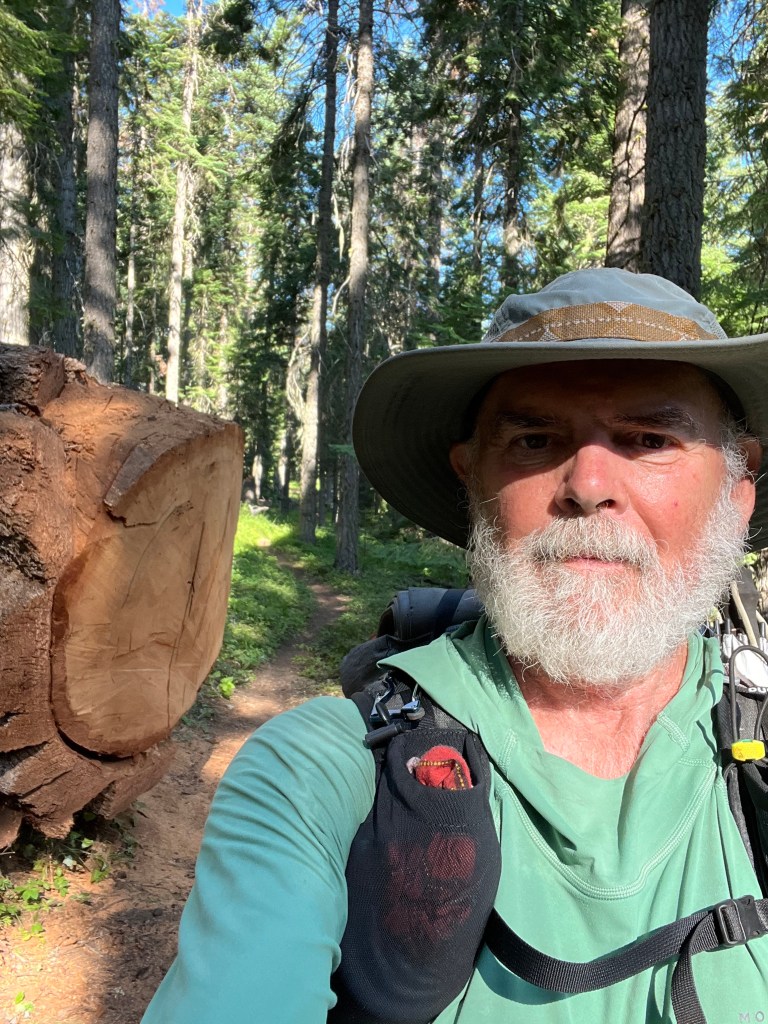
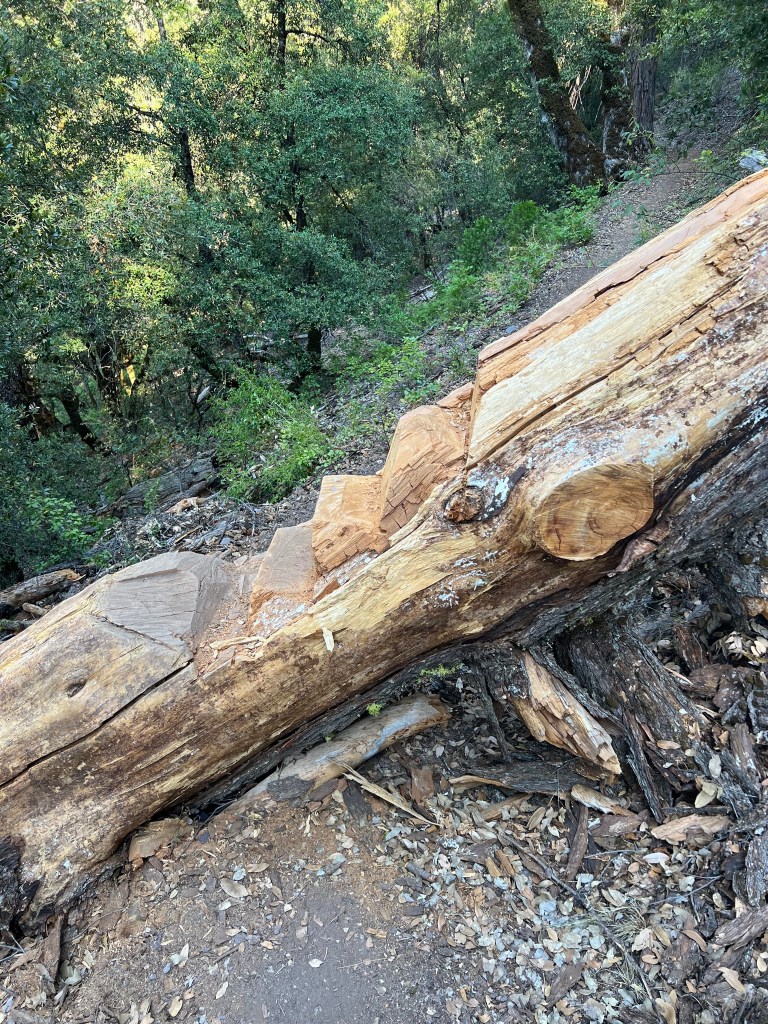
The trail was pretty level, no tough ups or downs. There were several blowdowns; one enormous. That tree was 6 feet in diameter.
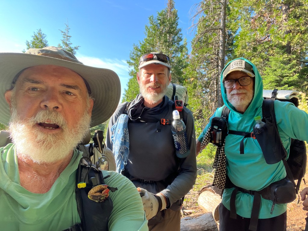
Around 8:00 I met the Codgers from YouTube coming northbound. We stopped to chat briefly, each took a selfie, and continued on our ways. Nice fellas.
I detoured 1.5 miles off the trail to get second breakfast at Hyatt Lake Resort. It was very tasty. I used their Wi-Fi to book a hotel in Ashland for the next two nights.
I carried a Powerade with me when I left Hyatt Lake, along with two liters of water. I again had a midafternoon climb, and that amount of hydration let me cover the 12 miles with half a liter to spare. The water from the spring here is clear and cold, and I guzzled a bunch as soon as I filtered it. Very satisfying.
From here it’s about 12 miles to Callahan’s Lodge, where I have a package with fresh shoes waiting for me. From there, I’ll Uber into Ashland to begin the 3R program – rest, resupply, REI.
Day 20
Piped spring Mile 924 to Callahan’s Lodge Mile 936
I think I was again the first hiker out of camp this morning. The trail had some fairly mild ups and downs, with a general downhill trend. At one point a dog came around a bend in front of me, wagged his tail when I greeted him, and turned around and went back around the bend. I heard a voice say, “Hello?” and when I rounded the bend there was a man and a woman on horseback. I stepped off the trail so they could pass, and we chatted a bit as they rode past.
I came off the trail onto the road to Callahan’s at around 10:45 and was road walking for about 5 minutes when a chatty woman stopped and gave me a ride to Callahan’s. Very kind of her. After arriving at Callahan’s I picked up my resupply package and an Amazon package I’d had shipped there. Then I Ubered to Ashland and my hotel.
First thing was a shower, followed by laundry. After a few resupply errands and a short nap, my Uber driver took me to the REI in Medford where I picked up a few gear items. I’m changing a few things in my gear setup. After he dropped me off at the hotel I went for an excellent Mexican meal at a restaurant about a 10 minute walk from the hotel. Then, an early bedtime.
Day 21
Callahan’s junction to piped spring – 23 miles
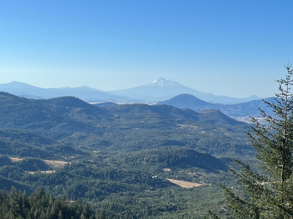
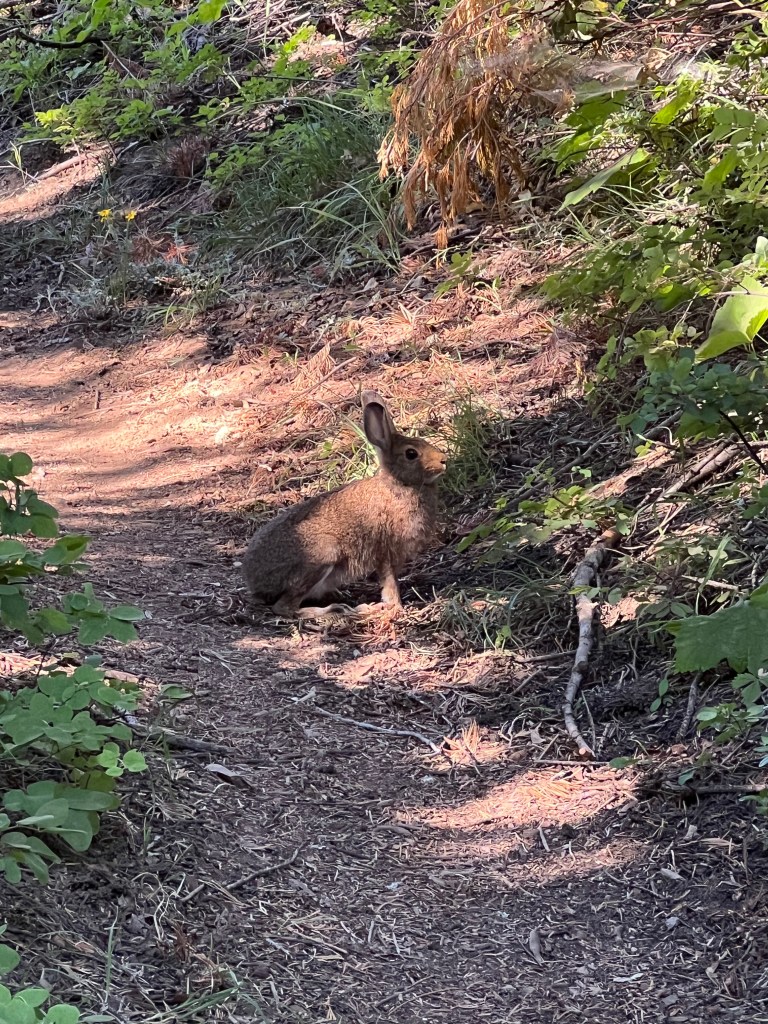
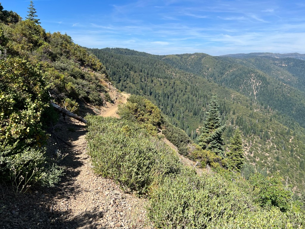
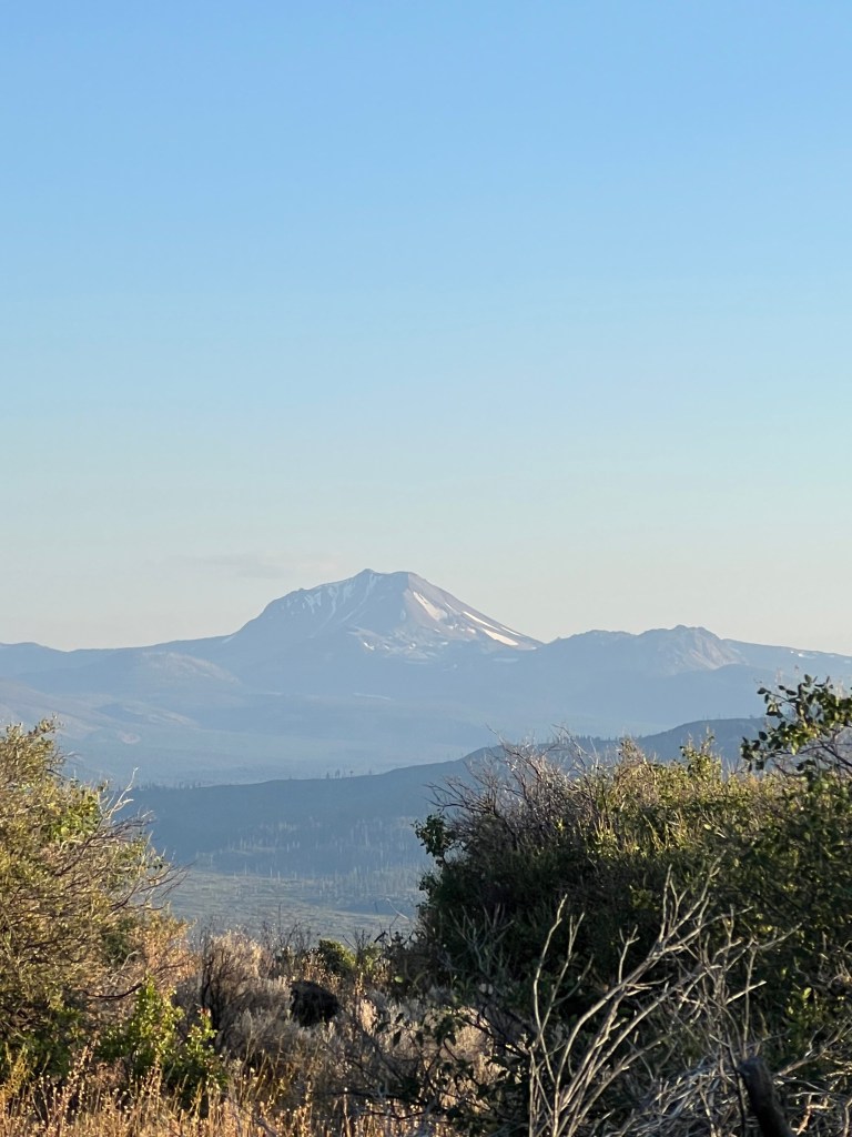
My ride was waiting for me when I stepped out of my motel room at 6:25. He dropped me off at the trail, and I was hiking shortly before 7:00. Less than 30 minutes later I came across the old Siskiyou Mountain Wagon Road. There was about an hour of climbing and the the trail leveled out into a series of ups and downs. At one point I broke out of the forest and caught my first view of Mt. Shasta. There were great views all day today, and the temps were in the 70’s, I think. Saw a deer running across the trail, and a rabbit posed for a picture.
There was another hiker (Bill) setting up camp at the spring when I arrived. We were chatting while I was picking out my tent site when a lady in an SUV came up the dirt road. She was there to get water from the spring, too. She was a butterfly fan, and had been watching butterflies like a birdwatcher watches birds.
After filtering water and eating dinner the temperature began to drop and I crawled into my tent. Great view from the camp tonight.


Day 22
Piped spring to Cook and Green Pass – 25 miles
Started hiking at 6:30 and by about 8:15 I was at the Oregon/California border. I signed the register and took a selfie. I heard cowbells from just before the border to late morning. Apparently there are cattle roaming free in the area. I stopped at the historic Donomore cabin to sign the register and chat with 30Percent and Easy Rider, and we saw two black bovines trotting across the meadow below.
I had a several hour climb in the morning and there were numerous sections with heavy brush intruding onto the trail. In the late afternoon there was another climb through a burned area from years ago, and the brush was thick in places there, too. Not to mention the large number of blowdowns. Made it tough to maintain momentum.
Eventually the trail opened a bit, and it was downhill to this camp. I went to the spring to grab some water and then snagged the first tent site. There are five others here tonight. Steepish climb out of here in the morning

Day 23
Cook and Green Pass to Seiad Valley – 17 miles
The climb out of Cook and Green Pass was a bit steep, and I was in low gear when a young guy overtook me. His name was Outlaw, and he was the first true southbounder I’d met. He’d started at the Canadian border, and he blew by me like I was standing still.
After the climb came the descent to Seiad Valley. It seemed like the entire trail from the pass until about 4 miles from town was burned area, blowdowns, and steep loose trail.
At piped Fern Spring I met Rabbit; he’d been one of team that made it through the Sierras and had posted videos on YouTube. He said it took a month to go from Kennedy Meadows South to Kennedy Meadows North. Badass. Nice guy, too.
Eventually the trail tread improved and I started making better time. Soon I found myself road walking to Seiad Valley. I checked in at the Wildwood RV park, which accommodates hikers. I paid for a tent site, shower, and laundry. Then I headed for the cafe for lunch, and the store for resupply. Then I headed back to the RV park to take care of my chores.
There were several other hikers there, and we swapped info and stories. At about 7:30, the campground hosts put out a nice buffet (donation $15), and it was excellent. After that, it was toothbrush time, and then to bed.

Day 24
Seiad Valley to Buckhorn Spring – 22 miles.
I started out at 6:00. The first 7-8 miles of the hike this morning was a road walk, so I covered those miles fairly quickly. By about noon, I’d hiked 14 miles. 14 miles in six hours, but the next 8 miles took five hours. All uphill, blowdowns and brush. Not easy miles. At the last bridge over Grider Creek I stopped to filter water and soak my feet. Then I found some shade under the bridge and was having my lunch. First one yellow jacket appeared, then two, then eight. I got the hint and packed up and left.
I encountered a lot of deer, and they were not shy. Near the end of my hike, one followed me for about half an hour, then jumped ahead and led me for a quarter of an hour. Then it fell back again and tailed me to camp.
There were two northbound hikers there when I arrived, but they were only getting water from the spring and not planning to camp there. We chatted for a few minutes. Nice folks from Boise, Moist and Ryan.
There are two or three deer hanging around the camp and I think they’re looking for salt. So, backpack straps, shoes, etc. I’m keeping my gear close tonight.
Day 25
Buckhorn Spring to Fischer Lake – 20 miles
Three other hikers showed up at the camp last night. I didn’t get their names and I tried to be quiet when packing up in the morning, since they weren’t stirring yet.
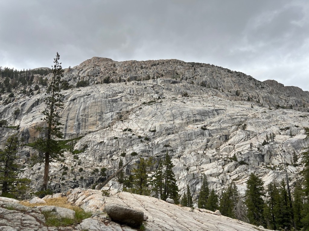
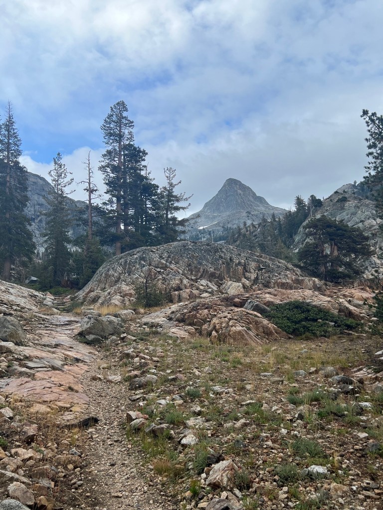
The miles were a little easier today. That long slog out of Seiad Valley yesterday took a bit out of me. There were terrific views most of the day as I walked through the Marble Mountain Wilderness. Late in the afternoon the trail switchbacked up a wall of the cirque above Man Eaten Lake. I’d like to know the story behind that name.
After setting up the tent and eating supper, I went to the lake and rinsed my dirty legs and feet. There haven’t been any deer around so far, but I’ve noticed chipmunks scurrying around so I hung my food bag and opened the empty pockets on my pack where I keep snacks for the day when hiking. Hopefully they won’t chew anything up.

Day 26
Fischer Lake to Etna – 14 miles
Ended up camping alone last night, and the chipmunks left me alone. The trail started out with a small uphill climb and then was mostly a relatively mellow traverse until the final descent to the road to Etna. At one point I met a guy working his way up a rise, and I stepped off the trail to let him pass. He stopped and looked at me and said, “What are two old guys like us doing out here?” His name was Dallas and he said he was 78 years old. Made me feel young.
As I was cruising along, I was thinking about how to contact one of the trail angels for a ride to Etna. When I was in sight of the road, I saw a hiker and a Subaru. The Subaru started to move and I waved and yelled at the hiker, who said something to the driver. My timing was perfect, and Molly gave me a ride to Etna, gave me a tour of the town, and I got checked into the Collier Hotel. After a beer and a bite at the brewery, I did laundry and took a shower. Later, I walked to Dotty’s for a burger and an ice cream cone. Town food! Shower! Real bed!
Day 27
Zero (miles) day in Etna.
I thought about heading back to the trail around noon, but I thought I could use a bit more rest. So I hung out at the hotel, took a couple of short walks, and read a book. I arranged for a ride from Molly; she’ll pick me up at 8:00AM tomorrow.
Day 28
Etna to South Fork Scott River- 21 miles.
Molly was right on time, and another hiker (Gandolf) and I were whisked back to the trailhead. Gandolf was soon out of sight as I was in low gear for the climb out of the valley. Soon I found him taking a short break and I kept going. A short while later, he passed me and I never saw him again. A bit later another hiker, Ultra, passed me and i didn’t see him again, either.
The trail was up and down, nothing brutal, and I made 11 miles by about 12:30. I stopped for lunch at a small stream and filtered water while I ate. From there it was another ten miles to this camp. Good views all day again as the trail ran in and out of burned areas.
I arrived at camp a bit before 6:00, and there was enough daylight left to get to the next campsite about 2.5 miles away, but it looked like a steep uphill and I decided to save it for the morning.
Four other people have joined me in camp, all northbound. The fast running creek is just 100 feet away, and the white noise should help us sleep.
Day 29
South Fork Scott River to Ridge at trail mile 1101 from Canadian border – 26 miles
One of the other campers told me some hikers had come past on the trail at 3AM. Maybe they needed to get to Etna before the post office closed. Anyway, I didn’t hear my alarm, and so got a late start.
It was hard to get my rhythm going early in the day. My navigation app was glitching and I probably lost a half hour messing with it. Finally got it working when I found a spot with 2 bars of 5G so it let me access the info I had already downloaded.
After that the trail miles started to go by a little better. I stopped for lunch at water at the outflow from Mosquito Lake, and soaked my feet for a few minutes. I figured it was about 10 miles from there to my intended camp site. Water availability along the way seemed iffy, so I drank a bunch and then took off with 2 liters.
When I got to my intended spot, I didn’t care for the campsites and the stream was just a trickle. So I pushed on another mile and a half to a viable stream and collected some water. From there it was another 1.3 miles to this camp on a 6000’ ridge. No other hikers in camp tonight.
Day 30
Ridge at Mile 1101 to Porcupine Lake- 22 miles.
The trail was fairly benign today, no major ups or downs and I was able to chug along at a steady pace much of the day. The parade of northbounders seems to be thinning out. Late in the morning I stopped at a stream to collect some water and chatted a bit with Twigs, a northbound British hiker. She was recovering from shin splints and had just returned to the trail.
I stopped for lunch at Upper Deadfall Lake and chatted with a local fly fisherman while I munched. According to my navigation app there is no water on trail for 24 miles after Porcupine Lake, which is about 5 miles further down the trail.
After leaving Deadfall Lake, the trail was the same relatively gentle up and down, with on and off views of Mt. Shasta. Upon arriving at Porcupine Lake at about 4:00 PM, I found a campsite and decided to stay for the night. 22 miles seemed enough for a day, and it’ll be more efficient to camel up on water before tackling the dry section. Hoping to make the 24 miles to East Fork Sulphur Creek tomorrow. It’s raining, and I’m confined to quarters (in my tent). I’m waiting for a break so I can brush my teeth without getting soaked. Hope it clears by morning.

Day 31
Porcupine Lake to East Fork Sulphur Creek- 24 miles. Trail mile 1147; miles hiked to date – 591.
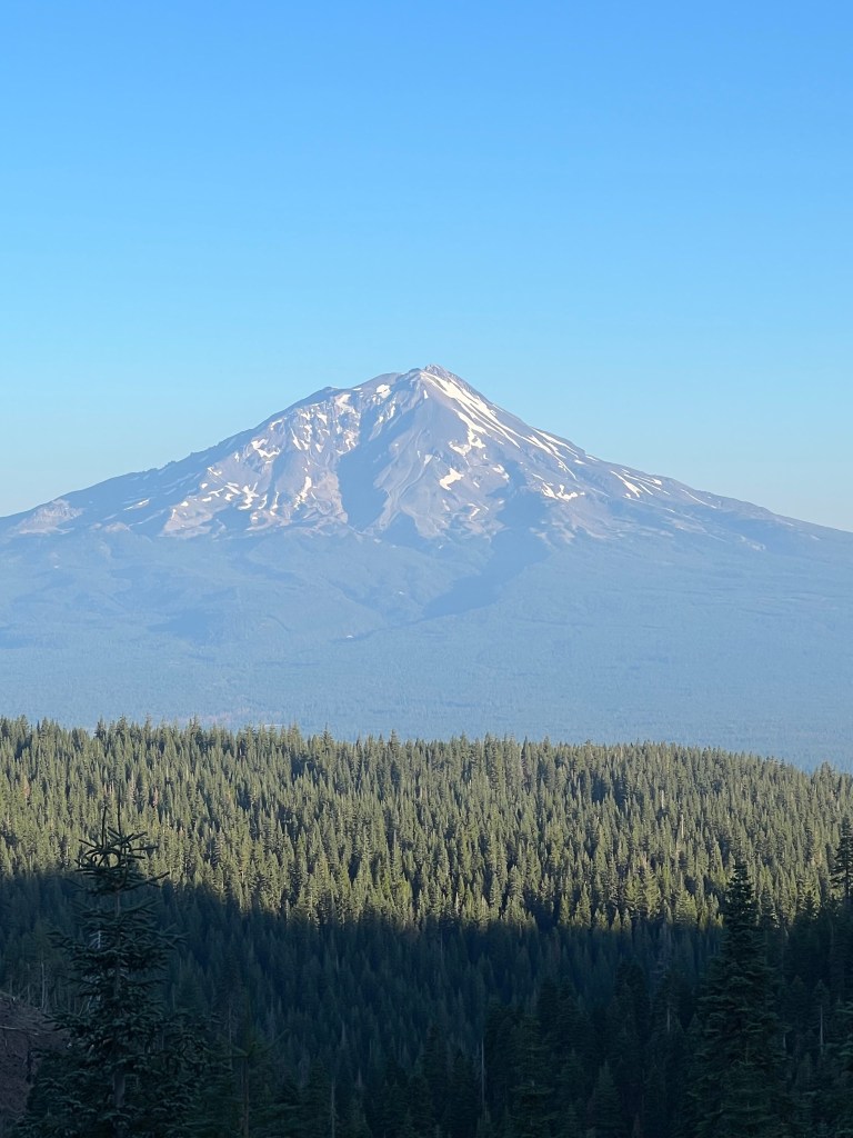
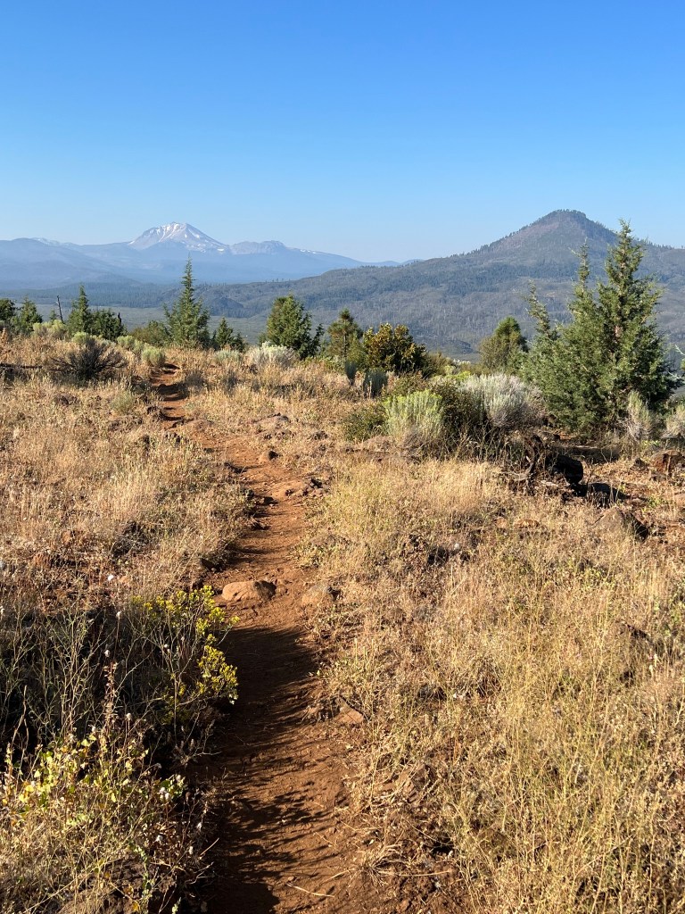
The trail started out fairly benign with good views of Mt. Shasta. There were some ups and downs with a few short ups that required low gear. As I approached the Gumboot Trailhead road and parking lot, I smelled wood smoke. I’m a bit paranoid about forest fires, so I was concerned. But it must have been someone’s campfire because the smell disappeared as I continued walking south.
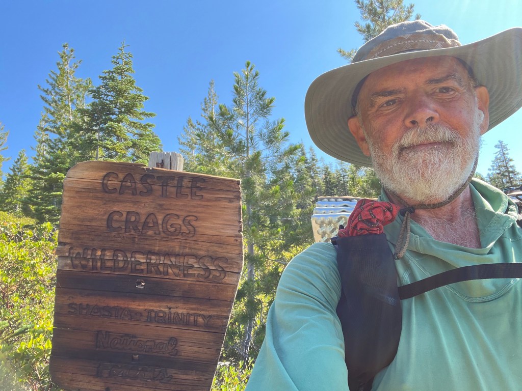
There were more water sources than my navigation app had indicated, so water was not a problem. Eventually I entered Castle Crags Wilderness and shortly after noon I stopped for water and lunch at a small stream with shade. One other hiker, Pushpop, was there. Soon we were joined by another YouTube guy, Kyle from Kylehateshiking. We chatted for a bit and exchanged trail scoop before parting ways.
After that the trail began a mostly downhill trend, with just enough uphills thrown in to make it a bit tougher. When I got a cell signal, I called to arrange a ride to Mt. Shasta city in the morning. I arrived at this camp at around 4:45 PM. It’s a nice little creek, with pools for soaking feet or rinsing out clothes. I rinsed my sun hoody out to remove some of the perspiration salt. 5.5 miles to my pickup point at 8:00 in the morning.

Day 32
East Fork Sulphur Creek to Castle Crags Visitor Center – 5.5 miles
I was up earlier than I needed to be, because I wasn’t sure of the trail conditions and I didn’t want to be late. So I arrived at the visitor center an hour early. That turned out okay because I had a nice chat with the guy at the center. Cool guy, knows the area very well. I gave him my NatGeo paper map for the area I had just walked through and he was appreciative.
My ride, Doc, showed up right on time and he took me to Mount Shasta. I asked to check in early, but the room was still occupied. So I went for a breakfast burrito at Yaks, and then to the grocery store for my resupply. After that I was able to join the weekly family zoom meeting. It was great to see and hear my loved ones.
After the zoom meeting I stopped by the outdoor store to pick up a few things and then continued to the motel. I sat outside in the smoking area under a big shade tree and sorted my resupply and hung out until 1:00 when they told me my room was available. Shower, laundry, etc. I tried again to track down the slow leak in my air mattress, but no luck. I walked to a Mexican restaurant and had a big dinner, then waddled back to the hotel. After a nice phone conversation with my wonderful wife, I was asleep early.

Day 33
Mount Shasta to campsite at Trail Mile 1176 -23 miles
Doc was unavailable today so I caught a bus back to the trailhead. It left at 7:30 and dropped me off at a little after 9:00, having followed a peripatetic route that included the town of McCloud. Anyway, I was hiking by 9:15.
The climb out of town with a full load of food, etc. is always a little challenging. The pack feels heavy and the uphill seems a bit more challenging than usual. I had purchased a box of donuts on impulse and was regretting it, since I already had enough food. After an hour or so I came upon Special K having her breakfast. I stopped to chat and it turns out she is living in Lacey, WA and working at an Amazon warehouse. And she lives in her van. Nomadland. While we were chatting, a northbound hiker named Dustbunny stopped to chat and I foisted the rest of the donuts on him.
As I continued up the hill the trail crossed a disused road and I saw no obvious (to me) continuation on the other side, so I began following a trail of many footprints. Soon I realized I wasn’t on the true trail, but on a “shortcut” used by northbound hikers. Knowing it eventually connected again with the PCT, I decided to just keep going. It was hot, steep, and exposed to the sun. For northbound hikers it is downhill and offers great views of the area including Mt. Shasta. For me it was steeply uphill and all the views were behind me. I was sweating from places I’d forgotten had pores. Once I’d rejoined the PCT I took a break, ate an apple I’d brought from town, and chugged some water.
This stretch of trail can be a little dry. I stopped at Squaw Valley creek for water and lunch. Later I filtered water at another creek and carried it to my campsite. I had just enough to cook supper and have enough left for the 5 mile walk to the next water source in the morning.

Day 34
Campsite mile 1176 to campsite mile 1199 – 23 miles
Overslept a bit and got started a bit late. The 5 miles to the next water source went quickly. A couple of miles after that I crossed the McCloud River on a nice high bridge. The the trail began a steady 10 mile uphill climb before leveling off a bit. Parts of the trail were very brushy. Not a lot of good views today, either. I think I met a bit more than a dozen northbounders today.
Water strategy continues to be a thing. Toward the end of the day, I stopped at a small stream to grab enough water to get me to my intended campsite. Then I pushed on another 4 miles or so to a side trail that leads to a small stream. It was a nasty 50 yards of bushwhacking from the PCT before the side trail opened up. It was about half a mile to the water and the trail followed and old road for much of the way. There was bear poop all along that road. I gathered enough water for the night and the next morning and came back to the PCT and this campsite. Camping alone again.


Day 35
Camp at Mile 1199 to Little Jake Spring (Mile 1226) – 27 miles
The trail began brushy and with blowdowns and an uphill grade it was difficult to get a good pace. I did kick up a nice 3 point buck in the first hour of walking, but he was too fast for a photo. I arrived at the next water source later than anticipated and took a break. I had an early lunch while I filtered water. After the break, the trail improved but there weren’t many views as the day went on. The trail alternated between shady forest and a few clear cuts.
I stopped for water at Kosk Spring, a quarter mile off trail, and soldiered on. I passed up Peavine Creek because I still had water, and continued to Screwdriver Creek. That entailed a 0.1 mile steep descent to to the creek and the steep ascent back to the trail. Tough after 26 miles of walking. There were supposed to be tent sites in the area but I found nothing suitable so I continued another .8 mile to another site. There I found another hiker, Jeff, in his hammock. He had shoe trouble and was slow footing it to Castella since his new shoes weren’t due there for a few days. We chatted a bit until the mosquitoes became too bothersome and I retreated to my tent.
Day 36
Little Jake Spring to Burney – 17 miles.
I was hiking shortly after first light, and within 15 minutes of leaving camp I startled a black bear. It took off running uphill and disappeared quickly, though I heard brush cracking in the distance. Don’t know if it saw me or heard me or smelled me, but it wanted no part of me. Probably smelled me. I must be ripe on the fourth day of hiking.
The trail was pretty mellow, considering, and I was at Burney Falls State Park by about 9:30. I took a selfie with the falls and wandered over to the store for a root beer and an ice cream cone. Second breakfast.
From there it was about 8 miles to Highway 299, the road to Burney. When I got to the road there were two Japanese hikers heading to town, too. We tried hitchhiking for about 30 minutes before a nice local woman pulled over. She offered us canned cocktails which we had to down quickly. No open containers in the vehicle. She dropped the other guys at the local church which offers free camping, showers, and laundry to PCT hikers; donations accepted. Then she dropped me off at my motel. I think I’ll take a day off trail to sort out my resupply plan for the upcoming stretch.


Day 37
Zero day in Burney.
I’ve decided I need to take in more calories so I had a big burger for lunch yesterday after checking in to the motel. Then I showered and did laundry and hosed my dusty backpack off in the shower. Later I pigged out at the Chinese restaurant. This morning it was the full diner breakfast, then the leftover Chinese, then another lunch, then the Mexican restaurant for supper.
I also bought some freeze dried meals from the sporting goods store, hoping that will help increase my caloric intake on the trail. Then it was a visit to Dollar General and Safeway to get the rest of the resupply. I repackaged a lot of the stuff into ziplock bags to save space and cut down on weight. It took more than an hour to get everything sorted. I sent a resupply package ahead to Sierra City. Jackie is sending my bear canister, warmer quilt, and new shoes there, so I have to stop there anyway. Also, I sent my slow-leaking air mattress home. I tried repeatedly to track down that leak, with no success. So I’ll be using only my Nemo Switchback foam mattress. Not as comfortable, but way less annoying.
I’ve arranged for the local cab to take me back to the trail at 8:00AM.
Day 38
Burney to campsite on Hat Creek Rim, Trail Mile 1265 – 22 miles.
The cab driver was on time and I was hiking by 8:30. The trail began in forest but soon broke out into a bushy terrain with almost no shade that continued for the entire climb to Hat Creek Rim. As the day wore on the temperature climbed into the 90’s. I deployed my umbrella and that helped, but it was a long, hot day. I stopped for an early lunch at the Hat Creek hydro plant and filtered enough water for the 13 miles to Cache 22. Due to the hot and shadeless conditions I used almost all of it. The sun beating down raised the temperature of my water bottles well above lukewarm, and I was hoping for cooler water at the cache.
Cache 22 is a water tank maintained by a local rancher. It’s a short distance off trail, down Road 22. Hence the punny name. I filtered water and had an early dinner. I drank two liters there, and packed out three for my dry camp tonight, and to get me to the next water source.
After leaving Cache 22 I pushed on another 4 or 5 miles to this camp. It’s a nice spot, and I’m camped alone again. Except for some noisy crickets.

Day 39
Trail Mile 1265 to northern boundary of Lassen Volcanic National Park- 24 miles.
There were cows rooting around in the bushes behind my camp this morning and I had a bovine serenade as I sipped my coffee and ate my oatmeal.
I was hiking before the sun came over the ridge to the east and there was a cool morning breeze blowing. But by 9:00 I had the umbrella deployed again. The temperature climbed throughout the day but I don’t think it was as warm as yesterday.
It was about 8 miles to my next water source and I stopped at Lost Creek to pick up a bit more. I think I might have been better off skipping it and toughing it out. It was a fairly steep switchback trail down and back, and it took me more than half an hour to get the water filtered and get back to the trail. Lot of work, but I was hydrated anyway.
At around 1:00 I stopped at the Old Station Resort store for a couple of root beers and a chicken sandwich. I chatted with a couple of German hikers for a bit and then went on my way.
A few miles after that the trail went very close to Hat Creek and I stopped to camel up and load up on water for my dry camp tonight. I chatted with northbounder Hiker Greg and exchanged trail intel, and took the opportunity to soak my feet in the creek. It was a beautiful spot, and it was tempting to camp there. But I pushed on a few more miles to this camp, right on the Lassen Park border. I just noticed deer sniffing around the camp, so I put my pack inside its waterproof liner to keep the deer from chewing on my pack straps during the night. They like the salt from sweaty packs.
Day 40
Northern boundary Lassen Nat’l
Park to North Fork Feather River- 25 miles. There was a deer sniffing around the tent off and on all night. Occasionally I’d pop the side of my tent from the inside and the deer would take off, only to return a few minutes later. But I managed to sleep anyway.
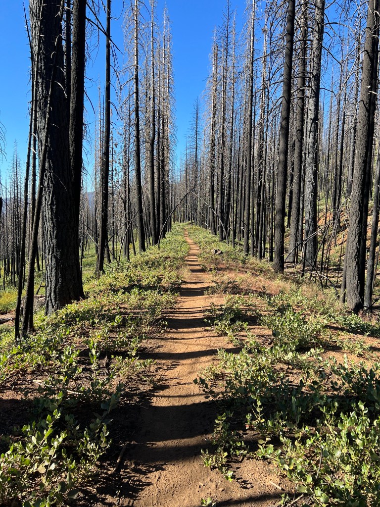
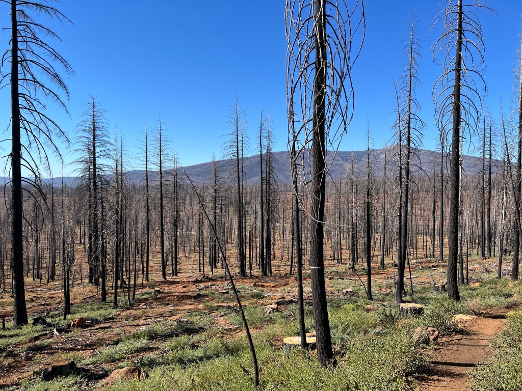
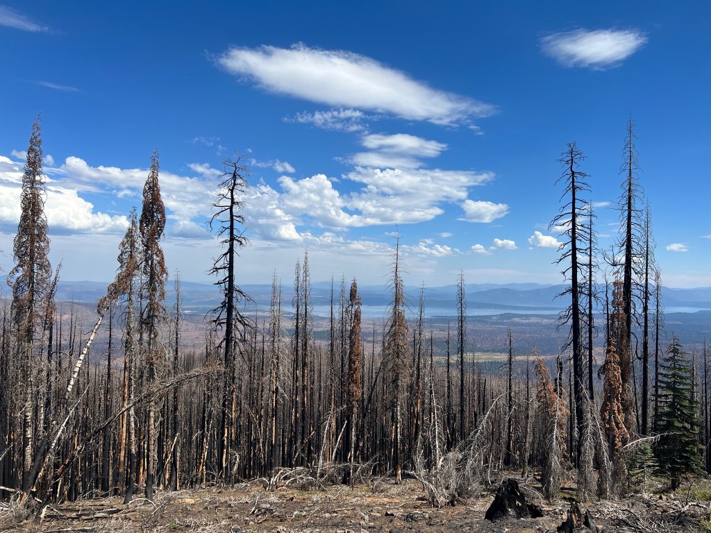
Another cool morning, but by 9:00 the umbrella was in use. I walked the 19 trail miles through the whole park today, and most of it was burned areas from the Dixie fire in 2021, I believe. It’s still beautiful in its own way, but it’s heartbreaking to imagine how truly beautiful it was before the fire.
A little after noon, I came upon a trail crew breaking for lunch at the burned out Warner Valley campground. They’re working on repairing some of the fire damage – rebuilding bridges, restoring trail tread, etc. We chatted for a few minutes before they had to get back to work and I had to get back to the trail.
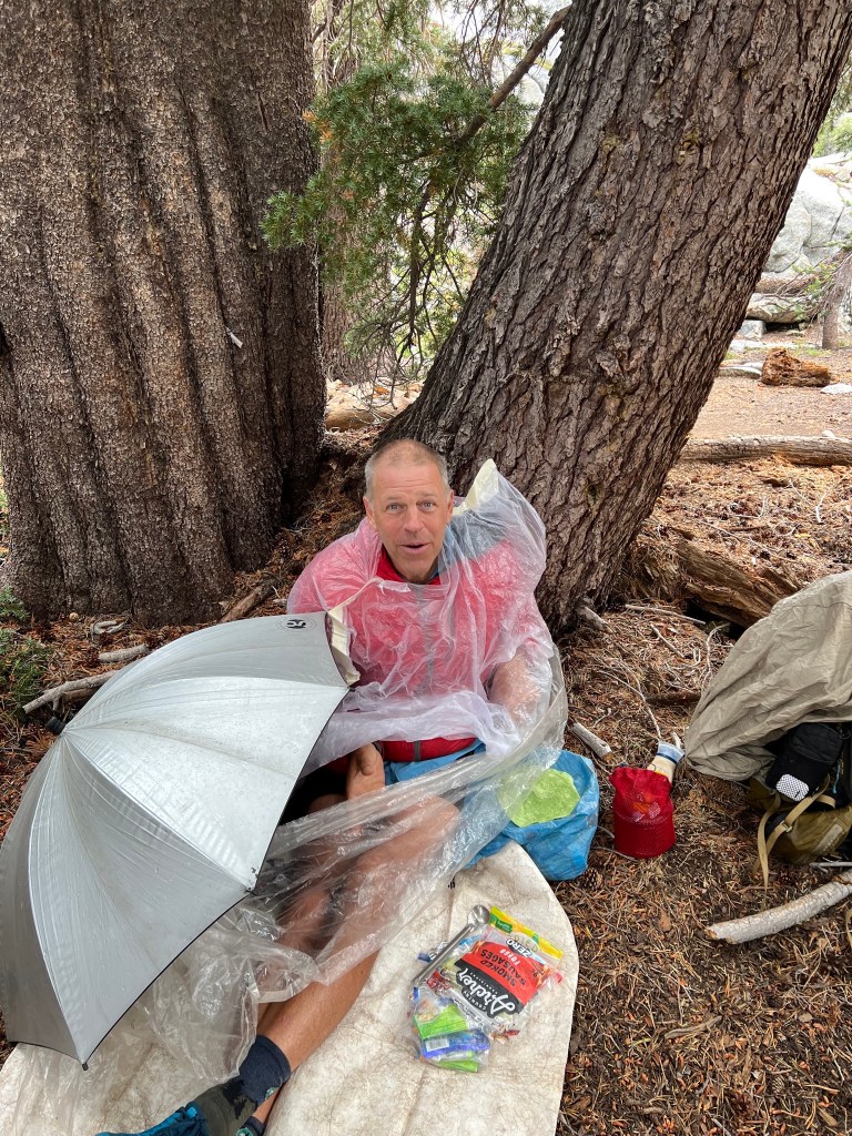
In the mid afternoon clouds began to form, and in the late afternoon it began to thunder and lightning and it rained pretty hard and hailed for half an hour or so. Even with the umbrella I got a little wet, but the clothes will dry quickly.
I arrived at my campsite a little before 6:00PM. I made supper and filtered some water. It’ll be an early bedtime tonight. Tomorrow I’ll try to hitchhike into Chester to top off my supplies for the hike to Quincy.
Day 41
North Fork Feather River to Chester – 10 miles
There were live trees in the area of my camp on the river, but soon after I started hiking I found myself in a burned area. I was plodding along, lost in my own thoughts, when I heard voices. At first I figured it was northbounders, but soon realized it was southbounders overtaking me. Brain Pain and Unicorn, from Switzerland, stopped to chat for a bit before taking off ahead of me. I caught them at a spring and we chatted a bit more before I took off. They didn’t catch me by the time I got to the highway and stuck out my thumb. After about 10 minutes a work pickup stopped to give me a ride. The young man mentioned a cousin, Nathan, and it sounded like Nathan works for the outfit in Ketchikan that provided our pilot boats. Small world.
After getting dropped off in Chester I arranged a hotel room and went for late breakfast while I waited for the room to become available. Once in the room, it was the normal routine of shower, laundry, and resupply. And calorie loading.
Day 42
Chester to Humboldt Summit – 19 miles.
The owner of the hotel gave me a ride back to the trail at 8:30. About a mile after starting I had to take my shoes off to wade a creek. The bridge had burned in the Dixie fire. After that it was a long uphill. I stopped at Soldier Creek for water and chatted with a northbound hiker named Hide, then continued my uphill slog. The next water source would be in ten miles.
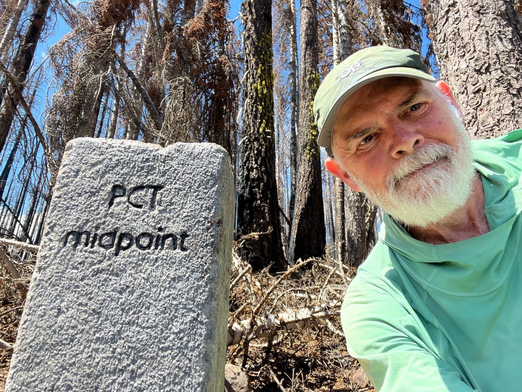
A little after 1:00PM I reached the official halfway point of the PCT. So I’ve walked more than half of the entire trail. It’s not the halfway point for my current hike, though.
The next couple of water sources were some distance off trail and I loaded up at the second one, planning on a dry camp. Late in the afternoon clouds began forming and I made sure my rain gear was ready. Sure enough, about 3 miles short of my campsite the thunder and lightning started. The wind picked up fast as the front moved through. I took shelter behind a big tree and donned the rain gear and then crouched on my sleeping pad under the umbrella as the front moved past. Once things calmed down a bit, I resumed hiking. I got to this camp a little after 7:00PM and set up quickly and had supper. There’s a curious young deer hanging around, so I’ll probably be waking often during the night.

Day 43
Humboldt Summit to Belden- 25 miles
There was a curious deer hanging around all night off and on. Because of the interrupted sleep I somehow missed the arrival of a pickup with a car top camper in the early morning. Also, it rained off and on. I missed my alarm and was about a half hour late in starting the day. I had a short chat with the pickup guy and he took off before I did.
The trail was fairly mellow for a few miles. At Cold Spring I collected some water and had a bit of lunch. While heading back to the trail my feet got tangled in some fallen branches and I went down, bruising my right lower shin. Clumsy.
There were a couple of creek crossings that involved tricky rock hopping, but I only got my feet wet once. Eventually the trail began a descent to the Feather River and Belden. This descent, however, seemed to have a lot of ascents thrown in.
I arrived at Belden a bit after 5:00 and had a root beer and a burger, several glasses of ice water and a couple of beers. I’m camped a short distance from Belden with two other southbound hikers. Big 7 mile steep climb out of here in the morning. Also, it’s still pretty warm as I type this -I’m sweating in the tent.
Also, I passed 800 miles for this hike today.

Day 44
Belden to Quincy – 19 miles.
Started out in low gear, and kept at it for about 3.5 hours until the trail leveled off a bit. Then it was the normal up and down, mostly through burned areas, with occasional areas of live trees.
I met about half a dozen northbound hikers, but other than that I had the trail to myself.
Just after 3:00PM I came off the trail at Buck’s Summit and tried hitchhiking for about 45 minutes before a pickup dropped a couple of hikers off at the trail, and picked me up for a ride to Quincy. I got a hotel room and settled in for the night.


Day 45
Zero mile day in Quincy
I decided to take a day and see how Hurricane Hilary develops. It looks like it will track east of the PCT, but sometimes predictions change. Rain and wind can be a little dangerous in burned areas because of unstable soil and dead trees.
Also, I’ve been dealing with a pain in one of my toes. I think it might be a blister that formed underneath a callus, and I feel it almost every step. Sometimes it’s kind of a sharp pain, depending on how the foot lands. I’ve tried different ways of protecting the toe with little success. So a day off can only do good for the toe.
Meanwhile I’ll sort out my resupply and try to rest.
Days 46 and 47
Zero mile days in Quincy.
After having Sunday morning breakfast with a local trail angel named Pounder, I checked out of the hotel and took the spare bedroom at his house. I’ve been following the storm predictions closely and it’s now looking like Tuesday would be the best and safest day to return to the trail.
Later that day, we drove out to the trailhead to pick up two more hikers, a couple of women named Roadrunner and Calypso. Then we drove to Bucks Lake Resort for supper, since most places in Quincy were closed on Sunday night. After a very good meal, we drove back to Quincy and spent the night at Pounder’s house.
On Monday, Pounder had to work so Calypso, Roadrunner and I took the free bus into town and had breakfast at a great cafe. We bused back, stopping at a grocery store so they could top off their resupply. In the evening four more hikers showed up. While they were showering, we other hikers and Pounder went for supper at a Mexican restaurant. Then Pounder dropped us off at the movie theater, drove home to collect the other four hikers and we all saw the Barbie movie. Overrated, I thought. But then, I guess I’m not really the target audience.
We all have arrangements to return to the trail at 7:30 tomorrow.
Day 48
Bucks Summit to campsite at trail mile 1407 – 21 miles.
We were picked up by trail angel John at 7:30 and trail angel Bruce collected the other four hikers immediately after that. On our way we picked up two more hikers. At the trailhead we posed for a group photo. It turns out there were at least a couple of dozen hikers who waited out the weather at Quincy.
Once on the trail, it was apparent that there’s been a lot of rain. The shallow ruts caused by rain running down the trail were very apparent. We also heard some horror stories of tents collapsing, etc. Glad I stayed in town.
The first few miles were pretty easy, and I made good time. I stopped for lunch at an overlook with Klepto and Prairie, two female Seattle hikers. They took off a couple of minutes before me, and I haven’t seen them since.
Around 2:00 I came upon about a dozen hikers having lunch on the Bear Creek bridge. I grabbed some water and had a small bite to eat before the upcoming climb. While there, Propaganda noticed a rash forming on here legs, with a bit on her hands. She suspected poison oak, so I gave her my only Technu wipe, which is supposed to help remove the poison oak oil. I hope it helped.
On the steep climb out of Bear Creek valley half a dozen hikers overtook me. I pulled up here for a dry camp. There apparently aren’t many flat sites ahead, and there are plenty of hikers ahead of me- most wanted to go 27 miles for the day. So I’m happy at 21 miles. Anyway , I needed some daylight time to re-tape my nagging toe. Trying to keep the pressure off the callus. My tape job this morning didn’t work out that well. I’m camped in a clear spot on an old road in the middle of a burned area. Dead trees all around, but none too close – no widowmakers above me, anyway.
Day 49
Camp at mile 1407 to A-Tree Spring- 27 miles.
A bubble of one. Yesterday when all the hikers came out of Quincy I gradually fell to the back of the bubble. After I camped only about 5 hikers passed my camp. So the southbound bubble has passed me by. I saw only 3 hikers on the trail today, all northbound. Two of them were a mother/son team I had previously met in Oregon. At that time I had complimented his umbrella mounting system, and his mother gave me her mounting device. So kind. So cool. I’ve used it ever since. It was nice to see them again.
Starting out in the morning I had a few miles of climbing left to do. Eventually the trail leveled out to its normal up and down. After 10 miles I stopped at Alder Spring and had lunch while filtering water. Ten miles after that I stopped at Beartrap Creek for water and and early supper. There was a bit of a climb after that. When I topped out on that ridge it was all downhill to this camp.
I tried a different taping strategy for my toe, and it was okay for a bit more than ten miles. Not bad, but still not great. A few miles after that, it became very uncomfortable for about 10 minutes. Then it eased off and was pretty good for the rest of the day. Dare I hope that the blister under the callus popped, or whatever the issue was is now resolved? I’ll know tomorrow. 24 miles to Sierra City from here. Maybe I’ll make it tomorrow.


Day 50
A-Tree Spring to Sierra City – 24 miles
Just after I camped last night a jeep had come up one of the roads and then turned around and slowly drove back the way it came.
The morning started with a bit of a climb. About 15 or 20 minutes I heard what I believe was a drone. I couldn’t spot it, but I definitely heard it. Since it was at first light, I thought it might be hunters scouting deer locations prior to deer season. Maybe those guys in the jeep.
The trail gradually closed in on the Sierra Buttes, and I had occasional views of them during the day. The final descent to Sierra City was a descending traverse of the slopes on the buttes. Most of it was tricky footing on loose rocks. There were steep drop offs most of the way and I was glad I wasn’t doing it in snow. On the final switchbacks near the bottom I came around a bend in the trail and startled a black bear, maybe 30-40 yards away. It took off downhill at a good clip, wanting nothing to do with me.
When I got to the highway, the first vehicle pulled over to give me a ride. It was a pickup with a dad and his two kids. They were camping in the area. He dropped me off right next to my hotel. I got checked in and then found I was too late for the store, where my packages had been sent (Thank you, Jackie!) so I walked down the road to Sierra Pines Resort where I had a nice Caesar salad and fresh blackened trout. Then back to the hotel. In the morning I’ll get my bear canister, new shoes, and resupply from the store.

Day 51
Sierra City to Mule Ear Creek – 16 miles
After a bit of confusion I got my bear canister and other things. Included in this shipment was my warmer quilt (it might be a bit cooler at night in the Sierras) and my new shoes. I packaged up the old quilt and a couple of other things and sent them home. Apparently I sent my titanium spoon home in that box, since I can’t find it. I’m improvising with my tick removal device until I can get a replacement.
It took some playing around to figure out the best way to carry the bear canister. I’m packing it vertically inside the pack and it seems to be the best way. Strapping it to the top makes the load too tall, and that much weight up top isn’t good for stability.
As usual when leaving town, there is a climb, and the pack is heavy with the resupply. I got a ride back to the trail with the hotel owner, and was hiking just before noon.
Late in the afternoon I came a logging operation which had torn up the trail. I stumbled around looking for the trail for a few minutes before following the logging road to another road which intersected the trail.
Then it was a gradual climb to this camp. It’s getting cooler at night now; I’m glad I have the warmer quilt.

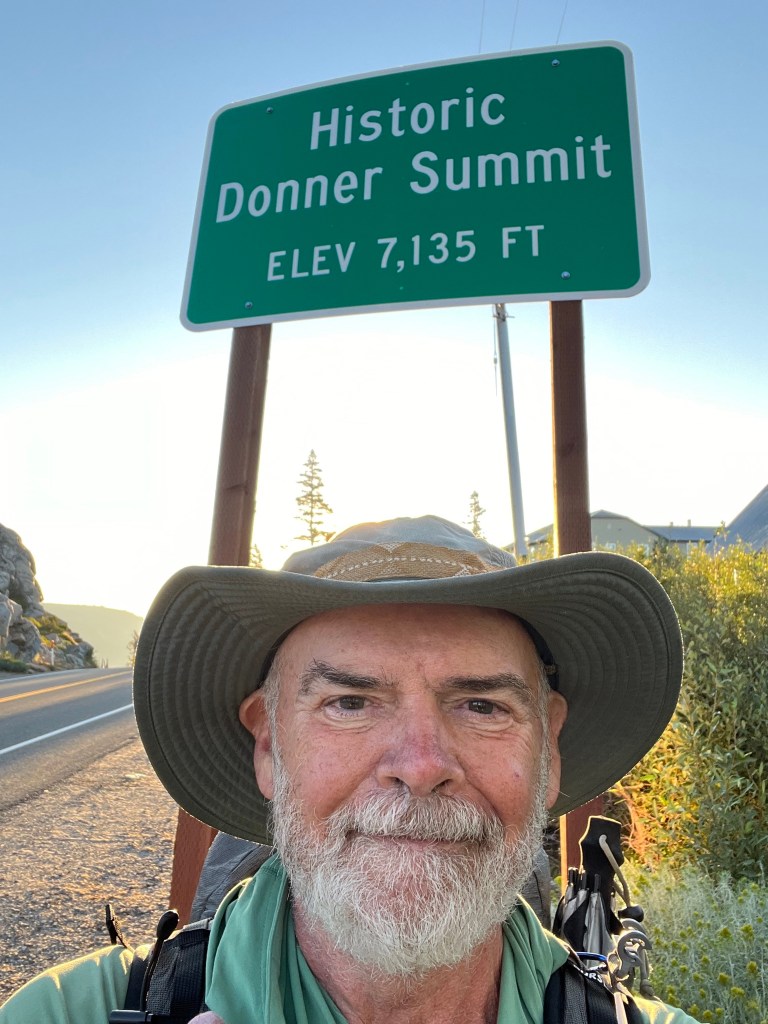
Day 52
Mule Ear Creek to Donner Pass
-26 miles
I was up and walking before dawn, using my headlamp for the first few minutes. There was a cool breeze blowing and it was pleasant.
I’d decided to try to make it to Donner Ski Ranch, where each PCT hiker of age gets a free 40oz beer. I didn’t want the beer; I was after a spoon.
After 10 miles or so, I stopped at Snowbank Spring for water and an early lunch. Then I soldiered on. The trail was relatively benign- no major climbs or descents and I just trucked along. There were some great views today – great vistas on the ridges and huge rocks left by the glaciers back when, now in the middle of the forest.
Eventually the trail spit me out at Donner Pass shortly after 5PM and I walked the short distance to Donner Ski Ranch for supper. I met some other hikers there; some I knew from Sierra City. Five of us are camped a short distance from the bar/restaurant and are planning an early start in the morning.

Day 53
Donner Pass to Five Lakes Creek- 18 miles.
Despite my camp mates all claiming they’d be up at 5:00 and on the trail by 5:30, none of them stirred until 6:00. I was awake at 5:00 but the tents were so close to each other, I just waited until they were awake before making my move. So it was a late start. As it turned out, they left camp a bit before me, and I never caught up to them.
It was a steep and fairly lengthy climb from the pass and it took a while to get to the next water source. Along the way I was able to check into the family Sunday zoom meeting for a few minutes and it was nice to see and chat with the family, if only briefly.
The views continue to improve, and I’m starting to get stoked for the Sierras, especially the segment with the John Muir Trail.
I decided to cut the day a little short because it’s a 6 mile water carry to the next campsite, and there’s a steep climb involved. Next water is about 8 or 9 miles from here. So I decided to take the climb with fresh legs in the morning. I’m camped here with a nice couple – Flash and Hollywood. We had supper together and had a nice chat.


Day 54
Five Lakes Creek to Middle Velma Lake – 26 miles
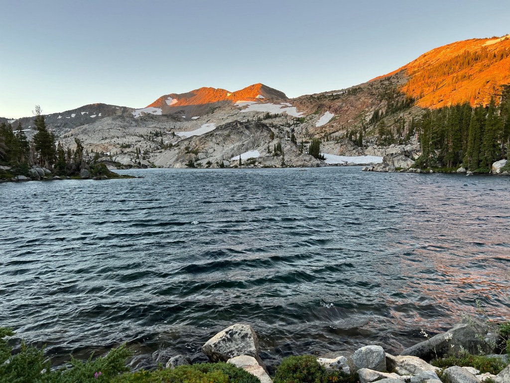
The morning began with a climb and after about six miles I entered the Granite Chief Wilderness area. There were the usual ups and downs. At about 19 miles for the day, I entered the Desolation Wilderness. A bear canister is required to camp in this area, which is why I’ve been carrying it since Sierra City. I pushed on another 7 miles or so, to a camp near Middle Velma Lake.


Day 55
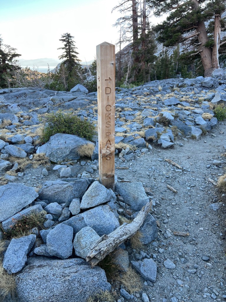
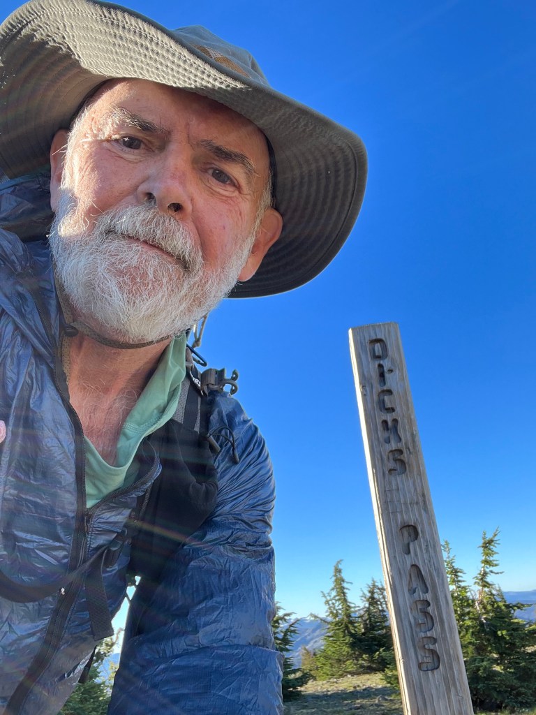
Middle Velma Lake to Echo Lakes Store – 17 miles.
During the near full moon last night, I could see a curious chipmunk scurrying around the camp, but it didn’t bother me or my gear. My food is in an odor proof bag inside the bear canister, which probably helped.
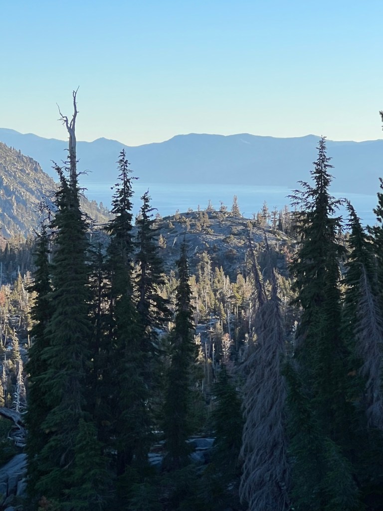
The wind came up strong around 3 or 4AM, but I was in a protected spot and had no problems. The morning began with a 4 mile climb to Dick’s Pass. The wind was still blowing, and at the top of the pass it was probably about 25-30 mph. I met a couple who had camped at the pass last night and they had a tough night – their tent stakes kept pulling out and I’m sure they didn’t sleep. Sometimes the great views come with a cost.
After the pass, it was downhill for a while and then the trail resumed its normal ups and downs. I didn’t stop for a long break, but just took several short breaks along the way. The wind kept up most of the day. When I walked along the shore of Aloha Lake I had to adjust my heading about half a point to starboard just to maintain the desired track. When I dropped further into the valley the wind slacked off, but I could still hear it blowing higher up.
I arrived at the Echo Lake store just before 3PM and was drinking a Pepsi and eating an ice cream bar when two of my camp mates from Donner Pass walked in. They had camped before Desolation Wilderness because they didn’t have a bear canister. So they hiked the 19 miles through the wilderness area and then the last several miles to Echo Lake. We shared an Uber into town. They’re staying with the other couple from Donner Pass at an AirB&B, and I got a nice hotel room. I’ve decided to take two days off in South Lake Tahoe.

Days 56-60
South Lake Tahoe – zero miles.
My two days off in South Lake Tahoe turned into five days off. I obtained my resupply and the new inflatable mattress Jackie sent to the post office here. I rested and ate watched the weather. On Friday I checked out of the hotel and the driver came to pick me up. The mountain forecast was not good – wind and rain, possible gusts of 45. It was supposed to improve day by day and I thought I might be able to tough it out. But as soon as I got in the car, I began to rethink things. I decided to wait for the weather to improve. So we drove to a couple of hotels to check for vacancies – no luck. Labor Day weekend and this is a tourist town. So I ended up in an 8-person room in a hostel. Not too bad, cheap for the area. And there are a bunch of other hikers here.
Speaking of other hikers, two of my roommates came later in the day I moved to the hostel. Their rain gear had soaked through, and one of them had been pret hypothermic – couldn’t stop shivering in the car to town. And a couple of New Zealanders left the hostel that same day, spent one miserable night and came back. And the weather has been awful ever since. Even here in town. So I know I made the right call. It’s just boring hanging around here. But hopefully back on the trail tomorrow.
Day 61
Echo Lake Chalet to mile 1581 – 20 miles.
I’d arranged to share a ride to the trail with two Canadian guys, John and Jack. We went for breakfast at a cafe and then called an Uber. We were on the trail by about 9:00AM.
Of course there was a climb to start things off, but it wasn’t a long climb and then it was the normal ups and downs. Great views continue and there was plenty of water, so no long water carries. All in all, not a bad day.
After crossing Highway 80 at Carson Pass in the late afternoon, we rounded a peak called the Elephants Back and in a couple of miles found our camp next to a creek, elevation 8500 feet.

Day 62
Mile 1581 to Mile 1607 – 26 miles.
Started off just before first light. There were no huge climbs today, just the normal up and down with the occasional short but steep climb. Great views most of the day, and the good weather continues. Plenty of water along the way, except I carried a couple of liters 2 miles to this dry camp site a couple of miles east of Ebbets Pass.

Day 63
Trail Mile 1607 to Trail Mile 1631 – 24 miles
We were up fairly early and hiking at first light. The trail was up and down and a nice variety of forest travel, with occasional meadows, and ridge top views. I often stopped just to enjoy the views.
We haven’t seen the other Canadian for two days now. He a fast hiker and may have overtaken us when we were on a lunch break or something. I hope he turns up at Kennedy Meadows North tomorrow, if he hasn’t already been there and gone. His partner is a bit concerned.
Day 64
Sept. 7, 2033
Trail Mile 1631 to Kennedy Meadows North to camp at Mile 1643 – 13 miles.
DaddyLongLegs (the Canadian I’ve been hiking with since South Lake Tahoe) and I were walking at first light. We wanted to get to the road and hitch a ride to Kennedy Meadows North early. He mailed himself a resupply box there, and I planned to buy my resupply from the store. If we didn’t get a ride, Kennedy Meadows runs a free hiker shuttle and it would pick us up at 10:30.
There was about a 3 mile climb, and then about a 3 mile descent to the road. We got to the road about 9:00 and got a ride with 30 minutes or so. At the store DLL collected his supply box and we paid for showers and laundry. We felt lucky to have arrived before the hikers coming in on the shuttle. No lines for showers or laundry.
When the clothes were in the dryer, we went to the restaurant for breakfast. While we were there, the shuttle arrived and our other Canadian was there. He joined us for breakfast. We’d been slightly worried about him, since we hadn’t seen him for a couple of days. So it was good to see him.
Afterwards I shopped for my resupply and then adjourned to the hiker area to organize my food, etc.
The hiker area is two large picnic tables under a tent canopy, surrounded on three sides by large flat top logs which are comfortable for sitting. Also there is a large charging port so many hikers can all charge their electronics at the same time. The store has all of the regular hiker resupply items; it’s really geared to hikers. Good restaurant. Rooms to rent. This place has it all.
We caught the 2:30 shuttle back to the trail and started hiking about 3:00. There was a climb up from Sonora Pass, and then the trail leveled off a bit for traversing some steep slopes. It was pretty windy. There were a few snow patches across the trail and one slightly steep climb up a snow patch to get to the trail above it. After about 6 miles we camped here, where some bushes and small, wind-stunted pine trees offer some protection from the wind.

Day 65
Sept. 8, 2023
Mile 1643 to Wilma Lake, Trail Mile 1667 – 24 miles
The morning was still windy and it seemed pretty chilly, so we layered up under the wind jackets and trudged onward. The trail traversed some steep slopes before descending into a valley. Just as we reached the point of descent we met a bow hunter glassing the area for game. After a short chat he continued upward and we began our descent.
We stopped for lunch at Dorothy Lake and there were several hikers there, some of whom took a swim. I did not.
From there it was about 9 miles to our camp at Wilma Lake, mostly downhill. The trail was a mix of granite slabs, soft forest trail, and swampy meadows. Also some great views. About a mile or so from camp I tripped on some roots and fell. I scraped my left shin just under the knee but it should be okay. The knee is just slightly stiff tonight, but ibuprofen should help.

Day 66
Sept. 9, 2023
Wilma Lake to Mile 1686.5 – 19.5 miles.
Today we did two separate
1000-foot climbs in the morning and one 1800-foot climb to finish the day. Along the way we had a thunderstorm for a couple of hours. The thunder was as loud as I’ve ever heard it. Maybe the granite walls accentuate the sound.
The first thunderstorm came just before we took a lunch break and we hunkered under some trees with a couple of other hikers. After lunch we decided to push on in the rain, hoping it would stop before we got too far into our climb. And so it did. We climbed to Smedberg Lake where most of the camp sites were occupied. Along the way there was another brief thunderstorm. We pushed on another mile and a half to a camp on granite slabs. The skies are clearing and it looks to be a cold night. I’m sleeping with my water filter, in case the temperature dips below freezing overnight.
Day 67
Sept. 10, 2023
Mile 1686.5 to Mile 1707 -20.5 miles
The morning began with a short and steep climb, then a long downhill to a few miles of mostly level meadow walking. At about 10:00 we stopped at a mostly sunny granite slab and spread our tents and sleeping quilts out to dry. Yesterday’s rain, the wet ground, and wet clothes made for significant condensation in the tent last night. It didn’t take long to dry things out.
There were a couple of wide creek crossings, one of which I took my shoes off to wade. My socks and shoes were already soaked from wet grass and bushes so I don’t know why I bothered.
After rock-hopping across Spiller Creek we stopped for lunch. After that it was smooth sailing for a while until the trail began climbing to and past Tuolomne Falls. Just after we crossed the bridge above the upper falls a thunderstorm was rolling in. We found a spot on a granite hill and I got the tent set up, and things stowed, before the rain and wind hit. It carried on for about an hour before the rain stopped. We cooked dinner and ate while enjoying a magnificent view.


Day 68
Sept. 11, 2023
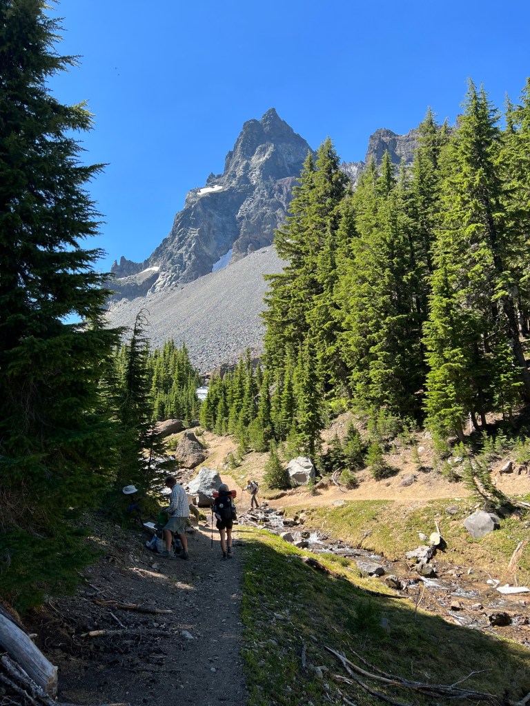
Tuolomne Falls to Thousand Island Lake- 25 miles
Once again, there was significant condensation in the tent, due to the wet ground from the thunderstorm. The trail was a fairly mellow climb for about 15 miles, passing through Tuolomne Meadows, then steeply rising to Donohue Pass (11,000 feet). As we approached the pass, thunderstorms moved into the area. I hunkered down to wait for the worst of it to pass, then continued to climb. By the time I got to the top the lightning and thunder were miles away, but the rain and hail continued sporadically. Not a pleasant climb. After the pass, we descended toward Thousand Island Lake where the PCT and the John Muir trail separate for a while. We found a camp site above the lake, protected by trees and rocks and with limited views.


Day 69
Sept. 12, 2023
Thousand Island Lake to Purple Lake via Red’s Meadow – 25 miles.
From our camp above Thousand Island Lake it was mostly downhill to Red’s Meadow Resort, where we planned a shower and lunch. I also needed to pick up a couple of days food to get to Vermillion Valley Resort. Naps and I were a little ahead of Daddy Longlegs, and once we left camp we didn’t see him until Red’s Meadow. He got to the road and hitched a ride, and was waiting when we arrived. The bridge over the San Joaquin river had washed out over the winter, leaving just one beam across the stream. I followed the shore to a closed campground and road walked to Red’s. Naps walked across the remaining beam and followed the trail past Devil’s Postpile, so I arrived before him. We got our showers and burgers and in the afternoon hit the trail again. We ended up hiking to Purple Lake. I was behind the other two, and a mile or two from camp it looked as if rain was coming, so I hotfooted it and got to camp a few minutes after they did. As it happened, the rain did not come. It was a nice protected spot, with water close by.
Day 70
Sept. 13, 2023
Purple Lake to Vermillion Valley Resort- 16 miles
From Purple Lake the trail rose for a couple of miles before losing about 1000 feet of elevation to Fish Creek. From there it was about a 1600 foot climb up and over Silver Pass, then a steady descent along the North Fork of Mono Creek to the junction with the trail to the Lake Edison ferry. That trail was a somewhat boggy/muddy 1.3 miles to the ferry landing. Naps walked the shoreline trail to the resort, while Daddy Longlegs and I waited for the ferry. There were a bunch of John Muir Trail hikers also waiting; and a trail runner who had passed us earlier. She ran 26 miles to the ferry and planned to spend the night before running 26 miles back the next day. Badass.
The ferry ride took about 30 minutes against a headwind, and we arrived at about 5:30. The resort gives everyone a free beverage on arrival and I enjoyed an IPA while waiting to check in. The three of us rented a tent cabin for the night. My partners had sent resupply boxes here, and I planned to resupply from the store. After supper, showers, and laundry we turned in.
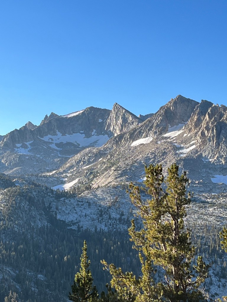
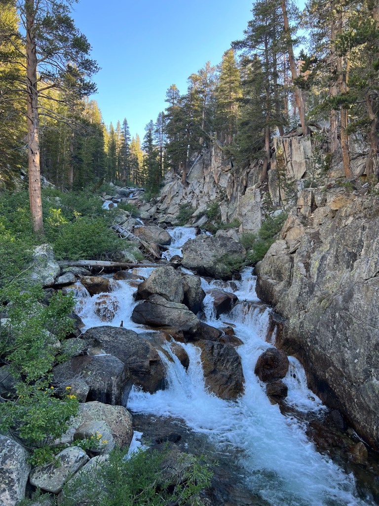
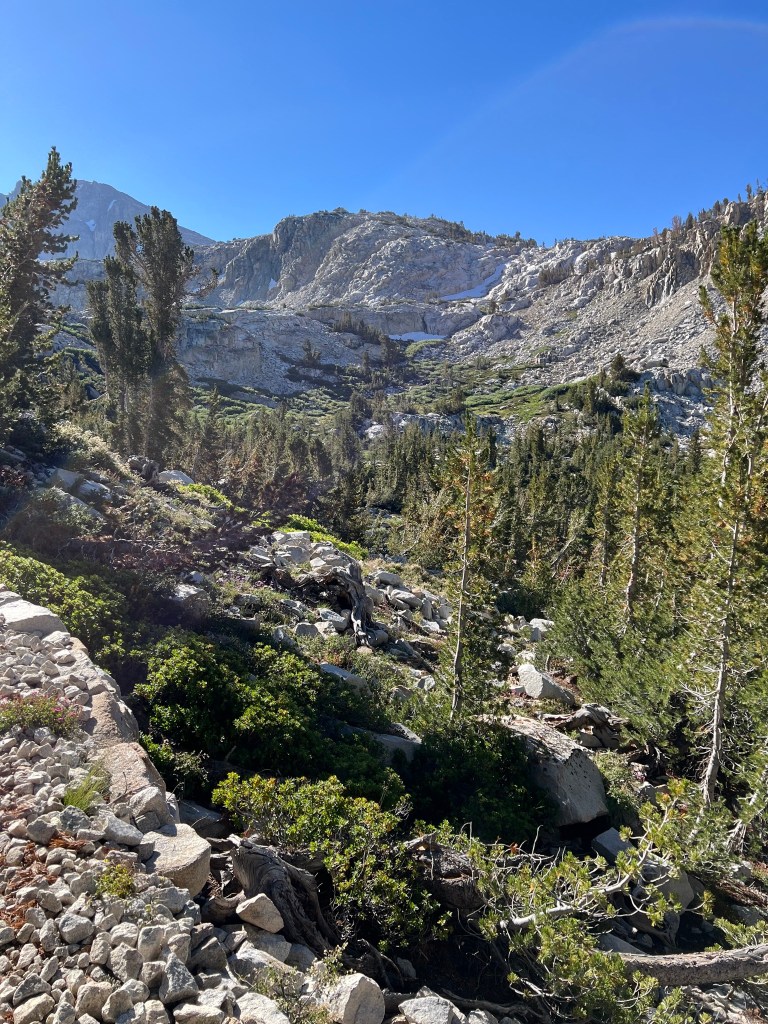
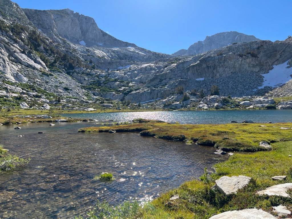

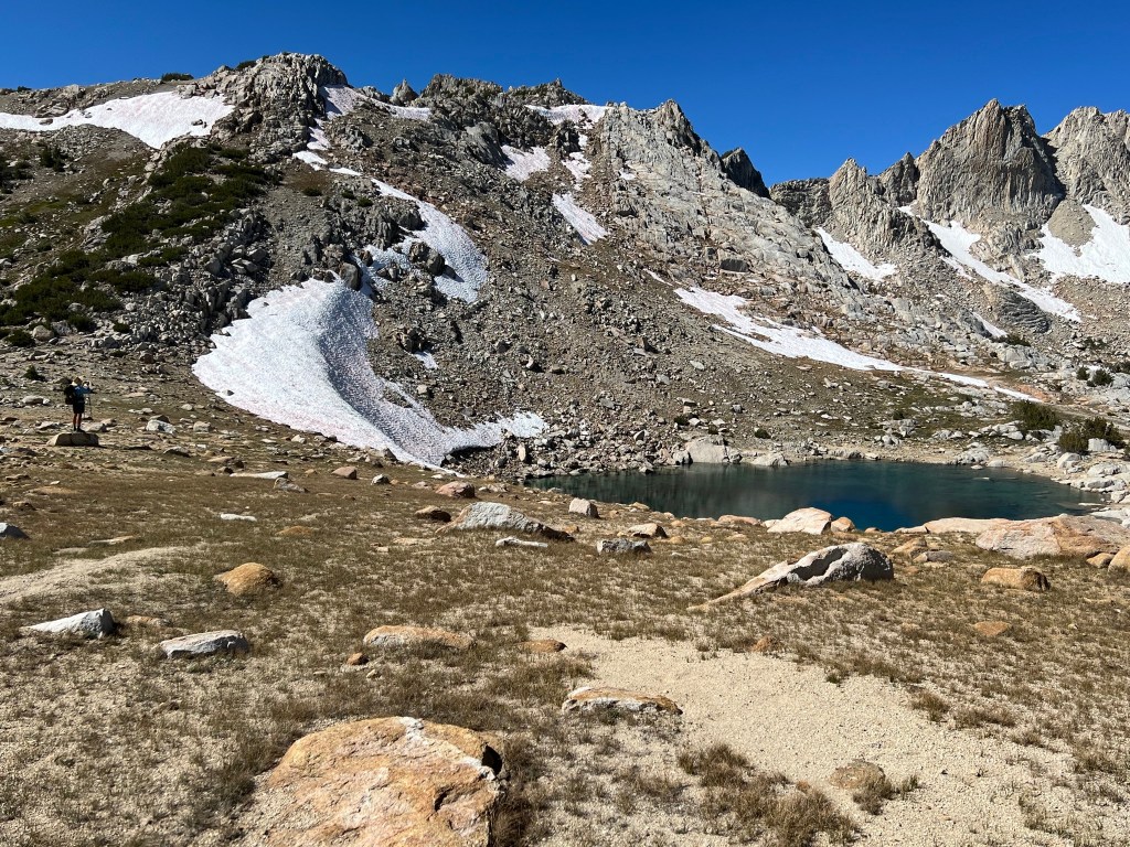
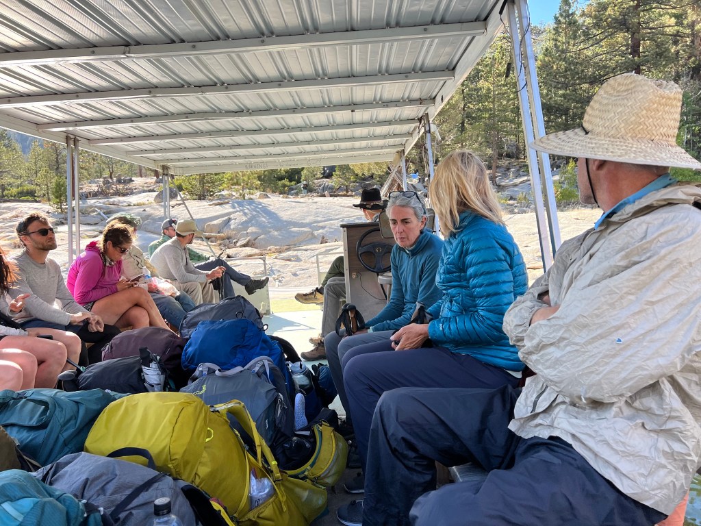
Day 71
Sept. 14, 2023
Vermillion Valley Resort departure and return – 16+ miles.
tl;dr: I walked over 1200 miles to smack my head on a rock.
Rather than catch the ferry across the lake, we opted to hike the Bear Ridge Trail back to the PCT, about 7-8 miles. Once on the trail, Naps took off and Daddy Longlegs and I trailed behind. When we reached the junction with the PCT we took a lunch break. Once back on the trail, there was a 2 mile descent before climbing to Selden Pass. Once again I was bringing up the rear and about a mile down the trail I tripped. As I staggered forward the heavy pack on my back propelled me head first into a granite rock. I had abrasions on the right side of my forehead and a small gash on the left side. I don’t think I lost consciousness, but I knew this was not good. A few minutes later two hikers showed up. One helped me rinse the wounds with filtered water and apply some steri-strips to close up the cut. I knew it was not a good idea to continue into the high country with a head injury, even if it was a minor head injury. I had a cell signal, so I sent a text to Daddy Longlegs informing him of my accident and that I was returning to the resort. (As it turned out it was a couple of days before he contacted me via his satellite communicator. They’d been worried when I didn’t show up at camp, and I felt bad about that.)
So I got myself together and proceeded to hike the 8-9 miles back at a careful pace. I met a couple of hikers along the way and told my story in the hopes they’d meet my partners and let them know what happened.
Once off the trail and road walking back to the resort I met a truck towing a horse trailer. I was surprised when the driver asked if I was the hiker with a head injury. Apparently the other hikers had met a horseman and told him to look out for me. The horseman called the resort to report that. Nice to know they were looking out for me.
I got back to the resort around 6:00 and booked a yurt for the night. Another hiker overheard some other guests talking about leaving the next day, and tipped me off. I hit them up, and a guy named Steve agreed to drop me off in Fresno.
We left about 7:00 the next morning and I was at the Fresno airport at about 10:00, too late for the morning flight. I got the afternoon flight and from SeaTac I ubered directly to an urgent care clinic near home. Despite the swelling, everything checked out okay. But the doctor referred me to the ER at Swedish Hospital in Edmonds for a CT scan of my head, just to be sure. There was a lot of waiting involved, but I left the ER at about 10:30 PM with a good CT scan result.
Very disappointed to have ended the hike this way. I’ll just have to go back later to finish up.
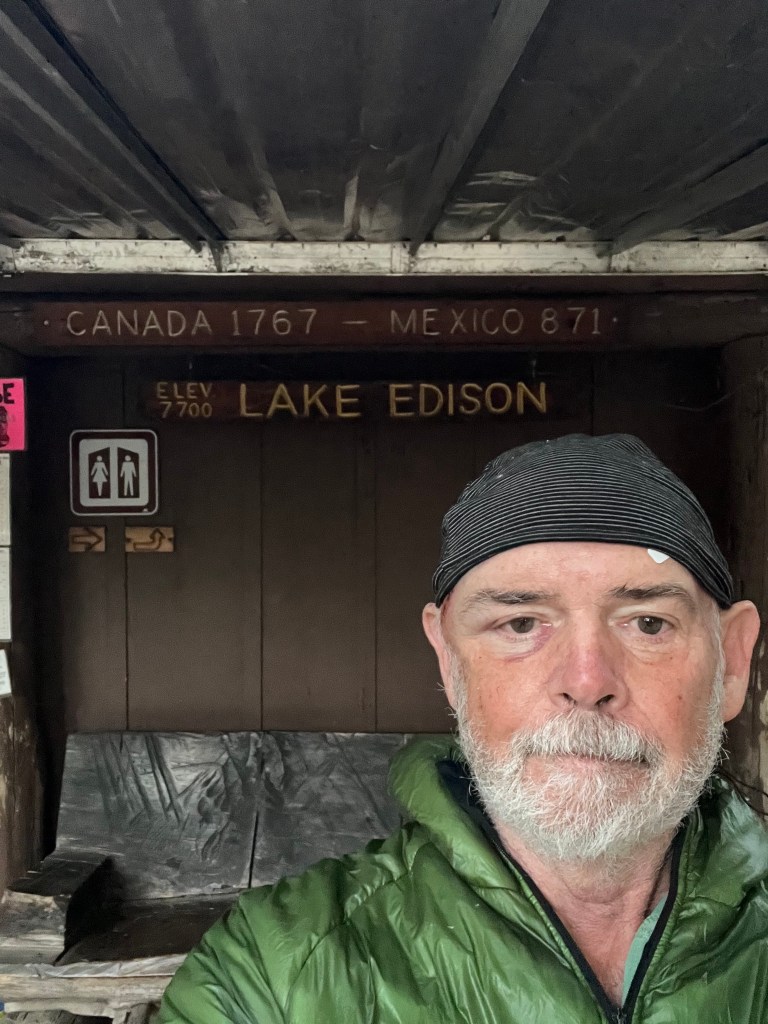


Leave a reply to Tick Tock Cancel reply