After getting off the trail with an injury last year, I’m going to try to finish off the approximately 875 miles to complete the PCT hike.
May 14, 2024
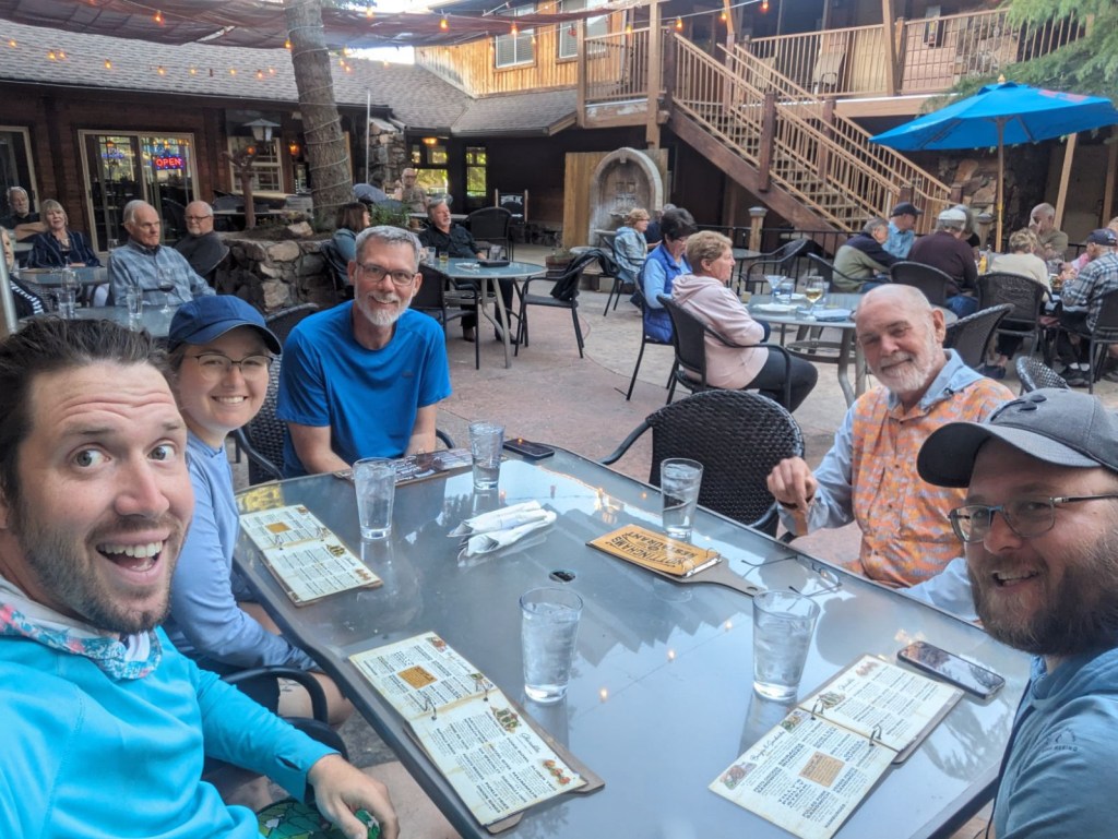
Stevie T drove over from Wenatchee to spend the night last night. We spent a little time getting our gear repacked and ready for the baggage check. The shuttle arrived at 05:45 this morning to take us to Paine Field for our flight to San Diego. We spent the night in a hotel in San Diego, and picked up a few last minute items. Taco Tuesday at Cafe Coyote in Old Town and a stop at Little Italy Pizza to pick up a couple of pastrami subs for our first lunch and supper on the trail tomorrow.
May 15
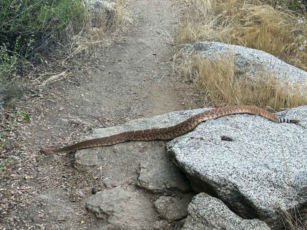
Day 1 – 11.4 miles, 1 rattlesnake
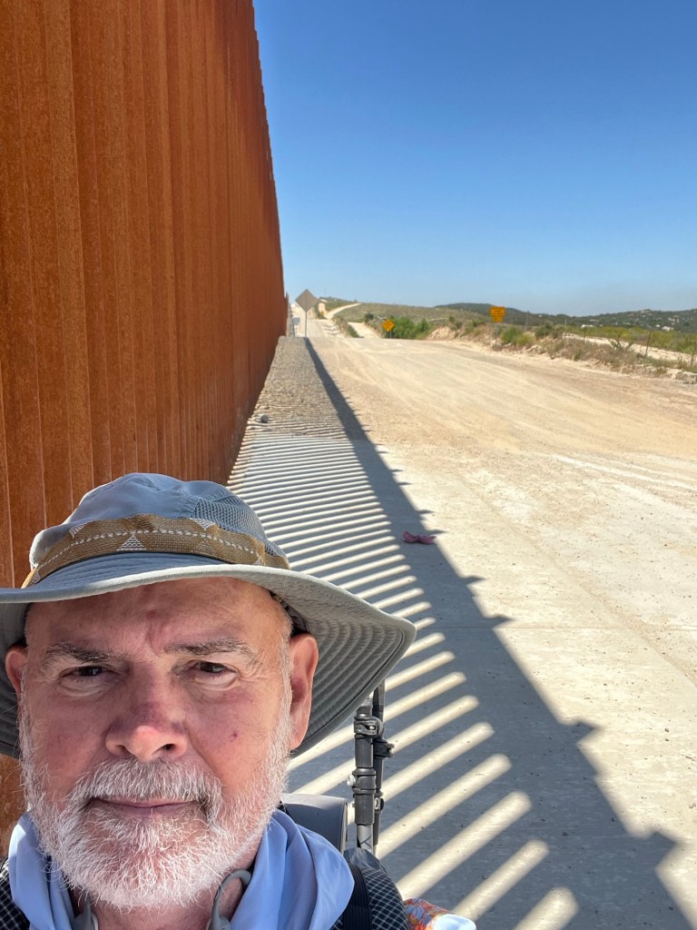
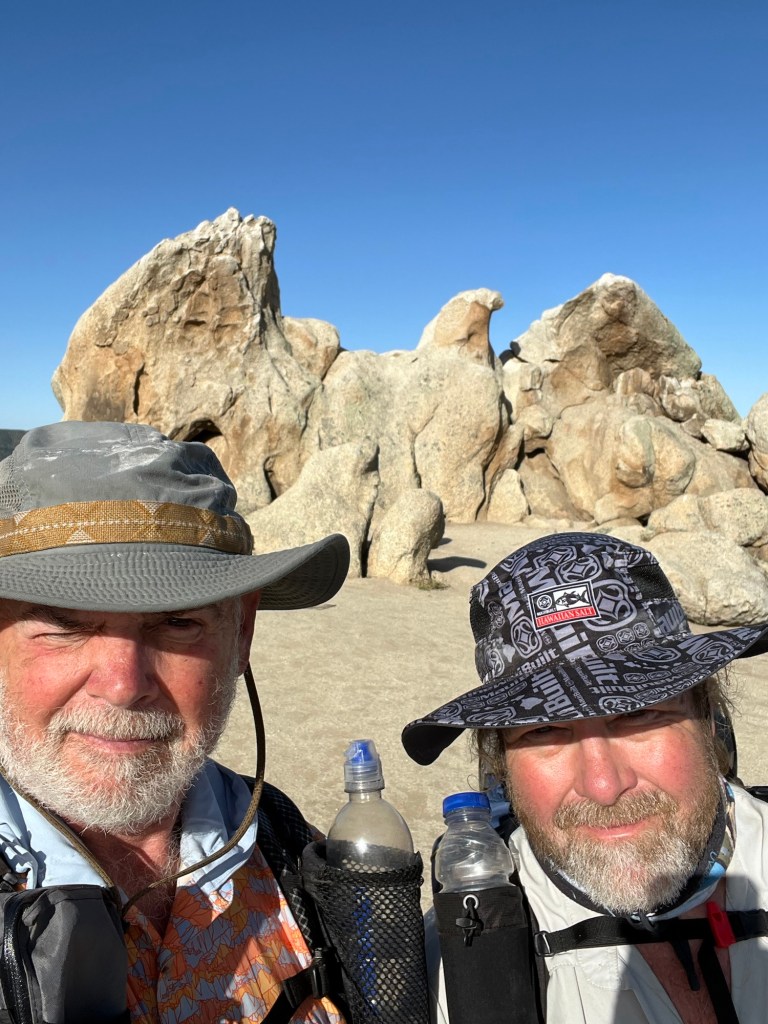
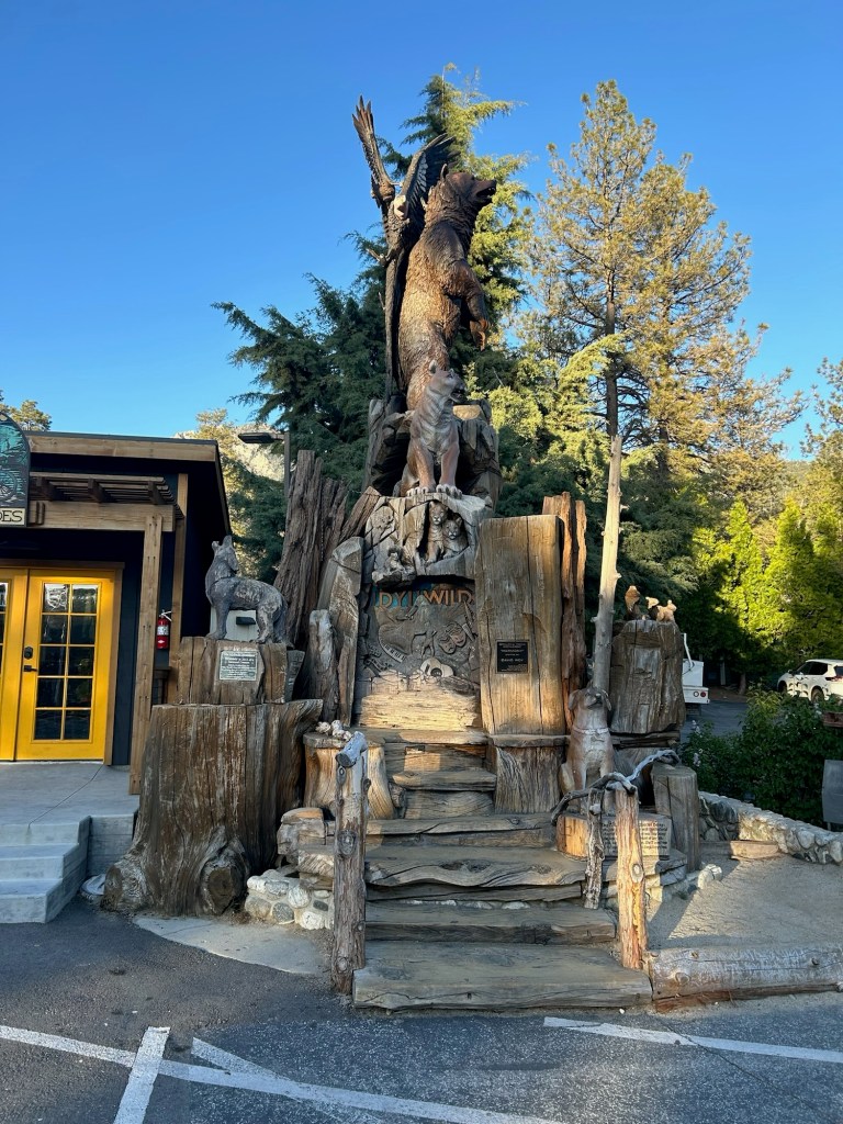
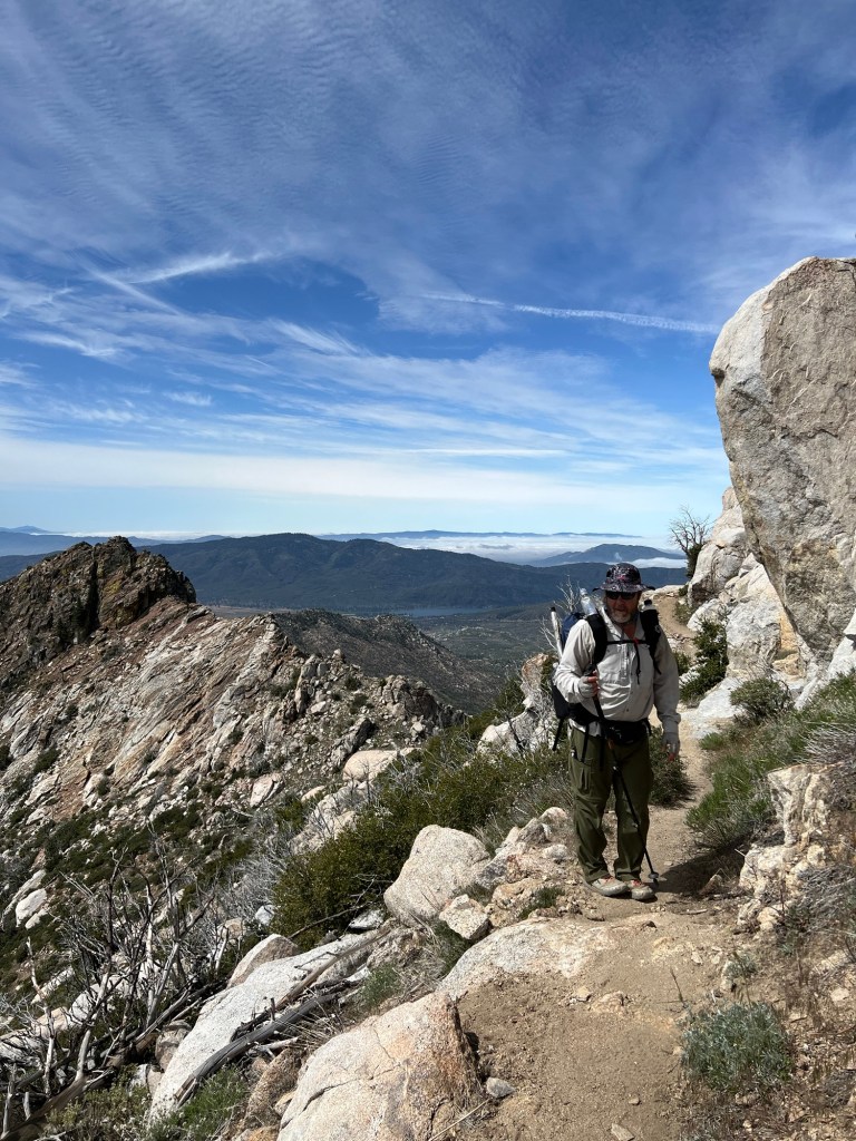
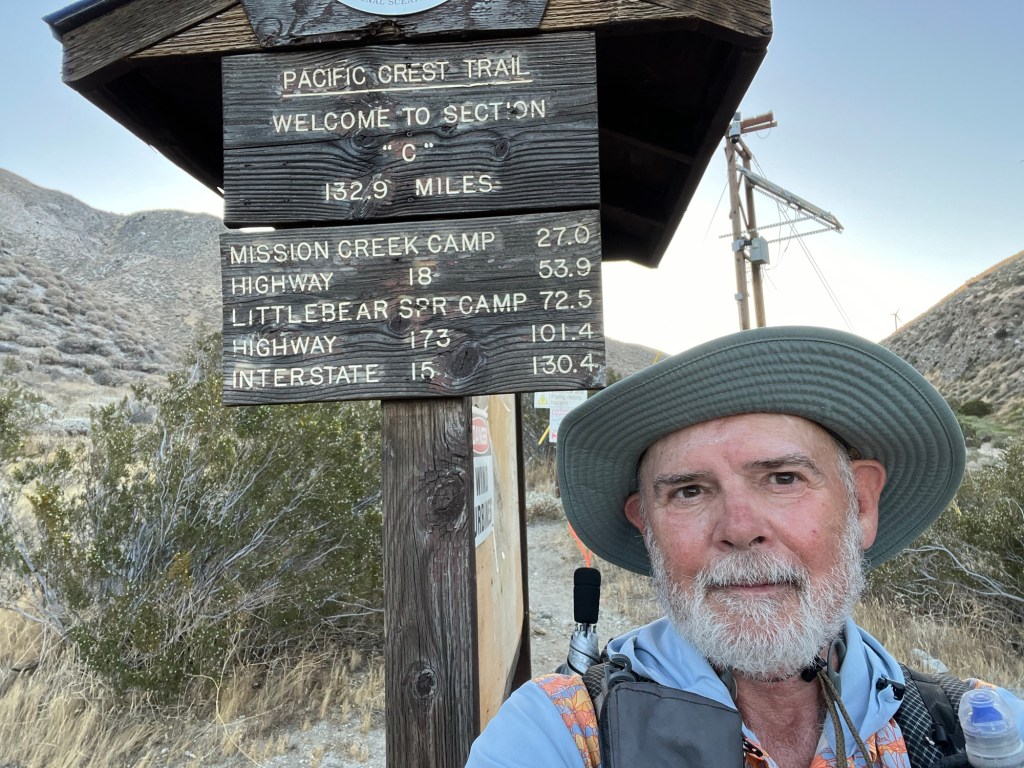
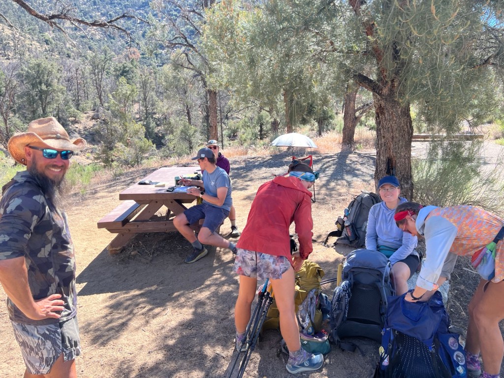
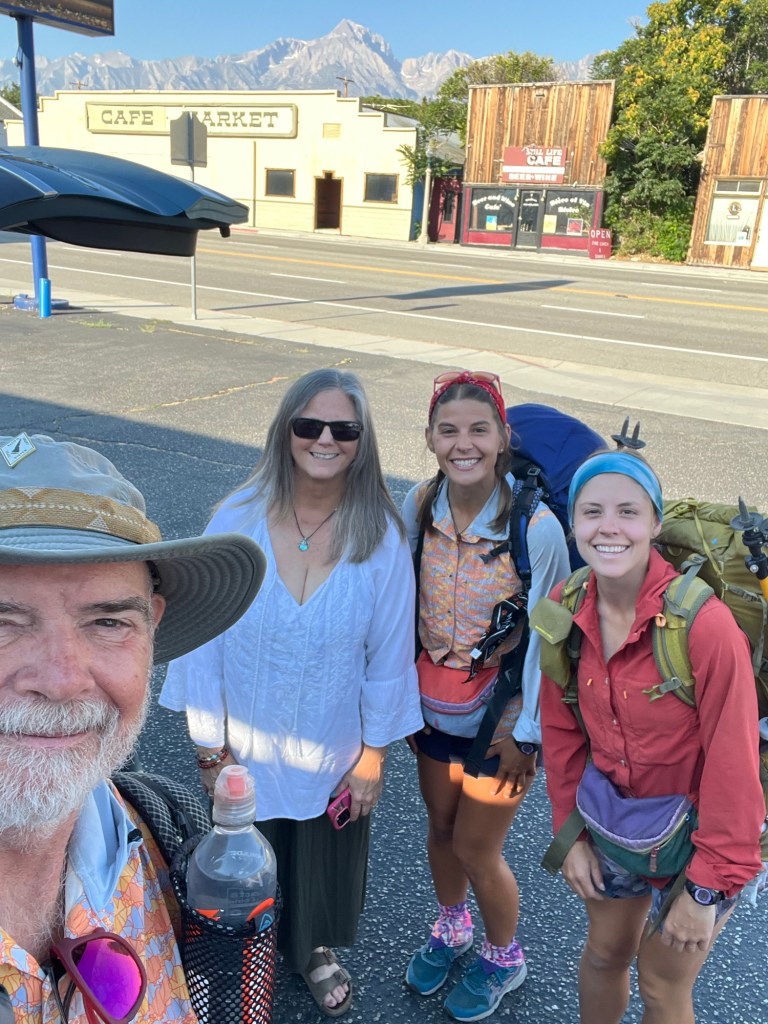
The shuttle picked us up at 09:30 at the Old Town transit center. There was a third hiker who boarded the shuttle there, also. We made a quick stop at Scout and Frodo’s house to pick up a hiker from Japan. Scout and Frodo are legendary trail angels, having hosted hundreds of hikers at the beginning of their PCT hikes, over the course of 17 years. It was an honor to meet them. After that, and a quick stop at REI, it was off to Campo and the southern terminus PCT monument. Dee, the driver, is a thru-hiker, having done the PCT in 2014. Her trail name is “One-speed”, and her husband’s trail name is “Just Paul”.
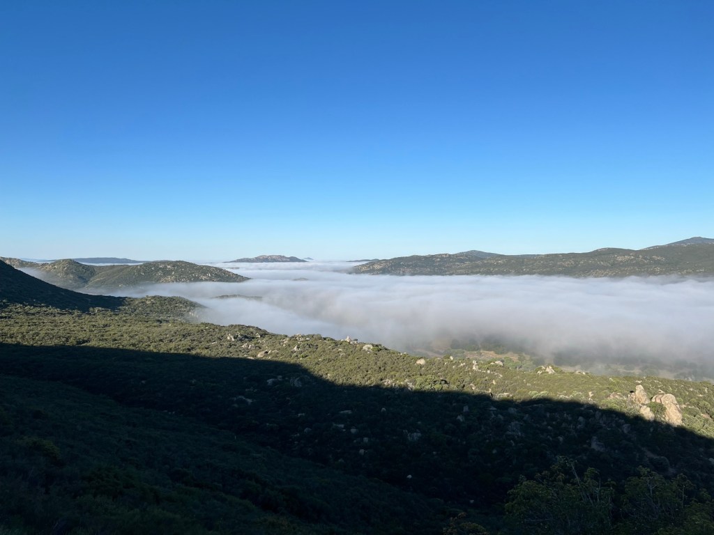
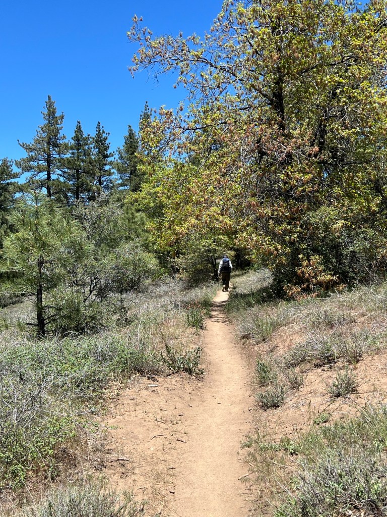
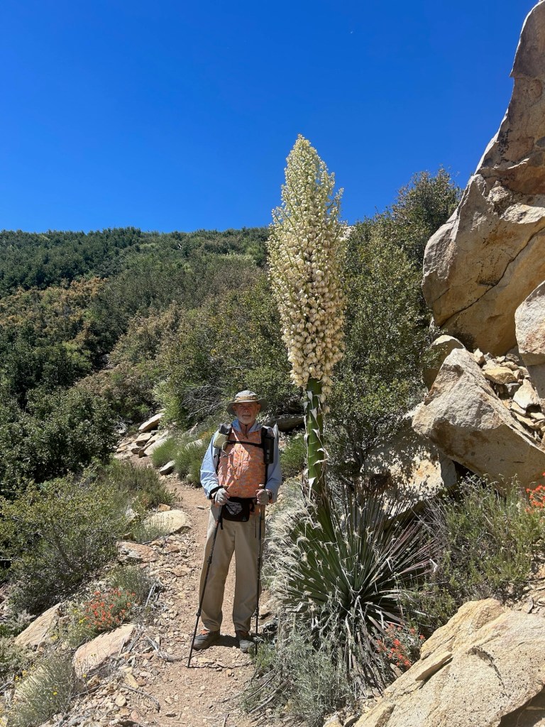
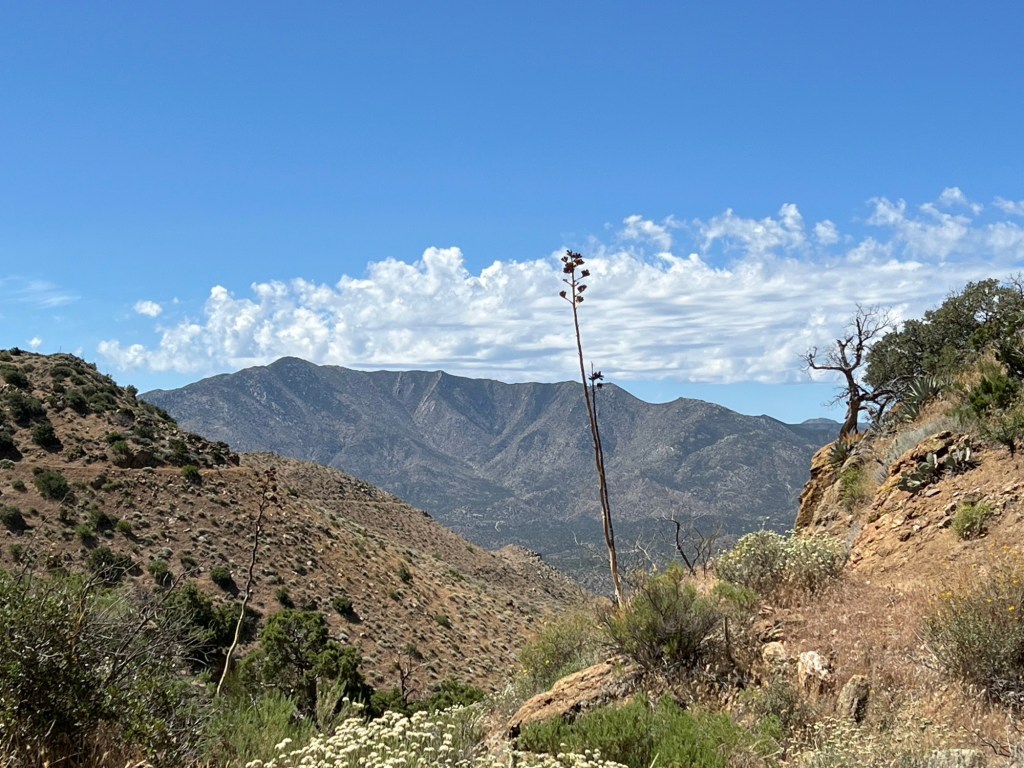
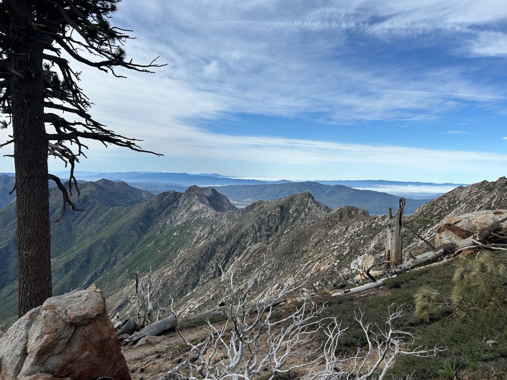
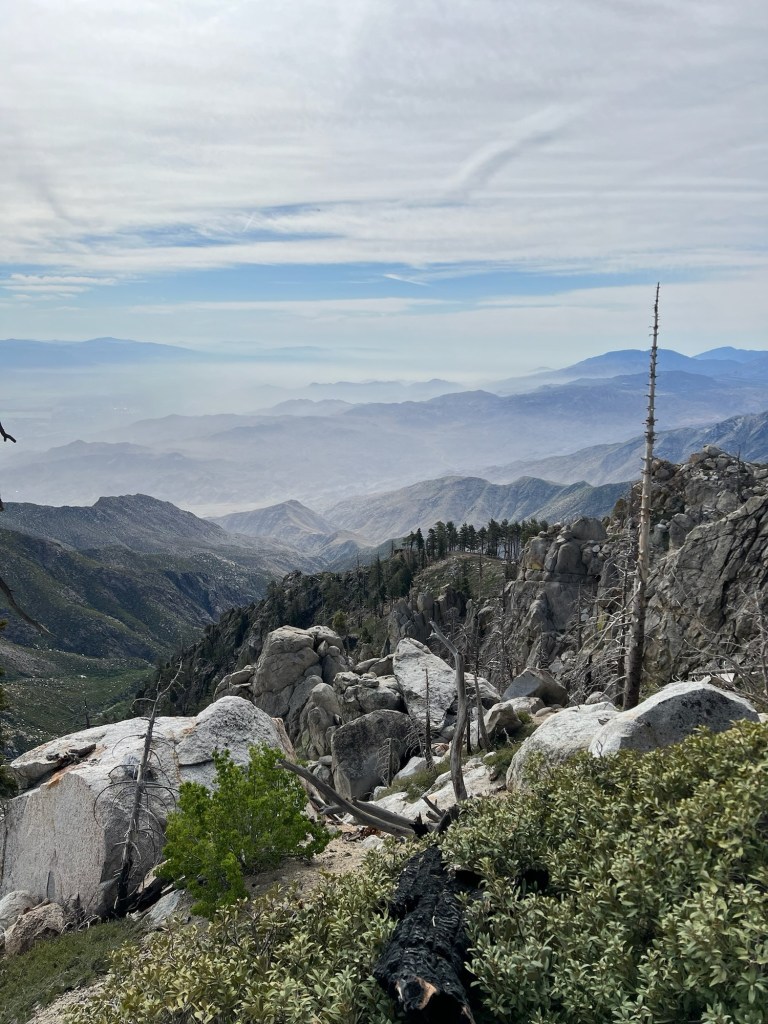
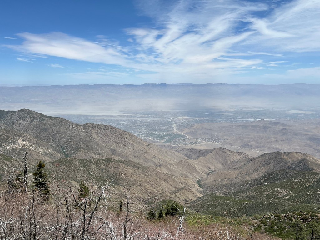
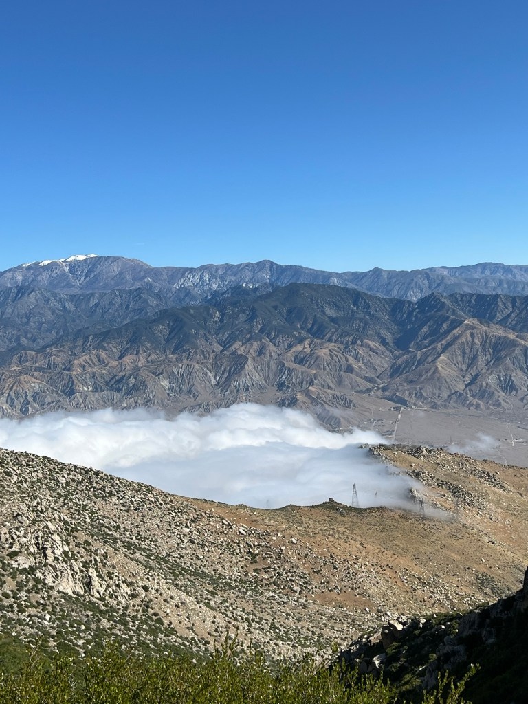
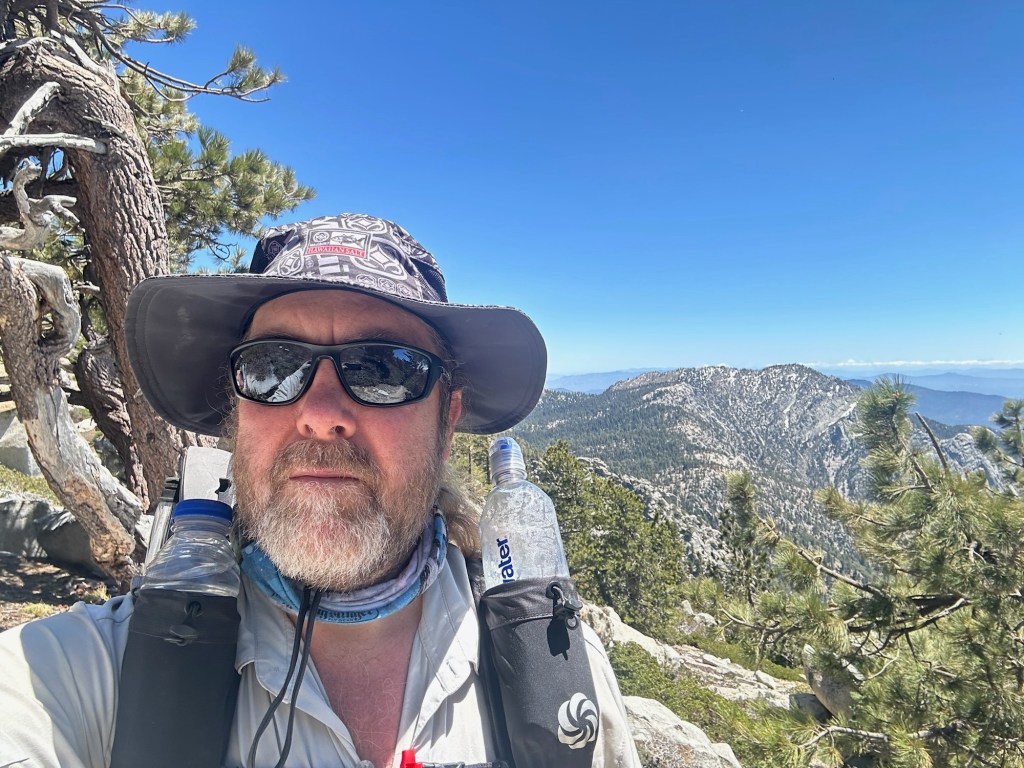
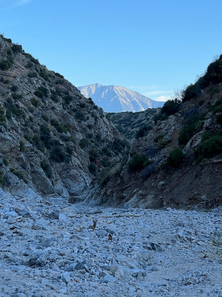
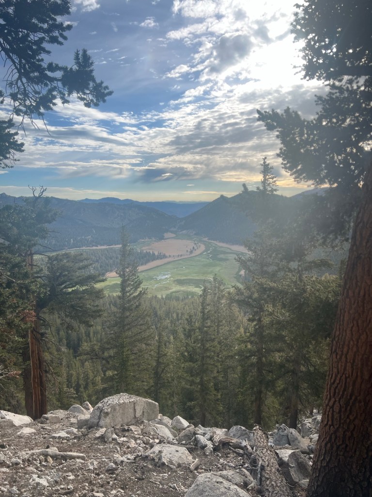
After arriving at the terminus, we took some obligatory photos and began hiking just before noon. The trail was in pretty good shape and the elevation gain was fairly mellow, so we were making pretty good time. We met a couple who had apparently gone past a water source before realizing the next source was pretty far away. They were carrying their empty water bottles when we met them, and were almost to the stream. So they would be okay. Then we passed a German hiker resting on the side of the trail. Maybe a mile later we heard someone yelling, and it took a moment to realize she was yelling at us. Apparently she had startled a rattlesnake and she couldn’t see it. When we got up to her, we located the snake about 3-4 yards ahead on the trail. It was rattling and apparently upset. It crawled into bushes and continued to rattle. We could see the snake, and knew it was safe, so we helped the woman get past the snake and then continued on our way.
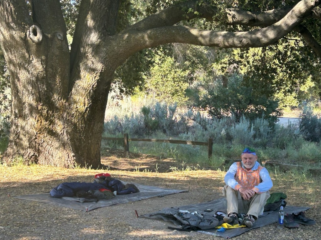
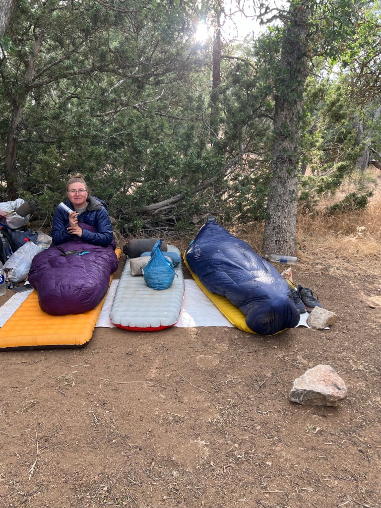
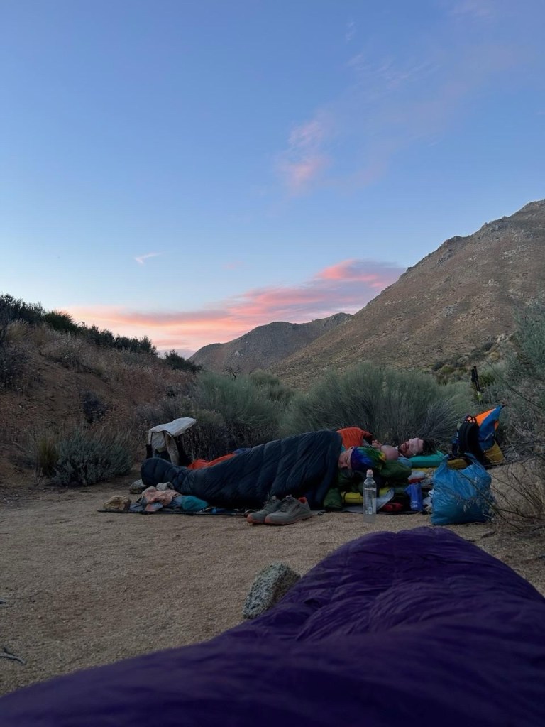
We reached our camp site at about 5PM. After pitching camp and eating the last of the sandwiches, we just chilled out. Shortly before dark Scott, one of the hikers from our shuttle, walked into camp. He had said he only planned to go 4 miles, so we were a little surprised to see him at mile 11. But there was plenty of room. He pitched his tent and we all turned in.


May 16
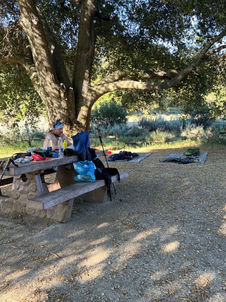
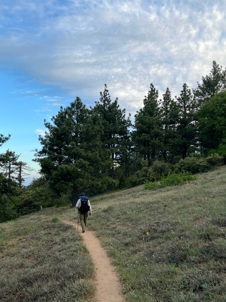
Steve and I were up at 5:00 and hiking just before 6:00. Scott was just getting going when we left. The trail dropped down to Hauser Creek where we watered up, and then we climbed about 1000 feet in just over 2 miles. It wasn’t easy, but it was much better doing it in the morning than in the hot afternoon.

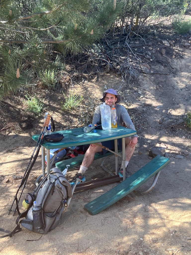
We scared up a couple more snakes along the way to Lake Morena, but no rattlers. Steve did find a 20 dollar bill on the trail just after we passed one of the snakes. Not sure if that’ll get him banished from the garden of Eden, or what. We got to Lake Morena a little after 10 and hit the malt shop for burgers and sodas. After hanging out there for a bit we hoisted our packs and hit the trail. It was getting warm, and there wasn’t any breeze, so we deployed the sun umbrellas. They do help. Just beyond Buckman Springs Road, we crossed a seasonal stream and stopped for water, and to soak our feet for a few minutes. It felt pretty good. From there it was about 2 miles to Boulder Oaks campground, where we pitched up for the night. We quit early in the day, but we’d done 16 miles. We’re trying to ease into it a bit before trying for the 20 mile days. 16 miles or so to Mt. Laguna where we have a resupply package waiting for us and where we’ve reserved a room. Showers and laundry after only 3 days!


May 17
16 miles; 1 rattlesnake

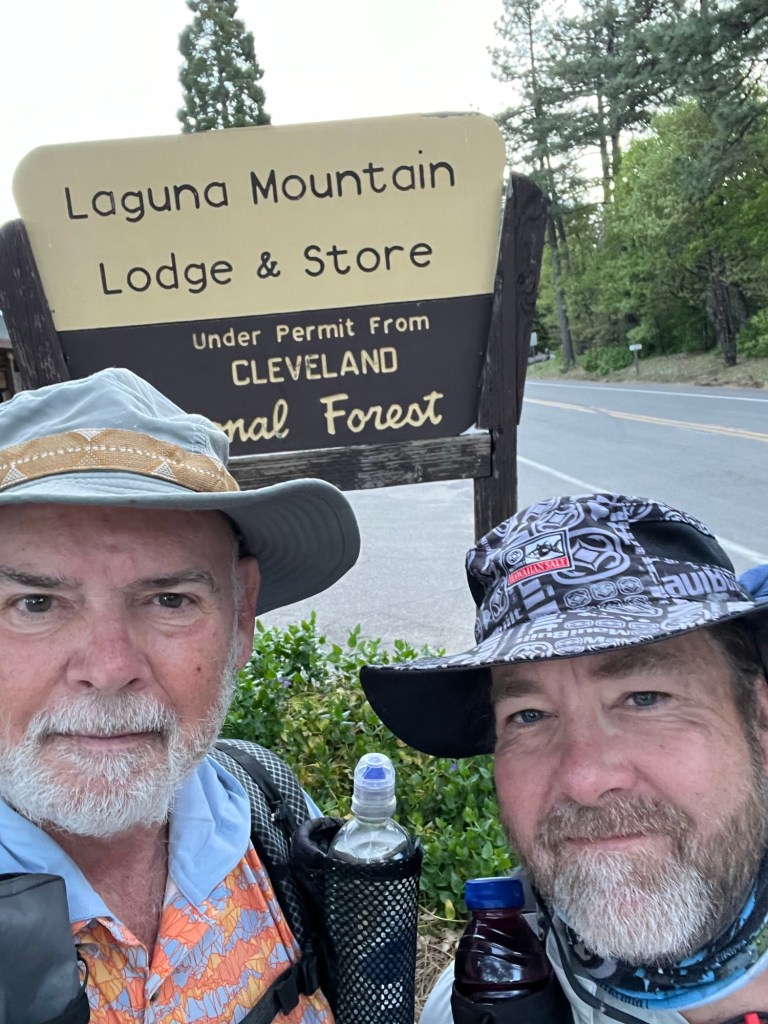
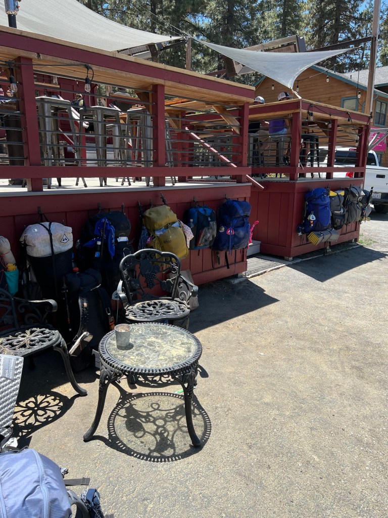
We both cowboy camped last night (no tent), and just after dusk the bats were very active , swooping through the campsite from all directions. A fog set in over night and was still there when the alarm went off at 5:00. We packed up, and Steve made some coffee. We spotted another hiker in the PCT area of the campground and went over for a chat. His name was Trevor, originally from the U.K. He’d got there on his first day, 27 miles. He was still packing up when we left, but we knew he’d catch us. Sure enough, about an hour and a half later, he did. We chatted some more while walking and when Steve and I stopped for a strategy discussion, Trevor kept moving. I doubt we’ll see him again, unless he comes up lame further up the trail. After that, we only met two other hikers on the trail, and one of them was a day hiker. But when we arrived at the Mt. Laguna store there were about six hikers hanging out and sorting their resupplies. We have a room for the night, got showers and did some laundry in buckets provided by the lodge.


May 18
Day 4, 26.2 miles, zero rattlesnakes
After the showers and laundry and resupplies were all sorted out, we went down the road a quarter mile to a restaurant that advertised French American food. It was run by a French couple and young French chef. The food was great, and unexpected in such an out of the way place. Then it was back to our room at the lodge for the night.
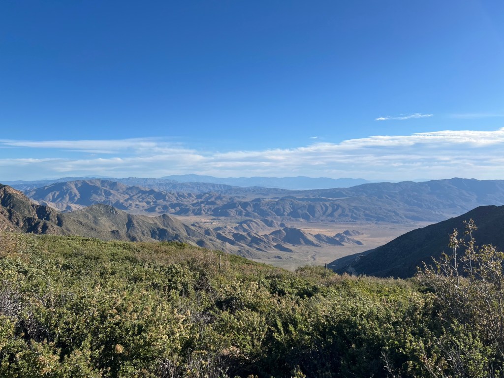
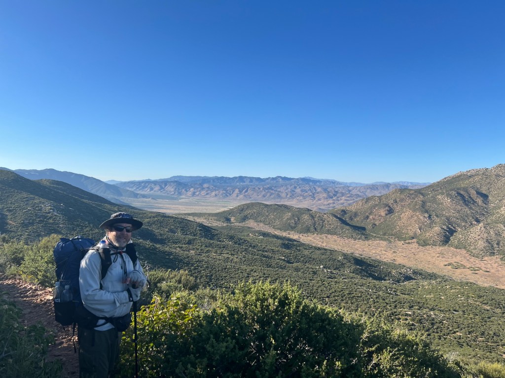
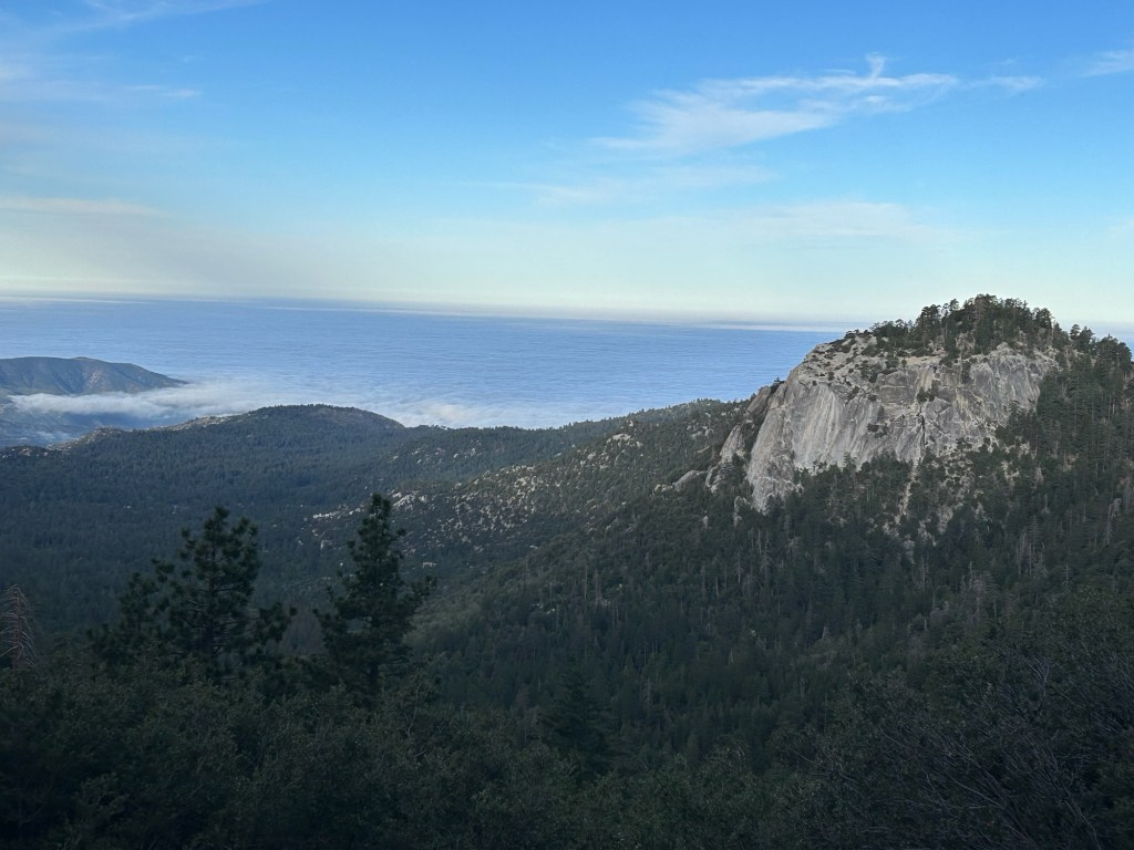
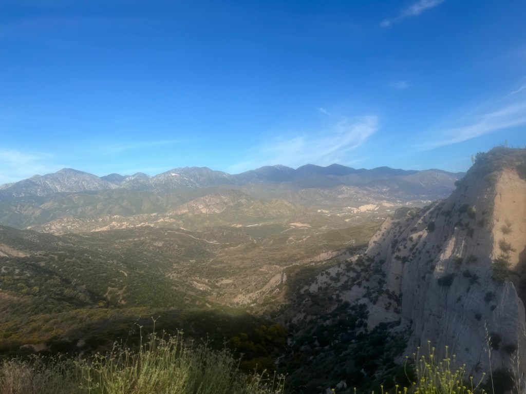
We were up at 5:00 and hiking just before 6:00. We got water at the Penny Pine Trailhead, 6.5 miles from our morning start. Then we chugged along and made our “10 by 10” – 10 miles by 10AM. Nine miles after Penny Pine, we stopped at a small stream for water and lunch. The rest of the day was relatively easy terrain and beautiful views.
Now we’re camped among some bushes to get some protection from the wind. We’ll get some water from a big stock tank about a quarter mile from here in the morning. A little tired after our marathon.

May 19
Day 5 – 8.7 miles, no rattlesnakes
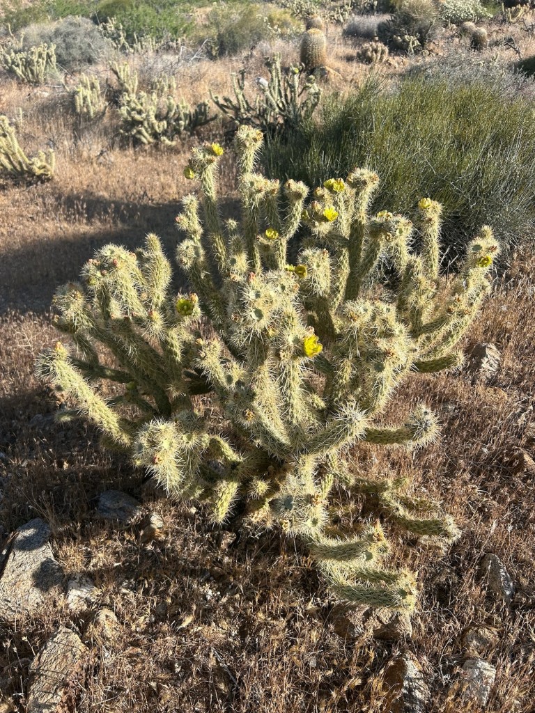
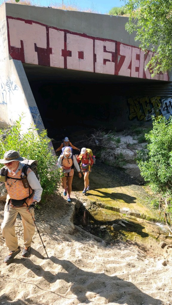
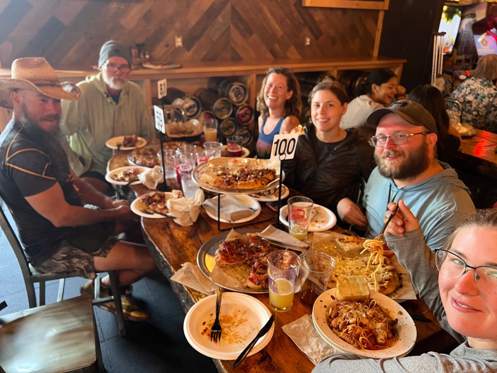
We were up at 5:00 and hiking by 6:00. At the water tank we chatted briefly with Sunsets and Chica, two middle aged thru hikers. They were heading into Julian for a town day. After we topped off our water, we started down the trail. After a bit, we came upon a pair of hikers in a shady spot. The guy was laying in the shade and the woman was trying to remove cholla cactus thorns from her arms. She’d stumbled into a cholla earlier. Steve gave her the trail name “Velcro”. They were also planning on staying in Julian. So we started thinking about our timing, and realized that since we had to wait for the post office in Warner Springs to open on Tuesday in order to get our resupply package, we could stay in Julian and not lose much time at all. So we got to Scissors Crossing at about 9:45 and called to reserve a room. I did manage to get a few minutes on the weekly family Zoom meeting. We were too early to check in, so we were just relaxing under the overpass where there was a water cache and a couple of folding camp chairs when a car pulled into the lot above to drop off a hiker and we ended up with a ride into Julian. By the time we finished our lunch at the Julian Brewery, our room was ready. Velcro and her partner checked into the room next to ours soon after our arrival. They told us her new trail name had “stuck”, so to speak, and she is now known as Velcro.
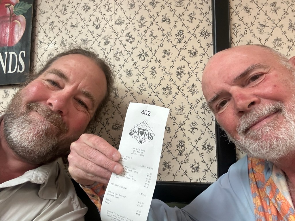
Just before closing time we went to Mom’s Pies, a famous PCT institution. They give free pie and ice cream to PCT hikers, and we took advantage. Tasty.

May 20
Day 6 – 24 miles –
A couple of hours after our pie and ice cream we decided a pizza was in order. So we called the local pizza place for takeout and took it back to the hotel. After the pizza and a little television it was time for bed.
In the morning we were up a 5:30 and getting ready for an Uber at 7:00. Despite making the reservation last night and receiving a confirmation email, when the time came there were no available drivers. There was no notification; I had to go to the Uber app to find it out. So we hoisted our packs and walked to the post office at the edge of town, which is the standard hiker hitchhiking spot. Less than a minute after sticking out the thumb a pickup stopped. The driver (trail name U-turn) took us right to where we left the trail, and we started walking. Shortest wait for a hitchhike ride ever.
There was a bit of a climb for the first few miles, and we were thankful to be doing it in the cooler morning hours. After the initial climb, the trail maintained a milder but steady uphill grade, and it was a beautiful morning, even though a bit windy. After a couple of hours we stopped to finish the last slice from last night’s pizza. Shortly after that we came upon two women sitting by the trail, having a bit of lunch. Their names were Caroline and Squatchy (a Bigfoot believer). While there , another hiker came by – Reuben from Stuttgart, Germany. In a bit we moved on and left the women to their lunch.
From our start in the morning it was 14 miles to the next water – a water cache a little bit off the trail. When we arrived, there was a group of about six younger hikers ready to move on. So we settled into the shade, stocked up on water, and had some lunch. Hiker Travis joined us a few minutes later. After a short rest, we continued on, leaving Travis in charge of the cache. On the way back to the trailhead we met hiker Eagle Cow on his way to the cache. We’d met him a day or two earlier. The trail trended uphill with a relatively mild grade and we made it another ten miles to Barrel Spring, where we’re camped for the night. Eagle Cow passed us on the trail, and Travis caught up just as we arrived at the spring. Several other hikers are camped here. Lots of frogs singing tonight.


May 21
Day 7 – 22 miles, plus a bit extra to get in and out of Warner Springs.
We started out early, hoping to get to Warner Springs shortly after the post office opened and to pick up our resupply package. After about five miles we came to Eagle Rock, a distinctive rock formation that is a sacred site to the Native Americans in the area. From there, it was another 5 miles into the small town of Warner Springs. The local postal clerk was extremely friendly and helpful. Next door at the gas station/convenience store they were selling gourmet sausage dogs. We each had two. We hung around for a couple of hours, getting the resupply sorted, and chatting with a few other hikers. Then we shouldered the packs and headed back to the trail. We stopped once or twice at San Ysidro Creek for water. That creek parallels the trail for several miles. Then it was a long hot slog up to Lost Valley Spring. We took a break in the shade and I grabbed the water containers to go about .25 miles down to the spring. I started off on the wrong trail, and realizing my error I bushwhacked back to the true trail. I somehow lost my sunglasses during the bushwhack. But we scored enough water to get us a few miles further down the trail.
We pushed on for 3 more miles before camping in a protected spot. Full moon tonight and the bats are active.

May 22
Day 8 – 24 miles, 1 rattlesnake
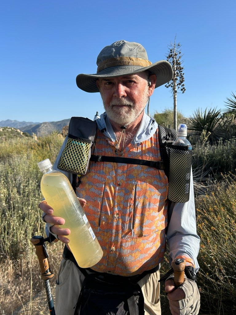
We were up with birds and hiking before 6:00. We hiked about 5 miles to Mike’s Place, a hiker-friendly stop a short distance off the trail. We ate our breakfast and watered up while chatting with some other hikers. We took what we hoped was enough water to reach Little Bear Hostel, another hiker-friendly spot about 0.7 mile off the trail. We wanted to avoid Tule Spring, which was reportedly not a great water source. But as the day grew hotter, and the trail became steeper, it became obvious that a visit to Tule Spring was in order. So we parked in the shade just off the trail. I watched the packs and had a short nap while Steve went to collect water. Turns out the reports were correct. Even after filtering and chemically treating it, the water was still kind of nasty. But safe to drink.
We had some lunch while waiting out the heat (low 90’s) and pushed on at about 4:00 PM. We arrived at Little Bear Hostel just before dark. A frozen pizza, a couple of sodas, and a chat with the other hikers here, and it was time for bed. We stretched out our mattresses and quilts on the patio to cowboy camp for the night.

May 23
Day 9 – 7 miles
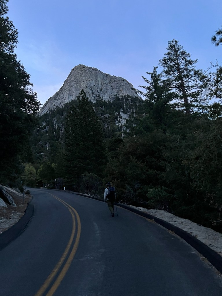
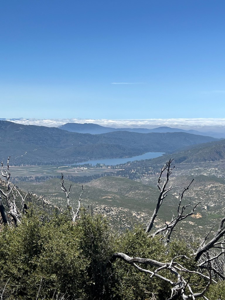
We were up and hiking by about 6:30. It was a kinda tough slog back up to the trail from Little Bear’s and it took us 25 minutes. But then the trail leveled a bit and we caught our breaths. Soon it became a series of ups and downs, trending upward. We eventually passed through a saddle, and continued down to the highway to head for the Paradise Valley Cafe. While walking the highway to the cafe, a white Subaru pulled over and asked if we wanted a lift. It was “Grumpy”, a semi-famous trail angel in the area. He gave us a lift to the cafe, where we began to plan the next leg of the trek over great American diner breakfasts. After discussion, we decided to book a night in the hotel in Idyllwild, and hike back to Paradise Valley Cafe tomorrow. Almost 30 miles, but mainly downhill, with lighter packs since it’s a (kinda long) day hike. Then, after arranging a ride from the cafe to Idyllwild, one more night in the hotel before heading down the other side of the mountain.


May 24
Day 10 – 33 miles, more than 6000 feet of elevation gain, and similar loss.
We had called an Uber for 04:30, but when the time came no drivers were available. Big surprise. So we started walking uphill to Humber Park, where the Devil’s Slide trail leads to the PCT at Saddle Junction. From the hotel to the PCT was a 5 mile uphill slog. From there it was nominally downhill back to Highway 74 and the Paradise Valley Cafe, where this scheme was hatched.
From Saddle Junction we hiked to Tahquitz Creek, where we loaded up on water – we left there carrying 6.5 liters each. The trail was a bit challenging in places, including a steep descent to Fobes Saddle and climb back up. And from the time we joined the PCT at Saddle Junction blown down trees across the trail were a constant annoyance, slowing our pace and disrupting our trail rhythm. After the climb out of Fobes Saddle the trail grade eased a bit, but was still not actually easy. The views were great, and the wildflowers were fantastic. We didn’t pause for many photos because we hoped to get to the Paradise Valley cafe before it closed at 8:00PM. That didn’t happen. In fact, it was already dark at 8:45 when we got to the highway. After unsuccessfully trying to arrange a ride from a trail angel, Uber, and a taxi company, we walked another mile to the cafe. When we arrived there were three women there who had just finished closing up. We offered cash for a ride to Idyllwild. One young woman agreed to take us, but repeatedly declined payment. Kayla was a lifesaver. She drove us directly to our hotel in Idyllwild. A great and kind young woman.
In Idyllwild it was too late for restaurants. So I walked to the liquor store and bought a beer and a juice and a couple of bags of chips. Back at the hotel, when the chips and drinks were done so were we. Lights out. We’d hiked from before dawn to well after sunset.


May 25
Day 11 – 13 miles
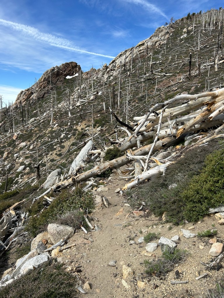
We slept in a bit, after our long day. Upon waking, we went to a good local diner for huge breakfasts and plenty of coffee. Checkout was at 11:00, so we spent the morning scouting the gear shop for minor additions to our kits. Just before 11:00 we checked out of the hotel and a local trail angel transported us to Humber Park. We had our permits checked by the local rangers and then began the climb up the Devil’s Slide Trail and back to the PCT shortly before noon. The trail was a bit tougher than we anticipated (you’d think we’d learn) and there were numerous blowdowns and small snowfields across the trail. We arrived at Fuller Ridge Campground a little before dark. We got our shelters pitched, had a quick dinner and crawled into the sacks.

May 26
Day 12 – 19 miles, 1 rattlesnake
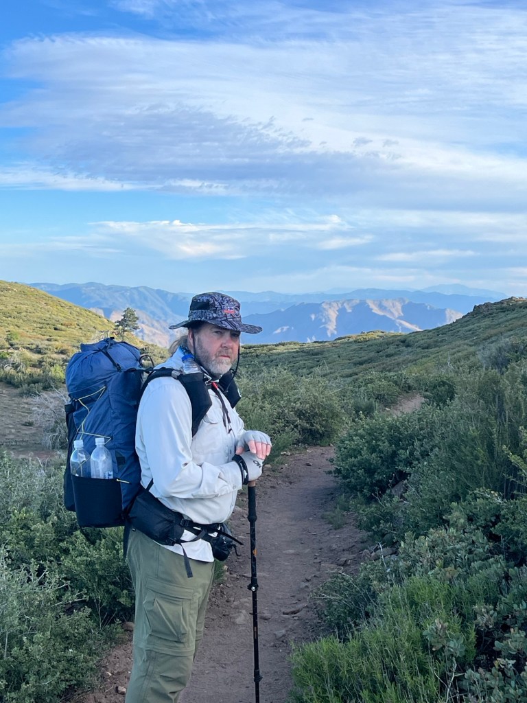
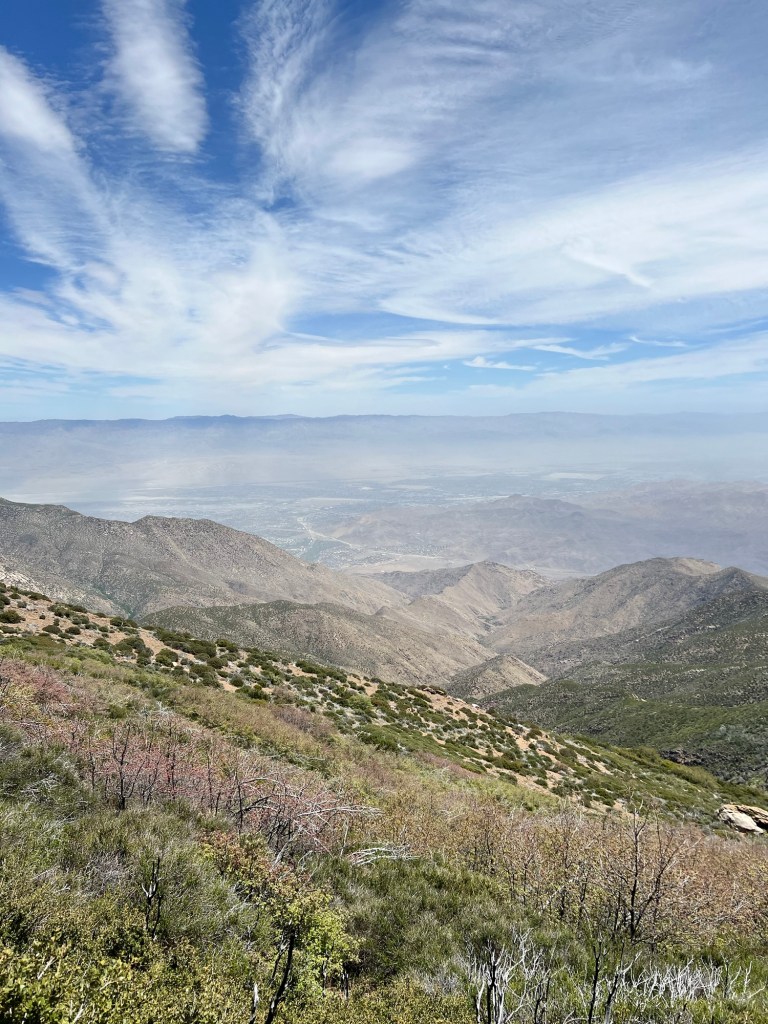
We were up and hiking before 6:00, and thinking the 19 miles downhill should be easier than yesterday’s 13 miles. As noted before, you’d think we’d learn. We’d carried enough water from a source 4 miles before our campsite, and needed to go 4 more miles to the next source. The trail started out nice and we were cruising. At the west fork of Snow Creek we dumped our packs at the junction and took our water bladders a couple of hundred yards down to the creek. “Ranger” was filtering her water at the creek and we chatted briefly before heading back to our packs to filter water and make a little breakfast. Then we continued on our way and the trail became rocky and brushy. As the day wore on, the wind increased and so did the temperature – up to mid-80’s. About 10 miles from our start we stopped to top off our water. About an hour later we rounded a bend in the trail to find “Ash” tucked up in a small shady cave eating her lunch. We stopped to talk for a while and then continued on our way. We stopped for more water at a spigot from a pipeline provided by the local water authority. From there it was a long almost 4 mile slog upwind to a bridge overpass on I-10. The wind was about 30-40 mph, I’d guess. We’d booked a hotel in Banning for the night, so Steve called an Uber and soon enough we were at the hotel. We’re both feeling a bit beat up after the last few days. Steve’s ankles are swollen and bothering him, and today’s rocky, brushy downhill aggravated my left high Achilles. Steve is needed at home, so he’ll be departing tomorrow. I’m seriously considering taking a zero day here, unless I feel much better tomorrow.


May 27
Day 13 – zero miles
Steve left in a Uber at 04:30 to catch a plane home. I went back to sleep for a couple of hours. Then I spent the day mostly keeping off my Achilles except to stretch periodically. It was feeling better by the evening, so I arranged an Uber for 04:45 AM, hoping to get some hiking done before the heat of the day sets in.
May 28
Day 14 – 21 miles
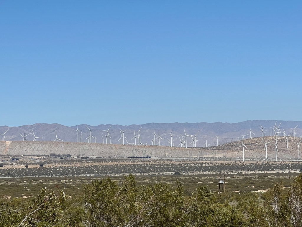
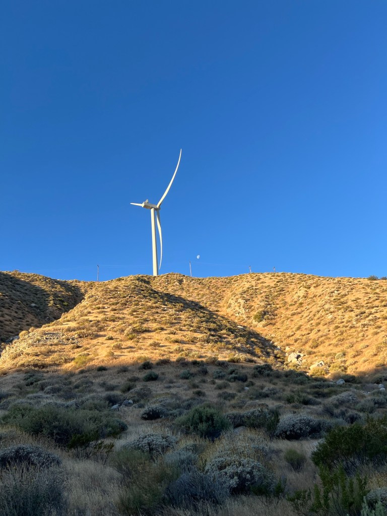
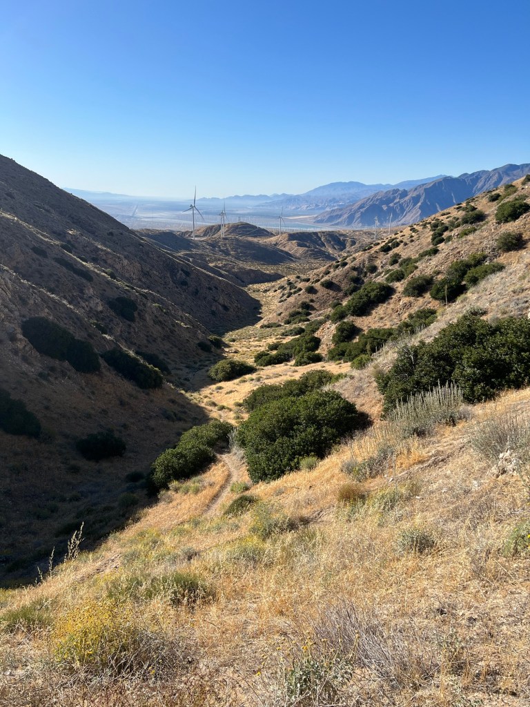
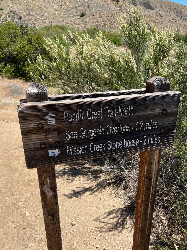
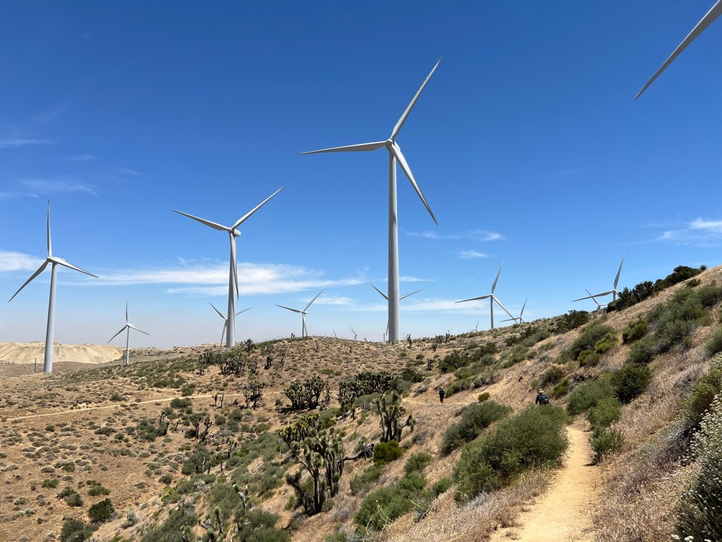
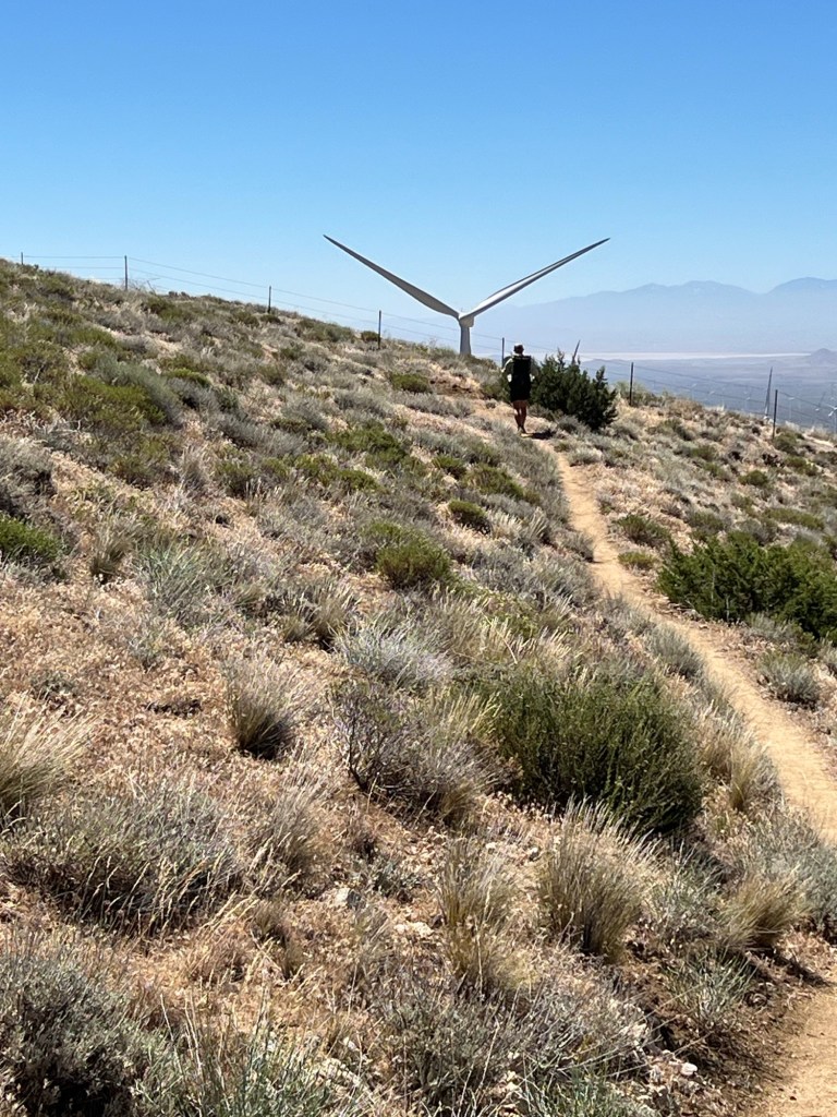
The Uber arrived on time and I was hiking by just after 5AM. The trail ran alongside a residential area for a mile or so before climbing steadily. In about 3 miles I came to Mesa Wind Farm, where the technicians have opened an area of their shop to hikers. They sell soft drinks, ice cream, and assorted food items pretty cheaply. I drank about a liter of their free bottled water while chatting with one of the techs, and then was on my way.
From there the trail rose fairly steeply to a crest overlooking the Whitewater valley. I continued down, eventually having lunch in the shade of a large boulder. Then I crossed the Whitewater and climbed to the ridge between Mission Creek and Whitewater. Once in the Mission Creek drainage I continued down to the creek bed. Over the last few years, storms have damaged and washed out large portions of the trail in this area, making travel difficult. I had originally planned to camp at trail mile 226 and continue in the morning. But the campsite was littered with used toilet paper. I’d notice some people resting in the shade across the creek and went to talk with them. Nice folks, and they agreed to tackle the hard part together. Jedi, Jinx, Riveter, Speedy, Neon, Halfway, Quartertank, and Hoo. After the siesta we pushed on a few more miles, mostly rock hopping in the creek bed, and camped at mile 230. Others in the group were only filtering water, but I was filtering and chemically treating my water because of an earlier outbreak of norovirus-like symptoms associated with Mission Creek water. Anyway, no one in the group experienced any issues of that sort.


May 29
Day 15 – 18 miles
Halfway and I started walking at 05:00, just as it was beginning to get light. Three of the group left a few minutes before us, and the rest were in camp when we left. Eventually the late risers caught up with us, and we pushed on together. All day long, the trail was a mix of loose rock and sand and boulder hopping, with occasional stretches of original trail tread. We crossed the creek countless times, and it was useless to try to keep our feet dry. The first group went up a wrong canyon and ended up behind us. After about 8 miles or so we were on the original trail for good, and it was a steady climb out of the Mission Creek valley. The entire group reunited at a rest break, and we continued on to this camp site. One of the group had lost his shoe insoles, apparently in a gust of wind during the night, and had hiked that rough terrain without them. Tough dude, in my opinion. At any rate, it’s nice to be finished with Mission Creek.
May 30
Day 16 – 18 miles
After Mission Creek, the trail to Big Bear was a real pleasure. Halfway, Quartertank, and Neon were already gone by the time I got going. Hoo left a bit after I did, and caught me at a water cache about 3 miles down the trail, just after I finished my breakfast. We continued more or less together for the rest of the day, and the rest of the group caught up with us at the last water source before the highway to Big Bear. the trail was mostly in really good shape, and the miles seemed easy compared to Mission Creek miles. It was a mix of pine forest with occasional great views. One of the more pleasant hiking days of this trek, so far. The first three of our group got to town well before Hoo and I did. When we arrived at the highway we found a German couple who had called a trail angel for a ride. Shortly, trail angel Tatiana rolled up, and we piled into her van. After a brief city tour, she dropped us off at our hotel. Hoo and I had one room, and Halfway, Neon, and Quartertank had another. The other four members of the group decided to camp just off the highway and come into town the next day for resupply, etc. After settling into the hotel, a trip to the laundromat, and a shower, the five of us went to the Himalayan restaurant just up the street. Lamb curry and garlic naan was excellent. Then it was back to the hotel, and lights out.

May 31
Day 17 – zero miles
Sleeping in until 07:00 felt pretty good. After the five of us were awake and ready, we walked several blocks down the street to meet the rest of the group for breakfast. After breakfast we all went back to the hotel so the campers could grab a shower. I rode the free bus to the Big Bear City post office to pick up my resupply package. I’d sent it there, instead of to Big Bear Lake for some forgotten reason. Then I had to wait for a while to catch the return bus. I dropped the box off at the hotel, and wandered over to the outdoor shop for a couple of items. Then it was time for a haircut and beard trim, and by then it was time for lunch. Hikers are hungry. I spent part of the afternoon dealing with my resupply, sorting and re-bagging to make it lighter and more space efficient. Later in the afternoon, the camping contingent resupplied at a grocery store on their way out of town. The rest of us had dinner at the hotel and called it a night.

June 1
Day 18 – 20 miles
Tatiana the trail angel collected us at 07:00 and drove us to the trailhead. We began hiking at 07:25. The trail was in pretty good condition and the elevation gain and loss was pretty mellow. Some good views, but mostly hiking in a pine forest. Hoo and I brought up the rear of the pack. At around 10:30 we stopped at a creek where the rest of the group congregated. We filtered some water and I had an early lunch before we pushed on for another couple of hours. Then it was time for a siesta in the shade. We chatted and napped a bit. Around 2:30PM we started walking again. The trail continued to be fairly easy and mostly downhill. We arrived at this camp around 5:15. After dinner, we all crawled into our sacks.

June 2
Day 19 – 24 miles
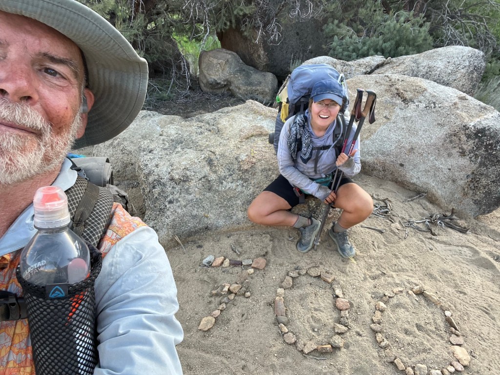
The first three to leave camp in the morning started at about 04:15. Hoo and I were walking by 05:20. The others left after us.
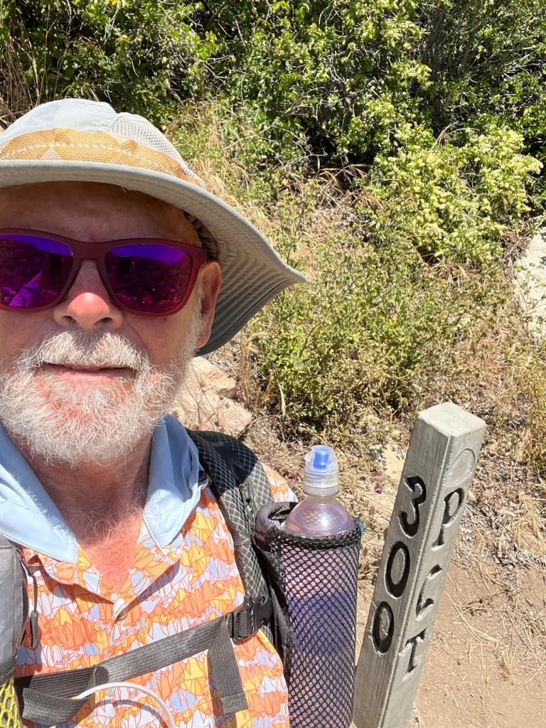
The trail was pretty civilized- mostly in good shape, not too many blowdowns, and reasonable elevation gains and losses. We ended up doing just under 16 miles by noon and taking a midday siesta. Along the way, we passed the 300 mile mark. When Hoo and I got to the spot, Jinx and the three early birds (Quartertank, Neon, and Halfway) were there, and Jedi, Riveter, and Speedgoat arrived almost immediately after us. We spent about two hours there – napping, chatting, and some of us took a dip in the creek. Then it was time to hike the remaining 8.7 miles to this camp, with a couple of water stops along the way. We’re camped at mile 310 next to the Rainbow Bridge over Deep Creek.


June 3
Day 20 – 26 miles
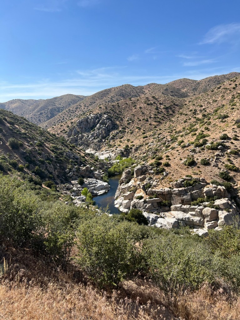
We were joined after dark by another hiker. I heard him come in, but didn’t check the time. In the morning we all packed up, and Hoo and I again fell to the back of the pack. The terrain was reasonable as we followed Deep Creek for several miles before crossing a dam on the Mojave River.
The day became increasingly hotter as we made our way to Silverwood Lake, a man made lake. The others planned to siesta at Cleghorn picnic area, but Hoo and I had to stop at a picnic area a couple of miles before that. It was 96 in the shade when we stopped. I emptied my pockets and jumped in the lake for a swim. I wanted to rinse the perspiration salt from my clothes. The water was cool, and it felt great. Hoo also took a dip, then we filtered water and stretched out on the shaded picnic tables for a couple of hours. At about 3PM, some high clouds moved in and the temperature began to drop. So we packed up and headed down the trail. When we came to the side trail leading to the other picnic site, the rest of the group was just leaving. So we pushed on for the remaining six-plus miles to this camp. Only 6-7 miles to Cajon Pass and I-15, where there is a McDonald’s.


June 4
Day 21 – 12 miles
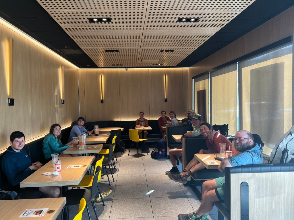
We didn’t wake up as early as usual, because the plan was to hang out at McDonald’s through the heat of the day. As usual, Hoo and I were in the back of the pack as we headed for Cajon Pass. On the final mile to McDonald’s I saw Hoo and Andrea walk faster than I’d ever seen them walk. The manager at McDonald’s was very friendly and accommodating and we kept ordering more food. Breakfast first, then lunch, along with shakes, cookies, etc. Most of the group decided to resupply only from McDonald’s for the day and a half to Wrightwood. I bought a sandwich from the gas station next door for supper, refusing the McDonald’s Resupply Challenge. I’d had enough Mickey-D’s.
Around 4 PM we packed up and headed out to walk the 6 miles or so to a water cache, where we camped for the night.

June 5
Day 22 – 22 miles, 8000 feet of elevation gain, 4000 feet elevation loss
During the night, Hoo heard something creeping around our camp site and woke me. We couldn’t see what it was, and I didn’t hear it. But she heard it circling around. I looked around with my headlamp for a bit then crawled back in the sack. There were no further disturbances during the night.
We woke at 3AM and were hiking by 3:40. There was a steep climb to begin the day, and we wanted to do as much of that as we could before the heat of the day. We made good progress, but I had the sun umbrella deployed by about 08:30. Not long after reaching the top of the big climb, we came upon my first trail magic of this trek. A man named Joe had his pickup parked where the trail crossed an old forest service road. He had Powerades, soda, fresh fruit, etc. We all took a break and took advantage of his kind hospitality. Much appreciated, Joe!
From there it was another six miles to Highway 2, where we could hitch a ride to Wrightwood. Hoo and Enya arranged accommodations for the three of us at some small cabins in a family’s back yard. Small, but cheap, and we had all the basics – shower, laundry, toilet. The owner was nice enough to pick us up from the trailhead and we stopped at the post office to pick up my resupply package, and at the grocery store for some cold beverages on our way to the cabins. We had a pizza delivered, and shared with another hiker, Curt, who was sleeping on their deck for the night.

June 6
Day 23 – 7 miles, 1 rattlesnake
At around 8:30 we met the rest of the group for breakfast at a local diner, then adjourned to the hardware store. That place has a designated charging station for hikers and a couple of benches. I repacked my resupply into ziplocs to cut down on weight and volume while the others hit the grocery store for their resupply. The temperature was in the 90’s so we weren’t interested in hiking uphill in the heat of the day. Around noon we went over to the brewery for a beer and a bite to eat. Then we killed time in front of the grocery store, which also has a designated hiker area. Wrightwood is a very hiker-friendly town.
Around 4PM we hoisted our packs and set out to hitchhike back to the trail. We did it in shifts. The first car we thumbed stopped and picked up 3 of us. The second group of two was right behind us, and a pickup dropped the last four off at the trailhead in short order. Amazingly short hitchhikes. Great town.
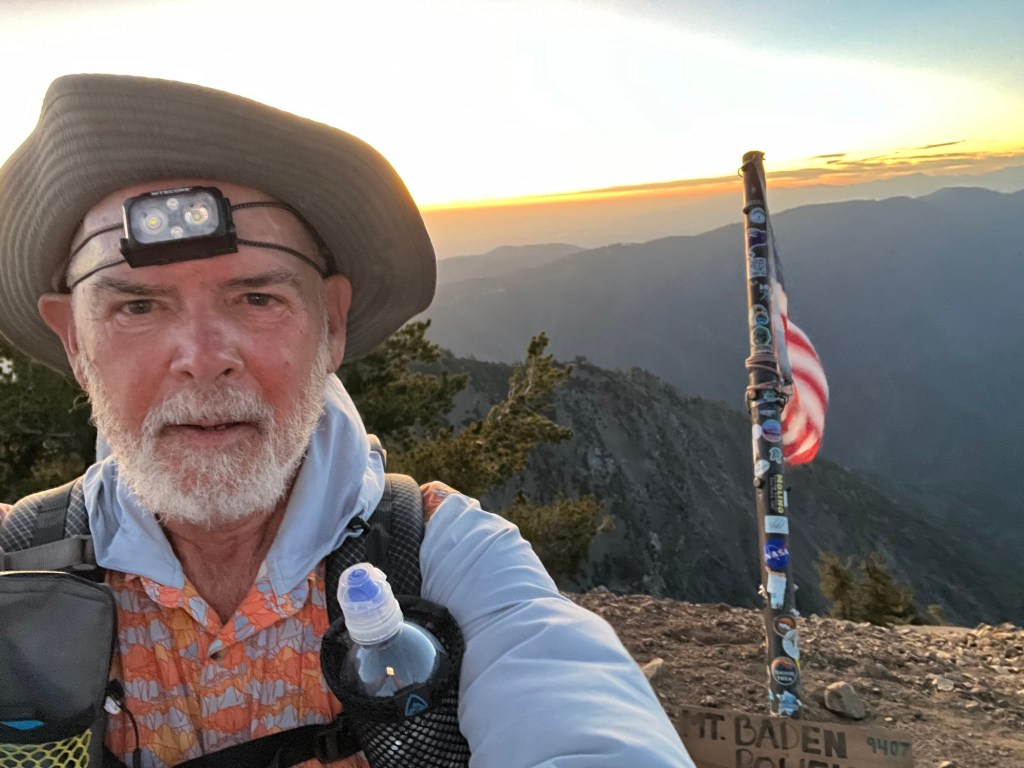
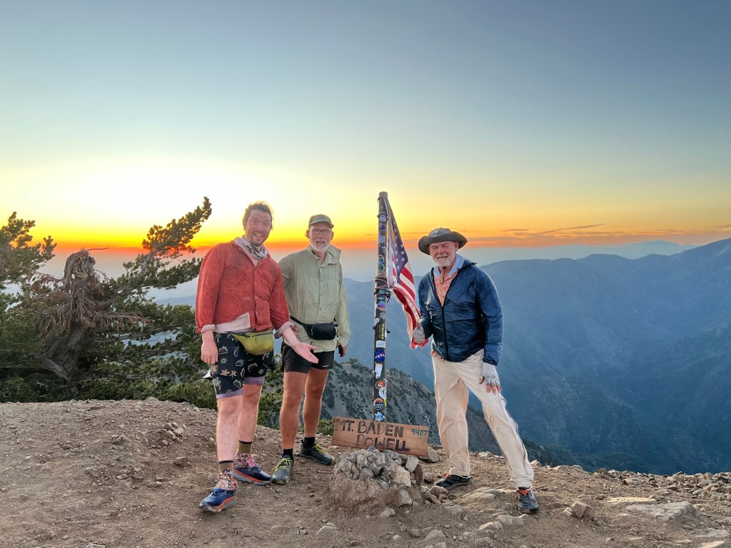
The trail was moderate ups and downs for the first 3.5 miles or so, then began a steep climb up the flank of Mt. Baden Powell. Hoo and I were in the rear again. About 1.5 miles before camp, we stopped for water a short distance off trail. It was a natural spring coming out of the ground. Cold clear water – it was great! Then we trudged on, arriving at camp just before dark. Four of our group had pushed on to the summit, and the rest of us will head up there in the morning.

June 7
Day 24 – 24 miles
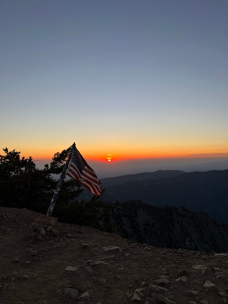
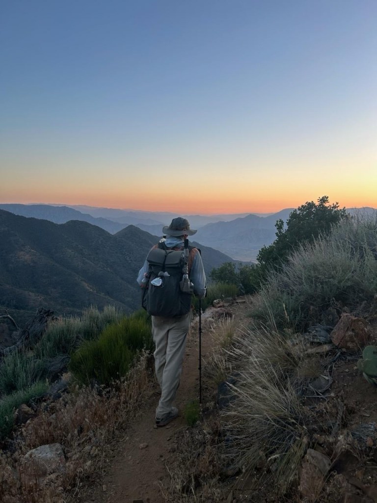
Up at 04:00, hiking just after 4:30. I made it to the top of Baden-Powell in time for sunrise. Pretty cool. There were snow patches here and there on the trail, icy enough to slow progress a bit. Halfway and Quartertank took the long way and arrived shortly after I did. After the mandatory photo ops, we found the rest of our group at the their camp sites near the summit. They said that the sunset had been spectacular.
The trail was up and down and quite steep at times. The climb out of Islip Saddle was especially tough for me. From the saddle, the trail climbs steeply to a junction with the Mt. Williamson summit trail, before descending steeply to the road. The road then runs to Islip Saddle. When I came off of that descent and onto the road, I saw Jedi and Jinx walking toward me. I could have road walked and saved myself the steep up and down. Doh.
Lunch at picnic area.
Road walk to campground.
Camped at 399.5.
June 8
Day 25 – 25 miles
I was up at 4:00 and hiking by 4:45 after forcing myself to eat breakfast in camp. I was using the headlamp and stepping carefully, so I missed the 400 mile marker, but Hoo said she got a photo.
After yesterday, today’s miles seemed to come easier. I made pretty good time during the steady moderate climbs and descents. We stopped for water at several small streams along the way. By the time I walked up to the Mill Creek Fire Station at about 1:00PM, the rest of the group were already there, and we’d done 19 miles.
After resting in the shade, restocking water, and eating lunch we left at around 3:00PM to continue the hike. It was a steady climb in a sun-exposed area, but we made pretty good time. There wasn’t enough room at our planned camp site, so we pushed on for another half-mile or so to camp near a road. Acton tomorrow.

June 9
When I walked off the trail at the LARV Resort, some of the gang were already there, waiting for a ride to the 49er Saloon in Acton. I picked up my packages at the resort ( new shoes, new water filter, food resupply. Then we got a ride with a trail angel to Acton. The saloon is set up for camping, with a porta-potty, bucket laundry, and a shower that doesn’t drain well. Also, burgers and beer. We had a nice lunch there, then resupplied from the local grocery stores, and relaxed a bit.
June 10
22 miles
We slept in this morning. After packing up we left Acton at 07:30 after a stop at grocery for coffee.
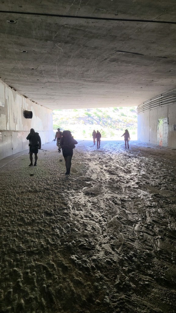
Some of us took an Uber to LARV Resort to climb out of Acton, then downhill and under the freeway through a tunnel. Jungly, brushed against poodle dog bush I think. Walked to Vasquez Rocks. Visitor center closed, hope for plastic PCT hang tag. Continued into Agua Dulce for lunch at local restaurant. Hung around to kill time until 3:30. 2.5 mile road walk out of town, then brutal sun-exposed climb. Water at spring, cnoc bag has hole. Then short walk to chosen camp site; decided to move 2 more miles- campers previous night reported persistent mountain lions around the camp.
June 11
Up before the birds, we hiked for about 45 minutes by headlamps. The morning climb was much better than yesterday- gentler grade and much of it still in shade. Then it became a moderate up-and-down downhill to a ranger station out of the town of Green Valley. There was a water spigot and a picnic table, and lots of flies. We got water and moved to a covered picnic table on the other side of the ranger station where there were fewer flies. We decided to park there for a siesta and wait for the heat to abate.
On the trail, if you’re in a valley, Green or otherwise, there will be a climb in your near future. And so it was. We loaded up and headed up the hill at about 4PM. It was still hot, but manageable. I deployed the umbrella for a short while before a tremendous gust almost caused me to do a Mary Poppins. It ripped the umbrella out of the mounting bracket. So I stowed it and continued hiking. After a bit more than a mile and a half the trail leveled for a bit before trending down to the camp site. We’re all cowboy camping next to a stream. Nice to have water nearby.
June 12
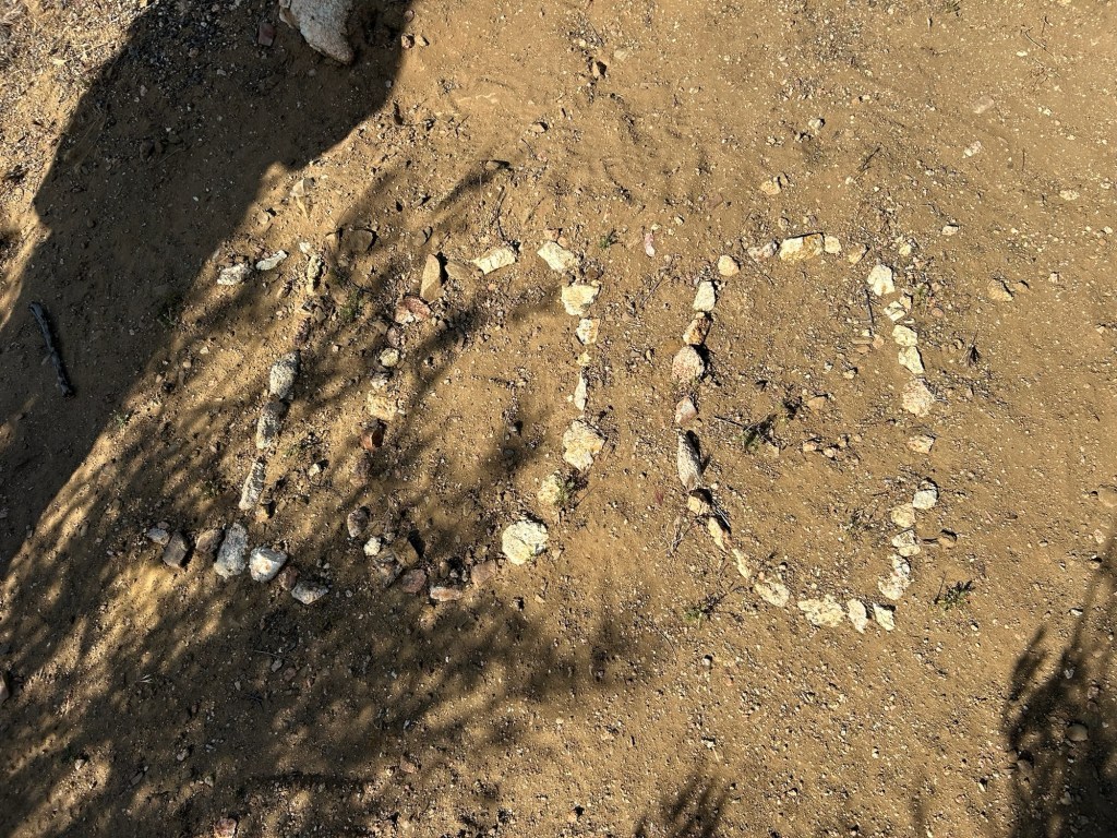
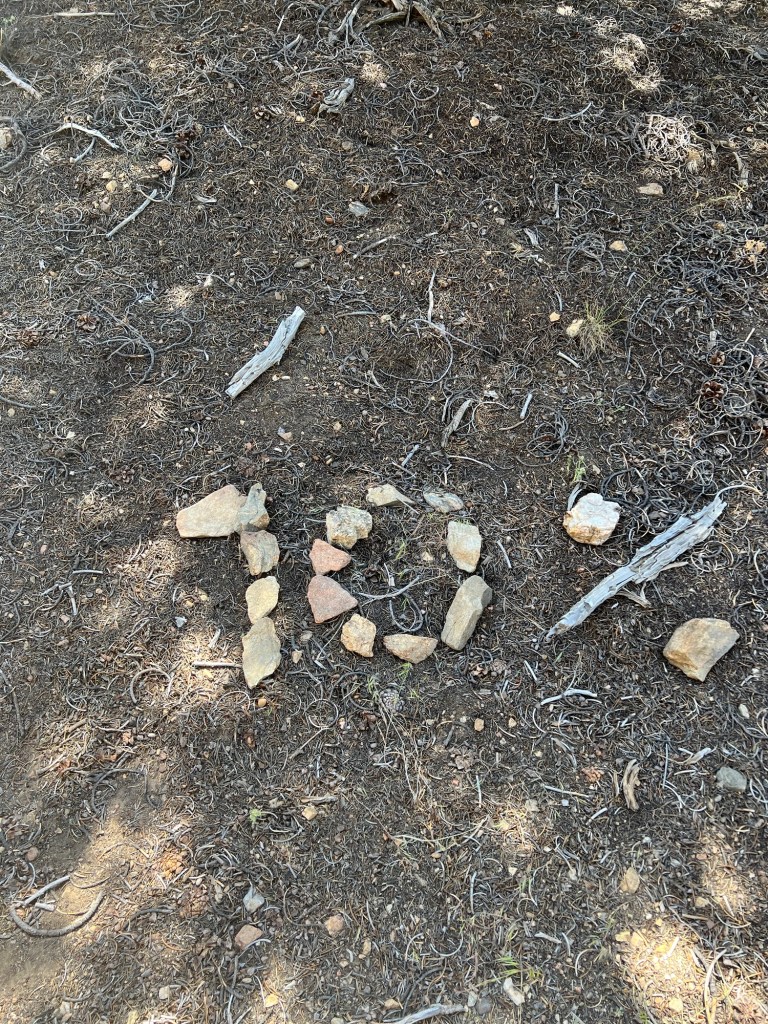
Overslept this morning, so wasn’t on the trail until 05:45. The morning miles came fairly easily, with no huge elevation gains and relatively nicer temperatures. After about 12.5 miles, we stopped at Sawmill campground for lunch and took a short break (compared to the normal siesta). That place has arguably the worst smelling outhouse in the western United States. From there we walked a couple of more miles to the 500 mile mark, where we stopped for a photo op. Then we pushed on to this camp, between a nice stream and a quiet paved road. We plan to walk about 7 miles to Hikertown in the morning. We’ll do a bit of resupply and try to rest for tomorrow night’s hike over the aqueduct.
June 13
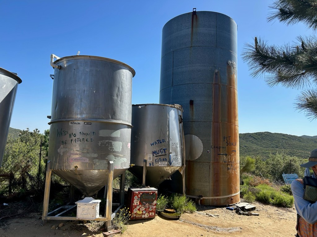
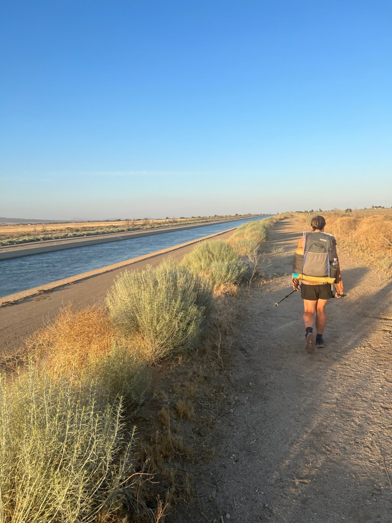
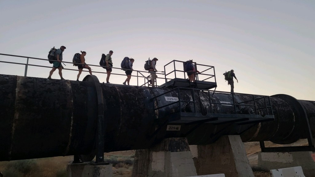
Hoo and I were up and hiking by about 04:40. Jedi, Riveter, Speedgoat, and Jinx started a bit later. We rolled onto Hikertown a little after 7:00 to find Neon. He had hiked into Hikertown the night before, hoping to hitchhike or Uber into Lancaster to join Halfway and Quartertank at a hotel. But he’d struck out, and spent the night at Hikertown. After the rest of the crew rolled in we called for a ride to the Neenach convenience store down the road a few miles. We hung out, charging our electronic devices until the ride unexpectedly showed up. We piled into the minivan and soon were at Neenach. We all ordered breakfast (I had the Filipino breakfast – eggs, rice, and Filipino sausage. Very good.) Then we found some shade outside and tried to nap in advance of our upcoming night hike. In the afternoon Quartertank and Halfway showed up from their night in Lancaster. Late afternoon we got shuttled back to Hikertown to wait for 7:00 PM to begin our night hike over the Los Angeles aqueduct, which brings water from the Sierras to the LA area.
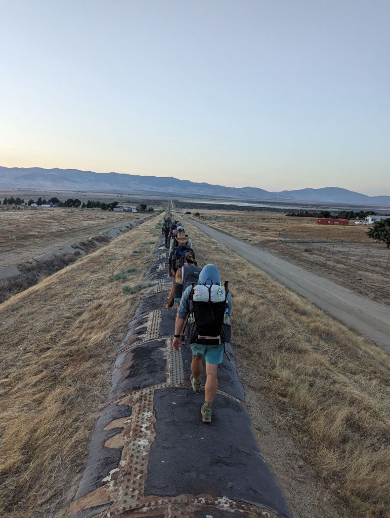
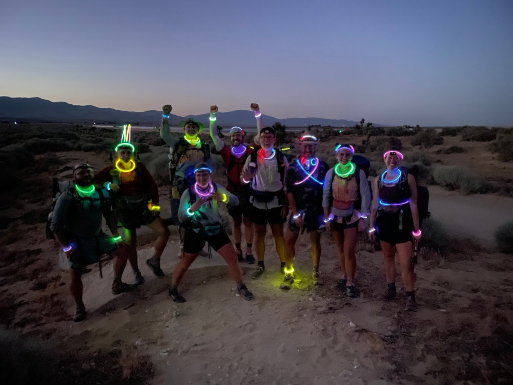
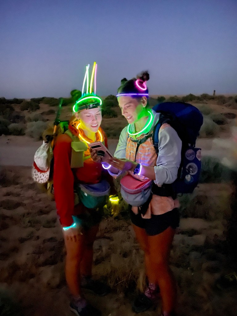
At about 7PM we started walking. The first part of the aqueduct was an open concrete channel, but it soon became a steel riveted pipeline, which was fairly easy to walk on. After a while the pipeline became covered by asphalt paving, and we walked on the road. At dusk we activated glow sticks that the Lancaster contingent had brought, and we wore them on our wrists, necks, ankles, wherever. It added a kind of festive feel to the night. The almost half moon helped to light the way and we walked for quite a way without the need for headlamps. A little after 1:00AM, we came to a water spigot just off the trail. We all grabbed some water and filtered it, and then tried to nap for an hour or so. It was windy, and I ended up wrapping myself in my ground sheet like a burrito. I probably only napped for a half hour or so, and then we were up and moving again. We pushed on to Tylerhorse Canyon, and the sun was well up by the time we got there. Jedi, Riveter, and Speedgoat were there when Hoo and I arrived. Halfway and Quartertank were also there, laying down and suffering from the effects of their visit to the Lancaster Asian buffet the day before. I wasn’t feeling very energetic and doubted if I could push on to Tehachapi without a long break, especially considering the stiff climb out of Tylerhorse Canyon that awaited us. But after getting water and eating a bit we started the climb anyway. It wasn’t easy. But once the climb was accomplished the next water source (about 8 miles further) seemed within reach. That source was a water cache maintained by trail angels. After watering up, and treating a nagging blister, we decided that Tehachapi just might be within reach after all. It was another 9.5 miles to the first road that could take us to Tehachapi.
Less than a mile after leaving the the cache, Hoo and I came upon Jedi, Riveter, and Speedgoat. They had been trying to nap in the shade. We chatted for a bit before pushing on. A short while later we came upon Jinx, who had also been trying to nap. She handed us a small can of Orange Crush from the water cache she had saved for me because I’d bought her a root beer the day before. Hoo and I shared it and then walked on with Jinx. She soon left us in her dust as walked toward town. Eventually Jedi, Riveter, and Speedgoat caught and passed us. When we arrived at the small shaded area near the road they were all there. Soon after our arrival Halfway and Quartertank and Neon showed up. I called an Uber which could seat four of us. Neon and Halfway got a ride with a trail angel. Jedi, Riveter and Speedgoat elected to walk the remaining 8 miles to the main highway. The rest of us got to the hotel in Tehachapi in mid-afternoon. The three who walked to highway showed up a few hours later.
After adding it all up, Hoo and I had walked 48 miles in about 33 hours, with only a few short naps here and there. Time for a zero day in Tehachapi.

June 17
After a double zero in Tehachapi, we planned to take the early morning bus to the trailhead. Jinx, Jedi, Riveter, and Speedgoat had left town the previous afternoon and would be about half a day ahead of us.
The bus was earlier than expected and Neon and Quartertank knocked on our door to tell us we had about 13 minutes to catch the bus. We scrambled to finish packing and raced out the door to the bus stop. We made it with a few minutes to spare.
We started hiking in the dark, around 4:30. The climb up from the highway was extremely windy – I’d estimate some of the gusts at 60 miles per hour. A couple of times my cheeks were pulled back from my teeth like a dog with its head out the window on the freeway. It was hard to keep my balance at times.
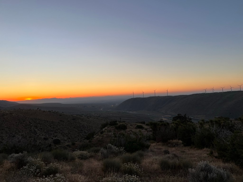
The first water was at 17 miles and we took a break there. A lot of the hiking after the climb was through wind farms.
Eventually we camped after 24.7 miles. There was water, but it involved a 0.9 mile hike each way. Neon was good enough to fetch water for all of us. Tough to do essentially 2 more miles like that at the end of the day.
June 18
After the tough day wrestling with the wind, we slept in until 5:15. Of course there was another stiff climb to start.
We stopped at Robin Bird Spring for water and then a few miles later at
Landers Meadow Spring. Then we got water from the cache at mile 617.
We camped in a dry wash at mile 618.5.

June 19
We were up at 4:00 for the climb to the next water cache at mile 632.
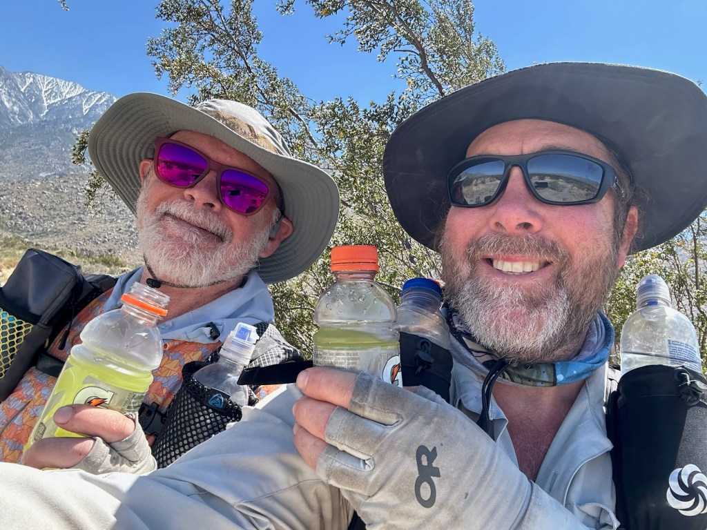
We met the Canadians Lloyd and Tanya at the cache. They were considering going to night hiking because of the forecasted heat wave for the area. It was another stiff climb out of cache, and I took a short nap at top.
After that , it was downhill until I came upon Hoo and Neon taking a break. We considered pushing to Walker Pass but by the time we stopped for water and supper at McIver cabin and spring, we decided to just push on a couple of more miles and get to Walker Pass in the morning. At McIver Spring we met Milkman; he and I had met at Etna last year, when I was southbound.
June 20
Up at 4:00 again. Hoo and I went
to Walker pass campground and got water from the cache there and used the pit toilets. Neon hitched to Ridgecrest for resupply and Hoo and I climbed out of Walker Pass. It was a bit warm and we stopped for a siesta at a creek after about 15 miles. We had supper at another creek 5 miles further, and decided to push 1.5 miles to another water source and camp site for the night. We loaded up with water, then went about 500 feet to the campsite. It was too muddy to use, so we climbed another 3 miles or so to another site. Bummer to add miles, especially uphill, after you thought you were done for the day. 27.8 miles for the day, over 8000 feet in elevation gain, a bit more in elevation loss. Less than 30 miles to Kennedy Meadows.
June 21, one rattlesnake
Today was “hike naked day”. Fortunately we didn’t see any naked hikers. In fact, we saw no one else for the entire day.
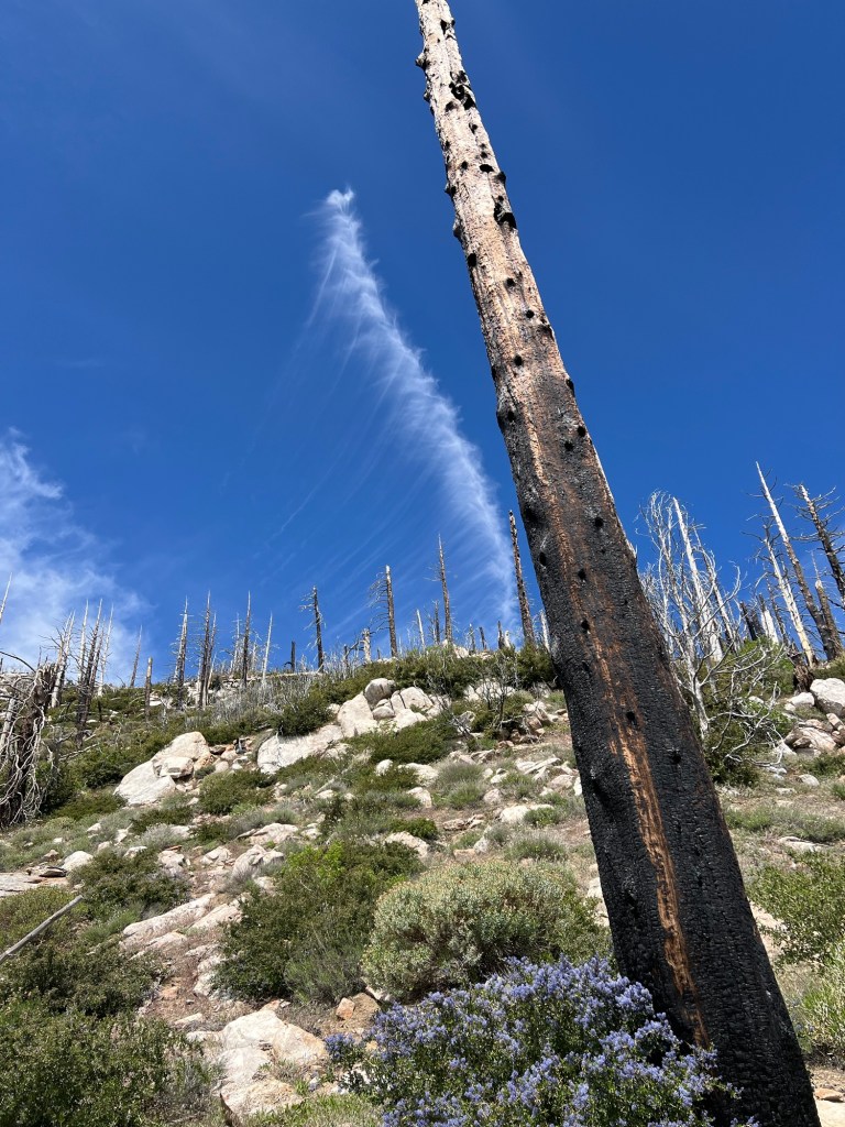
Hoo and I were hiking be 5:30. After the uphill slog the evening before, we began the day with a downhill, approximately 8 miles to the next water source. Then it was a 6.5 mile climb to 8000 feet. The day was warming up, and we reached the top just before noon. The temperatures at 8000 feet were bearable, but increased as we descended. I’m sure it reached over 100 degrees by around 2:00, when we reached Manter Creek. We grabbed some water and crawled under some bushes for shade and a siesta. We ended up waiting until 5:00 to break cover. The temperature was 97f then, but slowly decreasing. We pushed on another 5.5 miles to this camp site, grabbing water at Pine Creek along the way, passing an angry rattlesnake and passing the 700 mile marker . Kennedy Meadows tomorrow.
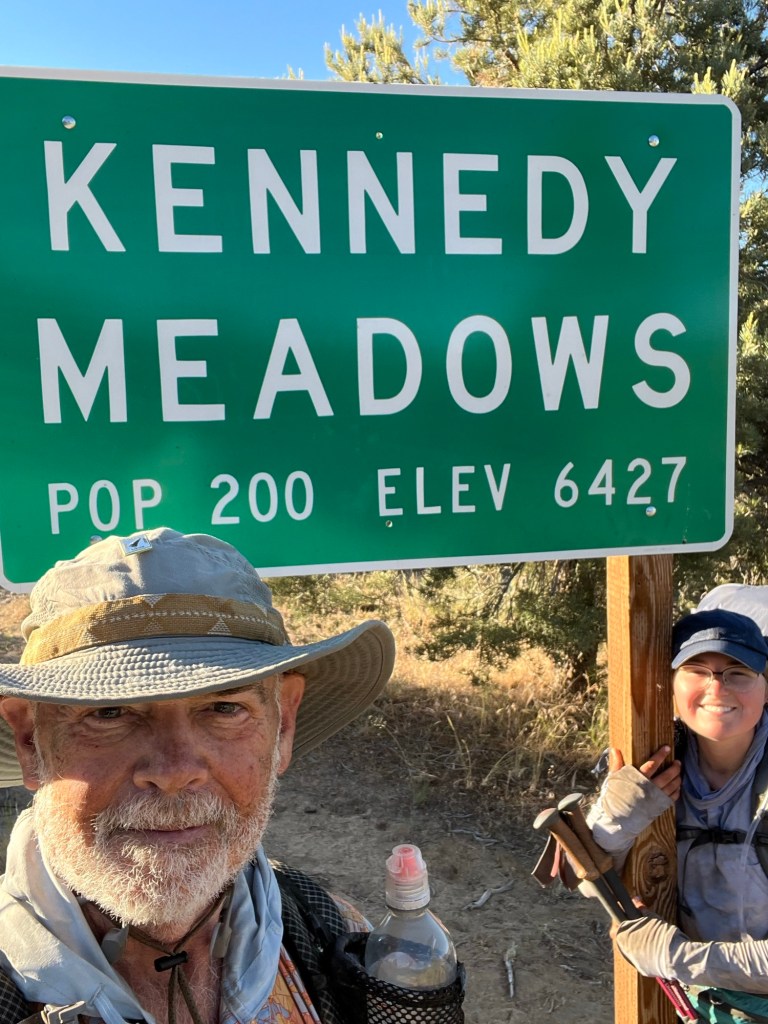
June 22
We slept in until 5:00, and arrived at Kennedy Meadows just in time for the 7:00 pancake breakfast. I visited 2 Foot Adventures to buy some shorts (changing from the long pants I wore for the desert) and some lightweight wind pants. I also bought some new shoes. We hung around until the store opened at 9:00 and I collected my packages- ice axe, shoes I thought I might need (but didn’t), and my bear canister. My bear canister had my tent inside. I sent the shoes I didn’t want, my bivy sack, and my tarp home. The tent will provide better bug protection in the mountains.
Neon showed up, and at 10:00 we caught the free shuttle to Grumpy Bear’s, where the vanguard of our group was waiting. It was good to have the gang back together, except for Halfway, who should be showing up soon. I also collected my resupply package which had been sent to Grumpy’s, and we all spent some time sorting and repackaging our resupplies. The plan is a six day food carry. Along the way we grabbed some lunch, and at 4:00 we caught the shuttle back to the general store. We’ll camp there tonight and get the pancake breakfast in the morning before walking back to the trail.

June 23, 20 miles, one transient rattlesnake
We slept in until 06:00, then packed up and went to hang out on the deck at the General Store. There was a bit of condensation overnight, but within a couple of minutes of direct sunlight the sleeping quilts were dry.
After breakfast Jinx’s boyfriend Donny gave a few of us a ride to the trailhead. I think he made a couple of trips. A mile or two down the trail a couple of PCTA reps had set up near a campground. They checked our permits and gave us PCT tags to hang on our packs.
The trail was fairly level for a few miles before beginning a steady climb. There was a lot of water along the trail and no need to carry more than a liter. It was a nice change from the desert.
The trail steepened in the last two or three miles, and coupled with the elevation made the going a bit slow. We camped at 9754 feet, with a great view of the area below.
June 24
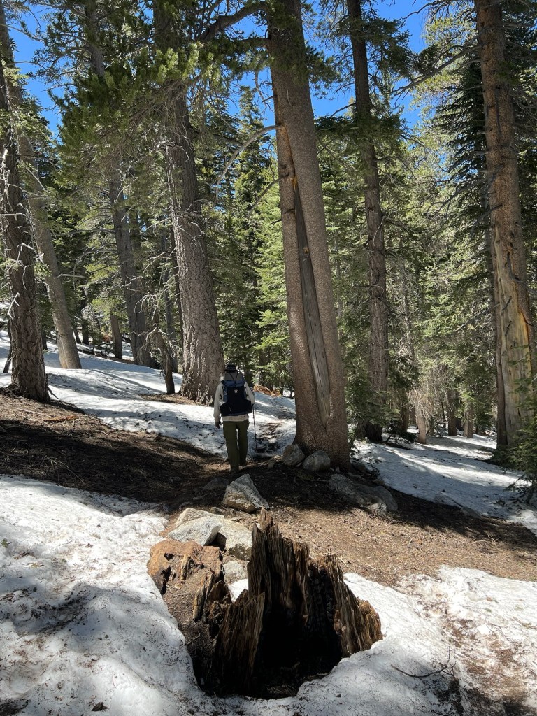
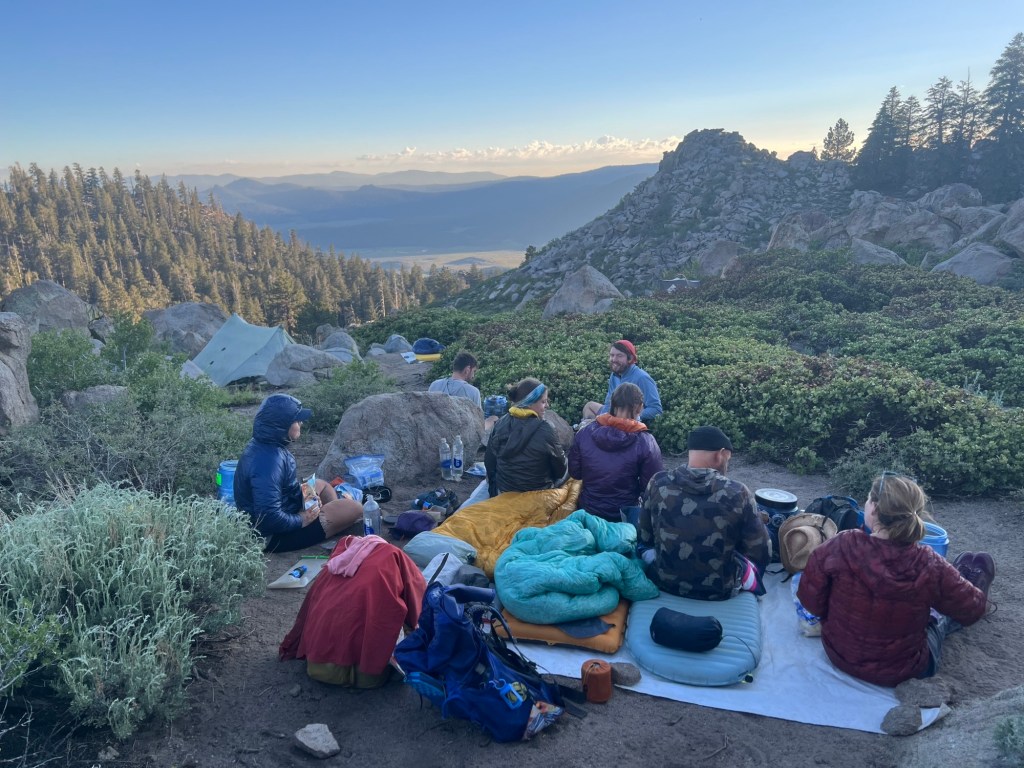
Woke naturally (no alarm set) at 5:00 and began hiking an hour or so later. Our campsite had filled up overnight, with some late arrivals. We seem to have caught a hiker bubble, with more hikers in our vicinity than previously. It was a short climb over 10,600 feet, then a descent. From there the trail was fairly mellow with occasional fantastic views until a fairly stiff climb in mid-afternoon. At our lunch/siesta stop, we experienced a brief thunder/rain/hail episode, but it didn’t persist. We reached camp shortly before 5:00. Since there were still clouds around, we all opted to set up our tents instead of cowboy camping (sleeping in the open). At this site we met a Canadian couple hiking with their almost 11 month old son. They’d started at the southern border in mid-April. Very cool folks. After setting up camp, they joined us while we ate supper and chatted.
June 25
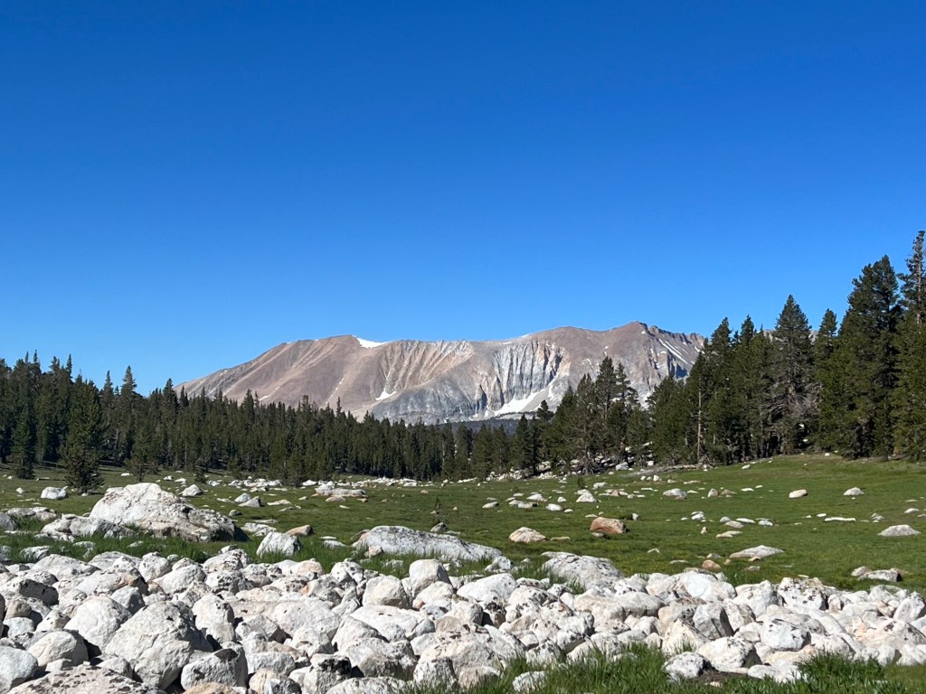
I started a bit earlier than the rest of the group this morning. The trail was the usual ups and downs, and they didn’t catch me until Cottonwood Pass. I hiked on to the junction for Chicken Spring Lake, and waited for them. Apparently I missed a snowball ambush and battle. When they caught up again we proceeded to the lake and everyone took a dip, some shorter than others. After drying out in the sun for a bit, we packed up and hit the trail again.
Later, after our noon break and as we approached Rock Creek, thunder showers began. It was hailing again, quite heavily, and I donned my rain poncho and took shelter under a tree while holding my sit pad over my head to protect it from the hail. We stopped briefly to chat with a ranger before proceeding to the creek. We waded across barefoot. Hoo had stayed behind a bit longer at the lunch spot and hadn’t caught up with us yet, so Jinx and I waited for her. About 40 minutes later she came down the trail and we headed for Crabtree Meadows. After a brief climb we stopped for water. There was a large group of teenage boys and their adult trip leaders there. After we started hiking again, Jinx and Hoo soon outpaced me and I was on my own. I finally straggled into camp at Crabtree Meadows about 7:30. Mosquitoes were bad, so I set up the tent and ate inside. Mt. Whitney tomorrow.
June 26
Zero miles. After yesterday’s tough going, I decided against trying to summit Mt. Whitney. I think I need the rest more than I need to bag a peak. So I hung around camp, eating and resting. Hoo left with the rest of the group at about 6:30, but she turned around at Guitar Lake and came back. She’d rather have the break, too. The successful summit part returned around 4:00. We all ate early and turned in early.
June 27
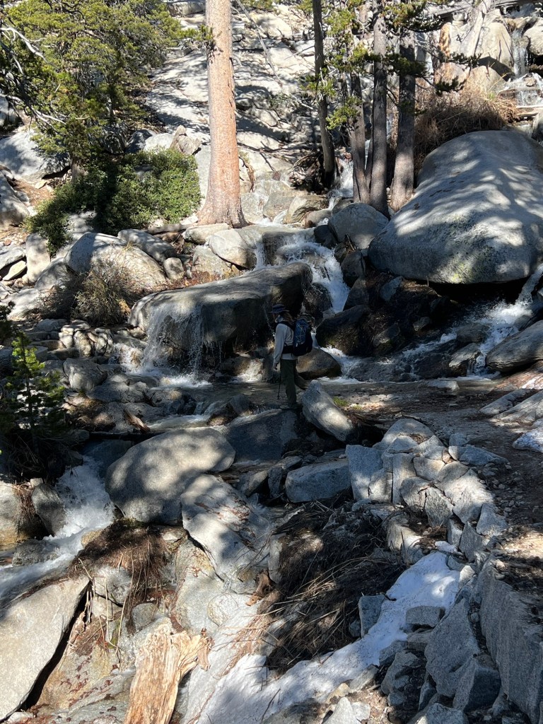
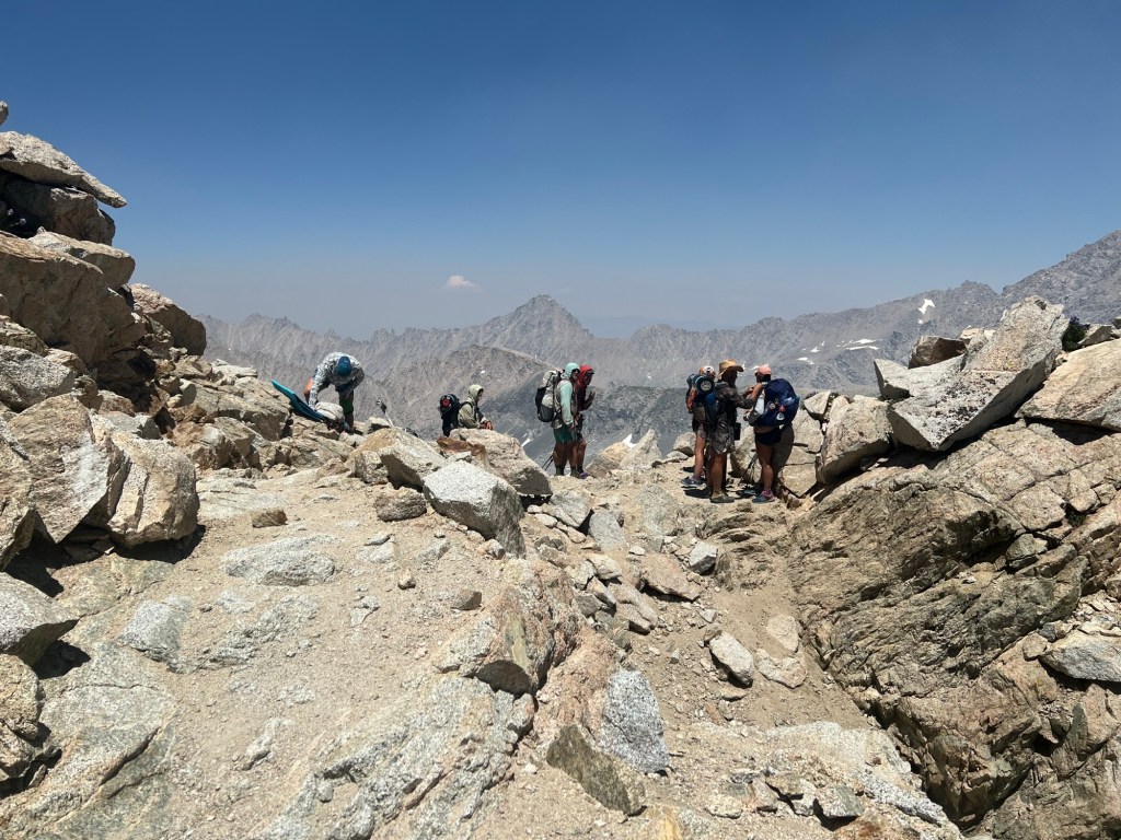
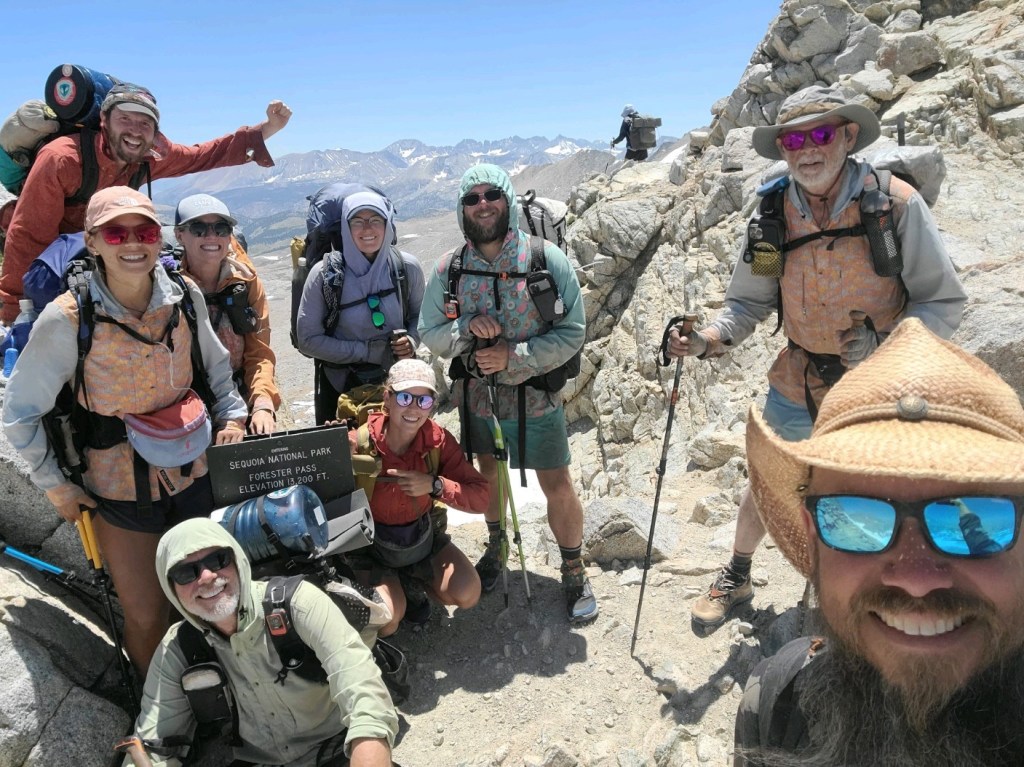
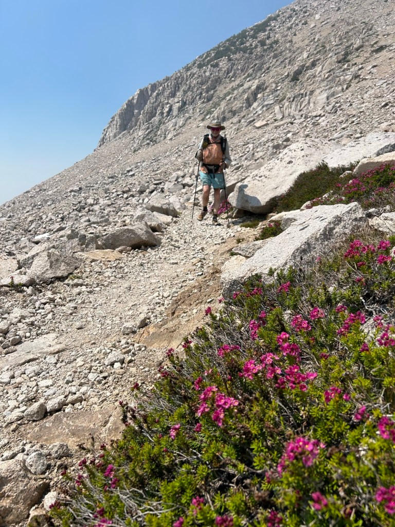
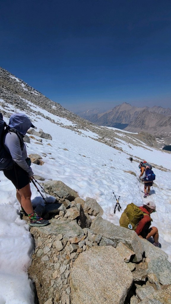
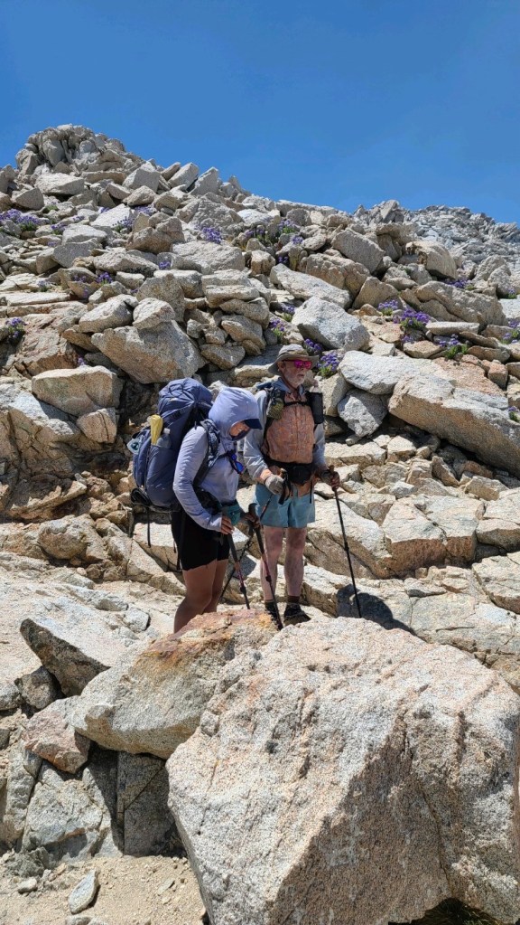
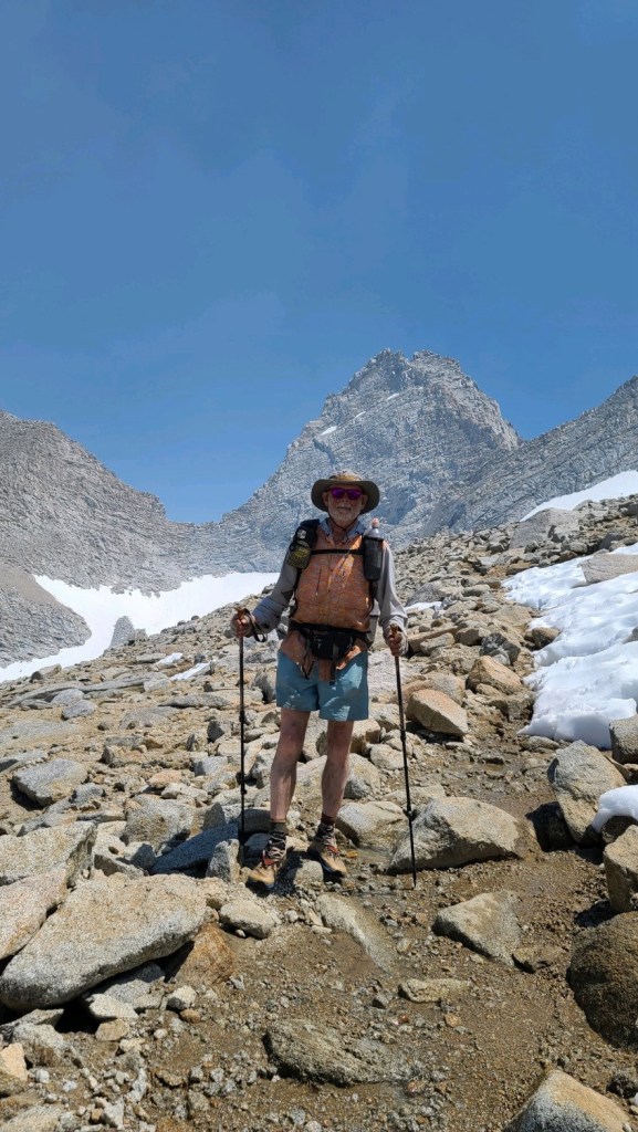
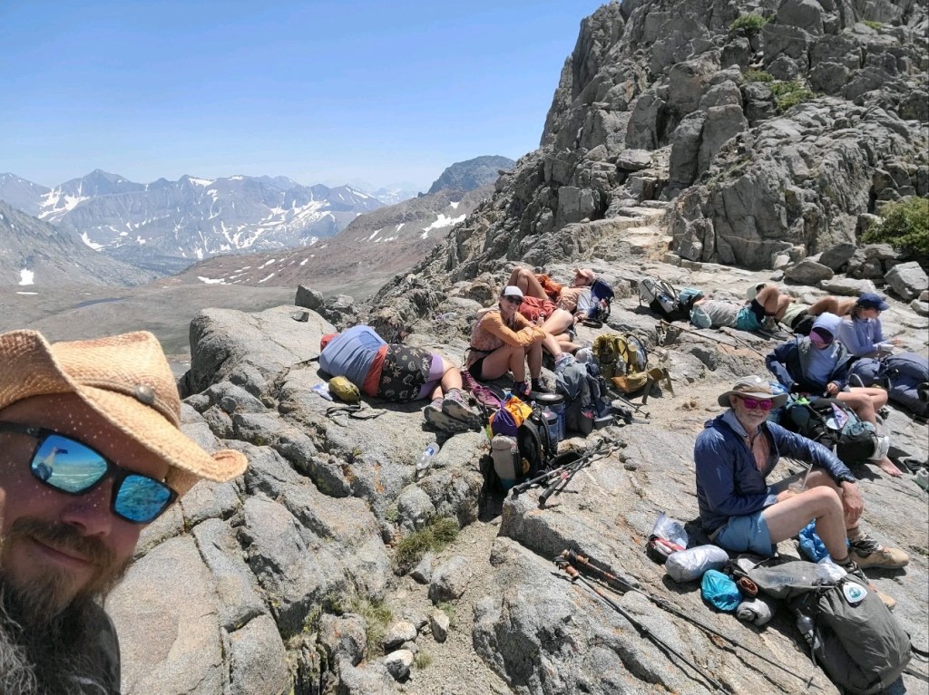
I left camp before the others, but by Tyndall Creek (8 miles from camp) they had all caught me. Hoo and I then brought up the rear and so began the climb to Forester Pass. About halfway up we came upon the group having lunch before the final push to the top. There were only a few small snow patches on the trail on the way up, and no snow on the chute at the top. We had all reached the top before 2:00 PM and after a few photos we began the descent. There were several snow patches on the way down. They all had slushy footprints to follow. I used my microspikes for a couple of the longer and slicker patches, but none of the rest of the group used spikes. When we reached our chosen camp site it was still early, so we pushed on another 2.8 miles to another camp. We’re 1.5 steep uphill miles from the turn-off to Kearsarge Pass. We’ll take Kearsarge Pass tomorrow and try to find a ride to Bishop for resupply and rest.
June 21, one rattlesnake
Today was “hike naked day”. Fortunately we didn’t see any naked hikers. In fact, we saw no one else for the entire day.
Hoo and I were hiking be 5:30. After the uphill slog the evening before, we began the day with a downhill, approximately 8 miles to the next water source. Then it was a 6.5 mile climb to 8000 feet. The day was warming up, and we reached the top just before noon. The temperatures at 8000 feet were bearable, but increased as we descended. I’m sure it reached over 100 degrees by around 2:00, when we reached Manter Creek. We grabbed some water and crawled under some bushes for shade and a siesta. We ended up waiting until 5:00 to break cover. The temperature was 97f then, but slowly decreasing. We pushed on another 5.5 miles to this camp site, grabbing water at Pine Creek along the way, passing an angry rattlesnake and passing the 700 mile marker . Kennedy Meadows tomorrow.
June 22
We slept in until 5:00, and arrived at Kennedy Meadows just in time for the 7:00 pancake breakfast. I visited 2 Foot Adventures to buy some shorts (changing from the long pants I wore for the desert) and some lightweight wind pants. I also bought some new shoes. We hung around until the store opened at 9:00 and I collected my packages- ice axe, shoes I thought I might need (but didn’t), and my bear canister. My bear canister had my tent inside. I sent the shoes I didn’t want, my bivy sack, and my tarp home. The tent will provide better bug protection in the mountains.
Neon showed up, and at 10:00 we caught the free shuttle to Grumpy Bear’s, where the vanguard of our group was waiting. It was good to have the gang back together, except for Halfway, who should be showing up soon. I also collected my resupply package which had been sent to Grumpy’s, and we all spent some time sorting and repackaging our resupplies. The plan is a six day food carry. Along the way we grabbed some lunch, and at 4:00 we caught the shuttle back to the general store. We’ll camp there tonight and get the pancake breakfast in the morning before walking back to the trail.
June 23, 20 miles, one transient rattlesnake
We slept in until 06:00, then packed up and went to hang out on the deck at the General Store. There was a bit of condensation overnight, but within a couple of minutes of direct sunlight the sleeping quilts were dry.
After breakfast Jinx’s boyfriend Donny gave a few of us a ride to the trailhead. I think he made a couple of trips. A mile or two down the trail a couple of PCTA reps had set up near a campground. They checked our permits and gave us PCT tags to hang on our packs.
The trail was fairly level for a few miles before beginning a steady climb. There was a lot of water along the trail and no need to carry more than a liter. It was a nice change from the desert.
The trail steepened in the last two or three miles, and coupled with the elevation made the going a bit slow. We camped at 9754 feet, with a great view of the area below.
June 24
Woke naturally (no alarm set) at 5:00 and began hiking an hour or so later. Our campsite had filled up overnight, with some late arrivals. We seem to have caught a hiker bubble, with more hikers in our vicinity than previously. It was a short climb over 10,600 feet, then a descent. From there the trail was fairly mellow with occasional fantastic views until a fairly stiff climb in mid-afternoon. At our lunch/siesta stop, we experienced a brief thunder/rain/hail episode, but it didn’t persist. We reached camp shortly before 5:00. Since there were still clouds around, we all opted to set up our tents instead of cowboy camping (sleeping in the open). At this site we met a Canadian couple hiking with their almost 11 month old son. They’d started at the southern border in mid-April. Very cool folks. After setting up camp, they joined us while we ate supper and chatted.
June 25
I started a bit earlier than the rest of the group this morning. The trail was the usual ups and downs, and they didn’t catch me until Cottonwood Pass. I hiked on to the junction for Chicken Spring Lake, and waited for them. Apparently I missed a snowball ambush and battle. When they caught up again we proceeded to the lake and everyone took a dip, some shorter than others. After drying out in the sun for a bit, we packed up and hit the trail again.
Later, after our noon break and as we approached Rock Creek, thunder showers began. It was hailing again, quite heavily, and I donned my rain poncho and took shelter under a tree while holding my sit pad over my head to protect it from the hail. We stopped briefly to chat with a ranger before proceeding to the creek. We waded across barefoot. Hoo had stayed behind a bit longer at the lunch spot and hadn’t caught up with us yet, so Jinx and I waited for her. About 40 minutes later she came down the trail and we headed for Crabtree Meadows. After a brief climb we stopped for water. There was a large group of teenage boys and their adult trip leaders there. After we started hiking again, Jinx and Hoo soon outpaced me and I was on my own. I finally straggled into camp at Crabtree Meadows about 7:30. Mosquitoes were bad, so I set up the tent and ate inside. Mt. Whitney tomorrow.
June 26
Zero miles. After yesterday’s tough going, I decided against trying to summit Mt. Whitney. I think I need the rest more than I need to bag a peak. So I hung around camp, eating and resting. Hoo left with the rest of the group at about 6:30, but she turned around at Guitar Lake and came back. She’d rather have the break, too. The successful summit part returned around 4:00. We all ate early and turned in early.

June 27
I left camp before the others, but by Tyndall Creek (8 miles from camp) they had all caught me. Hoo and I then brought up the rear and so began the climb to Forester Pass. About halfway up we came upon the group having lunch before the final push to the top. There were only a few small snow patches on the trail on the way up, and no snow on the chute at the top. We had all reached the top before 2:00 PM and after a few photos we began the descent. There were several snow patches on the way down. They all had slushy footprints to follow. I used my microspikes for a couple of the longer and slicker patches, but none of the rest of the group used spikes. When we reached our chosen camp site it was still early, so we pushed on another 2.8 miles to another camp. We’re 1.5 steep uphill miles from the turn-off to Kearsarge Pass. We’ll take Kearsarge Pass tomorrow and try to find a ride to Bishop for resupply and rest.
June 28
By the time Hoo and I started hiking Halfway, Quartertank, and Neon had already left camp. A while after the junction where we turned uphill for the Bullfrog Lake trail and Kearsarge Pass we found them taking a break. They’d initially missed the turn and ended up doing a bonus mile or so. They took off and I didn’t see them again until Bishop. We continued on the steep climb to the Bullfrog Lake junction. Then the trail leveled for a bit before climbing to Kearsarge Pass. It was a beautiful area. We got to the pass about 8:00 and there were lots of people taking a break before heading down. We spent enough time to get a photo and then continued on. Speedgoat, Riveter, and Jedi caught me on the way down and I arrived at the Onion Valley parking lot about 10:00. Speedgoat, Riveter, Hoo, and Curt were sitting there thinking about hitching a ride to Bishop. A few minutes later a father and son hiking team came off the trail and offered us a ride to Independence in the back of their pickup. We gladly accepted. After arriving in Independence, we hung around for an hour or so before catching the bus to Bishop. There was no real air conditioning on the bus and it was miserably hot. But we arrived eventually and got checked into our hotels. Halfway and I shared a room. Zero day tomorrow.


June 30
After the zero day in Bishop, Halfway and I were up shortly after 5:00, and were ready for the hotel breakfast at 6:00. Then we walked to the south of town to try to hitch a ride to Independence. Speedgoat had arranged a ride for four of us from Independence back to the Kearsarge Pass trailhead, leaving at 9:00, and we wanted to make that ride.
The whole gang grouped up at the Jack in the Box restaurant and left Speedgoat and Riveter to hitch, figuring it would be better not to hitch as a large group. They soon caught a ride, and as they were loading up I walked out to the highway to take their place. They signaled that there was room for one more, so I loaded up also, and away we went. The driver was an interesting woman named Stacey. She is an author and a very interesting conversationalist. She dropped us off in Independence and soon the rest of the gang trickled in. Hitching seemed to go well for everyone.
Soon the trail angel arrived to ferry us to the trailhead. Her name was Marge, and she was also a very interesting person.
I started up the trail and was eventually overtaken by most of our group. Hoo had stopped to take a break, and she and Jinx arrived at the top of the pass shortly after I did. We hung out for a bit, snacking and chatting before beginning the descent. Glen Pass was only a few miles away. I fell behind on the descent, but caught up with the group a mile or so below Glen Pass at a lunch break. At about 2:30, I pushed on to the pass and was soon overtaken by Jinx, Halfway, and Neon. We summited the pass and barely paused at the top before descending. There were a couple of dicey snowfields, and most of us followed previous hikers and scrambled down the rocks to join the trail below the snow. At the bottom we paused to watch the other half of our group negotiate the snow patches before moving on. We’re camped at the northernmost Rae Lake, a beautiful spot that is also enjoyed by a plethora of voracious mosquitoes. I ate supper in my tent after murdering those mosquitoes foolish enough to enter the tent with me.


July 1
The mosquitoes weren’t quite as voracious this morning. Not long after setting out on the trail, the long ascent to Pinchot Pass began. There were plenty of beautiful sights, including Woods Creek water slide. The creek cascades over sheer granite; pretty impressive. At the top of Pinchot Pass we took a break for lunch before descending. Then began the long gradual climb toward Mather Pass. We ended up camping just 1.5 miles below the pass.

July 2
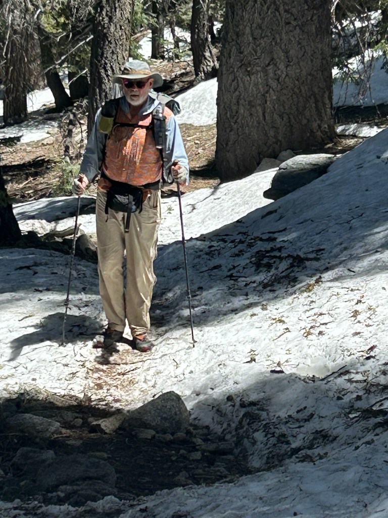
The climb from camp to the top of Mather Pass took less than an hour. The trail switchbacks up a pretty sheer wall to get to the pass. Glad there was no snow to speak of. However, on the descent there were a couple of snow/ice patches. One of them was pretty sketchy. It was early in the morning and the snow was very solid. We followed previous hiker’s frozen footprints. I was glad I had my microspikes – most of the others didn’t.
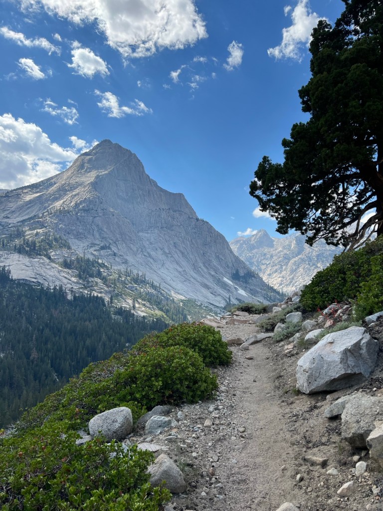
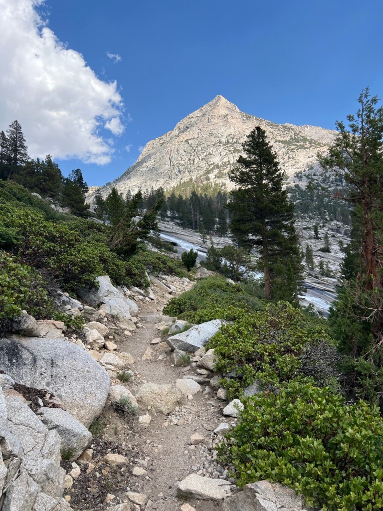
Then it was a long steep descent. My knees weren’t particularly happy about it. We stopped for lunch about 4 miles from the turn-off to Bishop Pass. We plan to camp about 4 miles up that trail. It’s a detour, because a bridge over the South Fork of the San Joaquin River was destroyed in the winter of 2022-23. The authorities don’t want people to ford the river, so they recommend this detour. We’ve talked to people who have nevertheless safely forded the river, and three of our group will attempt it. There is also an unofficial scrambling route that avoids the need to cross the river, if the ford looks unsafe.
We’re camped about 4 miles below Bishop Pass and will go over the pass first thing in the morning.
July 3
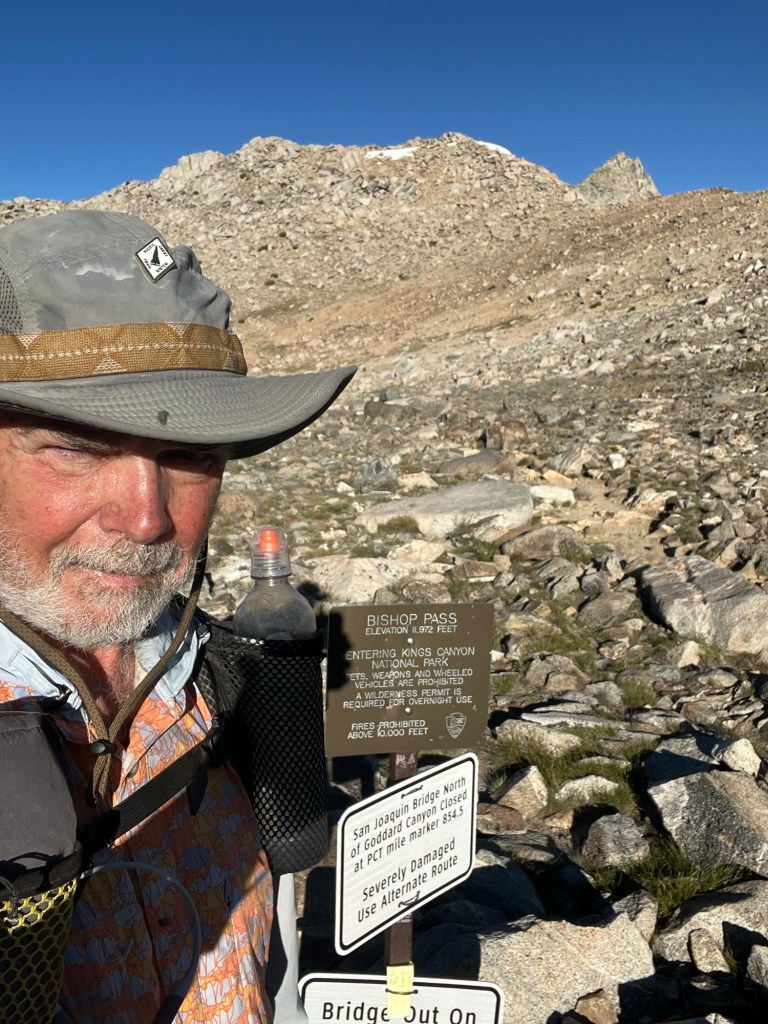
We were up early because some of our group needs to resupply in Bishop, and they want to do the 12 mile road walk between the South Lake (Bishop Pass) Trailhead and the North Lake (Piute Pass) Trailhead. Riveter and Speedgoat were the first two out of camp, and they seemed quite proud of the fact. I think it was the first time that they were first.
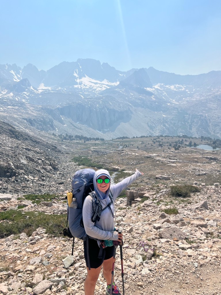
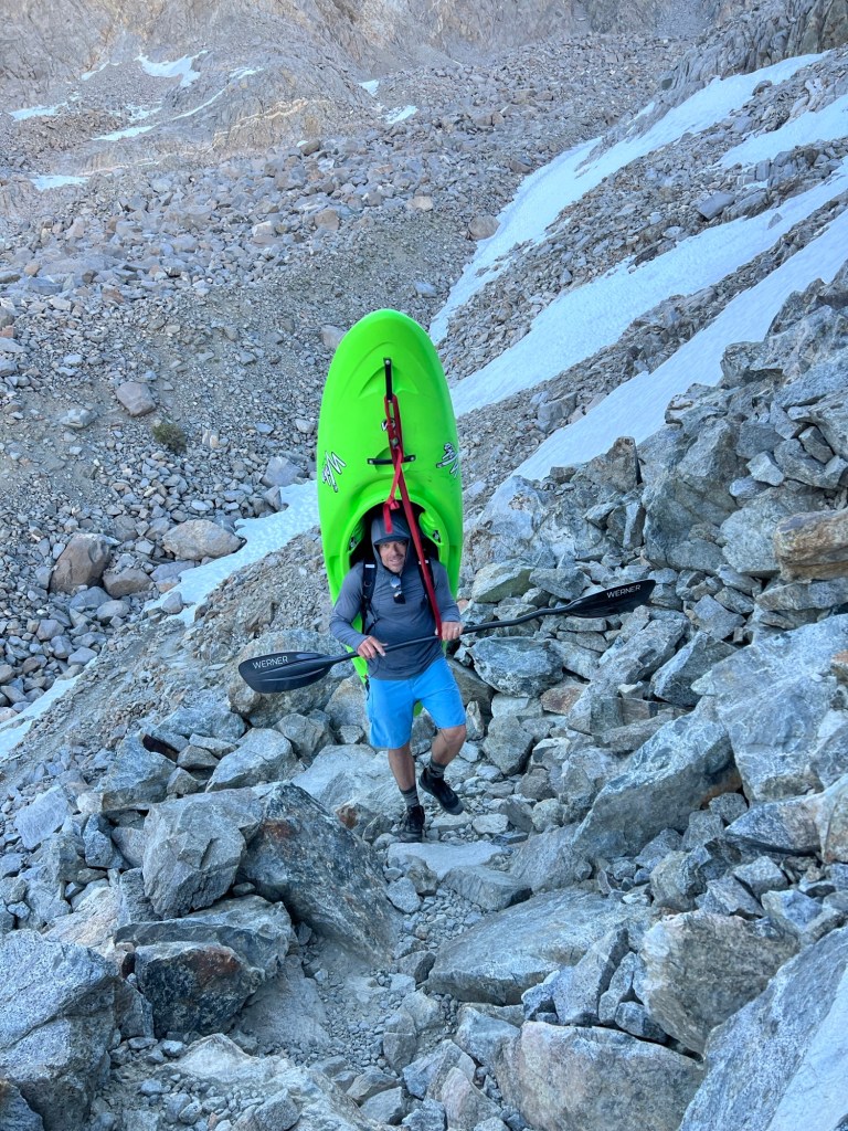
It was a bit of a slog up and over Bishop Pass (11,965 feet) but the views were fantastic. I was well behind the group. On the descent after Bishop Pass I met three kayakers hauling their kayaks up and over the pass so that they could kayak the middle fork of the King River. One of them was out of water, and one of his partners had his water bottle. I gave him one of my bottles with about 3/4 of a liter.
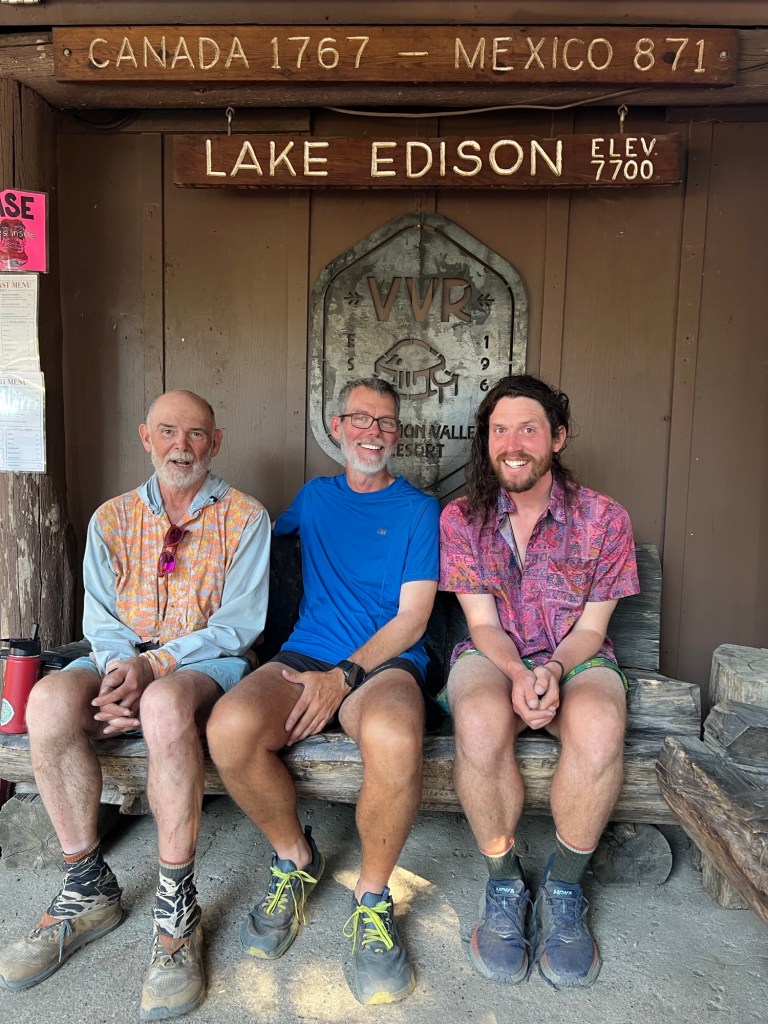
On reaching the trailhead, none of my companions were anywhere in sight. I disposed of my trash in a dumpster and started walking and hitchhiking. Within about a mile a trail angel name Carlisle stopped to pick me up. She had dropped some hikers at the trailhead I had just left, and was kind enough to take me directly to the North Lake/Piute Pass trailhead. It was a much easier hitch than I anticipated and I was at the trailhead before 11:00. I realized that I had enough daylight to make the 17 miles or so over Piute Pass and back to the true PCT that day. So that’s what I did. Piute Pass was about 5 miles from the trailhead and after that the trail trended downhill back to the PCT. The views were again beautiful. I leapfrogged throughout the day with a hiker named Pandora and we camped together once back on the PCT. That left about 25 miles over Selden Pass (10,913 feet) to Vermillion Valley Resort, and the end of my hike.
July 4
I was up at 4:00 and hiking before 5:00, using my headlamp for the first 40 minutes or so. It was a pleasant morning except for the mosquitoes, and the scenery was again spectacular. The climb to Selden Pass wasn’t too difficult and the views kept me motivated. Pandora caught up with me at the top of the pass, and I left him there while he re-arranged his pack and bear canister. I didn’t see him again until VVR.
If the views on the south side of Selden were great, the views to the north from the top of the pass were even better. I made pretty good time on the descent. I forded Bear Creek, which has a notorious reputation as a difficult crossing. But it wasn’t difficult when I crossed – a bit of strong current in the middle, but it was only just above my knees.
As I was walking down the Bear Ridge trail to the resort, I began to wonder if the 3 hikers from our group who had forded the San Joaquin near the bridge outage had waited for the ferry across the lake to the resort. Ifso, I might arrive before them.
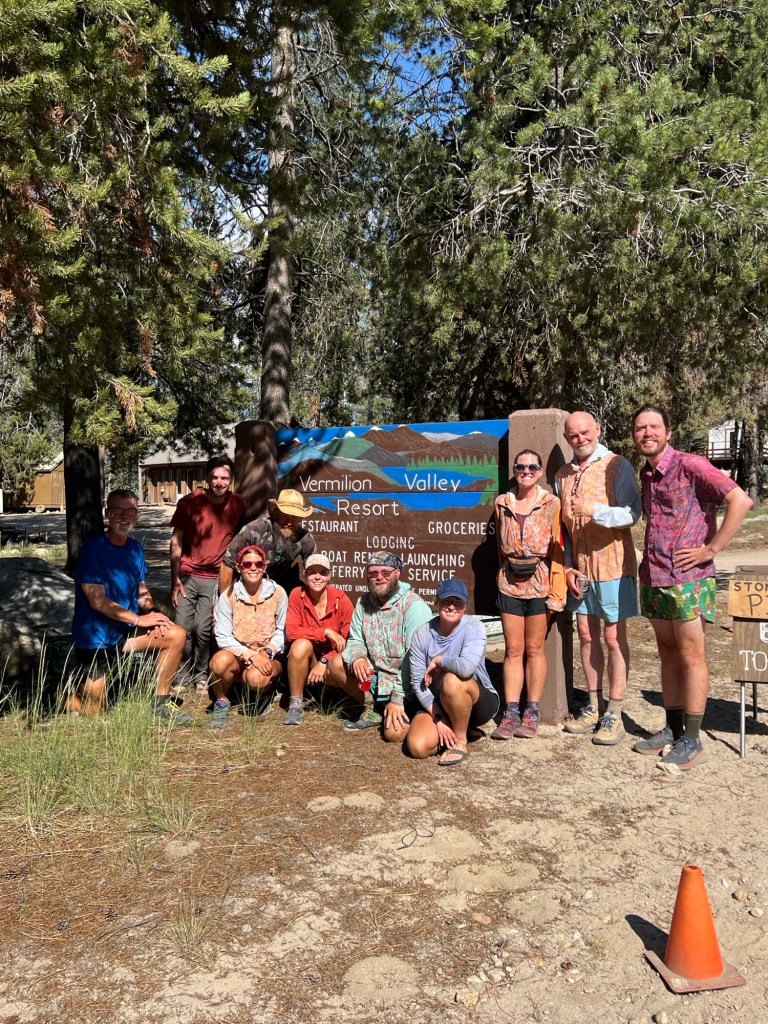
As it turned out, they were there when I arrived. I was checking in at the counter in the store, and went back to the refrigerator to get my complimentary beverage when Halfway came in to get a token for the shower. I said, “Hey, no cutting in line!” He was flabbergasted to see me, since I wasn’t expected until the next day. Halfway, Quartertank, and Barefoot had all safely forded the San Joaquin and arrived at VVR earlier in the day. We all had a beer or two and enjoyed a great dinner before retiring to our tents. The rest of the gang should show up tomorrow.

July 5
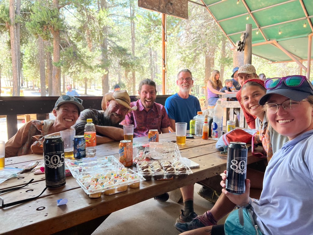
Around lunchtime, the rest of the tramily (trail family) trickled in. Neon was the first to show up and soon we were all together again. The group that had resupplied in Bishop and had done the “continuous steps” 12 mile road walk had carried two beers and two packs of mini cupcakes to celebrate my completion of the PCT. The intention had been to break them out at the top of the pass, but I ruined that by pushing ahead on my own. It was so sweet and generous of them to plan that, and then to carry the extra weight all the way to Vermillion Valley Resort. I put the beers in a chest freezer behind the store for a few minutes, and when they were cold enough we had the mini-celebration. I’m going to miss this gang.
July 6
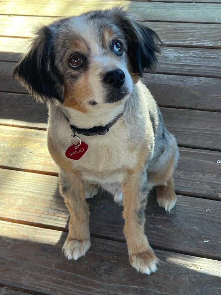
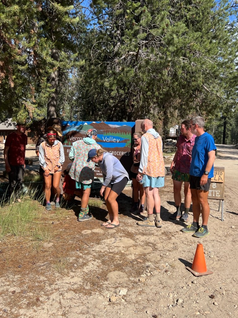
Jinx, Jedi, Riveter, and Speedgoat took off at around 6:00. We’d said our goodbyes the night before. I had breakfast with the rest: Hoo, Neon, Quartertank, Barefoot, and Halfway before they caught the ferry across the lake and back to the trail. At about 10:00 my shuttle arrived. We waited for the ferry to return, in case there were any more hikers looking for a ride to Fresno. There were none, so it was just me and Ellen, the driver. The road between VVR and Huntington Lake was one lane with many potholes and tight curves, but it smoothed out and widened to two lanes after that. After a 3 hour drive, I was dropped off at the Fresno airport. By 8:30 I was home again. Both the dog and the wife seemed happy to see me, but they were no happier than I was.
I was happy to have finally connected all the miles and finished the PCT. I’m also glad I met the folks that turned out to be my trail family, way back in Mission Creek 650 miles ago. I feel so lucky to have traveled with them, every one of them. The trek was so much more enjoyable because of them. Jinx, Jedi, Riveter, Speedgoat, Halfway, Neon, Quartertank, Barefoot, and my buddy Hoo – thank you all!

Leave a reply to ‘Cousin’ Cancel reply