Part 5
After I left the CDT at Cumbres Pass last year, I returned home for the winter to relax and plan the next trip.
My plan had been to return to the Mississippi River to finish that journey, but my partners for that had to back out – one for family reasons, and the other in order to let a shoulder heal more completely after surgery.
So now it’s back to the CDT. I took the train to Wenatchee to spend a couple of night and then One-K and I drove to Lander, WY to begin our hike. We’re spending the night with Marcia, and old friend I met in Yakutat during my piloting days. Marcia will take us to the trail in the morning. The plan is to hike south through the Great Divide Basin. One-K will be with me until Encampment, WY and head home from there. I’ll continue south into Colorado to Grand Lake, where I left off last year. After that, I hope to get to Cumbres Pass and hike to Ghost Ranch, NM. That will complete New Mexico and Colorado for me. From there I’ll get back to Lander and continue north on the CDT. That’s the plan, anyway.
June 3, 2026
Day 1
We left Marcia’s house at about 7:30AM and drove to where the trail crosses Highway 28. We took One-K’s truck, and Marcia drove it back to her house. It’ll stay there until he returns to get it.
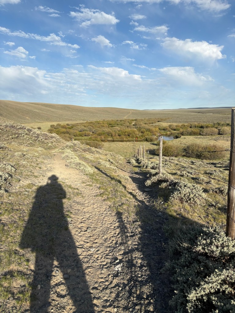
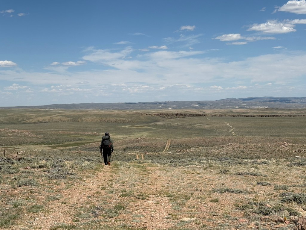
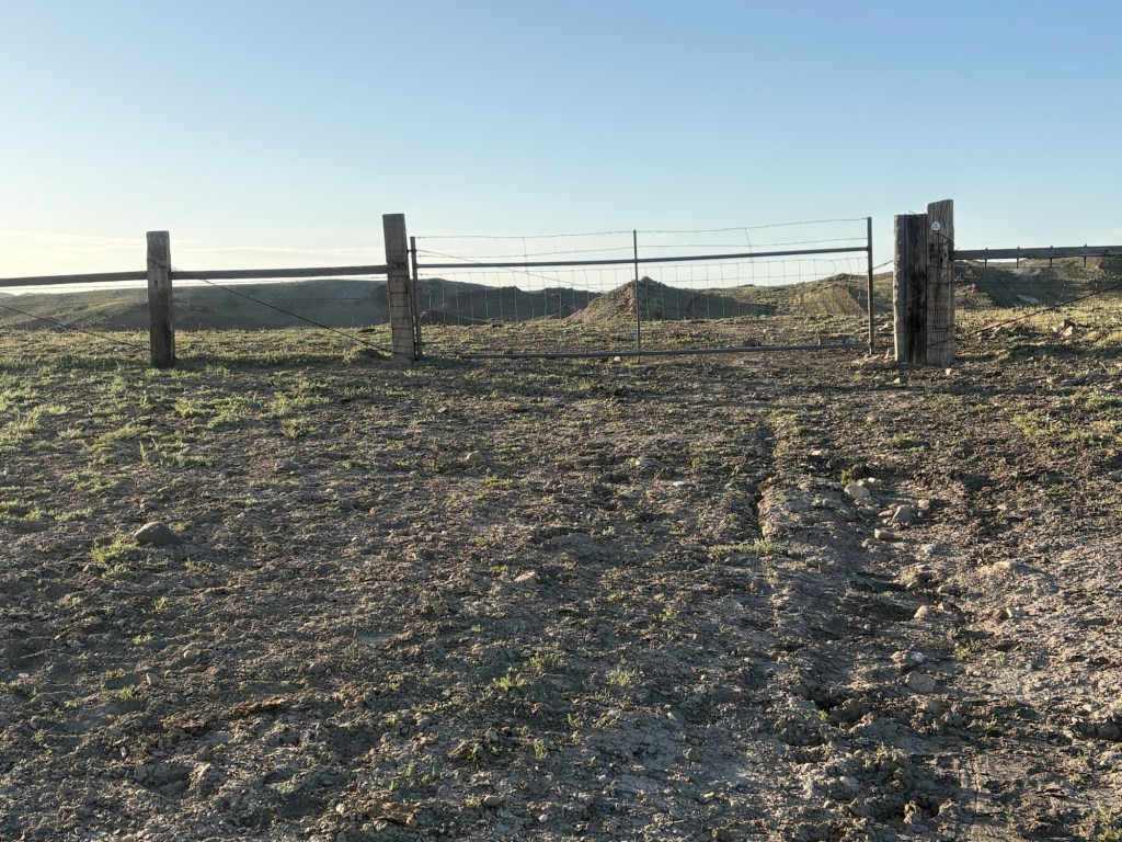
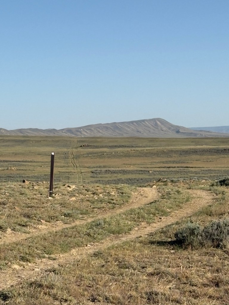
We walked less than half a mile before we noticed we were a little off track. The trail was poorly marked and we were following a cattle trail, I guess. We had challenges with staying on trail throughout the day. A lot of the markers were blown down and it was tough to discern the actual trail even when the navigation program told us we were right on it.
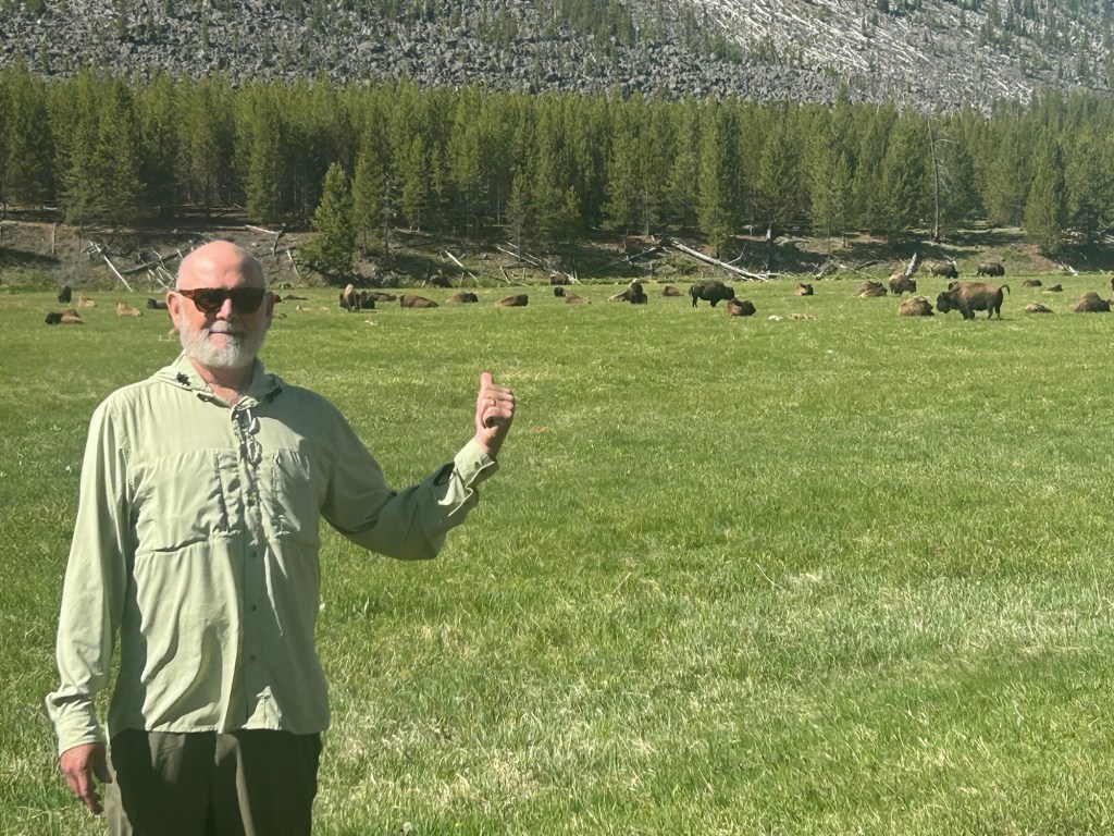
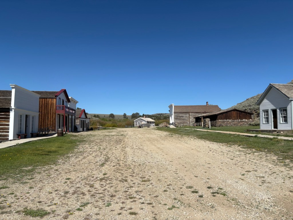
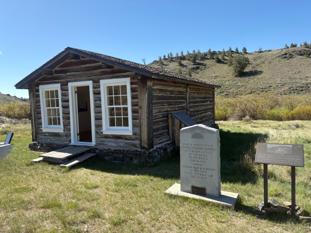
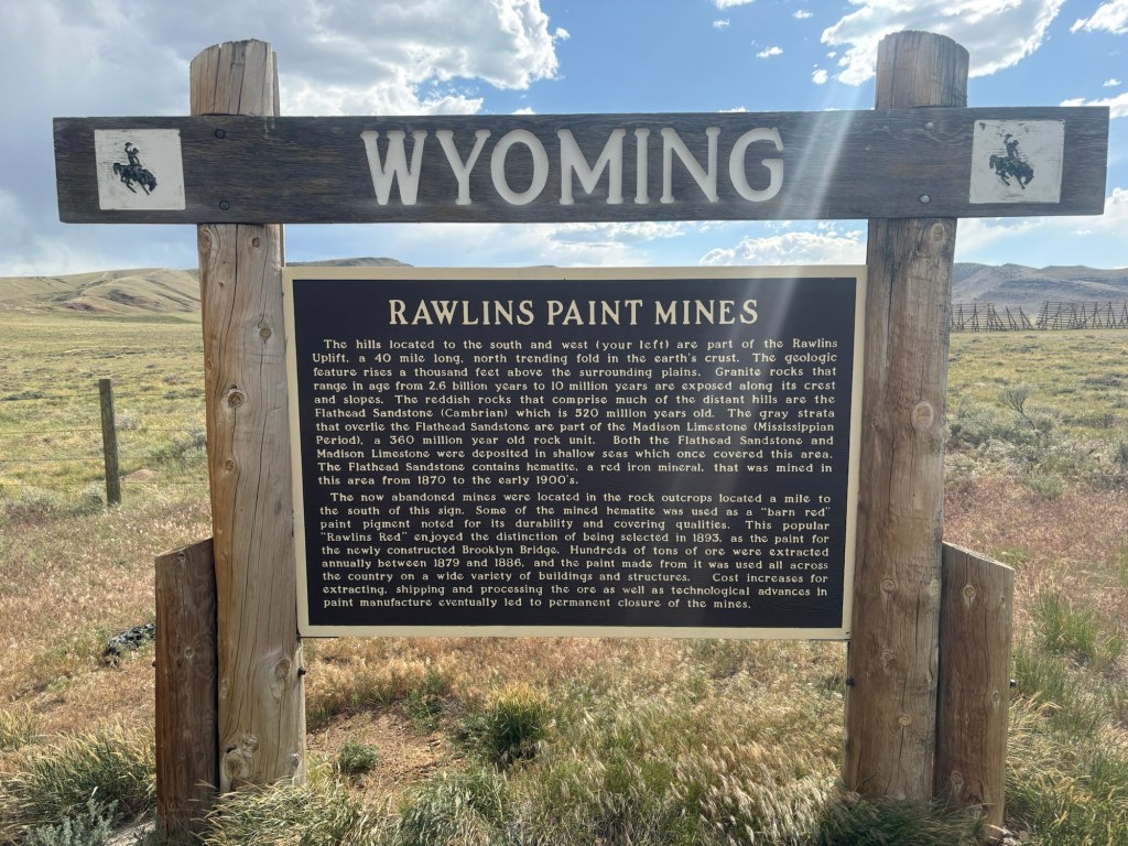
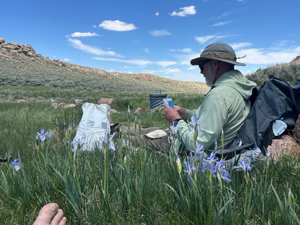
In about three miles we passed through the old mining town of South Pass. They’ve done an excellent job of restoring and preserving the old buildings. South Pass was the home of the first female justice of the peace in the world – 1870. We took a short break and then climbed out of there. It was a gradual climb for the next 4 miles or so. We stopped for lunch in the shade of a tree, with a nice view of the town of Atlantic City, another old mining town. There were abandoned little mines all along this section of the trail. I believe it was mostly gold they were after. We watched a parade of vans and buses going back and forth on the road below us. Tourists visiting old mines, we guessed.
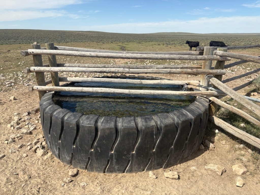
After lunch, we descended to and crossed that road and began an up and down traverse roughly paralleling the road. The going was kind of tough because there was no obvious footpath and the trail markers were often blown down or rotted out. Eventually we decided to cut over to the road and road walk. I’m guessing we weren’t the only hikers to do that, because there was no visible indication of a trail, even at the markers we were able to find. The road will take us to the Sweetwater River, an important water source in this section. So probably most hikers road walk this stretch.
Along the way we saw a few pickups and four-wheelers, but no other hikers. We lost track of the number of antelope we saw. At one point, One-K startled a young antelope at a distance of about 10 feet. It took off like a shot. We hope it found its mother.
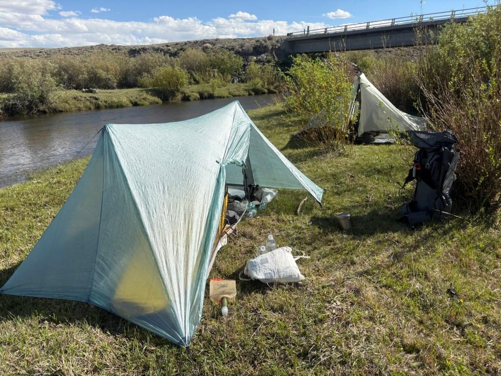
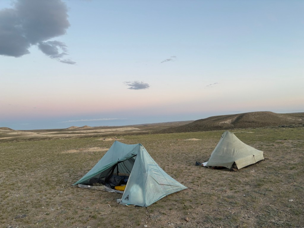
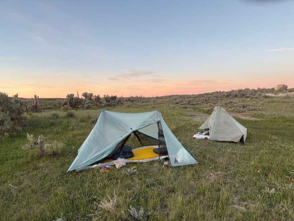
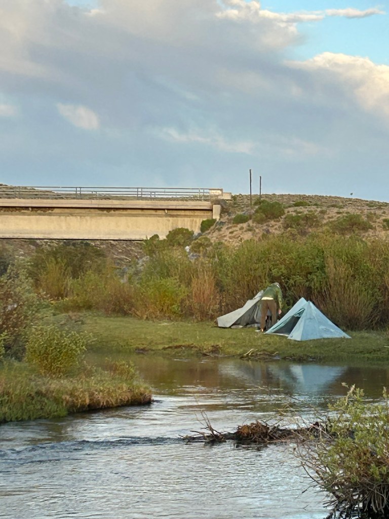
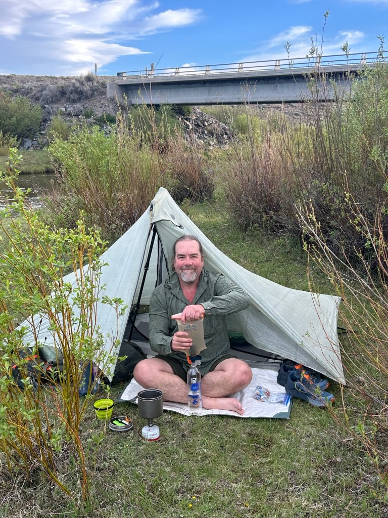
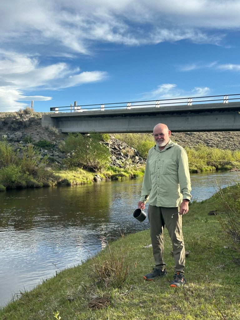
After about 8 or 9 miles of road walk we came to the Sweetwater River. We found some flat spots near the river and set up camp. After filtering some water and resting just a bit, we soaked our feet in the river until I couldn’t feel my toes. It felt great. The beavers have begun construction of a dam just downstream, and there are cows in the area. We had to move some dried cow pies and dried antelope pellets to clear spots for the tents. It was windy most of the day, but it’s calmed down a bit as the sun moves lower in the sky. One-K has a couple of small blisters to deal with, but my feet are okay so far. All in all, not a bad first day on the trail. 17.5 miles for the day. Countless antelope, two snakes.
June 4, Day 2
The wind died down and was fairly calm most of the night. The tents had a bit of condensation in the morning, as you would expect when camping next to a river. We were hiking by about 6:30
Our first stop was at Upper Mormon Spring. We filtered some water and took a break. Took off our shoes and socks to cool off the feet, snacked, etc.
From there it was only 6 miles to Weasel Spring, where we more or less repeated the procedure. Since we’re among the earliest hikers in the Basin this year, we’re trying to post water source updates for the hikers who will passing through the Basin in the coming weeks.
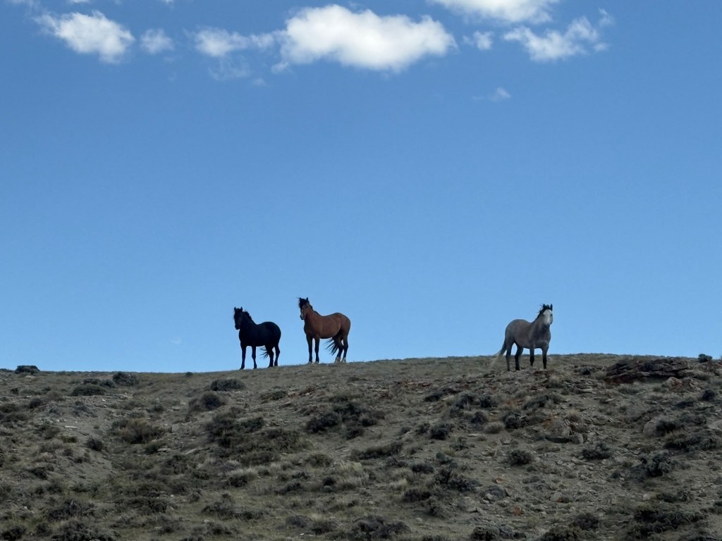
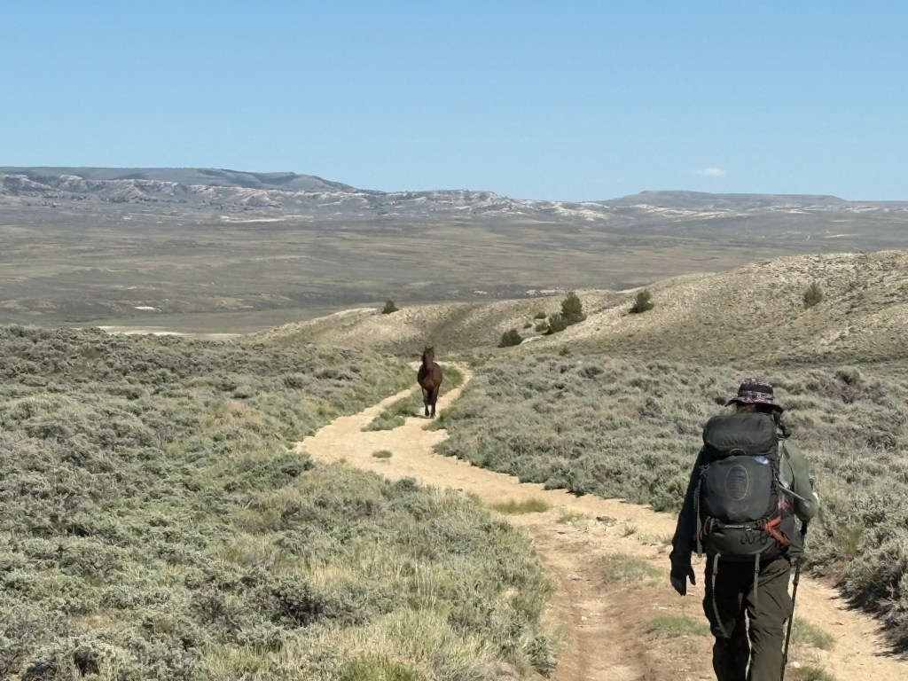
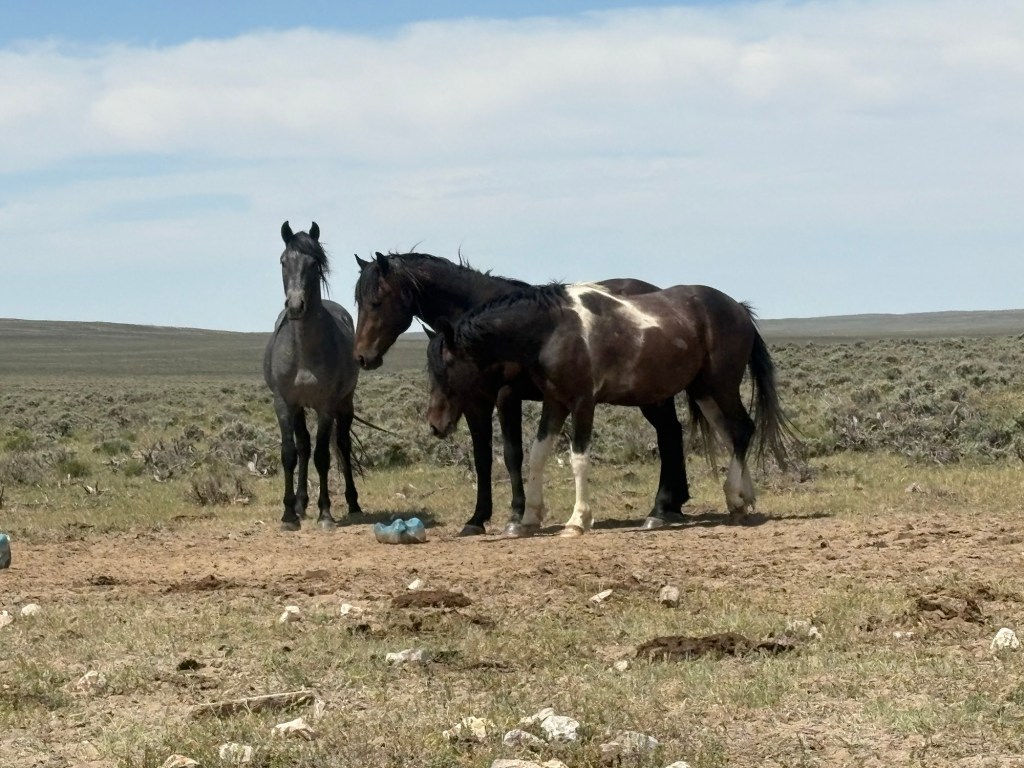
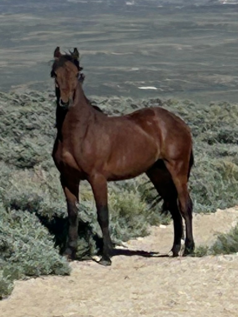
Six miles after that was a creek where we grabbed some water. On the way there, a wild horse appeared suddenly and galloped across the trail about 20 yards in front of us. We couldn’t believe we were seeing it – a beautiful chestnut with a black and white mane. Amazing. After getting water at the creek we encountered 3 more wild horses and those were kind enough to pose for a photo.
We decided to push on another 4 or 5 miles to a water cache and to find camping nearby. We were the first hikers to take advantage of the cache this year. We got some water, signed the logbook, and pushed on another .4 mile to a very exposed campsite. Fortunately the wind died off as the evening came on.
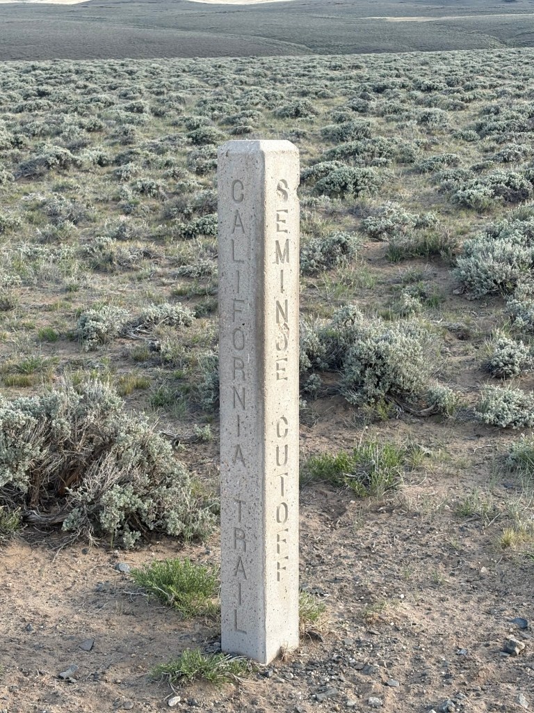
There are signposts indicating that this section of the trail coincides with the Oregon Trail and the California Trail. Much easier with GPS.
25 miles for the day.
June5, Day 3
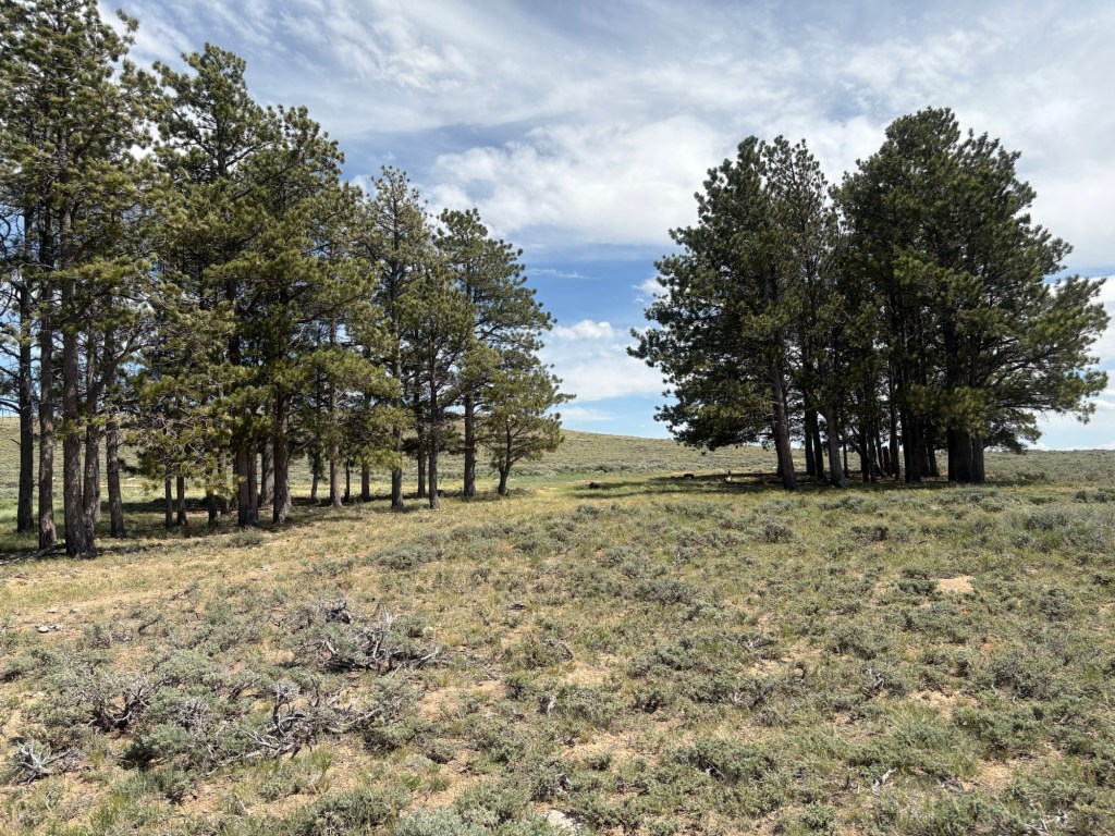
It was a peaceful night and we were packed up and hiking by 06:15. The trail meandered up and down between 7200 feet and 7700 feet, going above 7900 feet in one spot. The views were fantastic, and we saw our first trees in a while. And of course, dozens of antelopes. We also saw some horses on a distant ridge. Later in the morning we met our first hiker on the trail. His name was Truewood, and he’d skipped the snow in Colorado.
The first water stop was a cow pond 12 miles from camp. We took a short break and then began a 5 mile climb on our way to the next water stop. After about 6 miles, we arrived there and decided we had enough water to push on to Bull Spring, where we arrived and pitched camp for the night. On the way we encountered another wild horse on the trail, who allowed us to approach within 10 yards before trotting off the trail. It’s always so great to see these animals.
This spring is located right next to a gravel road that sees some traffic. One-K is having major blister problems and will probably hitchhike into Jeffrey City tomorrow. I’ll continue alone.
One-K is heading to town. The blisters are just too bad to continue. I packed up and we said our goodbyes. He’s hitching to Jeffrey City, and from there he’ll try to find a ride to Lander to snag his truck and meet me in Rawlins. The hope is that with a few days off and a different pair of shoes, he may be able to hike from Rawlins to Encampment.
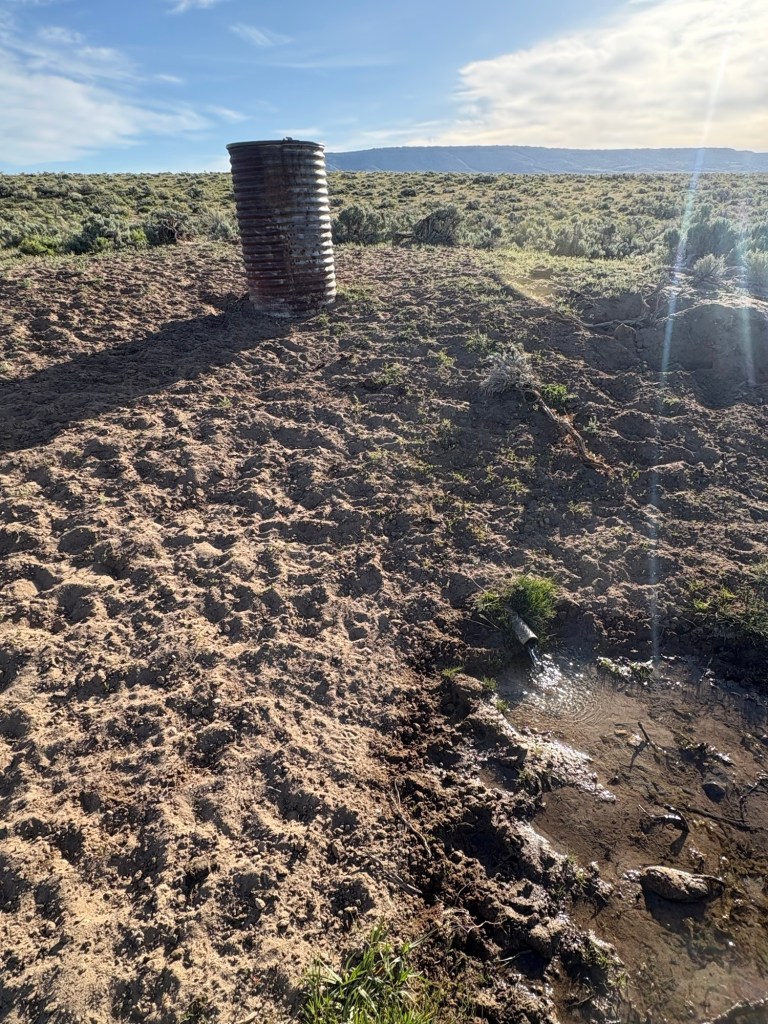
It was a pleasant morning. After about 4 miles I reached a spring with a pipe sticking out of a bank. I took a short break, filtered some water and rinsed my socks. From there it was another 7 miles to an electric well. It was running when I arrived, so I left it like I found it. I took a lunch break in what shade I could get and after about 45 minutes I moved on. The wind was strong and continued so for the rest of the day. 1.6 miles later I came to A&M reservoir and I was thinking about a swim. Temperatures have been in the 80’s the last few days. But there were some folks fishing there, so I went over for a chat instead. They gave me some tips about Rawlins and some cold bottled water. I appreciated both, but the cold water just a bit more.
The next water would be 14 miles. I decided to carry enough water to camp along the way, in case I couldn’t quite make it. Along the way I met two separate trucks with people out to view and photograph wild horses. I saw plenty of those horses today. Always kind of a thrill.
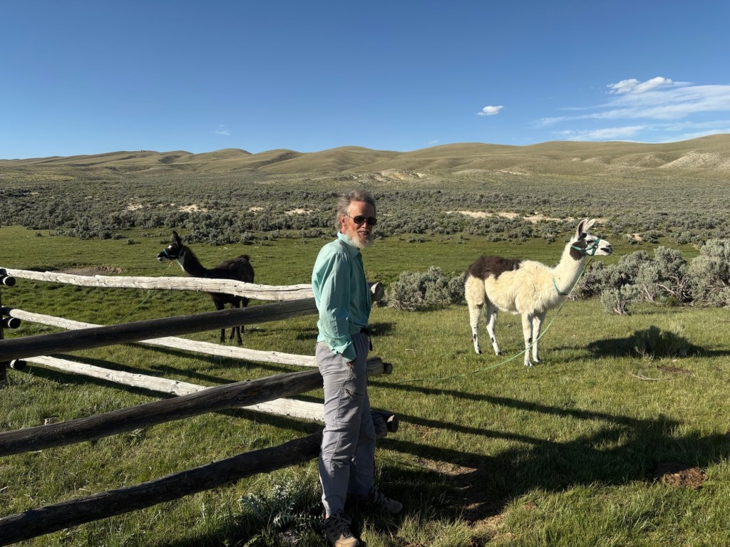
As it turned out I made it to Bull Springs, having left Bull Spring 27 miles ago. When I arrived there was a gentleman camping with his two llamas. He’ll be southbound in the morning, as well.
27 miles for the day.
June 7, Day 5
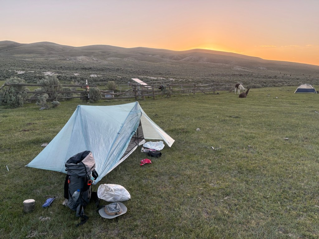
At about 6:00 I said goodbye to Kent and his llamas and set off for the next water source – Fish Pond in about 16 miles. It was a pleasant and cool morning, but the wind would pick up later.
At about 9:00 I had just crossed a road and was searching for the trail in the underbrush when Steve came along in his truck. He had hitched into Jeffrey City and caught a ride to Lander. Then he’d driven to Rawlins and found a hotel. He had a subway sandwich and some lemonade for my lunch. It was too early for lunch, so I stashed it in my pack. After a short conversation we parted ways: Steve to Laramie for different shoes, and me to Fish Pond for water and lunch. Steve intends to walk to Encampment with me, as was the original plan.
Given the difficulty of discerning the trail there, I decided to road walk for a few miles, before rejoining the trail. The road I was on eventually joined Highway 287, a busy road with semis and motorhomes and other traffic. It has a wide shoulder, but the uphill slog was not very enjoyable. The actual trail follows this highway for a bit. When I came to the place where the trail again diverges from the highway, I turned onto the trail and began a climb. Within half a mile I wished I had continued road walking. There was no discernible trail tread, the signs had all blown down. It was not easy terrain and that, combined with route finding, made for slow progress. I eventually arrived at Fish Pond, a cow pond just downhill from a corral with a solar well. There was water in the pond, so I didn’t bother either the well.
By this time, it was quite windy. There was no shade so I sat on a bank with my back to the wind and had my sandwich while filtering water and airing out my feet. After 30 minutes or so I was underway again. The trail between there and Rawlins was easier to follow and I was making decent time. I still managed to miss a turn which resulted in about half a bonus mile before I got back on track.
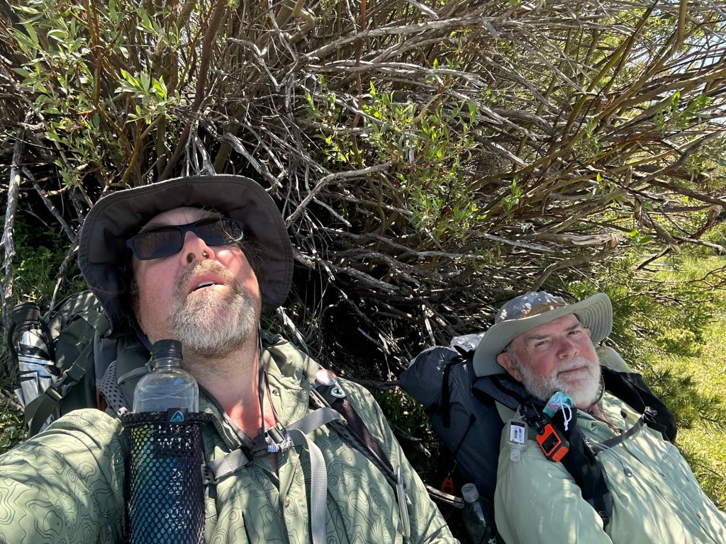
I came to another section where the trail was hard to follow and apparently had not accounted for more recent land development. After bushwhacking for a bit, I decided to go back to road walking. I called Steve and asked him to meet me where the trail joined the highway. When I got to that position, he was waiting with a cold root beer.
I saw a few antelope today, but no wild horses.
27 miles for the day.
June 8, Day 6
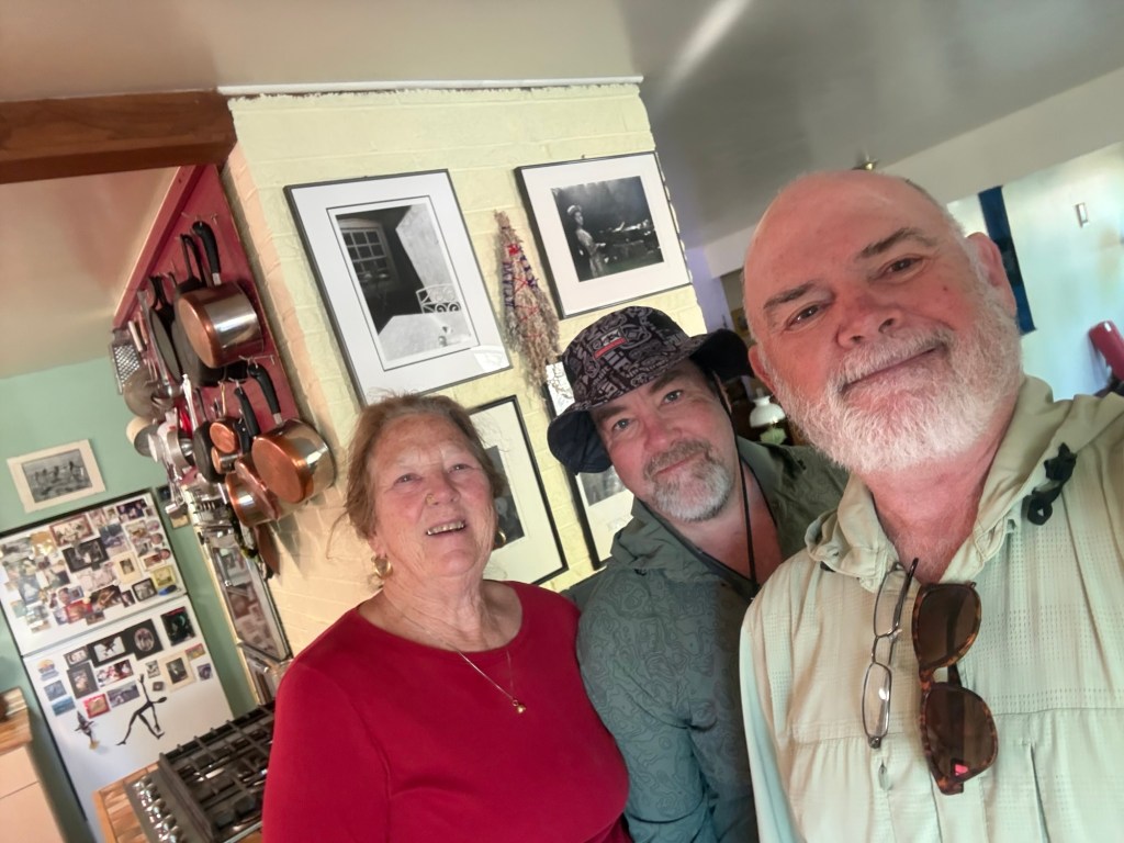
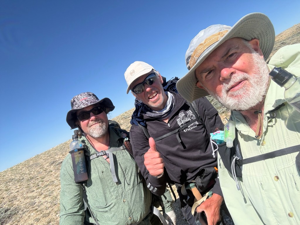
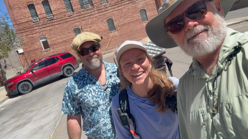
Zero day in Rawlins. One-K and I were driving down the road and saw another hiker. We pulled over to offer her a ride. Her trail name is Taser. She’s northbound and I got some good trail info for Colorado, and gave her some info about the trail ahead of her. We dropped her at the post office and she planned to hike out today. Here’s a selfie we took and some photos One-K just shared.

Leave a comment